Potoče - Planinska koča Iskra na Jakobu (by road)
Starting point: Potoče (520 m)
| Latitude/Longitude: | 46,30580°N 14,43200°E |
| |
Route name: by road
Walking time: 1 h 25 min
Difficulty: easy marked way
Elevation gain: 441 m
Elevation difference along the route: 450 m
Map: Karavanke - osrednji del 1:50.000
Recommended equipment (summer):
Recommended equipment (winter):
Views: 3.620
 | 1 person like this post |
Access to starting point:
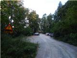
A) From the Ljubljana–Jesenice motorway, take the Kranj–East exit, then continue driving towards Jezersko. When we arrive in Preddvor, leave the main road and continue driving left, then after a few tens of metres, opposite the Jelovica company, continue right towards the village of Potoče, St. Jakob and Potoška gora and Lake Črnava. Further on, the road leads us through the settlement Hrib, above which we arrive at a crossroads, where we continue straight (left Hotel Bor and Lake Črnava, right Senior Citizens' Home Preddvor). This is followed by about 100 m of gentle ascent to the chapel, where the road turns right, and we drive along it past a few more houses, then before the Senior Citizens' Home we turn left onto a larger macadam parking lot.
B) From the Jesenice–Ljubljana motorway, take the Kranj–West exit and at the first crossroads continue left. Further on, we drive through the underpass under the motorway, then arrive at a roundabout, from which we continue driving towards Golnik. The route ahead leads us through the settlement Mlaka pri Kranju, and at the end of the settlement we continue right towards the settlement Srakovlje. This is followed by driving through Srakovlje, Spodnja Bela, Srednja Bela to Zgornja Bela, where we continue right towards Preddvor. At the end of Preddvor, just a few tens of metres before the road joins the main road Zgornje Jezersko–Kranj, we continue left towards the village of Potoče, St. Jakob and Potoška gora and Lake Črnava. Further on, the road leads us through the settlement Hrib, above which we arrive at a crossroads, where we continue straight (left Hotel Bor and Lake Črnava, right Senior Citizens' Home Preddvor). This is followed by about 100 m of gentle ascent to the chapel, where the road turns right, and we drive along it past a few more houses, then before the Senior Citizens' Home we turn left onto a larger macadam parking lot.
Route description:
From the starting point we continue on the macadam road, which after less than 10 minutes brings us to a smaller crossroads, where the road crosses the marked path leading from Senčnica Josipine Turnograjske towards Planinska koča Iskra na Jakobu. From here the road leads us for a short time through the forest, then we arrive at the edge of a smaller clearing, where there is an apiary.
We continue straight (the left road soon ends and turns into a cart track) on the road which for a short time crosses the slopes to the right, then turns left and starts to ascend more steeply. Higher up the road crosses the marked path and some unmarked paths several times and ascends in a few hairpin bends. After a few hairpin bends we arrive at a left bend, in the middle of which a newer cart track branches off to the right, and from it soon a path branches off to the left leading towards Babe, Mihčevi kopišča and the marked path past the spring below Potoška gora to St. Jakob.
We continue on the road, which continues ascending to the left, then brings us to the spot where a cart track about a minute long branches off straight ahead from the road towards the church of St. Jakob and Planinski dom Iskra na Jakobu (right Potoška gora).

Photos:
 1
1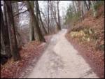 2
2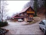 3
3 4
4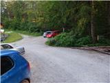 5
5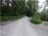 6
6 7
7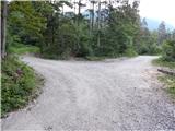 8
8 9
9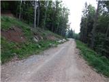 10
10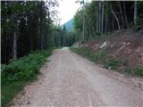 11
11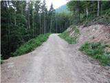 12
12 13
13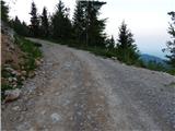 14
14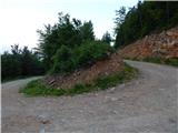 15
15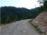 16
16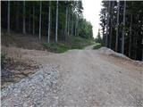 17
17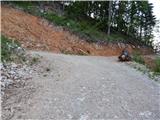 18
18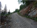 19
19 20
20 21
21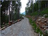 22
22 23
23 24
24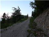 25
25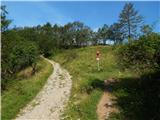 26
26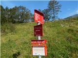 27
27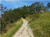 28
28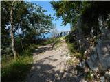 29
29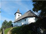 30
30 31
31 32
32
Discussion about the trip Potoče - Planinska koča Iskra na Jakobu (by road)
To post a comment you must log in:
If you do not yet have a username, you must first
register.