Starting point: Radlje ob Dravi (374 m)
| Latitude/Longitude: | 46,61440°N 15,22500°E |
| |
Walking time: 30 min
Difficulty: easy marked way
Elevation gain: 134 m
Elevation difference along the route: 134 m
Map: Pohorje - izletniška karta 1:50.000
Recommended equipment (summer):
Recommended equipment (winter):
Views: 883
 | 2 people like this post |
Access to starting point:
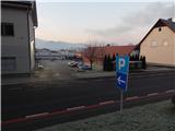
A) We drive to Dravograd, and then we continue driving towards Maribor. When we arrive in Radlje ob Dravi, from the intersection between the stores Hofer and Lidl we turn left in the direction of the Radelj pass and the center of Radlje ob Dravi. We continue on the road which leads us through the center of the settlement (left Austria over Radeljski prelaz), along which we drive to the parish church of St. Michael, where by the road we notice red signposts. We park on one of the parking lots in Radlje ob Dravi, but carefully, because on some parking lots it is possible to park only for 2 hours.
B) From Maribor through the Drava Valley we drive towards Dravograd, and we leave the main road before the settlement Radlje ob Dravi, where signs for the mentioned settlement direct us to the right. Further on, we drive past the cemetery, health home and police station, and then on the right near the parish church we notice red signposts. We park on one of the parking lots in Radlje ob Dravi, but carefully, because on some parking lots it is possible to park only for 2 hours.
Route description:
From the starting point, we head onto the path in the direction of Župank and Kapunar, where we first go past an educational board and past the parish church of St. Michael, a little further also past Rožni dvor (Rosenhof). The road on which we are ascending soon turns left, just a few steps further the blazes direct us sharply right onto a narrower road, from it we go immediately left onto the initially fenced marked path. After a few minutes of ascent we reach the macadam road, which we follow to the right, so that we bypass the water reservoir along the lower right side.
We continue towards Župank and Kapunar (slightly left unmarked path to Kapunar, which leads west of Perkolica (600 m), straight steeper marked path), where from the macadam we quickly switch to the asphalt road, along which we ascend all the way to the NOB monument at the Župank homestead.
Description and pictures refer to the condition in the year 2018 (December).
Photos:
 1
1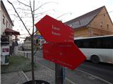 2
2 3
3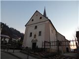 4
4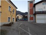 5
5 6
6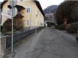 7
7 8
8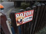 9
9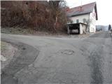 10
10 11
11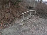 12
12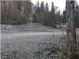 13
13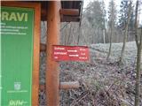 14
14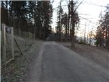 15
15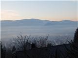 16
16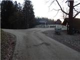 17
17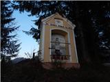 18
18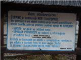 19
19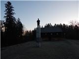 20
20
Discussion about the trip Radlje ob Dravi - Župank
To post a comment you must log in:
If you do not yet have a username, you must first
register.