Rifugio Bai de Dones - Rifugio Nuvolau (Trincee)
Starting point: Rifugio Bai de Dones (1889 m)
| Latitude/Longitude: | 46,51890°N 12,03790°E |
| |
Route name: Trincee
Walking time: 2 h 50 min
Difficulty: easy marked way
Elevation gain: 686 m
Elevation difference along the route: 720 m
Map: Tabacco 03 1:25.000
Recommended equipment (summer):
Recommended equipment (winter): ice axe, crampons
Views: 1.440
 | 1 person like this post |
Access to starting point:
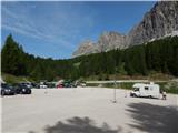
A) From Kranjska Gora over Korensko sedlo to Austria, where at the first larger crossroad we continue left towards Podklošter / Arnoldstein and Trbiž / Tarvisio. At the end of the settlement Podklošter signs for Šmohor / Hermagor point us to the right on a regional road, on which past the mentioned settlement we drive to the end of the Gailtal valley, or more precisely to the settlement Kötschach-Mauthen, where we turn right towards the settlement Oberdrauburg. The path ahead leads us over the Alpine pass Gailbergsattel (982 m), after which we descend into the mentioned settlement. After we cross the bridge over the river Drau, we continue left towards the settlement Lienz. In the main roundabout in Lienz we continue "left" in the direction of the settlement Sillian and Italy. Further, we cross the border between Austria and Italy, and we follow the main road to the settlement Dobbiaco / Toblach, where we turn left towards Cortina d'Ampezzo. When we arrive in Cortina d'Ampezzo, we follow the signs for the Alpine pass Passo Falzarego. The road above Cortina d'Ampezzo starts to ascend more steeply, and we follow it for quite some time, more precisely to the spot where just before a sharp right turn a road branches off to the left, by which we quickly arrive at the large parking lot at the hut Rifugio Bai de Dones. From Kranjska Gora to the starting point is 208 km.
B) From Kranjska Gora over the border crossing Rateče to Trbiž / Tarvisio and further on the highway towards Udine. We leave the highway at the settlement Tolmezzo, from where we continue driving towards the settlement Ampezzo and further towards the Alpine pass Passo della Mauria (1298 m). The road then starts descending and brings us into the Cadore valley, where we continue right towards the settlement Auronzo di Cadore. At the next crossroads we follow the signs for Cortina d'Ampezzo. When we arrive in Cortina d'Ampezzo, we follow the signs for the Alpine pass Passo Falzarego. The road above Cortina d'Ampezzo starts to ascend more steeply, and we follow it for quite some time, more precisely to the spot where just before a sharp right turn a road branches off to the left, by which we quickly arrive at the large parking lot at the hut Rifugio Bai de Dones. From Kranjska Gora to the starting point is 198 km.
C) From Nova Gorica we drive into Italy and further on the highway to the settlement Portogruaro, where at the highway junction we turn in the direction of Belluno. We follow the highway to its end (we do not turn towards the settlement Belluno), then we continue driving towards Cortina d'Ampezzo. When we arrive in Cortina d'Ampezzo, we follow the signs for the Alpine pass Passo Falzarego. The road above Cortina d'Ampezzo starts to ascend more steeply, and we follow it for quite some time, more precisely to the spot where just before a sharp right turn a road branches off to the left, by which we quickly arrive at the large parking lot at the hut Rifugio Bai de Dones. From the border crossing to the starting point is approximately 230 km.
Route description:
From the parking lot, we head east on path 425 following the signs »Cinque Torri, Rifugio Scoiattoli«. At the beginning we walk a few meters on a macadam road, then the markers direct us left onto a well-maintained footpath. Here we first walk on somewhat marshy terrain, then the path quickly takes us into the forest and leads us past Lake Lago Bai de Dones. Behind the lake the path turns slightly right and also descends slightly. Such a path then brings us to a junction where path 424 joins us from the left.
At the junction the path turns right again and soon begins to ascend through the forest. The path continues ascending through the forest for some time, then joins an asphalt road.
Further on, we ascend along the road from which views begin to open up, mainly towards the Tofane. Later the path brings us to a marked junction.
Further along the road it is not far to the Rifugio Cinque Torri hut, but we head right onto the footpath called Trincee. From the junction we walk on a narrow trail through increasingly sparse larch forest. Such a path then brings us to renovated military trenches along which we walk for some time. Here along the path there are also many information boards describing events from the First World War. As we approach the famous Cinque Torri towers, the path from the Rifugio Cinque Torri hut joins from the left. At the junction we continue right and bypass the towers, which are extremely popular among climbers, along the right northern side. When we reach the western side, a short descent follows, then the path begins to ascend again. Along the path there are still numerous military trenches and some renovated military buildings. In the last section to the Scoiattoli hut there follows an ascent along mostly grassy slopes.
From the Rifugio Scoiattoli hut, from which there is a nice view of Cinque Torri, we head right following the signs for Rifugio Nuvolau and Rifugio Averau. The path ahead leads along a stone road, or the much more pleasant parallel mountain path for walking, which ascends along the left side of the road. After a good 20 minutes of moderate ascent over panoramic terrain, initially still grassy slopes, the trail splits into two parts (the junction is unmarked).
We continue straight ahead (the right path joins the road and leads to the Rifugio Averau hut, from there it is also possible to continue to the Rifugio Nuvolau hut), along the path which continues to ascend moderately, only transitioning from grassy slopes into rocky terrain. A little higher the path brings us to a ridge, where the path from the Averau hut joins, and we continue in the same direction. Higher up the ridge narrows somewhat and becomes precipitous on the right side, but the path runs along the left side throughout, which is not demanding when dry. We follow this increasingly panoramic path, from which a view also opens to the highest peak of the Dolomites - Marmolada (Punta Penia), all the way to the summit where the Nuvolau hut stands, which we reach after a few minutes of further walking.

Photos:
 1
1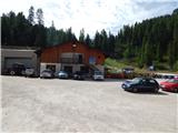 2
2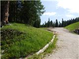 3
3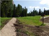 4
4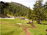 5
5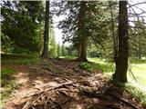 6
6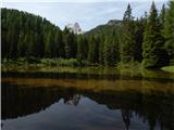 7
7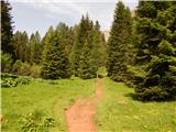 8
8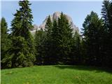 9
9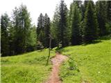 10
10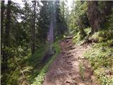 11
11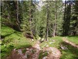 12
12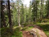 13
13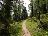 14
14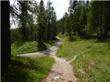 15
15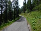 16
16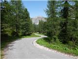 17
17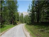 18
18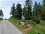 19
19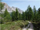 20
20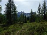 21
21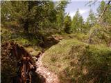 22
22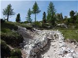 23
23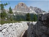 24
24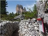 25
25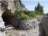 26
26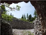 27
27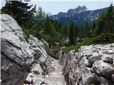 28
28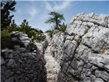 29
29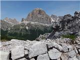 30
30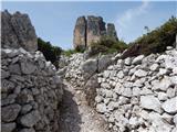 31
31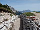 32
32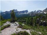 33
33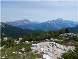 34
34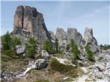 35
35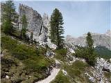 36
36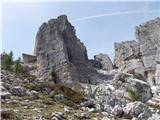 37
37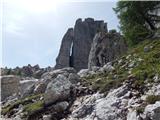 38
38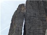 39
39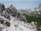 40
40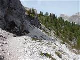 41
41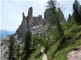 42
42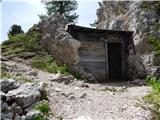 43
43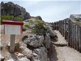 44
44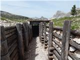 45
45 46
46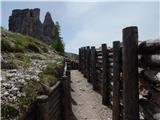 47
47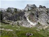 48
48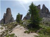 49
49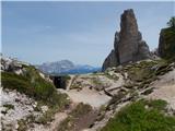 50
50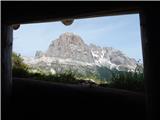 51
51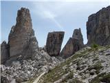 52
52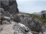 53
53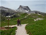 54
54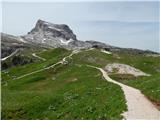 55
55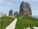 56
56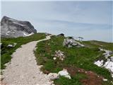 57
57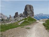 58
58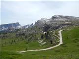 59
59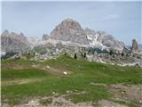 60
60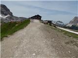 61
61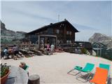 62
62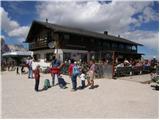 63
63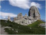 64
64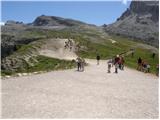 65
65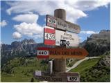 66
66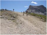 67
67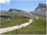 68
68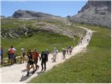 69
69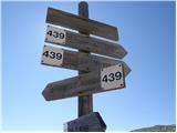 70
70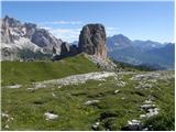 71
71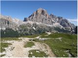 72
72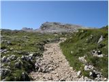 73
73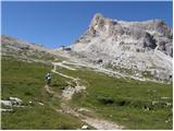 74
74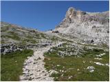 75
75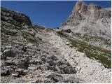 76
76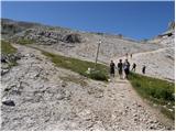 77
77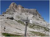 78
78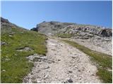 79
79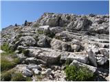 80
80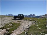 81
81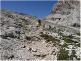 82
82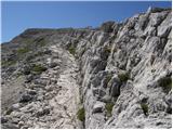 83
83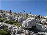 84
84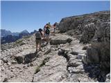 85
85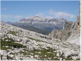 86
86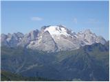 87
87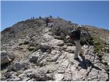 88
88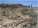 89
89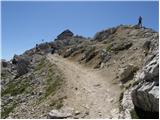 90
90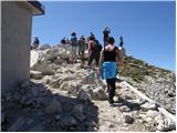 91
91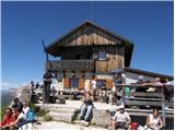 92
92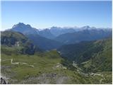 93
93
Discussion about the trip Rifugio Bai de Dones - Rifugio Nuvolau (Trincee)
To post a comment you must log in:
If you do not yet have a username, you must first
register.