Starting point: Spodnja Kokra (530 m)
| Latitude/Longitude: | 46,30270°N 14,47540°E |
| |
Walking time: 1 h 35 min
Difficulty: easy unmarked way
Elevation gain: 589 m
Elevation difference along the route: 589 m
Map: Karavanke - osrednji del 1:50.000
Recommended equipment (summer):
Recommended equipment (winter): ice axe, crampons
Views: 25.015
 | 3 people like this post |
Access to starting point:
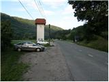
From the Ljubljana–Jesenice motorway, take the Kranj–east exit and continue following the road towards Jezersko. Just a few kilometres after the turn-off for Preddvor, on the right side of the road we will spot a transformer and a parking area next to it, where we park. There are also signposts for the Čemšenik hut here.
Route description:
From the parking lot, first carefully cross the road, then head onto the footpath towards the Čemšenik hut. The wide path barely noticeably ascends to the Polajnar farmstead, where we step onto the road and follow it to the right.
The road steeply ascends immediately behind the house, but a little higher it loses the asphalt surface. Further on, the road levels out and turns slightly to the left, where it comes very close to the Čemšeniški stream. A little further, we cross the mentioned stream and right after it reach a marked junction, where we continue on the left road towards the Čemšenik hut. The road then begins to ascend more steeply again and after less than 30 minutes of further walking brings us to the Čemšenik hut.
From the Čemšenik hut, continue behind the hut on a well-visible but unmarked path that goes into the forest and first gently then increasingly steeply ascends. The path soon brings us to a modest viewpoint, where it turns slightly to the right and then ascends across. Higher up, the path brings us to the main ridge (view of the Gorenjska plain), where it ascends even more steeply and after a few minutes of further walking brings us to a more level area where a wooden hut (weekend cottage) stands.
Just before the hut, the path turns to the right and after a few more steps brings us to the stamp box on Baba. From the stamp box to the summit, only a minute of walking along the partly scenic ridge remains.
Spodnja Kokra - Čemšenik 50 minutes, Čemšenik - Baba 45 minutes.

Photos:
 1
1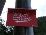 2
2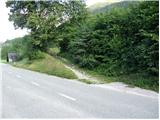 3
3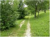 4
4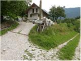 5
5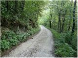 6
6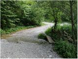 7
7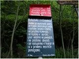 8
8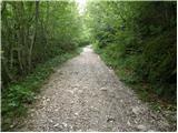 9
9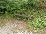 10
10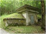 11
11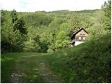 12
12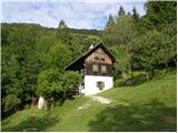 13
13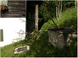 14
14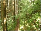 15
15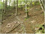 16
16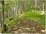 17
17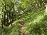 18
18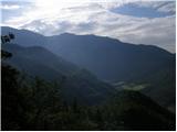 19
19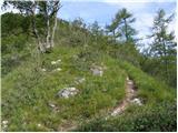 20
20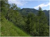 21
21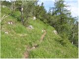 22
22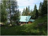 23
23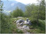 24
24 25
25
Discussion about the trip Spodnja Kokra - Baba
|
| grega_p10. 04. 2010 |
Nice trip with beautiful views over the Kranj plain. To Čemšenik hut (currently closed) along the road, then we bite into the steepness and reach a slightly overgrown ridge where the world opens up. Took 4 hours up and down with photography. Snow has already melted, so everything is dry.
The whole way a light brown four-legged mongrel (one parent was a terrier) accompanied me, which at the end wanted to come with me to Lj. Unfortunately I had to leave it there. If anyone misses it, it's hanging around the Polajnar farm.
|
|
|
|
| lubi127. 12. 2011 |
On New Year's Eve we'll treat ourselves to a midnight ascent with a merry friendly group that will welcome the new year 2012 in Dom Čemšenik. May snow whiten and beautify the landscape, wind disperse the fog and clouds. Magical holidays and pleasant companions in 2012 I wish with the good thought: SUCCESS is never final and FAILURE never fatal. COURAGE is what counts.
|
|
|
|
| katty21. 10. 2012 |
I've been waiting for the ascent to this Baba for quite some time. But today we went up here . We could have gone elsewhere, but night work doesn't allow for any exceptional feats far away . We could have gone elsewhere, but night work doesn't allow for any exceptional feats far away . Baba is a real training and polygon for building or maintaining fitness, as it is quite steep in some places, especially in the upper part where you walk along the ridgelet . Baba is a real training and polygon for building or maintaining fitness, as it is quite steep in some places, especially in the upper part where you walk along the ridgelet ...but fun, above all scenic. On a day like today, it's worth going even to such hills. I recommend it if you're looking for such solitary paradises. And at Čemšenik it was great, whatever you go for some blueberry pie, it's nicely tasty. ...but fun, above all scenic. On a day like today, it's worth going even to such hills. I recommend it if you're looking for such solitary paradises. And at Čemšenik it was great, whatever you go for some blueberry pie, it's nicely tasty.
|
|
|
|
| Kokta4. 11. 2012 |
From the hut to the summit the path is easy to follow, although not marked.
|
|
|
|
| Lisica8. 09. 2013 |
There was no stamp at Baba today. But there was a nice view. The path tempted me further to Potoška gora and Javorov vrh. But there was a nice view. The path tempted me further to Potoška gora and Javorov vrh.
|
|
|
|
| Gost8. 09. 2013 |
There has never been a stamp at Baba.
|
|
|
|
| jvidmar12. 05. 2014 |
Warm-up to the Čemšenik hut, then superb through the forest and along the ridge. Very scenic, recommended At the top there is a logbook, no stamp.
|
|
|
|
| Janez Seliškar22. 08. 2014 |
To Dom Čemšenik quite steeply along the road. Then nice path, well trodden to the nice alpine pasture with hut right below the summit. Unfortunately all in fog, so better luck next time.
|
|
|
|
| Lisica6. 09. 2018 |
Today again a wonderful day on Baba. Path for the soul... by chance the caretakers were at the hut and brewed a super coffee. The day was so perfect. I recommend visiting the hut on weekends when it's open. They are famous for their wild goulash.
|
|
|
|
| jurijt17. 02. 2020 |
Supplement to the trail description: to the modest viewpoint you walk briefly on the forest road, at the next junction go straight not right ahead on that road. Further the trail is easy to follow.
At the summit it's worth continuing the trail 100m further along the ridge, as the view there is much better (no trees obstructing it). The trail is suitable for dogs.
|
|
|
|
| tango25. 11. 2020 |
We drove to the parking lot where the road crosses the Čemšenik stream. Continued on macadam towards Krems and then on the panoramic path (Planinsko društvo Iskra), tried all three benches, in between jumped to the ridge towards point 1271 and back and then to Baba and down to the Čemšenik hut. Beautiful circular tour, not too strenuous, but for those who want to save their knees a bit it may be better to go in the opposite direction, as the section from the Čemšenik hut to the top of Baba is quite steep.
|
|
|
To post a comment you must log in:
If you do not yet have a username, you must first
register.