Stara Fužina - Koča na Planini pri Jezeru
Starting point: Stara Fužina (573 m)
| Latitude/Longitude: | 46,29030°N 13,88680°E |
| |
Walking time: 2 h 45 min
Difficulty: easy marked way
Elevation gain: 880 m
Elevation difference along the route: 920 m
Map: Triglav 1:25.000
Recommended equipment (summer):
Recommended equipment (winter): ice axe, crampons
Views: 36.264
 | 1 person like this post |
Access to starting point:
We drive to Bohinjska Bistrica, then follow the signs to Bohinj Lake. Upon arriving at Bohinj Lake in the settlement of Ribčev Laz, we turn right towards Stara Fužina. The route continues past the Church of St. John the Baptist, then we soon reach the settlement of Stara Fužina, from where we follow the signs to the Mostnica Gorges and the pastures Blato, Vogar and Voje. Above the settlement of Stara Fužina, we reach the start of the toll road to the pastures Blato, Vogar and Voje, where we park at the paid parking lot.
Route description:
From the parking lot we continue along the asphalt road leading towards Planina Blato, Planina Vogar and Voje Valley. The initially fairly steep road soon levels out and then takes us to a sign where a junction is marked.
At the sign we leave the asphalt road and continue left towards Planina Vogar and Pršivec. Further on, we first ascend transversely across a scenic pasture, then the path enters the forest through which it climbs along a stony cart track. In a few long serpentines we ascend to a higher level where the path levels out somewhat. A little further on, we notice signs for the NOB monument located at a beautiful viewpoint and paraglider take-off site, offering a fine view of Bohinj Lake, Rudnica and the Bohinj-Tolmin Mountains, sometimes called the Lower Bohinj Mountains.
From the viewpoint we return to the marked path which soon brings us to the eastern edge of Planina Spodnji Vogar. The path ahead mostly ascends gently across meadows, and along the way we notice a large number of former shepherds' huts now mostly converted into weekend cottages. We follow this path, which continues gently ascending, to Kosijev dom on Vogar, reaching it after a few minutes of further walking.
From the hut we continue right towards Pršivec and Planina pri Jezeru, the path leading along a wide cart track past a small cross to a marked junction.
At the junction we continue right (left to Pršivec, Planina Viševnik and Planina Vodični vrh) and proceed along a rough gravel road leading across the upper part of Planina Vogar. The path continues past the Dolenc homestead, and shortly after we reach a small crossroads where we go straight. From the crossroads we walk along the road for a few more metres, then continue slightly right onto a footpath that first gently ascends across the meadow before entering the forest where it steeply ascends briefly. Soon we return to the road which we follow right. After a short gentle ascent the road begins to descend, which we follow to the nearby marked junction where we leave it and continue slightly left on the parallel mountain path. For a while we gently ascend or traverse the slopes to the right, then join a tractor track. We ascend the track for about three minutes, then markers direct us onto a footpath that begins to ascend more steeply. Higher up the path joins a much better maintained cart track starting from Planina Blato, which we follow left.
Further on we continue ascending through the forest for a while, then the path turns left entering a small valley. In the valley the forest gradually thins, and higher up the path turns slightly right taking us to a marked junction where the path from Planina Vodični vrh joins from the left. Here we continue straight and after five minutes of further walking arrive at Koča na Planini pri Jezeru.
Starting point - Vogar viewpoint 1:00, Vogar viewpoint - Kosijev dom 0:15, Kosijev dom - Koča na Planini pri Jezeru 1:30.

Along the route: Vzletišče Vogar (983m), Spodnji Vogar (1028m),
Kosijev dom na Vogarju (1054m), Obeležje NOB (1080m), Zgornji Vogar (1097m), Razpotje Pungrat (1255m), Razpotje pod Vodičnim vrhom (1449m)
The trip can be extended to the following destinations: Planina Blato,
The lake Črno jezero,
Dom na Komni,
Planina Lopučnica,
Planina Dedno Polje,
Planina v Lazu,
Planina Viševnik,
Planina Ovčarija,
Koča pri Triglavskih jezerih (2 h 15 min),
Pršivec,
Rigeljc,
Stadorski Orliči,
Vrtec,
Visoka glava,
Kovačičeva glava,
The lake Jezero v Ledvicah,
Rušnata glava,
Bela glava,
The lake Zeleno jezero,
Vrh nad Vodeno Rupo,
The lake Rjavo jezero,
Kreda,
Zasavska koča na Prehodavcih,
Mala Tičarica,
Slatna,
Velika Tičarica,
Koča na Doliču,
Prvi Vogel,
Kopica,
Srednji Vogel,
Čelo,
Mala Zelnarica,
Malo Špičje,
Velika Zelnarica,
Zadnji Vogel,
Veliko Špičje,
Morbegna,
Glava v Zaplanji,
Kanjavec,
Triglav
Photos:
 1
1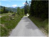 2
2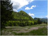 3
3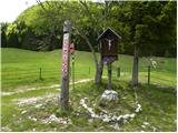 4
4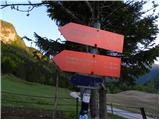 5
5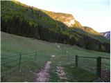 6
6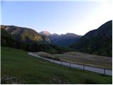 7
7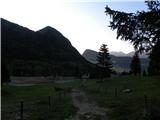 8
8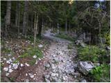 9
9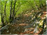 10
10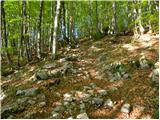 11
11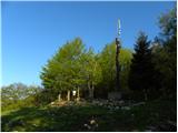 12
12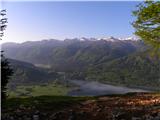 13
13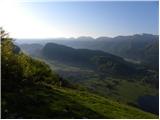 14
14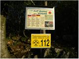 15
15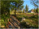 16
16 17
17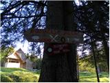 18
18 19
19 20
20 21
21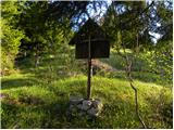 22
22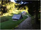 23
23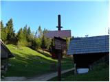 24
24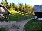 25
25 26
26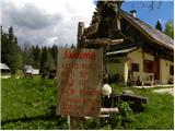 27
27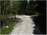 28
28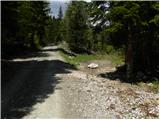 29
29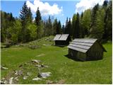 30
30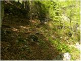 31
31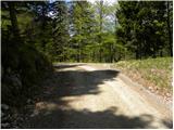 32
32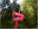 33
33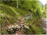 34
34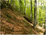 35
35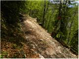 36
36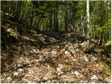 37
37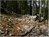 38
38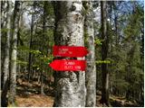 39
39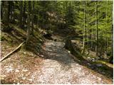 40
40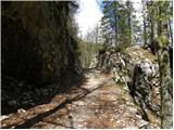 41
41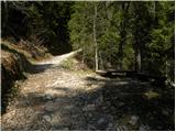 42
42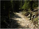 43
43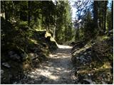 44
44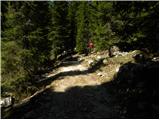 45
45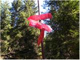 46
46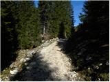 47
47 48
48
Discussion about the trip Stara Fužina - Koča na Planini pri Jezeru
|
| Jaka-Eva17. 03. 2013 |
Pleasant hike. Hiked yesterday. The path is trodden. Hut at Vogar open, hut at Planina pri Jezeru closed.
|
|
|
|
| Hribolazec8121. 08. 2015 |
How much walking is there still from Kosijev dom on Vogar to this hut at Planina pri Jezeru? 
|
|
|
|
| pikica121. 08. 2015 |
Look above at picture 33, those signs are on the road that leads from Stara Fužina towards Vogar. There you turn off the road up into the forest on the path it shows 1 hour and 15 min. Before that you came from the direction where the other sign shows Vogar 20min. And that's what interests you
|
|
|
|
| valerija11221. 08. 2015 |
1 hour and 30 minutes, leisurely walking like that.
|
|
|
|
| Hribolazec8121. 08. 2015 |
Bahkeopa, thanks Valerija, I'll see more tomorrow morning when I go to Vogar, Viševnik and many more depending on the people who will walk beside and how much their fitness
|
|
|
|
| pojoča travica28. 05. 2018 |
PD LPP announces that Koča na Planini pri Jezeru is opening its doors on 2.6.2018. Welcome!
|
|
|
To post a comment you must log in:
If you do not yet have a username, you must first
register.