Studenice - Plešivec (at Boč)
Starting point: Studenice (260 m)
| Latitude/Longitude: | 46,29990°N 15,61380°E |
| |
Walking time: 2 h
Difficulty: easy marked way
Elevation gain: 562 m
Elevation difference along the route: 620 m
Map: Posavsko hribovje Boč - Bohor 1:50.000
Recommended equipment (summer):
Recommended equipment (winter):
Views: 3.995
 | 2 people like this post |
Access to starting point:
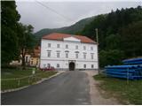
A) From the direction of Ljubljana we leave the highway in Slovenske Konjice and through Žiče, Loče and Zbelovo we get to the center of Poljčane. In the center, we turn right in the direction of Studenice and after about three kilometers, we reach Studenice, where we continue right across the bridge over the Dravinja River into the main part of the settlement. In front of the monastery complex we safely park.
B) From the direction of Maribor we leave the highway in Slovenska Bistrica, where signs point us to Poljčane. In the center, we turn left in the direction of Studenice and after about three kilometers, we reach Studenice, where we continue right across the bridge over the Dravinja River into the main part of the settlement. In front of the monastery complex we safely park.
C) From the direction of Ptuj, Kidričevo through Ptujska gora, Majšperk and Makole we get to Studenice, where we continue left across the bridge over the Dravinja River into the main part of the settlement. In front of the monastery complex we safely park.
Route description:
After a short tour of the main part of Studenice, we continue left from the monastery complex by the rectory. In the passage/underpass between the rectory and winegrowers association Studenice we continue upwards on a cart track by a stone wall and nuns' cemetery. We soon reach the source(s) of the Warm Studeniški stream left from the path and on a narrow footbridge we cross the stream. We continue upwards, now on the old Roman road which through long centuries retained the original form of the path higher into Boč. When we get to a forest road we turn left, right leads the road towards the settlement Podboč or Zgornje Poljčane.
We follow the forest road and at the first larger crossroad we continue right, left leads the road in the direction of Makole. Further, right by the road we reach a log cabin of hunters LD Poljčane na Golniku. We continue on the road which for a few meters flattens. After a short flat section, we continue uphill and we soon come again to a crossroad, at which we continue left on a narrower forest road, the right path continues towards the tower on Boč. On a narrower forest road between Kisovec left and Drevesnica right we soon reach the about 645 meters high saddle above Formila. We continue downwards, Formila is already visible on the right, from the left soon joins a marked mountain path from Makole.
Formila is reached and then follows a short extension to a crossing, left for partisan hospital, Gaveza, Gril's chapel, Plešivec... and right for mountain hut Dom na Boču. The crossing is also the juncture with the path Štajerska - Zagorje or „B“ - Bratska pot.
At the crossing, we continue left on the forest road and after some two hundred meters left a little below the route of the road, we reach an intermediate destination of the path, the partisan hospital on Formila. It is still well hidden even though it is located directly by the road. Wooden sign with the inscription is on the trunk, but unfortunately it has also been several times removed or knocked down.
After a short tour of the point by the path, we continue on the forest road a few hundred meters ahead and on the first turn-off to the right, we continue on a forest path. There are no signposts at the turn-off, but the mountain path through mixed forest of deciduous trees and partly also coniferous trees is easy to follow. During the growth season, there is a lot of wild garlic here.
We soon reach the forest road opposite a smaller football field and we turn left. We continue by the hunting lodge LD Rogaška Slatina, which is on the right by the path, and by the homestead Gavez, which is on the left by the path. From the right soon also joins an asphalted road from Rogaška Slatina. We continue higher on the forest road, direction signs are also helpful and after a few hundred meters, somewhere by the abandoned forestry ramp we continue right again to a crossing with signs.
A signpost points us left upwards, inscription Ložno or Donačka gora, to the right goes the path towards Gril's chapel. We continue through the forest part and the path soon passes onto a part cut years ago, where there is quite distinct erosion. A look back and the upper part of Boč is excellently visible in one of the more interesting views of it. We continue higher and left by the path there is a hunting blind. The continuation is in a more pronounced part with coniferous trees and soon again left by the path a larger feeding site for wildlife on Plešivec. We follow the excellently marked path further on varied terrain a little up/down and we reach somewhere the summit of Plešivec in the vicinity or at the point where the path turns downwards for Ravnocerje or Donačka gora - also a sign on the tree for the forest reserve.
The length of the path from Studenice is around 8500 meters, 620 positive elevation meters and 50 negative elevation meters.

Photos:
 1
1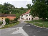 2
2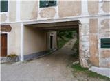 3
3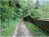 4
4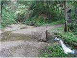 5
5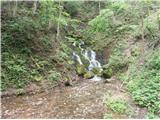 6
6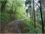 7
7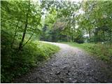 8
8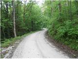 9
9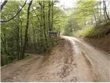 10
10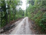 11
11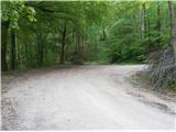 12
12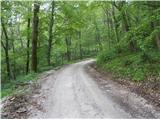 13
13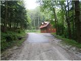 14
14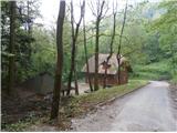 15
15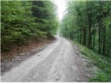 16
16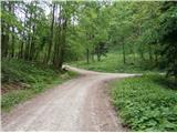 17
17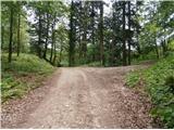 18
18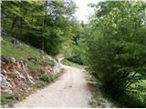 19
19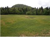 20
20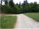 21
21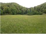 22
22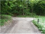 23
23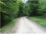 24
24 25
25 26
26 27
27 28
28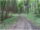 29
29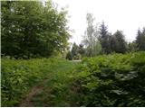 30
30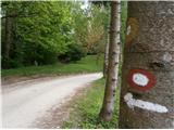 31
31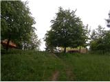 32
32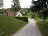 33
33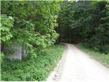 34
34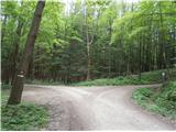 35
35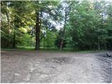 36
36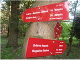 37
37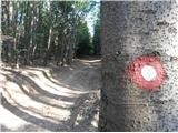 38
38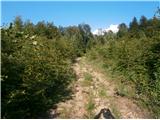 39
39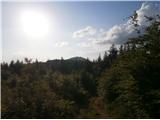 40
40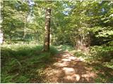 41
41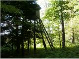 42
42 43
43 44
44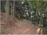 45
45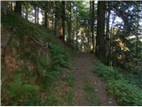 46
46 47
47
Discussion about the trip Studenice - Plešivec (at Boč)
|
| bruny19. 10. 2014 |
Today I included this path also in the hiking activity on Boč and Plešivec, except between photo 12 and 21 where I walked a different variant - combination of the mountain path from Makole to Boč. More perhaps on conditions...
|
|
|
To post a comment you must log in:
If you do not yet have a username, you must first
register.