Studenice - Source of Topli (Studeniški) potok
Starting point: Studenice (260 m)
Starting point Lat/Lon: 46.2999°N 15.6138°E 
Time of walking: 5 min
Difficulty: easy marked way
Difficulty of skiing: no data
Altitude difference: 35 m
Altitude difference (by path): 35 m
Map: Posavsko hribovje Boč - Bohor 1:50.000
Access to starting point:
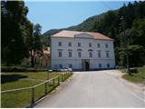
A) From the direction of Ljubljana we leave the highway in Slovenske Konjice and through Žiče, Loče and Zbelovo we get to the center of Poljčane. In the center, we turn right in the direction of Studenice and after about three kilometers we reach Studenice, where we continue right across the bridge over the river Dravinja into the main part of the settlement. In front of the monastery complex we safely park.
B) From the direction of Maribor we leave the highway in Slovenska Bistrica, where signs point us to Poljčane. In the center, we turn left in the direction of Studenice and after about three kilometers we reach Studenice, where we continue right across the bridge over the river Dravinja into the main part of the settlement. In front of the monastery complex we safely park.
C) From the direction of Ptuj, Kidričevo through Ptujska gora, Majšperk and Makole we get to Studenice, where we continue left across the bridge over the river Dravinja into the main part of the settlement. In front of the monastery complex we safely park.
Path description:
After a short tour of the main part of Studenice, we continue left from the monastery complex by the presbytery. In the passage/underpass between the presbytery and the winegrowers association Studenice we continue upwards on a cart track along the stone wall. To the left also the path to Studenice Castle branches off, higher and soon again to the left by the path a smaller stream, where water runs in a wooden trough. Further right by the path, entry through the iron door, old nuns' cemetery of Dominican sisters and Magdalene sisters, who marked the history of Studenice through turbulent centuries. Further left by the path a stone/wooden well and the remains of an iron/concrete skeleton of the quarry. The only "foreign object" which somehow blended into the environment. A few more steps and source/sources of the stream more or less rich with water. The area higher is typically somewhat similar to karst, limestone terrain and their water abundance depends on precipitation, snow melt. Some benches in the oasis of silence, peace and a smaller wooden footbridge for crossing the stream at higher water level and this is also approximately the goal of the short path, suitable practically for everyone.
Pictures:
 1
1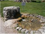 2
2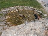 3
3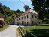 4
4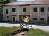 5
5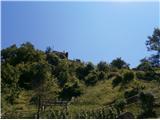 6
6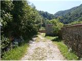 7
7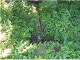 8
8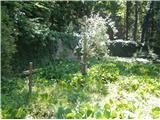 9
9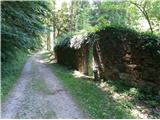 10
10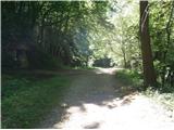 11
11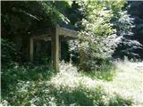 12
12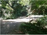 13
13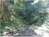 14
14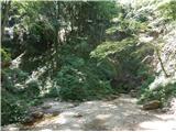 15
15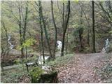 16
16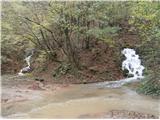 17
17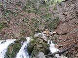 18
18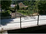 19
19