Studenice - Source of Topli (Studeniški) potok (Studenice - source of Topli potok - Zg. Poljčane)
Starting point: Studenice (260 m)
Starting point Lat/Lon: 46.2999°N 15.6138°E 
Path name: Studenice - source of Topli potok - Zg. Poljčane
Time of walking: 45 min
Difficulty: easy marked way
Difficulty of skiing: no data
Altitude difference: 35 m
Altitude difference (by path): 125 m
Map: Posavsko hribovje Boč - Bohor 1:50.000
Access to starting point:
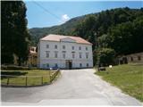
A) From the direction Ljubljana we leave the highway in Slovenske Konjice and through Žiče, Loče and Zbelovo we get to the center of Poljčane. In the center, we turn right in the direction of Studenice and after about three kilometers, we reach Studenice, where we continue right through a bridge over the river Dravinja into the main part of the settlement. In front of the monastery complex we safely park.
B) From the direction Maribor we leave the highway in Slovenska Bistrica, where signs point us to Poljčane. In the center, we turn left in the direction of Studenice and after about three kilometers, we reach Studenice, where we continue right through a bridge over the river Dravinja into the main part of the settlement. In front of the monastery complex we safely park.
C) From the direction of Ptuj, Kidričevo through Ptujska gora, Majšperk and Makole we get to Studenice, where we continue left through a bridge over the river Dravinja into the main part of the settlement. In front of the monastery complex we safely park.
Path description:
After a short sightseeing of the main part of Studenice, we continue left from the monastery complex by the presbytery. At the passage between the presbytery and winegrowers association Studenice we continue upwards on a cart track along the rocky wall. To the left also the path on Studenice castle branches off, and higher on the left by the path there is soon a smaller stream, where runs water in a wooden gutter. Further right by the path, through the iron door there is an old nun cemetery of dominican sisters and magdalene sisters, who marked the history of Studenice through turbulent centuries. Further left by the path there is a rocky-wooden well and remains of a quarry. The only,,foreign object,, which somehow blended into the environment. Few more strides and we get to source/sources of the stream which is more or less rich with water. Area higher is similar to karst, limestone terrain and water levels depend on precipitation, melting snow. Some benches in an oasis of silence, peace and there is a smaller wooden footbridge for crossing the stream.
After a short sightseeing, we continue upwards, now on the old Roman road which has retained its original form over the centuries. At the exit on the forest road we turn right, to the left leads the road higher into the area of Boč, Donačka gora...
On a well-hardened forest road in the arms of deciduous forest, which flattens we continue in the direction of destination. We soon reach a plain, to the right of the path are vineyards and also a beautiful view downwards on Studenice, Makole... to the left by the path is a small hunters' storage. We continue and again in the embrace of the forest, descend quite steeply downwards. Soon the terrain above the settlement Podboč opens, and the river Dravinja, Poljčane are clearly visible... We soon reach an asphalt surface and the settlement Podboč itself, which consists of only a few houses or homesteads. To the right by the path is yew Černogova tisa and a well/spring renovated years ago. We continue to the left and soon reach the settlement Zgornje Poljčane. To the right by the path is the parish church of the Holy Cross with a rich history, a relief of two Romans is visible on the facade, and the old market core was beautifully restored years ago. A few more steps downwards by the presbytery to the right, and we reach the central part of the settlement Zgornje Poljčane, which is also the destination.
The total length of the path from Studenice to Zgornje Poljčane is around 3500 meters, with 125 positive altitude meters and 115 negative altitude meters, very suitable also for mountain biking.
Pictures:
 1
1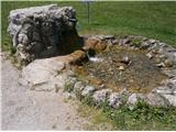 2
2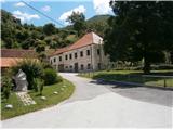 3
3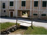 4
4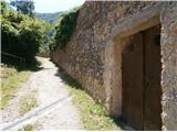 5
5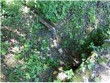 6
6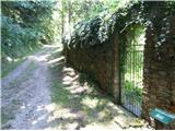 7
7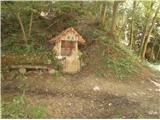 8
8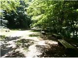 9
9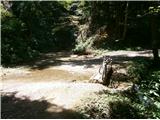 10
10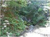 11
11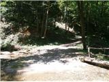 12
12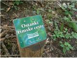 13
13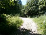 14
14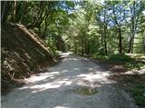 15
15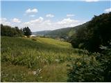 16
16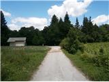 17
17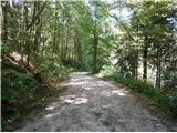 18
18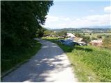 19
19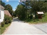 20
20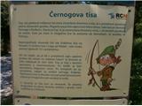 21
21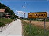 22
22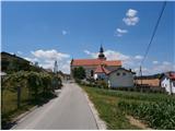 23
23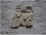 24
24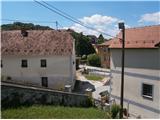 25
25 26
26 27
27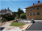 28
28 29
29