Tinčkova koča - Dom na Zelenici
Starting point: Tinčkova koča (1070 m)
| Latitude/Longitude: | 46,42280°N 14,19910°E |
| |
Walking time: 1 h 25 min
Difficulty: easy marked way
Elevation gain: 466 m
Elevation difference along the route: 500 m
Map: Karavanke - osrednji del 1:50.000
Recommended equipment (summer):
Recommended equipment (winter):
Views: 42.422
 | 3 people like this post |
Access to starting point:
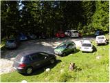
From the highway Ljubljana - Jesenice we take the exit Lesce and follow the road ahead in the direction of Žirovnica and Jesenice. After a few km of driving, we will arrive at an intersection, where the road to Žirovnica and Moste branches off to the right (from the direction of Jesenice to the left). Only a few meters ahead at the next intersection, we turn left to Moste (right to Žirovnica). Further on, we drive past the monument to the fallen fighters, where the road begins to climb up a slope under the railway line. At the top of the slope, we turn right (at the sign for Vila Karin), but we continue ahead towards Završniško jezero and Valvasorjev dom. The road then flattens and brings us to an intersection, where the road to Valvasorjev dom branches off to the left, and we continue straight ahead on the initially still asphalted road. The road soon becomes macadam, and we follow it to the parking lot near Tinčkova koča. The road in the upper section is often in rather poor condition.
Route description:
From the parking lot at Tinčkova koča we continue on a wide rocky cart track in the direction of Koča pri izviru Završnice. Already after a few steps of walking the blazes direct us slightly to the right onto a somewhat steeper footpath, which climbs over a panoramic grassy slope, then returns to the previously mentioned cart track, which we follow to the right. The cart track, which ascends relatively steeply through the forest, brings us after a few minutes of further walking to a pasture fence, behind which we arrive at the marked junction.
We continue straight ahead (slightly right Roblekov dom) on the still rocky cart track, which higher up leads us out of the forest onto the vast grassy slopes of Smokuška planina. Here the gradient eases and the increasingly panoramic path brings us in 15 minutes of further walking to Koča pri izviru Završnice.
From the hut we continue right on the marked footpath in the direction of Zelenica. The path already after a few steps of walking brings us to the spring of Završnica, beyond which we step onto a pleasant meadow. Beyond this meadow the path ascends somewhat more steeply and after a few minutes of further walking brings us to the foot of the western part of the Zelenica ski area. Here the path turns slightly to the right and ascends moderately through a short and sparse strip of forest. After the short ascent we step onto an indistinct saddle, from which we then descend in a few dozen steps to the Dom na Zelenici.

The trip can be extended to the following destinations: Roblekov dom na Begunjščici,
Klagenfurter Hutte/Celovška koča,
Spodnji Plot,
Vrh Ljubeljščice (Triangel),
Na Možeh,
Srednji vrh (above Završnica),
Žleb (Suho ruševje),
Srednja peč,
Bielschitza/Svačica,
Pautz/Zelenjak,
Selenitza/Palec,
Begunjščica,
Prešernova koča na Stolu,
Vertatscha/Vrtača,
Hochstuhl/Stol
Photos:
 1
1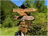 2
2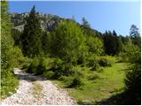 3
3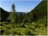 4
4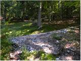 5
5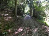 6
6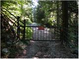 7
7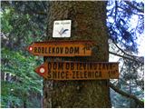 8
8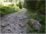 9
9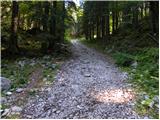 10
10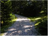 11
11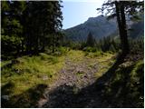 12
12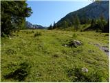 13
13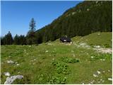 14
14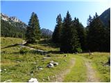 15
15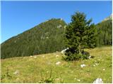 16
16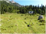 17
17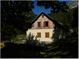 18
18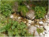 19
19 20
20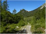 21
21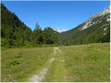 22
22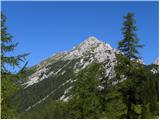 23
23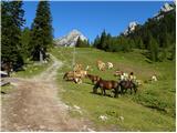 24
24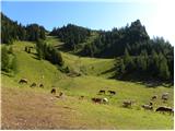 25
25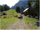 26
26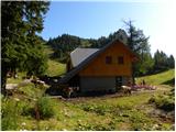 27
27
Discussion about the trip Tinčkova koča - Dom na Zelenici
|
| johnybravoslo26. 02. 2008 |
Hello,
yesterday I went along this path. The road was slightly icy in the morning, but it was possible to walk on the side.
Up high very warm, on the descent the ice on the road had melted and there were streams of water.
Regards
|
|
|
|
| hribi26. 02. 2008 |
Hello,
Are the huts at the source of Završnica, Tinčkova koča and Dom na Zelenici open on weekends at this time, or at least some of them? Best regards to all hikers. MIMI
|
|
|
|
| Klin26. 02. 2008 |
On Zelenica it's open on weekends, perhaps during the ski area operation also during the week.
|
|
|
|
| gorska roža2. 05. 2010 |
Hello, on Saturday I went on this path, but I have some tips for everyone who decides to visit this destination:
- disappointed with the path description published on this site, as searching took me quite some precious time. When it says:"Further we drive on a somewhat narrower road, which we follow at intersections in the direction of Valvasorjev dom and Završnica. " Just before turning back to the main road, on the hillock, we turn right at the junction, where there is no sign for Valvasorjev dom or Završnica, so I advise to look for the sign hunting hut and pizzeria, at the next intersection there is the correct sign (right Završnica), then drive past the water dam and then straight on asphalt, then on gravel. Then again no signs for Tinčkova koča (many weekend houses confuse you, similar to the hut), to it you drive by car from the end of gravel another 10-15 min, the road is bad and difficult to drive in the upper part - just before the hut a stream crosses it, so potholes. If you leave the car lower, at the wider even more gentle path, it's 50 min walk to Tinčkova koča. " Just before turning back to the main road, on the hillock, we turn right at the junction, where there is no sign for Valvasorjev dom or Završnica, so I advise to look for the sign hunting hut and pizzeria, at the next intersection there is the correct sign (right Završnica), then drive past the water dam and then straight on asphalt, then on gravel. Then again no signs for Tinčkova koča (many weekend houses confuse you, similar to the hut), to it you drive by car from the end of gravel another 10-15 min, the road is bad and difficult to drive in the upper part - just before the hut a stream crosses it, so potholes. If you leave the car lower, at the wider even more gentle path, it's 50 min walk to Tinčkova koča.
- for now the hut on Smokuška planina is not open on weekdays.
But I would praise the wonderful landscape and views, clean mountain air, along the path we are accompanied all the time by the murmur of the stream. Best regards to all.
|
|
|
|
| heinz3. 05. 2010 |
I absolutely do not agree with what's written, that if you leave the car lower (Žaga), to Tinčkova koča it's 50 min walk. "At the wider even more gentle path" could be anywhere.
From Žaga where I usually park the car, it's 10-15 min to T. koča.
It's true that in "access to the starting point" it doesn't say how much gravel there is to the hut, but the fact is that there is no parking at any of the weekend houses.
Otherwise, there shouldn't be problems with orientation and searching, if we use one of the maps. E.g. the above-mentioned Karavanke - central part 1:50 000.
So, if we know where our goal is, we certainly won't look for the starting point somewhere in Zavrhu pod Stolom..
|
|
|
|
| JutranjaZarja18. 10. 2013 |
Hello, we're heading on the above described trip. Interested if the road to Tinčkova koča is really that bad. Or is it better to park at "ŽAGA" and how far below the summit is that? Is the road to there normally drivable?
Best regards
|
|
|
|
| Daaam18. 10. 2013 |
Last year I left it a bit lower ..probably somewhere near Žaga (as Heinz describes) ..My suggestion is..just drive as long as you don't feel sorry for your car ..at that time there were quite a few cars parked near Tinčkova koča, so in principle you can "brave it" up there, if not, just park at a suitable spot..
|
|
|
|
| Jošt12. 09. 2023 21:39:37 |
Is the hut open this Sunday?
|
|
|
|
| balon27. 09. 2023 11:14:58 |
Hello,
is access possible with a minivan to the parking lot? The description says that the road in the upper part is in quite poor condition.
Thank you for your answers.
|
|
|
|
| bumbi27. 09. 2023 11:57:05 |
The road to the parking lot at Tinčkova koča is not in too good condition, but drivable. Dacia Sandero and Suzuki Ignis were parked there on Monday.
|
|
|
|
| bbugari127. 09. 2023 14:44:50 |
And the ramp can also be bypassed for free... 
|
|
|
|
| balon28. 09. 2023 09:31:45 |
Thanks for the answers. For the ramp or parking lot, I gladly pay, because I know that the access is more or less arranged.
|
|
|
|
| balon28. 09. 2023 09:57:37 |
One more question. How much walking is it from the hut to the ferrata Spodnji plot?
|
|
|
|
| cofka28. 09. 2023 15:31:16 |
|
|
|
|
| balon29. 09. 2023 14:44:54 |
|
|
|
|
| cofka29. 09. 2023 20:00:03 |
Correcting and apologizing... From the hut on Zelenica to the ferrata Spodnji plot is 10 minutes
|
|
|
|
| bojanslo1. 06. 2024 19:59:21 |
1.6.2024
We started from the parking lot at Tinčkova koča in very cloudy weather... The path is well marked and at a moderate pace, considering we're no longer in our prime, we reached Dom na Zelenici in 1 hour and 12 minutes.. with a few stops. The path is well marked and you can't get lost. But really, the parking space at Tinčkova koča is quite small for about 5-8 vehicles.... We were lucky there was no "crowd" because it was cloudy that day and on the way back from Zelenica to Tinčkova koča it rained on us continuously, but if properly equipped it's no obstacle.
nice hike...
p.s.
The view into the valley must be wonderful, but unfortunately it will need to be repeated in better weather.
|
|
|
To post a comment you must log in:
If you do not yet have a username, you must first
register.