Starting point: Tolminske Ravne (924 m)
| Latitude/Longitude: | 46,22940°N 13,77150°E |
| |
Walking time: 7 h 30 min
Difficulty: difficult marked way
Elevation gain: 1320 m
Elevation difference along the route: 1740 m
Map: TNP 1:50.000
Recommended equipment (summer):
Recommended equipment (winter): ice axe, crampons
Views: 1.180
 | 2 people like this post |
Access to starting point:
We drive to Tolmin, and then we continue driving in the direction of Žabče and Zadlaz (the turn-off from the main road is located on the left bank of Tolminka). When we get to Žabče, at the smaller crossroads we continue slightly right in the direction of the settlement Zadlaz. In the settlement Zadlaz-Žabče the road for some time descends, where over a bridge we cross Zadlaščica, and then it again starts ascending steeply on a narrow, but all the time asphalted road. After approximately 12 km from the main road we get to the marked parking lot in Tolminske Ravne, where we park.
Route description:
From the parking lot, we return a few steps back to the red mountain signposts, which we follow in the direction of the mountain hut Koča na planini Razor and mountain pasture Planina Kal. The path ahead first leads over a grazing fence, and then we continue on a cart track, which continues through a meadow, from which a nice view opens up on Tolminski Migovec. The cart track soon turns right and brings us to a stone fence, where it splits into two parts.
We continue on the left upper cart track in the direction of mountain pasture Planina na Kalu (slightly right Koča na planini Razor), which then ascends gently. A little higher, at the older water trough we continue right, and then we cross a torrent. We soon reach the next junction, where the path to Škrbina branches off to the right, and we continue on the left cart track, following the signs for mountain pasture Kal and Tolminski Migovec.
The old mule track further for some time continues by or slightly right of the nearby torrent, and then at the smaller cairn from the mule track slightly to the left branches off a path which continues by the torrent and leads further towards the saddle between peak Javor on the left and Grušnica on the right, and we continue to stick to the mule track.
Higher we reach the next marked junction, where another path towards mountain pasture Razor branches off to the right, and we continue left and for a short time continue in only gentle ascent. A minute or two further we leave the gentle path and continue slightly right in the direction of mountain pasture Planina na Kalu (straight we arrive at the previously mentioned saddle, from which we can continue to Javor or to the village Čadrg, in between there is also another turn-off towards mountain pasture Planina na Kalu). After a shorter somewhat steeper ascent we return to the mule track, where we also join the path from Čadrg.
We continue right and ascend on the mule track all the way to mountain pasture Planina na Kalu, where right of a smaller saddle stand some old huts.
At the huts where another path from mountain pasture Razor joins us we slightly ascend and quickly reach a marked junction, where the path to Tolminski Migovec branches off to the right. We continue left in the direction of Prehodci and Krn and further walk on the mule track. The path becomes flatter and runs towards the north, from the path we have a nice view towards the Tolminka valley. The path then brings us to steeper slopes on the southwest side of Tolminski Kuk, and at some places fixed safety gear assists us. The fixed safety gear ends and the path brings us to the chapel of Mother of God Hud Klanec next to which there is also a bench. From here there is also a wonderful view of the Tolminka valley and the peaks above the valley. At the chapel there is also a logbook box and a stamp.
From the chapel onwards the slope becomes somewhat less steep and the path mostly gently descends and crosses slopes which are mostly covered with dwarf pines towards the northwest. Later the path starts to descend even more in longer zigzags and also leads us through a strip of forest. A little before mountain pasture Dobrenjščica we reach a junction.
At the junction we continue straight on the marked path where the signs direct us to Prehodci and Krn. To the left downward leads an unmarked mule track to the nearby mountain pasture Dobrenjščica. Our path here slightly descends on a steeper slope and on a shorter section a steel cable also assists us. Such a path then soon rejoins the mule track which leads past mountain pasture Dobrenjščica.
Further we again cross slopes and the path leads us past a junction where to the left downward branches off a path to the nearby spring Čaramonka. Further we cross slopes, along the path dwarf pines and shorter strips of forest alternate. When we reach steeper slopes on the southwest side of Mahavšček, the path starts to ascend more steeply. Occasionally the slope is very steep and at some places a steel cable also assists us. The path otherwise runs on a mostly relatively wide mule track, so the ascent does not cause major difficulties. Higher the slope becomes less steep and the path for a short time again leads through a strip of forest, then mostly runs along dwarf pines. Such a path then brings us to a marked junction where to the right branches off a path towards Dom na Komni.
We continue left towards Prehodci and from the junction the path first for a short time ascends more steeply. Further the path becomes flatter and further leads us mostly along dwarf pines all the way to Prehodci where there is a marked junction.
We continue straight in the direction of Krn (left mountain pasture Polog) and continue on the path on a gentle and scenic path. Somewhat further from the right another path from Krnsko jezero joins us, and we further continue in the same direction. The path ahead from the plateau-like terrain again brings us to steep eastern slopes, from which a nice view opens up on the Tolmin side (the area is called Na Tminskem). The path then turns somewhat to the right and gradually brings us to a smaller high mountain valley. Here it starts to ascend more steeply and after approximately 20 minutes of further walking brings us to a large monument to the fallen in World War I.
Here we continue right on the marked path, which transversely ascends at the foot of Mali Peski. Higher the path brings us to numerous remains of World War I, then it still slightly ascends and brings us to a saddle between Mali Peski and Vrh nad Peski (somewhat more to the right are Veliki Peski). We continue on the marked path, from which soon to the right branches off an unmarked path to Vrh nad Peski, and we continue straight and bypass the mentioned peak over screes on its southern side. After a shorter crossing we reach Prag, where the path from the lake in Lužnica joins us.
At Prag, where there is a marked junction, we continue straight in the direction of Batognica (left downward lake in Lužnica, right downward Krnsko jezero) on the path which moderately ascends on the ridge slope of Batognica. This increasingly scenic path we then follow to the summit, which we reach after 15 minutes of further walking.
From Batognica we continue on an initially somewhat less visible path, which continues on the left side of the peak. The path, which initially only gently descends, soon brings us to steeper terrain, where we start to descend more steeply. After a short descent, we reach relatively steep steps, on which we start to descend steeply. On this section due to scree on the path there is a great risk of slipping. The path ahead gradually flattens and only somewhat further brings us to Krnska škrbina (we can reach the notch also if at Prag we continue on the so-called Northern path, which bypasses the peak Batognica; the latter is somewhat shorter, but also substantially less scenic).
From the notch we continue straight (left mountain pasture Kuhinja, right Krnsko jezero) on the path which starts to ascend on the grassy slope of the mountain. This increasingly scenic path we then follow to the scenic summit, which we reach after approximately 30 minutes of walking from Krnska škrbina.
Tolminske Ravne - Planina na Kalu 1:30, Planina na Kalu - Planina Dobrenjščica 1:30, Planina Dobrenjščica - Prehodci 1:30, Prehodci - Batognica 2:15, Batognica - Krnska škrbina 0:15, Krnska škrbina - Krn 0:30.

Photos:
 1
1 2
2 3
3 4
4 5
5 6
6 7
7 8
8 9
9 10
10 11
11 12
12 13
13 14
14 15
15 16
16 17
17 18
18 19
19 20
20 21
21 22
22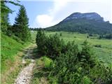 23
23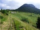 24
24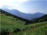 25
25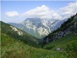 26
26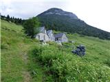 27
27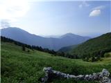 28
28 29
29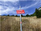 30
30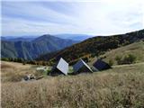 31
31 32
32 33
33 34
34 35
35 36
36 37
37 38
38 39
39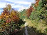 40
40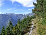 41
41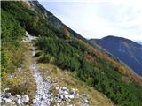 42
42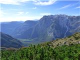 43
43 44
44 45
45 46
46 47
47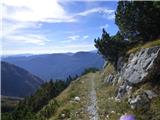 48
48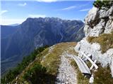 49
49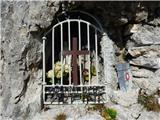 50
50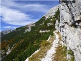 51
51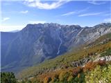 52
52 53
53 54
54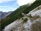 55
55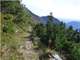 56
56 57
57 58
58 59
59 60
60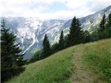 61
61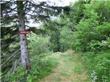 62
62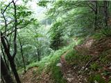 63
63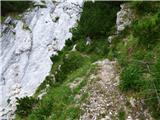 64
64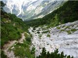 65
65 66
66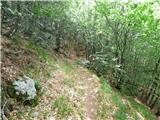 67
67 68
68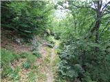 69
69 70
70 71
71 72
72 73
73 74
74 75
75 76
76 77
77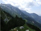 78
78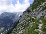 79
79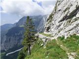 80
80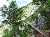 81
81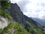 82
82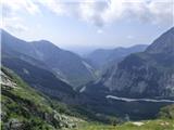 83
83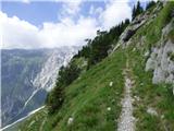 84
84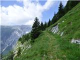 85
85 86
86 87
87 88
88 89
89 90
90 91
91 92
92 93
93 94
94 95
95 96
96 97
97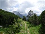 98
98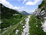 99
99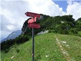 100
100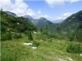 101
101 102
102 103
103 104
104 105
105 106
106 107
107 108
108 109
109 110
110 111
111 112
112 113
113 114
114 115
115 116
116 117
117 118
118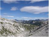 119
119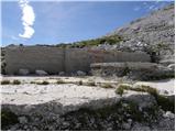 120
120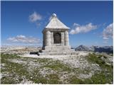 121
121 122
122 123
123 124
124 125
125 126
126 127
127 128
128 129
129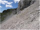 130
130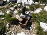 131
131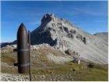 132
132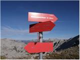 133
133 134
134 135
135 136
136 137
137 138
138 139
139 140
140 141
141 142
142 143
143 144
144 145
145 146
146 147
147 148
148 149
149 150
150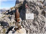 151
151 152
152 153
153 154
154 155
155 156
156 157
157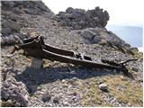 158
158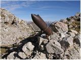 159
159 160
160 161
161 162
162 163
163 164
164 165
165 166
166 167
167 168
168 169
169 170
170
Discussion about the trip Tolminske Ravne - Krn
To post a comment you must log in:
If you do not yet have a username, you must first
register.