Urbas - Bivak na Belščici
Starting point: Urbas (1280 m)
| Latitude/Longitude: | 46,43440°N 14,13400°E |
| |
Walking time: 1 h 15 min
Difficulty: easy unmarked way
Elevation gain: 470 m
Elevation difference along the route: 470 m
Map: Karavanke - osrednji del 1:50.000
Recommended equipment (summer):
Recommended equipment (winter): ice axe, crampons
Views: 9.317
 | 2 people like this post |
Access to starting point:
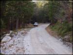
From the highway Ljubljana - Jesenice, take the Lesce exit and follow the road ahead in the direction of Žirovnica and Jesenice. After a few km of driving, we will arrive at a crossroad, where the road to Žirovnica and Moste branches off to the right (from the direction of Jesenice, left). Only a few meters ahead at the next crossroad, we turn left to Moste (right Žirovnica). Further on, we drive past a monument to fallen fighters, where the road starts to ascend under the railway track. At the top of the climb, we turn right (at the sign Vila Karin), but we continue towards Završniško jezero and Valvasorjev dom. The road then flattens and brings us to a crossroad, where the road to Valvasorjev dom branches off to the left. We take the mentioned road (straight Koča pri izviru Završnice), which starts gently at first, then steeper and steeper, ascending an occasionally quite rough road (the steepest parts are asphalted). Higher up, the road brings us to a somewhat larger crossroad, where we continue left towards Potoška planina (right Doslovška planina). The road then flattens and a little further brings us to the next crossroad, where the road to Valvasorjev dom branches off to the right, but we continue on the left lower road, which then continues for quite some time without major changes in elevation. The road then leads us past the turn-off to the path to Ajdna and then starts to ascend more steeply on an occasionally quite poor road. The road then flattens again and past Potoška planina brings us to the Urbas spring, near which there are a few smaller parking spots.
Route description:
From the parking lot, we first walk to the Urbas spring, where we notice a mountain sign for the Belščica pasture, which directs us to an initially somewhat difficult-to-follow footpath. The first 15 minutes of walking, the path ascends only gently, then it starts steeply ascending through the forest. Higher, the forest becomes thinner and slowly transitions into a belt of dwarf pines, and the path starts turning more and more towards the west. After a good hour of walking, we step onto grassy slopes and the path brings us after a few more steps to the bivouac on Belščica (emergency bivouac).
Photos:
 1
1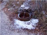 2
2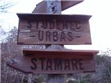 3
3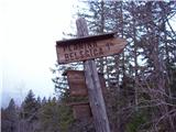 4
4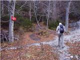 5
5 6
6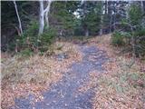 7
7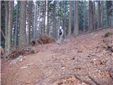 8
8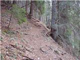 9
9 10
10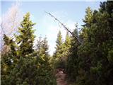 11
11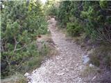 12
12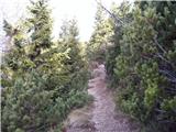 13
13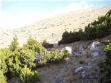 14
14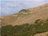 15
15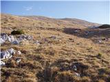 16
16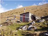 17
17
Discussion about the trip Urbas - Bivak na Belščici
|
| ghost13wolf16. 10. 2013 |
The bivouac is in catastrophic condition. The ceiling and things inside are moldy, sleeping bags are damp, there is so much mouse or I don't know whose droppings that I could shovel them out with a shovel... I wanted to sleep there with a buddy last night to today, but we rather went back to the valley...
|
|
|
|
| viharnik16. 10. 2013 |
The bivouac at Belščica has not been in this condition since yesterday, but for quite a few years. I have never seen such a neglected bivouac or building in my life . Even any plastic portable workers' toilet is better, provided they don't throw stones through the chimney at each other when they go for a big dump through the chimney into the bowl . Even any plastic portable workers' toilet is better, provided they don't throw stones through the chimney at each other when they go for a big dump through the chimney into the bowl . .
|
|
|
|
| ghost13wolf17. 10. 2013 |
Well, from what I've seen, it's not from yesterday...
|
|
|
To post a comment you must log in:
If you do not yet have a username, you must first
register.