Starting point: V Koncu (900 m)
| Latitude/Longitude: | 46,34200°N 14,56820°E |
| |
Walking time: 4 h
Difficulty: very difficult marked way
Elevation gain: 1324 m
Elevation difference along the route: 1324 m
Map: Kamniške in Savinjske Alpe 1:50.000
Recommended equipment (summer): helmet, self belay set
Recommended equipment (winter): helmet, self belay set, ice axe, crampons
Views: 33.495
 | 2 people like this post |
Access to starting point:
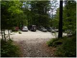
We drive to Kamnik and follow the road ahead towards the valley of Kamniška Bistrica. From the hut in Kamniška Bistrica we continue driving on the forest road, which brings us higher to a crossroad, where we continue straight (right Jermanca, starting point for Kamniško sedlo). The road then past Žagana peč brings us to the parking lot at the lower station of the cargo cableway to Kokrsko sedlo.
Driving from the mountain hut in Kamniška Bistrica to the parking lot V Koncu is now forbidden (traffic sign), this extends the path by less than an hour.
Route description:
From the parking lot at the cargo cableway we go on a footpath in the direction of Kokrsko sedlo and Grintovec. The path which runs through the forest is at first only gently ascending, but this part of the path is short. Already after a few minutes of walking, the path starts ascending steeply and a little higher we have fixed safety gear to help us, which come in handy when the ground is wet and slippery (when dry undemanding). Well visible and still steep path higher starts turning a little towards the right. For a short time the ascent becomes less steep and the path brings us out of the forest on avalanche slopes below Kokrsko sedlo. Here the path becomes steep again and with increasingly beautiful views (those are most beautiful on peaks above the valley of Kamniška Bistrica) it ascends by the foot of the walls of Kalška gora and Mali vrh. Easy to follow, but because of a lot of stones (slightly overgrown scree) on the path strenuous path, after a good 2 hours of walking, brings us to Kokrsko sedlo, where Cojzova koča stands.
From the hut we continue left towards the south in the direction of Kalški greben. At first we cross slopes below Kalška gora and then we get to a less steep wall, which with the help of some fixed safety gear we climb over (danger of slipping). When we step out of the wall the path flattens and in front of us we notice wide grassy slopes of Kalška gora. We continue on the right path in the direction of Kalški greben, which on parts slightly exposed ridge and with the help of some fixed safety gear brings us to the most difficult part of the path. The path brings us to an almost vertical wall, which we have to climb down with the help of fixed safety gear. Helmet is mandatory, a self-belay set is also recommended! The path then starts ascending again towards Kalški greben, to which we have approximately half an hour of walking on a panoramic ridge.
V Koncu - Kokrsko sedlo 2:15, Kokrsko sedlo - Kalški greben 1:45.

Photos:
 1
1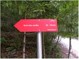 2
2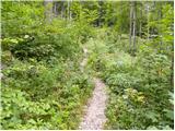 3
3 4
4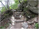 5
5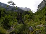 6
6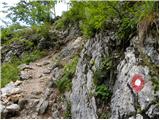 7
7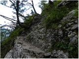 8
8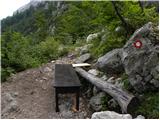 9
9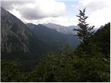 10
10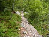 11
11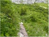 12
12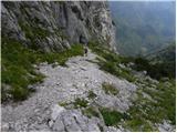 13
13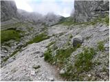 14
14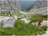 15
15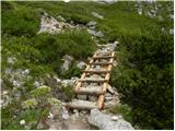 16
16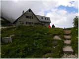 17
17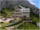 18
18 19
19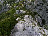 20
20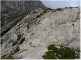 21
21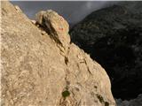 22
22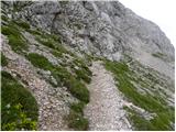 23
23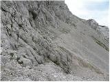 24
24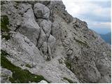 25
25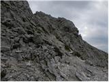 26
26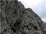 27
27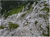 28
28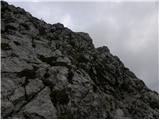 29
29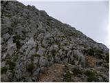 30
30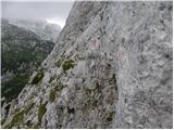 31
31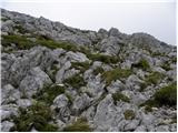 32
32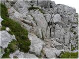 33
33 34
34 35
35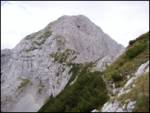 36
36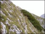 37
37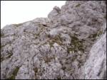 38
38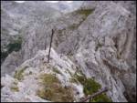 39
39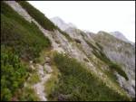 40
40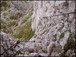 41
41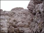 42
42 43
43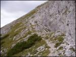 44
44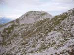 45
45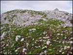 46
46
Discussion about the trip V Koncu - Kalški greben
|
| Lisa26. 09. 2010 |
Please, can those who went to Kalški greben from Cojzova koča provide comments.
Thanks and best,
S.
|
|
|
|
| nata2426. 09. 2010 |
A bit of climbing, one wall is a bit more demanding, but nothing special. Fun path.
|
|
|
|
| mukica27. 09. 2010 |
Last year we went from Krvavec to Cojzova koča. The path is very nice, caution is needed from Kalški greben towards the hut as part of it is exposed, (picture 42) lots of scree on the rocks. I really liked it. We'll repeat it in the opposite direction when the weather allows We'll repeat it in the opposite direction when the weather allows
|
|
|
|
| Lisa27. 09. 2010 |
Great, thank you. You are golden.
Good luck further!
best, S.
|
|
|
|
| garmont7. 06. 2011 |
On 5.6.2011 did the tour. The wire ropes in the first smaller notch are damaged (part missing). On the ridge before the main notch the wire ropes are very loose, twisted pegs don't make sense to mention. However, most importantly, the wire ropes through the main notch are completely fine. A little more care is needed just below the summit (also inadequate protection).
From all this it is clear that the path is in relatively poor condition and needs renovation.
Best regards
|
|
|
|
| hike_mare22. 07. 2017 |
Today did the tour and it was excellent. Here and there one encounters a slightly bent peg and loose cable, but it can be traversed and climbed without problems the entire path.
For adrenaline lovers this is an excellent tour
Lp
|
|
|
|
| mirko111. 11. 2018 |
In the last two years I have hiked and climbed many paths in the Alps marked as very and extremely difficult. Today I went on this one, where this short side branch is marked as demanding and you won't believe it, I turned back because I was afraid of this 10-meter descent down the vertical wall and it's a bit funny to me to read some messages here that the path is fun and nothing special..
|
|
|
|
| KJ11. 11. 2018 |
Mirko1 you are the King!!
|
|
|
|
| Hribolazec8130. 06. 2019 |
Yesterday I did this trail, with car it's a bit harder to reach the cable car because the road is very rutted, with slightly higher clearance it still goes, the lower part drags to Kokrško sedlo, especially back to the valley, but the path from Kokrško sedlo to Kalški greben is top-notch and beautiful, real paradise.
On the way I also detoured to Kalška gora, I liked the path to Kalški greben because it's varied, cables, pegs,...
Respect for the vertical wall climb, it didn't seem too bad to me, but for some it's scary even if they visit ferratas.
When returning back up after climbing down, it's much easier.
A couple descended this part without protection and went back up, to me personally a bit irresponsible, but everyone according to luck.
I'm really sorry about something, if I do this trail again, I'll definitely take this route (towards Krvavec it's very hot in summer, path without any shade):
V Koncu - Kokrško sedlo - Kalška Gora - Kalški Greben - Through long meadows towards Krvavec - Can also do Veliki žvoh on the way - Dom na Gospincu
I wish you safe hiking steps
Gregor
|
|
|
|
| 12a3bc8. 08. 2024 15:25:20 |
Is the road to the starting point passable?
|
|
|
|
| meta509. 08. 2024 14:10:57 |
The road is passable to the parking lot in front of the lower cable car station.
|
|
|
To post a comment you must log in:
If you do not yet have a username, you must first
register.