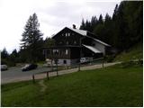
Valvasorjev dom pod Stolom - Weinasch/Vajnež
Starting point: Valvasorjev dom pod Stolom (1181 m)
| Latitude/Longitude: | 46,42600°N 14,14680°E |
| |
Walking time: 3 h 30 min
Difficulty: easy unmarked way
Elevation gain: 923 m
Elevation difference along the route: 1070 m
Map: Karavanke - osrednji del 1:50.000
Recommended equipment (summer):
Recommended equipment (winter): ice axe, crampons
Views: 29.232
 | 1 person like this post |
Access to starting point:
From the highway Ljubljana - Jesenice we go to the exit Lesce and follow the road ahead in the direction of Žirovnica and Jesenice. After a few km of driving, we will get to a crossroad, where the road to Žirovnica and Moste branches off to the right (from the direction of Jesenice left). Only a few meters ahead in the next crossroad, we turn left to Moste (right Žirovnica). Further, we drive past a monument to fallen fighters, where the road starts ascending on a hill below the railway track. On top of the slope, we turn right (at the sign Vila Karin), and then drive towards Završniško jezero and Valvasorjev dom. The road then flattens and brings us to a crossroad, where the road to Valvasorjev dom branches off to the left. We go on the mentioned road (straight Koča pri izviru Završnice), which starts first gently, then steeper and steeper ascending on an occasionally quite rough road (the steepest parts are paved with asphalt). Higher, the road brings us to a slightly bigger crossroad, where we continue left in the direction of Potoška planina (right Doslovška planina). The road then flattens and a little further brings us to the next crossroad. This time we continue slightly right in the direction of Valvasorjev dom (slightly left Ajdna and Potoška planina) and drive on a steeper road all the way to the mentioned hut. We park on one of the parking lots by the road near the mountain hut; parking in front of the hut is allowed only for guests.
From Poljane (crossroad before Završniško jezero) to Valvasorjev dom is 5 km.
Route description:
From Valvasorjev dom we go right on a footpath in the direction of Stol. The path soon goes into the forest, where it slightly ascends and brings us to a smaller crossing, where we continue right. The path then brings us out of the forest, where it crosses slopes below Monštranca. This gentle and partly panoramic path, which a little further crosses a short lane of forest, we follow to a crossing on Žirovniška planina.
We continue left in the direction of »Stol - Žirovniška pot« (slightly right Stol Zabreška pot) on the path which only a little higher passes into a dense forest, where we continue the next 10 minutes. The forest then gets thinner, and the path passes among bushes, through which it then ascends all the way until we get to the next lane of forest. When we again step into the forest, we will get to a pile of stacked logs and above them a sign, which "asks" us that if we can, we carry one of them with us to Prešernova koča. A little further, we step out of the forest, by the edge of which we then ascend steeper. Higher, the path turns a little to the left and crosses a short slightly exposed grassy slope. The path then for a short time slightly flattens and brings us to a pleasant resting place, from which a nice view opens up on Gorenjska.
The path ahead again steeply ascends, this time on a slope which is mostly covered with dwarf pines. Higher, the path turns slightly to the right and brings us from the dwarf pines onto grassy slopes, where we also come to a less noticeable crossing.
At the mentioned crossing, we leave the path which leads towards Prešernova koča and continue the ascent slightly left into the valley between both Stols. After a short ascent, we reach the mentioned valley, and the path brings us to a marked crossing at the intermittent spring. Here we continue left in the direction of Golica (straight Stol) and gradually start descending on the other side of the already mentioned valley. A little lower we reach the ridge, which connects Stol with Potoški Stol. We continue on and along the panoramic ridge, at first still a little downwards. Next follows a short ascent and the path brings us to a wooden cross and a few 10 meters further also to the top of Potoški Stol.
From Potoški Stol the marked path turns to the right and in a few minutes descends towards Vajneževo sedlo. Here we continue left, and after a few 10 steps, we get to a smaller crossing, where a fallen mountain sign for Vajnež directs us right onto an initially still easy-to-follow path. Higher, the path vanishes, and on easier pathless grassy terrain in a few minutes we reach the panoramic peak.

The trip can be extended to the following destinations: Hochstuhl/Stol
Photos:
 1
1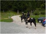 2
2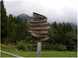 3
3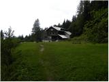 4
4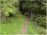 5
5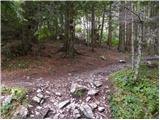 6
6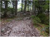 7
7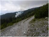 8
8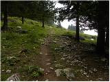 9
9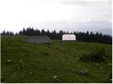 10
10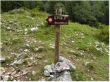 11
11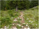 12
12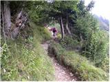 13
13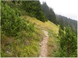 14
14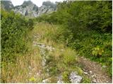 15
15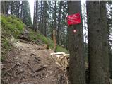 16
16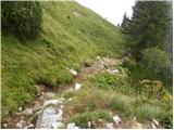 17
17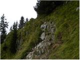 18
18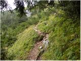 19
19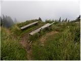 20
20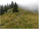 21
21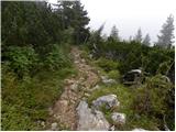 22
22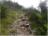 23
23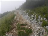 24
24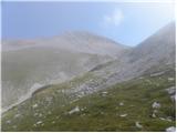 25
25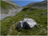 26
26 27
27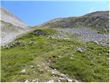 28
28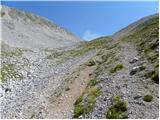 29
29 30
30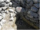 31
31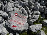 32
32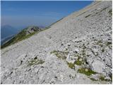 33
33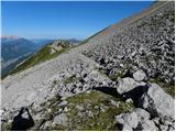 34
34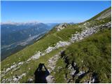 35
35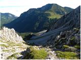 36
36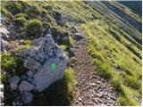 37
37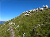 38
38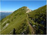 39
39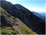 40
40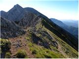 41
41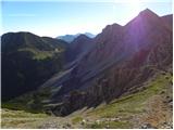 42
42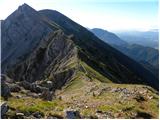 43
43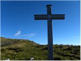 44
44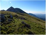 45
45 46
46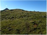 47
47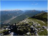 48
48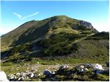 49
49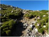 50
50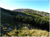 51
51 52
52 53
53 54
54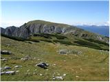 55
55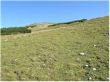 56
56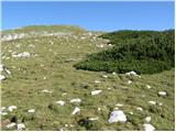 57
57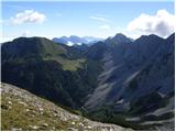 58
58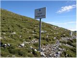 59
59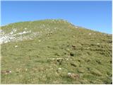 60
60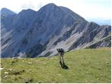 61
61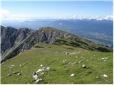 62
62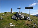 63
63 64
64
Discussion about the trip Valvasorjev dom pod Stolom - Weinasch/Vajnež
|
| mako4419. 08. 2012 |
nice photos....watch your shadow a bit when taking pics xixix otherwise super...safe steps further. Stol, nice memories when Carinthians brought us coffee, we brought them tobacco and cigarettes even in SFRJ times....was quite fun! hi
|
|
|
|
| Majdag16. 07. 2019 |
14.7. ..Stol, Potoški Stol, Vajnež, Mali vrh - ridge traverse. Lots of blooming primroses along the paths. Traversing the Belščica ridge goes up and down and the grass is steep. Descent from Belščica bivouac past fallen trees from last year is a bit awkward. The bypass is made across wet, steep slope. I slipped at the end, even though I watched every step. Luckily nothing serious. Nice circular route.
https://jelenkamenmajdag.blogspot.com/2019/07/od-stola-do-malega-vrha-po-grebenu.html
|
|
|
|
| lina1229. 09. 2023 09:07:27 |
28. 9. 2023 - visited Potoški Stol and Vajnež. Nice path that first goes along the Žirovnica path to Stol, then turns left at the saddle below Stol (a small spring is also found there) and crosses the scree. The path later winds along the ridge going a bit up, a bit down. The cross on Potoški Stol is somewhat worn, upper part missing, no stamp. Vajnež however has both stamp and logbox. I returned the same way.
|
|
|
To post a comment you must log in:
If you do not yet have a username, you must first
register.