Vrh Bače - Planina Za Črno goro
Starting point: Vrh Bače (1273 m)
| Latitude/Longitude: | 46,23810°N 13,98040°E |
| |
Walking time: 1 h 30 min
Difficulty: easy marked way
Elevation gain: 67 m
Elevation difference along the route: 285 m
Map: Škofjeloško in Cerkljansko hribovje 1:50.000
Recommended equipment (summer):
Recommended equipment (winter): ice axe, crampons
Views: 2.628
 | 1 person like this post |
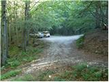
Access to starting point:
A) First, we drive to Bohinjska Bistrica, then we continue driving towards Soriška planina and Tolmin. Before we get to the parking lot below the ski center Soriška planina, i.e., about 400 m lower, a macadam road branches off to the right, which we follow to its end.
B) From Železniki or Podbrdo, we first drive to Soriška planina, from there we begin descending towards Bohinjska Bistrica. After about 400 m of descent, we pay attention to the left branch-off of the macadam road, because we will continue driving on it. We then follow this road to its end, where we also park.
Route description:
From the end of the road, we walk to the mountain direction signposts, from there we continue right in the direction of Črna prst. There follows a few-minute ascent through the forest, then the path flattens and brings us to the GRS cottage. Further on follows a short descent, the path from the slopes of Šanc gradually passes to the less vegetated slopes of Kobla. Here we first ascend through sparse forest, then the path brings us to a slightly exposed ridge, along which we begin to ascend steeply (in wet conditions there is danger of slipping at some places). Higher the ridge flattens, the path turns to the right, which after a minute of further walking brings us to the indistinct summit of Kobla.
From Kobla follows a slight descent, then the path continues along a less steep ridge towards the neighbouring Krevl. Towards the summit of Krevl somewhat further to the left branches off a marked path in the direction of "Kobla žig", we continue straight and bypass the summit on the right side, to which there are otherwise only a few dozen steps.
On the other side of Krevl the path again starts to descend, this time to the nearby ski slope. When we reach the edge of the ski run, we notice signs for Črna prst, which direct us left downward. There follows some more descent, then we arrive at a smaller marsh Na Kalu, where there is also a less noticeable junction. We continue on the right path (left over a smaller saddle leads an old shepherd path, which crosses the southern slopes of the lower Bohinj mountains, it joins after some time the path from Podbrdo towards Črna prst), which still gently descends and somewhat lower brings us to a marked junction. At the junction we continue on the lower right path (the upper left path leads towards Črna prst), which still descends briefly through the forest, then turns to the right and brings us from the forest to the Planina Za Črno goro.

Photos:
 1
1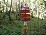 2
2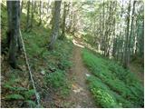 3
3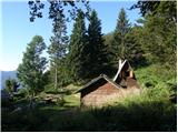 4
4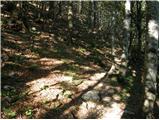 5
5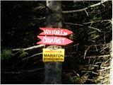 6
6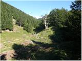 7
7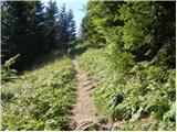 8
8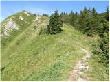 9
9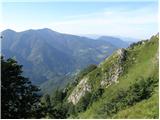 10
10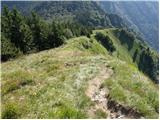 11
11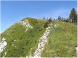 12
12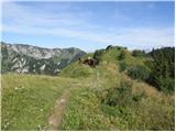 13
13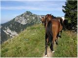 14
14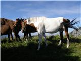 15
15 16
16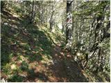 17
17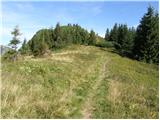 18
18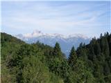 19
19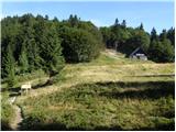 20
20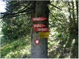 21
21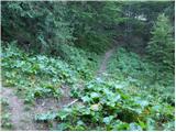 22
22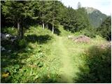 23
23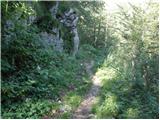 24
24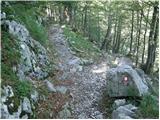 25
25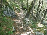 26
26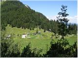 27
27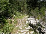 28
28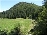 29
29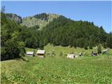 30
30
Discussion about the trip Vrh Bače - Planina Za Črno goro
|
| ločanka6. 05. 2020 |
And who knows how to get to Črna gora next?
|
|
|
|
| ločanka6. 05. 2020 |
yes, turbo thanks, already studying
|
|
|
To post a comment you must log in:
If you do not yet have a username, you must first
register.