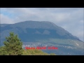
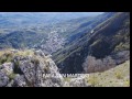
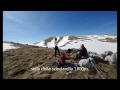
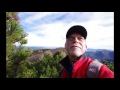
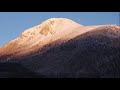
 | Monte Giano 1820 m
28. 10. 2014 02:12:45
Description from Madonna delle Grotte 740 m via trail no. 10 to the cross of Monte Giano and summit Monte Giano, return same route.... |
 | Abruzzo National Park, Monte Mare and Cima Mare
5. 11. 2014 03:26:21
Description from Prato di Mezzo to Monte Mare and to Cima Mare return same route.... |
 | Abruzzo National Park, Serra delle Gravare di Sotto 2087 m
12. 11. 2014 10:15:20
Description from the Gravare chairlift parking follow the track to about 1900 m, climb left along the ridge to the summit Serra Gravare di Sotto 2087 m, then quota 2033 m, Monte i Tre Confini 1981 m, descend north and follow rocky crest, cross a small patch of woods and take an evident left trail th... |
 | Majella, Cima Sala del Monaco or Cima delle Mandrelle 2214 m
22. 11. 2014 01:49:10
Description from Fara San Martino through Vallone Santo Spirito to the junction for Cima Pomilio Grotta dei Porci, about 1650 m, then reaching Piano della Casa about 1940 m along the ridge to Cima Sala del Monaco or Cima delle Mandrelle, 7.50 hours for about 1800 m elevation gain.... |
 | Majella, Cima Macinerelle 2217 m
27. 11. 2014 00:19:45
Basic description and descend to the pasta factories, the road passes behind and climbs, skirting a sports field then you arrive at signs for Macinerelle, park, the trail climbs steeply to Colle Bandiera, then continues to a junction, climb right to a band of rocks, continue skirting right to the st... |
 | PARCO NAZ D'ABRUZZO La Vedetta 2007 m
19. 12. 2014 02:36:23
Description: from Piana di Campitelli, trail L1, out of the wood on Piana dei Biscurri climb directly southeast to Vedetta descent same itinerary.... |
 | MERRY CHRISTMAS
23. 12. 2014 22:58:04
Description... |
 | PARCO NAZ D'ABRUZZO Gendarme della Meta 2185 m
26. 12. 2014 23:20:59
Description: from Prato di Mezzo through Valle della Meta to Passo dei Monaci, straight to Cima della Meta to 2100/2150m then traverse right passing under towers and following a natural ledge to a saddle, from there a few tens of meters to the summit.... |
 | MAJELLA Cima di Colle d'Acquaviva 2200m
11. 01. 2015 01:25:52
Description: just before Lama dei Peligni coming from Palena, at km 29 left an asphalt road leads to a clearing to park the car. take the trail to Rif. Tarì (signage) and upon arrival continue to a plateau, ignore signs right to descend to Grotta del Cavallone and left to H10, proceed straight along... |
 | PARCO NAZ D'ABRUZZO East summit of Passo Cavuto 2002m
17. 01. 2015 01:00:02
Description: from Civitella Alfedena through Val di Rose and Passo Cavuto follow the left ridge to the summit 2002m.... |
 | VELINO SIRENTE Sperone Tiburtini 2128m
31. 01. 2015 01:28:31
Description: from Ovindoli enter Valle d'Arano, Vallone dei Puzzilli, after a shepherds' hut follow a marked channel right then through small valleys in sight of Punta Macerila turn sharply left to the summit.... |
 | MONTI AURUNCI Monte Fàmmera 1168 m from Selvacava
13. 02. 2015 23:48:16
Description: from Selvacava pass the church and continue through the pine forest to a right clearing with shrine and map, signs for trail 914, the trail cuts the entire east wall (trail Cannalelle, Pizzicongo, Cialaria) and reaches Forcella Fàmmera di Spigno 950m. from there following the panoramic ... |
 | MONTI AURUNCI the Strettola di Fàmmera
19. 02. 2015 03:07:09
From Selvacava climb through the pine forest to a right clearing with shrine and signs for trail 914. following trail 914 after a few hundred meters left an evident trail (bent barbed wire) in about 15 min. leads under the line of Strettola di Fàmmera, with difficulty follow trail traces right under... |
 | MONTI AURUNCI great tour of Fàmmera
26. 02. 2015 18:20:31
Description: from the Selvacava pine forest take trail 914, at the first gabion there is a trail rising right towards Canale Bartolomeo follow right overcoming a spur the trail is lost among numerous tracks we follow a series of ditches and then small valleys to an evident rocky forcella, take the r... |
 | MONTI AURUNCI Monte Fàmmera ascent via Strettola and descent via Canale Bartolomeo
22. 03. 2015 15:48:24
Description: from the Aurunci park shrine to the end of the pine forest take trail 914, after a few hundred meters left with red signs and barbed wire, follow it right under the Strettola channel, upon reaching under the jump right red signs and cairn take a steep and delicate trail that follows the... |
 | PARCO NAZ D'ABRUZZO Serra Traversa 1865m
2. 04. 2015 23:32:58
Description: road to Forca d'Acero, Tre Ponti Superiore, follow the trail to 1450m, junction right to a saddle on the ridge around 1600m, descend to the bottom of a small plain, continue through a small valley that rises steeply to the left along the NW ridge to the summit.... |
 | GRAN SASSO Valle fredda, Monte Cristo, Cima di Faiete, Costa Ceraso
24. 04. 2015 01:14:45
Description: ascent through Valle fredda to Sella della Scindarella 1800m. right to the summit of Monte Cristo 1928m, descend to the road 1780m and climb the evident ridge leading to Cima di Faiete 1915m, descend to the plain with Monte Archetto hut and climb to Costa Ceraso 1965m. descend to the pl... |
 | APPENNINO TOSCO EMILIANO from Passo dell'Oppio to Passo delle Radici
7. 06. 2015 17:14:31
Description from Passo dell'Oppio to Passo delle Radici, CAI trail 00, 75km for 4650 m elevation gain uphill.... |
 | VELINO SIRENTE Il Tempio 2099m
27. 07. 2015 23:56:06
Description a solitary and unknown summit, the approach is long both from north and south, from the ridge the descent is delicate and treacherous. The final wall of about 30-32 meters presents second grade steps with unstable boulders and scree so to be done secured. Done from south about 17 km. for... |
 | MAJELLA Fiume Orta
7. 10. 2015 11:26:09
Description motorway Roma-Pescara, exit Scafè, Bolognano.... |
 | LA NUDA 1828m
25. 11. 2015 00:59:38
Description from Vidiciatico 800m. following the road to the ski lifts of Corno alle Scale, at the bend of Rio Ri 1016m. follow trail 325 to Sboccata dei Bagnadori then 129 to summit Nuda and Passo dei Vallone here with 337 to Rifugio Cavone and with 331 to Madonna dell'Acero from here to Rio Ri. 16... |
 | LA NUDA 1828m
25. 11. 2015 12:43:17
Description from Rifugio Cavone 1424m. trail 335 to Passo della Porticciola and Punta Sofia 1939m. Corno alle Scale 1944m., Punta Giorgina 1927m. then following Alta Via dei Parchi trail 00 to Lago Scaffaiolo and Cupolino 1852m. then trail 329 back to Rif. Cavone. 11.200 km 5 hours.... |
 | APPENNINO TOSCO EMILIANO from Passo dell'Oppio to Passo delle Radici
25. 11. 2015 17:49:39
Description Appennino Tosco Emiliano from Passo dell'Oppio to Passo delle Radici, following CAI trail OO, 75 KM FOR 4650 m elevation gain uphill.... |
 | LA NUDA 1828m
25. 11. 2015 23:36:55
Description from rif. Cavone trail 337 then 333 to Cascate del Dardagna then again 337 to Passo delle Riva 1454m. Then 401 Passo del Lupo 401 then 411 to summit M. Spigolino, Alta Via dei Parchi trail 00 to Lago Scaffaiolo then with 329 back to rif. Cavone. 11.400 km for 4.40 hours.... |
 | PARCO NAZ D'ABRUZZO Cima di Costa Camosciara 1925m
1. 01. 2016 15:22:00
Description from the sawmill follow trail F2 which enters Val Fondillo, Grotta delle Fate, to the pass Passo dell'Orso, from here great panorama on Balzo della Chiesa, Monte Capraro, Tre Mortari, Forca Resuni, crest Capraro Meta, Valle di Canneto, Monte Irto, extensive beech forests, from here take... |
 | PARCO NAZ D'ABRUZZO Val di Rose, Monte Sterpalto 1966m
3. 04. 2016 02:51:13
Description from Civitella Alfedena on the classic route, high snow and mushy due to temperatures, so we had fun circling around there. 6 km for just under six hours.... |
 | PARCO NAZ D'ABRUZZO Val di Rose Val Jannanghera, Monte Boccanera 1982 m
18. 04. 2016 13:35:12
Description from Civitella Alfedena take the trail to Val di Rose before the stazzo, traverse left crossing the stream and reach the edge of the wood, follow passing under Monte dei Quadri and climbing through a splendid wood exit under the forepeak of Boccanera which is reached following the ridge.... |
 | PARCO NAZ D'ABRUZZO Torretta di Paradiso, La Meta, Gendarme della Meta
25. 04. 2016 00:58:41
From Prati di Mezzo follow Val Tabaccaia left (right Valle della Meta) to the summit of Torretta di Paradiso then following the west side to summit of La Meta. Descending towards Passo dei Monaci about halfway traverse the gully descending to Val Pagana taking a ramp that rises to a notch between La... |
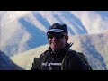
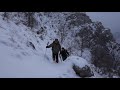
 | GRAN SASSO Dente del Lupo 2297 m south side first ascent of Filo Interdentale route
12. 08. 2016 02:28:12
From Fonte Vetica to Sella del Tremoggia, descend to Forchetta di Penne through meadows and steep treacherous gullies. The route starts in the highest part of the Forchetta, fix for belay and proceeds climbing an obvious gully on the right. Stay left and right of it for 60 m (III and two IV pitches,... |
 | Dente del Lupo south face 1st repeat via Filo Interdentale
3. 10. 2016 10:17:43
... |
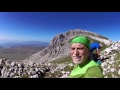
 | Pizzo Pellecchia Monti Lucretili 22.11.2017 the return
28. 11. 2017 22:16:46
Via the directissima of Blu (Pino) imagined, marked, realized by him.... |
 | Monte Tarino 1961 m
25. 10. 2018 19:52:36
from Santuario della SS. Trinita, with a detour to Monte Assalonne, about 1 hour round trip on trail 651, Monte Tarinello and Monte Tarino, total 6 hours.... |
 | Monte Amaro di Opi 1865 m via Val Fondillo
28. 10. 2018 14:29:45
from the sawmill parking lot along Val Fondillo, return same way.... |
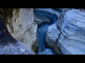
 | Novella Fluvial Park Canyon Val di Non
28. 10. 2018 14:53:33
Novella fluvial park is a nature trail of exceptional beauty through lush orchards and woods that takes us into the bowels of the earth in one of the most spectacular canyons of Val di Non. Easy trail 3.5 km, duration 2 hours. Minimum age 3 years, trekking shoes required. With guide 9 helmet provide... |
 | Coste dei Vecchi | Cima Campi della Magnola | Monte delle Lenzuola | Monte Arso
28. 10. 2018 19:24:25
... |
 | Monte Circeo from Torre Paola
30. 10. 2018 22:35:03
It's somewhat a tradition to start the new year with the hike on Circeo. From Torre Paola along the ridge and return via the directissima.... |
 | Monte Trascinone 1936 from Villalago via Valle Franchitta
1. 11. 2018 15:16:36
from Villalago via Valle Franchitta.... |
 | Cima i Re Magi, Anito delle Viarelle, Anito Lungo via Val Inguagnera
14. 11. 2018 11:56:12
park on a small clearing on the left just before the park entrance at Forca d'Acero after a hairpin bend. Take trail P3 and climb the entire Val Inguagnera to its head where climb Cima dei Re Magi, follow the ridge to Valico delle Gravare and from there to Anito delle Viarelle. From here take the be... |
 | Monte Irtò 1960 m
17. 11. 2018 19:40:08
from Settefrati take the road to Val Canneto, after about 1 km at a hairpin bend leave the car (892 m) take a dirt road, leaving the road to Valico La Rocca continue on a forest road that bypasses and cuts numerous ditches and ridges, then enters Val Fischia. The road ends in a clearing with a refug... |
 | Colle Nero 1991 m | Monte San Marcello East 1977 m via Val Inguagnera and Val Lattara
22. 11. 2018 22:54:14
park at the hairpin bend km 28 on the road to Forca d'Acero about 1400 m, descend into Val Inguagnera and after a few hundred meters on the right a trail climbs over Costa Matarazzo, cairns, descend into beautiful and open Val Lattara follow it to the head (below 2007 m) on the right climb an eviden... |
 | Colle Vallanetta | Cima delle Fossate | Capra Giuliana | Rif. Coppo dell'Orso
3. 12. 2018 22:48:05
start from Madonna della Lanna (Villavallelonga) along Valle delle Fossate, good forest road then trail through the woods to rif. Coppo dell'Orso. Capra Giuliana and continuing to Cima delle Fossate, go back to the evident ridge leading to the top of Colle Vallanette, without losing much elevation c... |
 | Monte Pietra Gentile 1979 m
10. 12. 2018 21:31:20
From about km 24 on the Bisegna-Pescasseroli road climb the ridge of Valle dell'Atessa to the homonymous summit 1798 m. Then passing the quarry to the summit of Monte Pietra Gentile 1979 m. From there descended into a small valley continue to Cima Colle Macerone 1924 m, Cima Macchia di Rose 1932 m a... |
 | Monte Marcolano, Monte Rocca Genovese, Macchia Petrosa, Prato Maiuri
12. 12. 2018 21:24:08
From Madonna della Lanna, trail R4 to summit Marcolano, then in sequence Rocca Genovese, Macchia Petrosa, Prato Maiuri.... then with long diagonal traverse downhill resume R4 to starting point. Km. 15 about for 7 hours 20.... |
 | Quota 1922 m Balcone della Sentina
22. 12. 2018 16:32:38
From Forme through Vallone della Sentina trail 9, at the end of the valley directly right up to the top, splendid views over the valley on Sasso on Sentina on Cafornia Costa Stellata etc. Descent same way. About 10 km for 5 hours 45.... |
 | Il Sasso 1944 m
12. 01. 2019 18:17:03
Gruppo Velino Sirente, from Forme trail no. 9 through Canale della Sentina, before the channel fully opens at an isolated small tree right directly up, traverse the ridge and descend into the 'incacchiato' channel crossing it, bypassing a rocky rib directly up to the summit. Descent same way. About ... |
 | From San Candido to Baita del Cacciatore 1830 m
4. 02. 2019 16:26:29
From San Candido after Conad trail 4/5, passes by Sacrario dei Caduti di San Candido of WWI, continue following the excellent signage to Baita del Cacciatore. No difficulties mostly on beaten forest road, beautiful woods and nice views on Baranci, Cima di Sesto and Tre Scarperi. About 700 m elevatio... |
 | From San Candido 1175 m to Rif. Tre Scarperi 1620 m via Val Campo di Dentro
4. 02. 2019 23:01:35
From center of San Candido Hotel Post, after Conad right on trail 4/5 passing near Sacrario Caduti 1915-18 and continue trail 4/5 (about 2.5 km) to the right deviation for Val Campo di Dentro beautiful path along the river, and shortly after passing a bridge cross the San Candido-Sesto road restaura... |
 | From San Candido 1175 m to Rif. Baranci 1500 m
8. 02. 2019 18:31:01
From the center of San Candido Hotel Post head towards the ski lifts and bike path, take the bike path passing by an interesting historic house, follow the cross-country ski trail to the junction for trail no. 7 to Bagni di San Candido, interesting with a resurgence spring, rest at the church above ... |
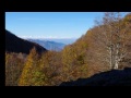
 | Serra Santa Maria 1928 m and Serra Pantanella 1907 m - 1900s Appennino
7. 03. 2019 15:52:08
From Passo Godi trail Y2 to Valico dello Scalone, descend and climb to Serra Santa Maria 1928 m, return to Valico dello Scalone and along the ridge continue to Serra Pantanella 1907 m. Return same way to Passo Godi. About 11 km for 5 hours and 35, elevation gain about 900 m.... |
 | Colle di Camporotondo 1919 m and Serra Capra Morta 1937 m - 1900s Appennino
9. 03. 2019 18:55:16
From Masseria Parenti (Scanno) at the junction take left trail 19, arriving around 1800 m instead of cutting and descending to Stazzo di Campo Rotondo we decide to climb to the summit of Capra Morta, from there descend to the stazzo and climb back to Colle di Camporotondo, descent and return via Val... |