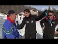
 | CAMPITELLO MATESE hike MONTE MILETTO 2050 m TREKKING in MOLISE
7. 08. 2019 17:32:03
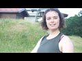
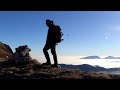
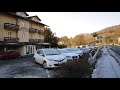
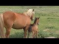
Campitello Matese is a mountain locality administered by the municipality of San Massimo, Molise, located at 1450 m a.s.l. From here it is possible to walk various trails during spring and summer. ... |
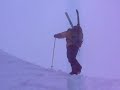
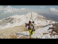 | Monte Miletto (2050m)
14. 04. 2015 23:08:05
Ascent and descent to close a beautiful spring snow day at Campitello Matese... |
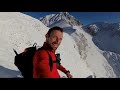
 | Cilento 14/8/2020 | Cilentano.it on Monte Cervati with drone
16. 08. 2020 02:17:27
Cilento, the most beautiful place in the world also because there is Monte Cervati.Monte Cervati is a mountain of the Lucanian Apennines at 1899 m a.s.l. located in the province of Salerno.It is one of the highest mountains in Campania by altitude, surpassed only by Punta Giulia (1917 m a.s.l.) of L... |
 | Flight with don Olgierd in the beauty of Cilento - Monte Cervati
31. 12. 2015 08:34:40
Flight to rediscover the beauty of Cilento and particularly the highest mountain of Campania: Monte Cervati (1898 m a.s.l.).... |
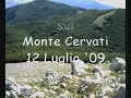 | Monte Cervati (1898 m) 12 July 2009
16. 07. 2009 23:34:49
The Carbonari conquer the highest peak of Campania... |
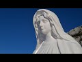 | Redentore Summit and Monte Petrella from Rifugio Pornito
8. 11. 2020 22:13:58
Maranola-Cima del Redentore-Monte Sant'Angelo-Monte PetrellaReached from Maranola the parking spot near Rifugio Pornito (829 m), ascent on comfortable path (Via del Redentore), passing a Cross with viewpoint on Golfo di Gaeta and then the striking statue of Madonna della Rupe (stops obligatory here!... |
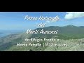
 | Monte Petrella | Monte Redentore | Loop trail Monti Aurunici
30. 12. 2020 19:30:02
One day outFeel like a day excursion between Lazio and Campania? The Parco dei Monti Aurunici (Latina) is the place for you!I propose a loop trail in the most spectacular part of the Park, where you can indulge your passion for photography, immerse in nature or act silly like the undersigned.... |
 | Formia, Italy - DJI Phantom Drone - Monte Petrella, Parco Aurunci
30. 11. 2018 16:29:52
Clips from a hiking excursion in the Natural Park of Monti Aurunci, starting from Rifugio Pornito in Formia. The route included two intermediate stops at the Eremo di San Michele Arcangelo and the Redentore summit, then reaching the Monte Petrella summit (1533 m a.s.l.), between the municipalities o... |
 | 2 November 2014 | Monte Velino (2486 m)
2. 11. 2014 22:00:36
Start from Corona di Massa d'Albe (920 m). Ascent via path no. 5 and descent via path no. 7... |
 | Mt. Velino normal route path no.3 (2486 m)
30. 08. 2009 16:54:29
Normal ascent to the summit of Monte Velino from Rosciolo. Path no. 3 to Capanna di Sevice. GPX track in the download section.... |
 | From Piani di Pezza to the summit of Monte Velino 2486 m - Trekking in Abruzzo
8. 10. 2012 21:23:15
SUBSCRIBE! - https://bit.ly/2J7yMD3 Social Media:https://www.instagram.com/winterseaso...https://www.facebook.com/winterseason...https://www.winterseason.it/Trekking excursion in the Sirente-Velino Regional Natural Park. From the karst plateau of Piani di Pezza to conquer the summit of Monte Velino... |
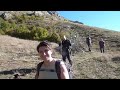
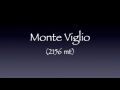 | Monte Viglio (2156 m) 23.07.2017
26. 07. 2017 18:16:24
Hike on the Monti Ernici.Music: Opeth - Isolation Years... |
 | 16 January 2016 | Monte Viglio 2156 m (M. Cantari)
28. 02. 2016 16:11:39
Winter ascent from Valico di Serra S. Antonio via Fonte della Moscosa and Gendarme.... |
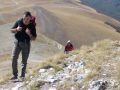
 | Monte Viglio 2156 m
29. 05. 2016 20:28:58
Starting from the Serra Sant'Antonio pass along path 651 and then 696 towards Fonte della Moscosa. After reaching the little madonna on Monte Piano, it was the turn of the Gendarme, a massive rocky spur.... |
 | Monte Vettore (2476 m)
27. 11. 2007 14:07:05
Ascent to Monte Vettore, splendid mountain marking the Umbria-Marche border, overlooking the Castelluccio plain and exciting us with its glacial forms.... |
 | Summit of Monte Vettore 2476 meters
18. 07. 2020 10:15:47
Time lapse GoPro 8... |
 | Monte Vettore 2476 m
3. 11. 2014 05:02:58
... |
 | Sunscreen recommended | DAY AT MONTE LESIMA
5. 07. 2020 22:31:07
Here is the video of our route to the summit of Monte Lesima at 1724 m. Total 14 km hike:- Start from Stradella (PV): 8:30- Piani di Lesima, 'Prodongo' hotel: 10:15... |
 | Monte Lesima (1724 m)
3. 08. 2020 17:23:22
Hi, 4 simple pieces of information to start So you start from (Piani di Lesima), take the dirt road next to the hotel, follow it to a clearly visible intersection, where in front of you there is an asphalt road, on the left there is the sign (Lesima summit) (CAI trail 101), follow it to the ridge, b... |
 | Monte Lesima 1724 m Pv
3. 04. 2020 01:00:31
... |
 | Monte Amiata 07/01/2021 On Snowmobile
7. 01. 2021 19:10:52
... |
 | Monte Amiata The Protagonists of the Mountain
29. 10. 2014 14:15:20
WATCH the web TV of ski enthusiasts http://www.lagrandeneve.tv/The Monte Amiata station, all offers and news from Toscana Neve.... |
 | ASCENT TO MONTE AMIATA (1738 M) FROM ABBADIA SAN SALVATORE 922 M IN TUSCANY - MON. 25-12-17
16. 05. 2018 01:53:23
Snow hike in Tuscany from Abbadia S. Salvatore (822 m) to the top of Amiata (1738 m). ELEVATION GAIN 916 m, DISTANCE ABOUT 10 KM...... |
 | Cimone 2017 Northwest Channel
27. 04. 2017 06:23:09
A nice ascent in good conditions on Monte Cimone, from the northwest channel, with son Giorgio.The video shows the most beautiful sections of the hike, a sunny day with optimal temperatures made this tour pleasant.... |
 | Monte Cimone 2,165 m (MODENESE APENNINES)
10. 08. 2020 11:18:59
Monte Cimone 2,165 m FROM FIUMALBO. (Org, 'the mountain path' guide Francesco Rosati)With its 2,165 meters of altitude, Monte Cimone is the highest peak of the Northern Apennines and Emilia-Romagna. From a landscape point of view, its profile, with a stocky and vaguely three-faced pyramidal shape,... |
 | August 2013 | Tuscan-Emilian Apennines: Monte Cimone 2165 m
31. 07. 2017 21:39:41
Easy ascent from Sasso del Lupo, reaching the highest peak of the Tuscan-Emilian Apennines in a few hours. From its summit, you can admire the Apuan Alps chain.... |
 | MTB Passion Montalto 2016
2. 06. 2016 22:01:40
Amateur video shot in Aspromonte (RC) on the highest peak: Montalto (1956 m).... |
 | To Redentore di Montalto 1956 m
23. 05. 2015 21:48:58
... |
 | Aspromonte LiberaMente 2016 - Finally I climb Montalto
3. 01. 2016 19:29:32
Video of a very sweet mountain hike, done with dear friends, on January 2, 2016.... |
 | Montalto, Aspromonte | Into the wild
25. 05. 2016 17:06:37
Amazing experience in the mountains filmed with SJCam 5000x Music: Coldplay - Midnight (Kygo Remix)... |
 | Time Lapse | Montalto (Aspromonte) 23/08/15
24. 08. 2015 01:13:33
Montalto is the highest peak of Aspromonte. It rises near Gambarie, close to Reggio Calabria, reaching 1,955.92 m a.s.l.Located almost in the center of the southern part of the province of Reggio Calabria, it offers a panorama embracing eastern Sicily and Calabria itself up to the Sila.... |
 | Pollino National Park | Serra Dolcedorme
2. 11. 2020 20:05:40
Short video that tells, in my own way, the ascent from Colle dell'Impiso (1578 m) to Serra Dolcedorme (2267 m), the roof of Calabria and the highest peak of the southern Apennines.... |
 | Pollino National Park | Serra Dolcedorme (2267 m a.s.l.) - 12/10/17
13. 10. 2017 13:58:26
... |
 | Serra Dolcedorme 2267 m
1. 08. 2018 09:01:00
July 26, 2018, between Basilicata and Calabria regions in Pollino National Park. Hike to Serra Dolcedorme 2267 m, the park's highest peak, starting from Colle dell'Impiso via Piano Toscano, Piano di Pollino, Canale del Malevento, Sella Dolcedorme, final ridge of Murge di Celsa Bianca, Timpone di Val... |
 | Block Haus | Majella | Bivacco Pelino - 2793 m a.s.l. - Monte Amaro
21. 09. 2020 21:15:05
Similar to the ascent of Corno Grande on Gran Sasso, the ascent to Monte Amaro is certainly the most classic and coveted in Abruzzo.The itinerary from Rifugio Pomilio is undoubtedly the most spectacular, as it develops entirely above 2000 meters, crossing the lunar environment of the summit plateaus... |
 | Majella, 80s, ascent to Monte Amaro 2795 m
28. 05. 2013 11:37:30
... |
 | Monte Amaro 2795 m a.s.l.
5. 12. 2019 22:20:33
... |
 | 2015 | CAI Portogruaro | Ascent via normal route | Gran Sasso (2912 m)
15. 01. 2015 12:11:00
Ascent via the normal route to the western summit of Gran Sasso (2912 m) carried out by a group of CAI Portogruaro members, validly accompanied by friends Bruno and Latino from CAI dell'Aquila, whom we thank again for their great availability, as well as their competence and friendliness.... |
 | Corno Grande 2912 m
23. 06. 2010 21:00:36
Exit from the Ghiacciaio del Calderone towards the western summit of Corno Grande 2912 m a.s.l.... |
 | Gran Sasso d'Italia, Abruzzo - Corno Grande (2912 m.) West Ridge
18. 04. 2020 20:13:42
November 2019, Gran Sasso d'Italia!I take advantage of some vacation to return to Abruzzo. In the past I was there only for the sea, this time I go to central Italy with the idea of visiting Rome again (wow how beautiful our capital is) but first I want to touch the summit of Gran Sasso (the next da... |
 | Sasso Manduino
23. 09. 2013 21:28:29
West Ridge... |
 | gopro pizzo ledù 2503 m
4. 10. 2017 20:13:37
05 August 2017With Fabio. Video made by him with gopro.I took the photos, see photo/video: https://youtu.be/Eo0GH6iuegwOther links: Pizzo Badile: https://www.youtube.com/watch?v=SQJ6l2LoBzY... |
 | Pizzo Ledù 2503 m From SW side via West Ridge (Alto Lario - Val Chiavenna)
5. 11. 2016 15:04:52
1-11-2016Starting in the dark from Pra Pincee we ascend the entire Val Garzelli admiring the spectacular amphitheater of Alpe Campo then cross Bocchetta del Cannone and reach Val Ledù.Lago Ledù is always a great sight, a privileged terrace over the upper and central Lake Como.... |
 | Cima di Terrarossa 2018 | MTB
20. 07. 2018 06:51:47
2420 m... |
 | From Sella Carnizza to Cima Est dei Musi and Veliki Rop
31. 10. 2019 04:45:34
27-10-2019: Monte Musi can be reached from Val Resia, starting from Sella Carnizza, via CAI trail 737. From the pass, the trail ascends through beech forest to about 1420m, where a flat traverse begins. At the end of the traverse, the beech forest ends, first dwarf pines appear, and you enter a kars... |
 | The Mascabroni and the epic of Cima Undici
14. 10. 2017 09:08:01
© Andrea Carta 2017 - all rights reserved: public reproduction is prohibited. Info and book: andreacarta62@gmail.comThis dual story is part of me and my family: I told it in 1993 in a book and today with this video. My dad, Pietro, and my uncle Paolo (to whom the bivouac is dedicated) were among the... |
 | Cima Pape 20 08 2017
14. 08. 2019 08:37:50
... |
 | Cima Pape 2503 m
26. 04. 2017 18:16:34
... |
 | Villanderer Berg 2509 m. Hikers and mountaineers enjoy the beautiful view and good weather
24. 11. 2011 00:56:44
Villanderer Berg 2509 m. Hikers and mountaineers enjoy the beautiful view and good weather... |
 | Deep view at Villanderer Berg 2509 m
24. 11. 2011 00:38:45
Deep view at Villanderer Berg 2509 m.... |