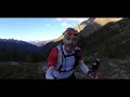
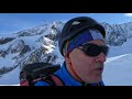
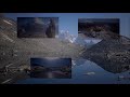
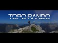
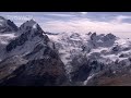
 | Mont Gelé Aosta Valley 3518 m
24. 09. 2018 19:11:42
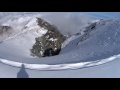
Mont Gelé is a summit located on the Italian-Swiss border.Via Valpelline access the hamlet Le Ru.Direction to refuge Crête Sèche, bivouac Spataro, then Col du Mont Gelé. Follow Glacier de l'Aroletta. Pass at the foot of Mont de la Balme, via Glacier du Mont Gelé.... |
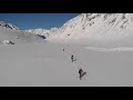
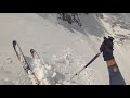
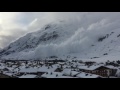
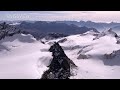
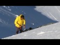
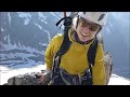
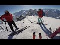 | Skiing Mont Fort, Verbier
20. 01. 2017 17:03:30
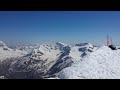
Skiing the steep moguls on the front side of Mont Fort in Verbier, in the 4 Vallées in Switzerland. Views out over Mont Gele, and the Bec des RossesBlizzard Bonafide skis - good for steep and icy, less good for moguls.... |
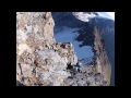
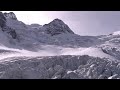
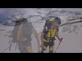
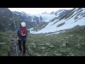
 | Ski touring Valpelline Vda | Mont Gelé 3518 m Ski mountaineering
25. 04. 2018 23:57:03
The most spectacular alpine and prealpine landscapes... |
 | Bivacco Regondi and Mont Gelè 3518 m Ollomont, Aosta
8. 09. 2019 09:54:23
... |
 | Rocciamelone 3538 m in winter, FPV Long Range (MauryX)
3. 01. 2020 19:28:19
December 30, 2019mountain hike with night return, up to the Madonna di Rocciamelone with FPV longrange drone... |
 | 3538 m - Rocciamelone
8. 07. 2020 17:30:29
... |
 | Rocciamelone 3538 m
16. 09. 2007 10:40:49
15/09/2007... |
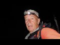 | Adamello Summit 3539 m
2. 09. 2020 11:54:48
July 20, 2020This time solo departure, a long story from last summer but finally the accounts must be settled.Departure at night from Vione and reach Pont del Guat, at 3:30 backpack on, headlamp on, pass by Malga Premassone and reach Rifugio Gnutti, dawn begins.... |
 | Adamello Group, Valcamonica | Monte Adamello (3539 m) Via Terzulli
26. 08. 2017 00:29:53
Ascent to the summit of Adamello, the highest in the province of Brescia, done at the end of July 2017 via Terzulli. Beautiful hike, done at unusual times (afternoon) to enjoy the stunning sunset lights at high altitude! Then overnight at Bivacco Ugolini and finally the summit the next day!... |
 | Overnight at Bivacco Ugolini 3280 m | Rifugio Gnutti | Via Terzulli | Monte Adamello 3539 m
2. 07. 2019 22:30:04
Leave a comment and a like if you liked the video, let me know what you think and if you have any advice on hikes or anything else, don't hesitate to tell meMonte Adamello, 3539 m ... a dream!... |
 | Summit bivouac at 3545 m | Vertainspitze
7. 10. 2016 18:01:37
The last beautiful days in September, used for a mountain tour in South Tyrol. Ascent - sunset - starry night - sunrise - descent. All with a view of Ortler, Zebrù and Königspitze. A great experience!... |
 | Hike and Fly Vertainspitze 3545m
23. 10. 2017 22:20:56
Ascent from Sulden... |
 | Vertainspitze 3545 m
25. 09. 2019 20:41:18
05.09.2019Vertainspitze (Italian: Cima Vertana) is with 3545 meters the highest mountain of the Laaser Mountains in the Ortler Alps, a range of the Southern Eastern Alps. It is located in the Italian province of South Tyrol and is part of the Stilfser Joch National Park. To the northeast, southeast ... |
 | Ski mountaineering Monte Leone 3553 m
17. 04. 2020 06:00:03
From Simplon Pass to the beautiful Monte Leone with ascent of Breithorn 3437 m afterwards. On Monte Leone south ridge with crampons. Good conditions without ice axe.... |
 | Monte Leone, 3553 m
11. 07. 2010 15:13:31
Southern Switzerland, on the border to Italy... |
 | Aouille Tseuque
30. 04. 2016 20:32:36
Powder snow end of April 16... |
 | Aouille Tseuque 3554 m - Ski touring
8. 11. 2020 15:06:04
http://alpinisme.over-blog.net/tag/valais/Ascent of Aouille Tseuque with BastienStart from Vignettes hut, col de Chermotane, col de l'Aiguillette (Aiguillette bivouac), Aouille Tseuque... |
 | Rifugio Denza | Cima Presanella (3558m)
5. 11. 2020 17:54:07
Fast and Light tour with Ciano.Video entirely made with Gopro Hero 7 Black.Music:Elektronomia - Energy [NCS Release].Syn Cole - Feel Good [NCS Release]... |
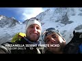 | Couloir dell'S | Presanella 3558m North Face
5. 11. 2014 15:26:03
02/11/2014 ascent to Muraccia, north face of Presanella, route couloir dell'S TD- 450m III/75°... |
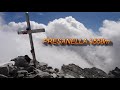 | Cima Presanella 3558m
26. 11. 2018 21:01:08
Beautiful and long alpine excursion, we start very early and in about one hour we reach the Segantini refuge. We continue along the endless moraine until we arrive, after crossing a small glacier, at the short ferrata of Corno Nero. The ferrata takes about 25 minutes. The path then resumes marked on... |
 | Ouille d'Arbéron
23. 05. 2013 15:16:16
... |
 | Ouille d’Arbéron 3563m
15. 10. 2017 15:54:07
This peak of the Graian Alps is at the crossroads of the Maurienne valley and the Lanzo valleys. This summit is part of a series from Mont Tour, passing notably by Bessanèse and Levanna up to Pointe de la Galise, peaks marking the border between Savoy, Piedmont and Aosta Valley, on the Italian side.... |
 | Mont Brulé via Refuge des Bouquetins
15. 02. 2020 10:17:46
2 days at Refuge des Bouquetins... |
 | Pointe Marcel Kurz (Mont Brulé), North Face, 6.5.2018
7. 05. 2018 23:43:29
... |
 | Mont Brulé
30. 08. 2015 17:56:14
Crossing of Mont Brulé (3585m).Music:NevadaRnd - 1000 miles License: CC: BY, NC, SAhttp://creativecommons.org/licenses/by-nc-sa/3.0/ Steady Hussle - Coat CheckLicense: CC: BY... |
 | Savoie - Rhône Alpes | Haute Maurienne | Fort de la Turra loop via Pas de la Beccia
15. 07. 2018 16:23:56
Detailed filmed itinerary of the loop hike to Fort de la Turra and Pas de la Beccia. Located in the Grés Alps massif, this pleasant hike starts at Col du Mont Cenis. The first part is easy and playful with the visit to the old fort. The second part is more alpine and requires more attention from Pas... |
 | Avalanche at Bessans
12. 01. 2016 12:32:40
... |
 | Pointe de Tierce at Bessans
13. 01. 2020 21:57:38
Located at an altitude of 2973 m at the entrance to the Avérole valley and Ribon valley, Pointe de Tierce offers an exceptional 360° panorama. The view of the Avérole valley is striking: Pointe de Charbonnel (3752 m), Bessanèse (3592 m), Albaron (3637 m), Pointes de lOuillarse (3435 m), Ouille Alleg... |
 | GR, Vadret da Roseg | SWISSVIEW
17. 01. 2012 08:12:18
SWISSVIEW App for iPhone and iPad download now for free!rSWISSVIEW App für iPhone und iPad jetzt gratis downloaden!rhttp://www.swissview.com/app . http://www.swissview.com/blu-rayr... |
 | 2 - SWISSVIEW - GR, Bernina Group 1
17. 01. 2012 08:17:27
SWISSVIEW App for iPhone and iPad download now for free!rSWISSVIEW App für iPhone und iPad jetzt gratis downloaden!rhttp://www.swissview.com/app . http://www.swissview.com/blu-rayr... |
 | GR, Piz Glüschaint | SWISSVIEW
17. 01. 2012 08:19:57
SWISSVIEW App for iPhone and iPad download now for free!rSWISSVIEW App für iPhone und iPad jetzt gratis downloaden!rhttp://www.swissview.com/app . http://www.swissview.com/blu-rayr... |
 | Tsanteleina in winter
15. 11. 2018 06:49:49
Tsanteleina, Rhémes valley. 3601 m.Solo ascent starting from Thumel, hamlet of Rhémes Notre Dame, support at Benevolo hut (winter shelter). Approach by snowshoes.... |
 | Bike Ski, Tsanteleina
1. 12. 2020 16:30:01
Start at 1400m by bike, target Tsanteleina 3602m, loop: ascent south face and descent north. It's really a magnificent route that I recommend!Bonus: a saddle, handlebar tape and a pair of shoes devoured by a marmot!... |
 | 3602m | North Face of Tsanteleina
1. 09. 2009 22:02:20
Ascent of the North Face of Tsanteleina 3602 m altitude.... |
 | Colle Grande Rousse
19. 05. 2020 22:21:45
... |
 | Grande Rousse 3607m (22 April 2017) | Ski touring
24. 04. 2017 09:25:08
... |
 | Eastern Levanna
16. 12. 2018 20:11:25
Music: Kevin MacLeod, licensed under Creative Commons, by Attribution... |
 | Western Levanna (3593m)
18. 06. 2018 02:44:34
... |
 | Central Levanna
5. 09. 2016 06:53:49
... |
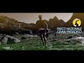 | Royal Ultra Sky Marathon Gran Paradiso 2015
30. 12. 2017 09:11:50
The Royal Ultra Sky Marathon is the sky race of Gran Paradiso. 7 cols up to 3000 m altitude, 52 km length, D+ = 4000 m, but above all pure wild nature of Italy's first National Park.Start from Teleccio Dam in the wild Vallone di Piantonetto along the monumental network of Royal Hunting Roads of Gran... |
 | Royal Ultra Sky Marathon Gran Paradiso 2013
17. 12. 2017 18:39:16
52 km 4000 m D+ The Royal Ultra Sky Marathon is the sky race of Gran Paradiso. Start from Teleccio Dam in the wild Vallone di Piantonetto along the monumental network of Royal Hunting Roads of Gran Paradiso. Snowy passes, ibex, lammergeiers and chamois, ledges and exposed sections, scree and steep p... |
 | Sustenhorn via east ridge and Tierberg
7. 08. 2013 01:22:55
High tour from Göschenen - Voralphütte 2126 - Sustenhorn 3503 via East Ridge (ZS-IV) - Tierberglihütte 2795 - Mittler Tierberg 3418 (WS+) - Hinter Tierberg 3447 (WS+) - Trifthütte 2520 - Triftbrücke 1870 - Undere Trift 1357 - Gadmen... |
 | Pizzo d'Andolla (Portjengrat)
28. 07. 2020 21:00:11
A group of climbers who belong to the Swiss Alpine Club (section UTO) successfully reached the summit of Pizzo d'Andolla (3656m) via the Portjengrat. This peak is located in the main ridge of the Alps between Switzerland and Italy. The access was from Saas-Almagell after staying overnight in Almagel... |
 | Pizzo d'Andolla 3654 | Portjengrat Traverse
28. 08. 2014 22:54:59
From Almageller Hut - 8 hours including approach and descent to the hut (ZS+ / IV)... |
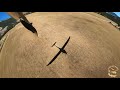 | | 360 | Best 2020 touring motor glider Pipistrel Sinus Flight over the Alps | 2020.08.19
8. 01. 2021 22:20:15
Flight with a Pipistrel SinusQueyras - Matterhorn - Mont RoseGrand Paradis - Vanoise - EcrinsAgnès & Pierre2020/08/19 Take-off approx. 15 pm local time - Landing 20:30 - LFNJ - Aspres-Sur-Buëch... |
 | Uja di Ciamarella (3676m) | Pian della Mussa
22. 07. 2013 19:53:33
Val d'Ala di Lanzo Torinese (TO). We start from Pian della Mussa, a few kilometers after Balme, overnight at Rifugio Gastaldi and on the second day climb Uja di Ciamarella (3676m). Photos and story at this link: http://www.aereisentieri.it/gallerie/ciam0713/index.html... |
 | Uia di Ciamarella 3676m
28. 10. 2015 00:13:40
26/09/15 - last stretch.... |
 | Traverse from Pizzo Tresero | Punta San Matteo 3678 m
15. 08. 2020 08:02:21
Traverse starting from rifugio Berni at Passo del Gavia, ascent to Pizzo Tresero (3594 m), Punta Pedranzini (3599 m), Cima Dosegù (3560 m) and Punta San Matteo (3678 m) with ascent via normal SW route and descent from south ridge.... |
 | Panorama from Punta San Matteo 3678 m. 09-06-2014
10. 06. 2014 21:01:33
... |
 | Punta San Matteo (3678 m)
9. 08. 2014 01:22:22
... |