 | Crossing of Ranc Traversier via Pas de Serre Brion to Pas Morta (Eastern Vercors)
19. 06. 2012 19:41:39
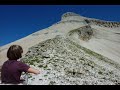
Crossing of Ranc Traversier via Pas de Serre Brion to Pas Morta (Eastern Vercors)Wonderful aerial passage on steep slopes, Pas de Serre Brion winds along a grassy ledge in the middle of the cliff and ends with a steep rocky couloir.... |
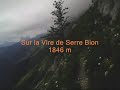 | Ranc Traversier via Pas de Serre Brion to Pas Berrièves (Eastern Vercors)
14. 07. 2012 12:01:43
Crossing of Ranc Traversier via Pas de Serre Brion to Pas Berrièves (Eastern Vercors)Back on the wonderful aerial passage of the ledge leading to Pas de Serre Brion 1948 m.At the exit of the pass we head left southwards to climb successively the summits of Malaval 2097 m and Rocheherbe 2084 m.... |
 | Moucherotte 1901m East Face (Northern Vercors)
21. 07. 2012 18:21:59
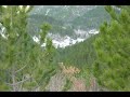
Moucherotte 1901m East Face (Northern Vercors)This East Face remains quite accessible overall. After a crossing under the Pucelles in a bucolic forest, the path climbs gently. The rocky section following the Roche de Château Bouvier offers small rock sections where hands are placed: never hard and a... |
 | Walks in Cathar Country (11 Aude)
6. 08. 2012 19:05:33
Walks in Cathar Country (11 Aude)Cathar Country is a historical territory in the south of France.Come discover or rediscover the castles and abbeys of Cathar Country thanks to this video.... |
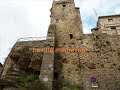
 | Galamus Gorges Upper Corbière Cathar Country (11 Aude)
6. 08. 2012 19:24:07
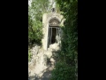
Galamus Gorges Upper Corbière Cathar Country (11 Aude)Great walk in one of the strongholds of Catalan hikingThe Hermitage St-Antoine de Galamus, carved into the rock right on the cliff at the exit of the gorges...... |
 | Pas du Touet Trail 1051 m (Vercors centre)
10. 09. 2012 11:02:43
Trail walk Pas du Touet (1051 m) out-and-back via 'Chemin des Moines'Vercors centreThis short out-and-back run follows the Pas du Touet path once frequented by the monks of Léoncel and descends to the plain after a short incursion onto the Vercors plateau.... |
 | Toulau Trail Tour and Comblezine Crest (Vercors centre)
21. 09. 2012 18:55:33
Toulau Trail Tour and Comblezine Crest (Vercors centre)Very beautiful hike in central Vercors (based on an idea by Antoine Salvi):Start from 'Le Col de la Bataille' to reach 'le Roc du Toulau' circling it, offering superb panoramas and magnificent views on the Rochers de la Sausse return to 'Bouvant... |
 | Gobert Trail and Fauge Valley (38 Vercors north)
28. 09. 2012 12:00:50
Between Col de l'Arc and Col Vert, the Gobert trail offers varied views over the Lans plain.Distance: ~17.5 kmAltitude: Max 1560 mElevation gain: ~ +900 mLevel: T2... |
 | Between Vercors and Diois The Crests of La Raye (Vercors centre)
10. 10. 2012 16:54:37
Wooded ridge line overlooking the Valentinois plain above La Baume Cornillane and Ourches. At its summit stands a pylon (1015 m). Some marked paths suitable for hiking and 'boar' trails run along the flanks of this crest.... |
 | The tour of Serre de l'Aup from the village of Espenel (26 Diois)
12. 10. 2012 22:01:48
The Diois, located in the Vercors Regional Natural ParkThe tour of Serre de l'Aup from the village of Espenel (26 Diois)Attention on the topo video map to the yellow area without markings, + a very poorly visible path.... |
 | Ascent of the Grand Ferrand 2752 m (Dévoluy)
14. 10. 2012 17:32:04
The Tête du Grand Ferrand, Tête du Vallon Pierra, Tête du LauzonIn a loop from JarjatteSome sections of this mountain itinerary are steep and/or exposed, not recommended for people prone to vertigo.... |
 | Ascent of the Grande Tête de l'Obiou 2789 m (Dévoluy)
16. 10. 2012 11:34:02
The Obiou is the highest point of the Dévoluy. It is a massive mountain without being heavy, of relatively modest altitude, but undoubtedly majestic.Some sections of this mountain itinerary are steep and/or exposed, not recommended for people prone to vertigo.... |
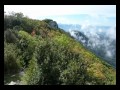
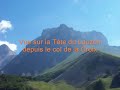
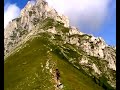
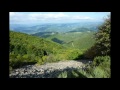
 | Vercors East Balcony from North to South (Isère-Drôme)
7. 12. 2012 14:53:26
On the Vercors ridges 'East Balcony from North to South'Vercors gets its name from a Celtic people living in these mountains at the time of the Roman invasion: the Vertacomicorii.Some walks on the Vercors East Balcony are not yet climbs for mountaineers, but are no longer just hikes.... |
 | Between Soyons and Charmes sur Rhône (07 Ardèche)
18. 12. 2012 09:36:11
Beautiful walk to Charmes sur Rhône. The medieval town and old silk millsIn Soyons the Leaning Tower, dating from the early 13th century, is the only remnant of Yons castle.Distance: ~14 km... |
 | La Chaudière in the Saillans Region (26 Drôme)
30. 12. 2012 17:40:37
La Chaudière in the Saillans Region (26 Drôme)'Saillans Region, the heart of Drôme'The Provençal Drôme is a blend of Provence and Drôme.The Provençal Drôme is already a vacation just thinking about it.... |
 | The Vatilieu Crests of the Vinay Region (38 Isère)
7. 01. 2013 13:11:25
The Vatilieu Crests of the Vinay Region (38 Isère)From the Vercors plateau to the Chambaran massif passing through the Isère Valley, such is the extent of the Vinay region. By walking its paths, discover all its riches. The route passes by 'Les sculptures aux 4 vents'... |
 | The Cresta Rocks Diois (26 Drôme)
25. 01. 2013 13:06:51
The Cresta Rocks Diois (26 Drôme)This satellite of the 3 Becs is noticeable on the right when descending the Col de la Chaudière road on the Saillans side. This small summit is hardly listed except by locals, others generally preferring to climb to the 3 Becs.... |
 | Saint Moirans between running and nordic walking Diois (26 Drôme)
6. 02. 2013 13:11:02
Saint Moirans between running and nordic walking Diois (26 Drôme)The Auches & Montfor satellites of the 3 Becs are noticeable on the right when descending the Col de la Chaudière road on the Saillans side.Distance: ~14.3 km... |
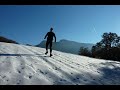
 | Snowshoeing on the Rancs du Touet (26 Vercors)
24. 02. 2013 15:54:11
Snowshoeing on the Rancs du Touet (26 Vercors)Easy little walk to spend 2 hours of a winter afternoon.Distance: ~5 kmAltitudes: Max 1080 mCumulative elevation: ~ +162 m i.e. 9%... |
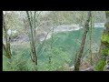
 | Between Gourniere and Bournillon (38 Vercors north)
13. 05. 2013 09:16:51
Between Gourniere and Bournillon (38 Vercors north)Magnificent walk around Choranche on the northern VercorsDistance: ~8 kmAltitudes: Max 627 mCumulative elevation: ~ +400 mLevel: T1-T2... |
 | Pas de la Charmade
27. 05. 2013 23:26:45
... |
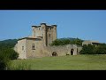
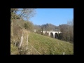
 | Thorrenc, Castle, Tunnel and Viaducts (07 Ardèche)
17. 06. 2013 11:01:44
Thorrenc, Castle, Tunnel and Viaducts (07 Ardèche)Thorrenc is a picturesque village dominated by a magnificent 11th-century medieval castle. Nice walk on a large viaduct of an old railway line that ran from Firminy to Saint Rambert d'Albon. There is a 200 m tunnel to cross, so don't forget your torc... |
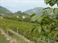
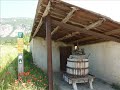 | 'The Vineyard Path' of Label Mountain (26 Drôme)
19. 06. 2013 20:40:16
'The Vineyard Path' of Label Mountain (26 Drôme)Start from Saint Roman via 'The Vineyard Path', toChâtillon en Diois the medieval village nestled at the foot of Glandasse, return via a path on Label Mountain.... |
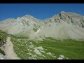 | Col de la Cayolle (Mercantour)
23. 08. 2013 09:43:30
Beautiful day hikes. Varied landscape, snowfields, scree, lakes everything for pleasure.Distance: ~10 kmAltitudes: Max 2251 mCumulative elevation: ~ +- 507 mLevel: T2... |
 | The Lauzanier Valley (Ubaye)
23. 08. 2013 09:52:18
THE LAUZANIER VALLEY (Ubaye)The Lauzanier valley is the source of the Ubayette. To reach Lake Lauzanier (2,284 m), allow 1h45 of walking (and 380 m of elevation gain). The lake, which has very beautiful colors, is dominated by a small chapel, the Notre-Dame des Lumières chapel.... |
 | Grand Ferrand (2,758 m) Dévoluy massif
23. 08. 2013 09:59:51
The Grand Ferrand (2,758 m) is the second highest summit of the Dévoluy massif in the French Alps. It is much less known and frequented than the Obiou and the Pic de Bure.It is located on the border between Isère and Hautes-Alpes.... |
 | Small Trail in Central Vercors (26 Drôme)
12. 12. 2013 14:58:14
The route starts from la Muletier at the exit of Barbière and climbs to Col de Tourniol, the descent is off-piste and some forest trails.« RANDONNÉE MICRODROME »The site is aimed at all nature lovers, mountain flora and fauna.... |
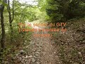
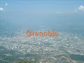
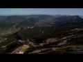 | Vercors from the Sky
26. 12. 2013 09:55:59
New Year Wishes 2013Find us on the site« RANDONNÉE MICRODROME »The site is aimed at all nature lovers, mountain flora and fauna.http://microd.chez-alice.fr... |
 | Microdrome Trailer
26. 12. 2013 21:47:47
... |
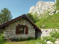
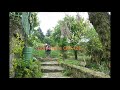
 | Winter Walk at La Goulandière Les Coulmes Vercors (38 Isère)
23. 01. 2014 11:48:00
Winter walk at La GoulandièreLes Coulmes Vercors(38 Isère)The La Goulandière shelter, located on the road to Pra-Létang between Presles and Rencurel, is an old village abandoned for a century. Recently restored with museography that helps us understand life in the past in Les Coulmes.... |
 | Walk in Northern Ardèche From Toulaud on GR 42B (07 Ardèche)
22. 04. 2014 17:18:28
Walk in Northern ArdècheFrom Toulaud on GR 42B(07 Ardèche)Numerous hiking circuits are possible starting from the village of Toulaud. The one leading to Col des Ayes via GR 42B is particularly atypical. The trail, swept by winds, rises along a ridge above the village in the heart of Mediterranean ve... |
 | Savel to Pennes le Sec Loop (26 Drôme)
1. 05. 2014 00:04:57
Savel is a picturesque hamlet overlooking the Roanne Valley. Perched at 558 m altitude,The Roanne valley is a link between Diois and Provençal DrômeThis walk starts from Savel, crosses the Forêt Domaniale de l'Aup, joins Rocher des Bâches, descends to Pennes le Sec and climbs back through the Roanne... |
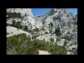 | Calanque of Marseille
8. 05. 2014 12:46:58
Calanque of MarseilleThe Callelongue calanque is the easiest to reach as it is connected by road. To get there, just go to the end of Marseille! And once there, you will feel like you are at the end of the world.... |
 | Pas de l'aiguille and Pas de la selle from la Richardière Haut Plateau Vercors
14. 07. 2014 23:09:17
Pas de l'aiguille Pas de la selle from la Richardière Haut Plateau Vercors southA crossing completely off the beaten paths, where only a few cairns will guide you through the wild vastness of the Hauts Plateaux du Vercors. The beauty of the landscapes crossed, where solitude is guaranteed, will leav... |
 | Lac de l'Oronaye and Roburent Lakes (Mercantour)
19. 08. 2014 20:24:15
Lac de l'Oronaye and Roburent (Mercantour)A hanging valley, formerly glacial, shelters a turquoise blue lake: marmots, Moses' head, carved border markers, with one more hour you dive down to Lac du Roburent.... |
 | Meyronnes St Ours Loop via La Rochaille (Alpes de Haute Provence)
25. 08. 2014 11:03:47
Boucle Meyronnes St Ours via La Rochaille (Alpes de Haute Provence)Do not be fooled by the hostile appearance of this mountain as it is a nice reforestation trail equipped with informative panels that winds through this rocky route: old slate quarry, fountains.... |
 | Lac de Terres Pleines (Mercantour)
29. 08. 2014 14:01:38
Lac de Terres Pleines (Mercantour)Discovery of the pastoral valley of Terres Pleines, arriving at the high-altitude lake.(Keep dogs on leash in pastoral area)Altitude: Max 2482 m... |
 | St Cierge la Serre Serre de Gruas 07 Ardèche
20. 10. 2014 11:04:21
12 km hike in Ardèche.Starting from St-Cierge-la-Serre located 10 km above La Voulte-sur-Rhône to traverse Serres de Gruas and de Leyrier passing through the hamlets of Le Vignal, Aurelle and La Coste with a small detour to the ruins of the Saint Quintin farm.... |
 | Loop walk from Pouzin to Rompon 07 Ardèche
23. 10. 2014 20:22:13
Loop walk from Pouzin to Rompon 07 Ardèche10 km hike in Ardèche.Starting from Pouzin village to traverse the plateau summits, ridges without forgetting the magnificent cornice passages.... |
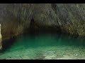
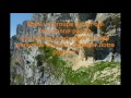
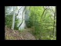
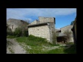
 | Balme Noire Cave via Pas des Rages Vercors
28. 12. 2014 10:39:03
Balme Noire Cave via Pas des Rages VercorsDescent with beautiful viewpoints overlooking the Gorges de la Bourne from Pas de la Ferrière and the pylon.The old Haute Valette path, besides its ruins surrounded by skeletal trees, offers the charm of a beautiful avenue between old ashes and larches. The ... |
 | New Year wishes for 2015
31. 12. 2014 10:09:02
New Year wishes end of 2014Find us on the siteRANDONNÉE MICRODROMEThe site is for all nature lovers, mountain flora and fauna.http://microd.chez-alice.fr... |
 | Spring walk around La Garde-Adhémar and Val-des-Nymphes 26 Drôme
9. 03. 2015 17:26:23
Spring walk around La Garde-Adhémar and Val-des-Nymphes.Fief of the Adhémar in the 12th century, La Garde-Adhémar has kept its medieval atmosphere almost intact, and as such deserves its ranking among the 100 most beautiful villages in France.... |
 | Col des Caux Pass Châtillon en Diois 26
16. 05. 2015 15:26:09
Here is a beautiful classic hike with geocaching.The walk starts from the village alleys. Take the Tricot climb, pass the cemetery and continue on the GR towards Col des Caux. Follow the stream at the bottom of the Baïn valley for a while until the junction leading to the Baïn farm. The path now goe... |
 | Geocaching hike “Les bornes de Serre la Dame” 38 Vercors
26. 05. 2015 17:29:34
Geocaching hike Les bornes de Serre la Dame 38 VercorsThis is a 13 km trail with some cumulative elevation changes ± 600 m.Caution: use GPS to locate yourself, as the video shows trails are not visible everywhere and sometimes non-existent.... |
 | Pissoun de Terres Pleines 04 Upper Ubaye
11. 08. 2015 17:05:21
Located on both banks of a torrent, the path allows circling a glacial barrier called Les Portes de l'Enfer.Caution: avoid the hike in bad weather.Time: 3h30Altitude: Max 1920 m... |
 | Serenne Loop 04 Ubaye
11. 08. 2015 19:03:43
Serenne Loop 04 UbayeDelicious loop along the Ubaye river, very close to the hamlets stretching at the foot of the old cultivated hillsides: sundials, wood craftsmanship, fountains, rural habitat, church.... |
 | Geocaching in the Alpes de Haute Provence
11. 08. 2015 19:41:42
Geocaching in the Alpes de Haute ProvenceShort video gathering the caches done over three days:Mercantour «La Croix de la Bonette» «Casernement du Restefond (2569m)»L'Ubaye «La Croix de St Paul» «Fort inférieur de Roche-la-Croix (2105m)»... |
 | Col des Sept Laux via Rivier d’Allemont (38 Isère)
13. 10. 2015 13:31:18
Col des Sept Laux via Rivier dAllemont (38 Isère)A somewhat steep itinerary to access Lac de la Sagne: first lake of the Sept Laux starting from Rivier d'Allemont. A beautiful sequence of lakes in the Belledonne massif. The path climbs steeply above the old road. At the start, it is equipped in plac... |
 | The Auberts Passage 26 Saou
5. 12. 2015 22:52:16
The Auberts Passage is one of the very little known and even less used passes of the Saou mountain.It allows to reach the Rochers de la Laveuse more quickly, as it is located halfway between Pas de la Motte and Passage de la Picourère, it also allows a quicker return to the Aubrets hamlet.... |
 | Walk on the Bel Air ridges
31. 12. 2015 16:49:53
Beautiful 14 km walk on hills with low elevation Find us on the site« RANDONNÉE MICRODROME »The site is aimed at all nature lovers, mountain flora and fauna.... |