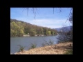
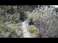
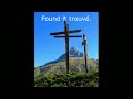
 | Vercors Regional Park In the heart of nature
31. 12. 2015 17:06:49
New Year's wishes 2015Find us on the site« RANDONNÉE MICRODROME »The site is aimed at all nature lovers, mountain flora and fauna.http://microd.chez-alice.fr... |
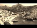 | Marseille Calanques in sepia tones
10. 01. 2016 16:47:05
We invite you to a beautiful walk in the Marseille calanques in sepia color.... |
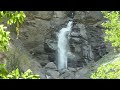
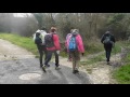 | Walk around Piégros La Clastre Diois 26
1. 03. 2016 22:52:22
Walk around Piégros La Clastre Diois 26Distance: 13 kmAltitude: Max 562 mCumulative elevation: ~ +/- 466 mlevel: medium Find us on the site« RANDONNÉE MICRODROME »... |
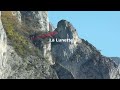
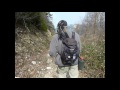 | 'La Grande Dent' Trek in Geocaching 26 Vercors
13. 03. 2016 16:20:21
La Grande Dent Trek in GeocachingWelcome to the series «The La Grande Dent Trek»It is a small loop of about 10 to 11 km The loop starts and ends at the small path near the 'La Loubiere' farm on D 749 and is done in the direction of the cache numbering.... |
 | Saint-Paul-sur-Ubaye (04) | Slackline at Pont du Châtelet
16. 03. 2016 18:00:43
Slackline at Pont du Châtelet - Saint-Paul-sur-Ubaye (04) If I say «slackline» to you, you'll ask me what it is. So I answer you! Slackline is -as the title indicates- extreme tightrope walking. That is to say, you have to walk on a rope stretched between two trees, two poles, two cars... But why «e... |
 | Quint Towers at Sainte Croix 26
10. 04. 2016 19:49:26
3 km hike, elevation +/- 225 mThis is a geocaching hike, as 3 boxes await you around the summit placed by our friend Glassalle master diois of geocaching.Be really careful with children, DANGER rock falls and dizzying cliffs.... |
 | Geocaching Hike The Grand Buisset Mountain from the hamlet Le Moulin Diois 26
28. 04. 2016 14:53:34
Geocaching Hike Grand Buisset Mountain from hamlet Le Moulin Diois 26Attention this walk is airy with numerous exposed and technical passages to be avoided by vertigo sufferers and children. No signage and some trails get lost in the woods or boxwoods, good sense of orientation, IGN map or good GPS ... |
 | The Baise Mountain Diois 26
5. 05. 2016 12:51:16
Geocaching hike that is part of the series 'LES SENTINELLES du DIOIS' by placer GlassalleNice geocaching walk between Chamaloc and Le Pas de la Roche. A large part of the walk follows GR95. 13 caches will be found in a breathtaking landscape, a real pleasure for the eyes and nose in this Provençal v... |
 | MTB on Via Rhona 07
9. 05. 2016 18:28:17
MTB between Tournon and La Roche de Glun 07... |
 | Trek to the Rochers de l'Hériter Rocks (Central Vercors)
18. 05. 2016 20:00:37
Welcome to the series « The Rochers de l'Hériter Trek »It is a small loop of about 8 km with 2 very little known passages 'Le Col de Péril and Le Pas de Macaire' Passages missing on the IGN map.... |
 | From Archiane to Benevise via the High Plateaus (Vercors)
22. 05. 2016 21:54:15
Combe de lAblaise Bergerie de Tussac Village of Benevise In loop To do in summer over two superb days!!!! Attention provide water and dogs are not allowedThis walk has an indicative total length of 26.1 km... |
 | From Archiane to Benevise via the High Plateaus (Vercors)
23. 05. 2016 14:23:59
Combe de lAblaise Bergerie de Tussac Village of Benevise In loop To do in summer over two superb days!!!! Attention provide water and dogs are not allowedThis walk has an indicative total length of 26.1 km... |
 | Geocaching trek on the Sambardou ridge 26 Vercors
29. 05. 2016 19:33:19
Trek of the Sambardou ridges (26- Archiane)I offer you a 15 km trek with ± 1100 m positive elevation gain.Including the Sambardou ridge and Combe de l'Aubaise, departure and return from the village of Archiane.... |
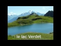 | The Five Forclaz Lakes Beaufortain 73 Savoie
14. 08. 2016 05:30:24
The Five Forclaz Lakes Beaufortain 73 Savoie Superb hike in a magnificent setting where you will discover a succession of glacial lakes.1/ From « La Chapelle de La Trinité » ... |
 | MTB on 'La Voie Douce' from Cheyard 07 Ardèche
15. 09. 2016 23:14:54
MTB on « La Voie Douce » from Cheyard to Voulte sur Rhône 50 km trail ArdècheFind us on the site« RANDONNÉE MICRODROME »The site is aimed at all nature lovers, mountain flora and fauna.... |
 | Walk from the hamlet of Saint Germain to the Petit St Bernard Pass, Savoie 73
28. 09. 2016 12:48:13
Walk from the hamlet of Saint Germain to the Petit St Bernard Pass Savoie 73Heritage in Savoie: The department has a rich heritage to discover ... Saint Germain is a hamlet on the old Roman road that led to Petit Saint Bernard via GR Pays tour de haute Tarentaise.... |
 | Walk on 'Le Signal des Têtes' from Les Arcs 1600 Savoie 73
28. 09. 2016 19:57:39
Walk on 'Le Signal des Têtes' from Les Arcs 1600 Savoie 73Distance: 12 kmAltitude: Max 2245 mCumulative elevation: ~ +- 800 mLevel: mediumFrom Bourg-Saint-Maurice, head towards Arc 2000 and park near the UCPA center (second hairpin from Arc Pierre Blanche - 1600).... |
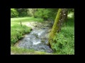
 | Kingfisher Trail 38 - Isère
29. 09. 2016 17:20:03
About 1 km from St-Romans park at Pont de Beauvoir. There begins the Kingfisher Trail.This trail offers several bird observatories (coots, mallards, grey herons, swans...).... |
 | THE SENTINELS of DIOIS 26 Drôme
6. 10. 2016 15:39:36
THE SENTINELS of DIOISFrom Pas de Romeyer to Laval-Aix 26 DrômeNice geocaching walk created by GlassalleIt is not a loop, plan for 2 cars.Distance: 16 kmAltitude: Max 983 m... |
 | Rays Loop Glandasse Vercors south
29. 10. 2016 22:35:04
Rays Loop Glandasse Vercors southNice hiking loop at the foot of Glandasse.Attention: do the loop in the direction of the blue arrows.This walk has an indicative total length of 15.5 km.... |
 | Abbey of Valcroissant to Dôme du Glandasse Geocaching High Plateaus VERCORS South
4. 11. 2016 23:21:13
Abbey of Valcroissant to Dôme du Glandasse Geocaching High Plateaus VERCORS SouthInfo: Regarding the extraterrestrial allusion, it's a wink to the 4 caches at the Dôme summit bearing that name placed at the 4 cardinal points.... |
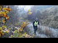
 | Secret corners of the mysterious Gorge d’Oyans. 26 Drôme
18. 11. 2016 16:29:25
Walk in the mysterious Gorge dOyans. 26 DrômeA short airy walk in the cliffs of Gorge dOyans to discover some little-known spots to hikers but used by climbers. This walk takes you through the big scree, the lunette d'Oyans, the great arch, and down into the Eye of Oyans, return via the bottom of Go... |
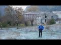
 | 'DAD TEACH ME GEOCACHING' on St Justin mountain 26 DIE
28. 11. 2016 13:11:26
'DAD TEACH ME GEOCACHING' on St Justin mountain 26 DIE13 boxes await you on the trail.Loop starts from the road up to Croix de Justin and goes through Col de Cour and Col de Beauvoisin with a short detour to Pic de Beauvoisin to return to the starting point.... |
 | new year 2017
1. 01. 2017 16:23:34
New Year wishes 2017... |
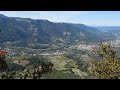
 | Pennes-Sec Crests Diois 26
25. 03. 2017 23:14:28
From Col de Pennes to Montagne d'AucelonToday, I offer you a beautiful hike with a succession of ascents and descents along the crests of Pennes-le-Sec and Montagne d'Aucelon.From there, you will overlook the Diois valley between Aix-en-Diois and Luc-en-Diois with superb views of the Vercors and the... |
 | d’Aix 26 Diois | Laval Geocaching Trek
20. 04. 2017 17:42:10
Laval Geocaching Trek - dAix 26 DioisThe Laval d'Aix loop. Hike of 11 km, with about 500 m elevation gain, 3h30 to 4h, between 17 caches, very family-friendly trail, 5 km ascent and 6 km descent. For cache No. 1 take the direction Combemare. At Pas de Peyrol you can dip your feet, super picnic spot,... |
 | Geocaching Trek to Rochers de la Truite (Vercors Centre)
18. 05. 2017 12:07:50
Welcome to the «Trek des Rochers de la Truite» seriesAttention off-piste route without markings This is a small loop of about 10 km (if you don't get lost), which will take you through two lesser-known passes in central Vercors, Pas de logue and return via Pas de lAubasse. Between the two passes, me... |
 | Geocaching Trek of Vire d’Archiane 26 Diois
10. 06. 2017 08:10:55
This hike has an indicative total length of 11 kmThe highest point of the hike is near 1624 m (lowest at 771 m), for an elevation difference of 853 mTo give you an idea of the difficulty, the overall slope (ascents) is around 32 %... |
 | Gresiere Mountain Loop Geocaching 26 Diois
6. 07. 2017 14:47:17
Gresiere Mountain Loop 26 DioisThis hike has an indicative total length of 11 km. The highest point of the hike is near 1465 m (lowest at 698 m), for an elevation difference of 767 m... |
 | A Corner of Paradise around Col de Larche 04 UBAYE
8. 08. 2017 12:17:24
Just for the pleasure of the eyes. A pure moment of happiness.For this video we start from Lake 'Della Maddalena' in Italy. And we will return to the border pass Col de La Madeleine.Find us on the site... |
 | Col d'Arsine from Col du Lautaret 05 Haute Alpes
10. 08. 2017 12:05:49
Hike to Col d'Arsine from Col du Lautaret 05 Haute AlpesNice hike on Sentier des Crevasses and GR54 This hike has an indicative total length of 20 kmThe highest point of the hike is near 2359 m (lowest at 2032 m), for an elevation difference of 327 m... |
 | Gates of Hell 04 Haute Ubaye
10. 08. 2017 15:57:30
'Porte de lEnfer' 04 Haute UbayeNice short hike in this old glacial cirque. Attention, since the small earthquake of 2016 some aerial passages are damaged and remain dangerous (risk of slipping on the steep slope).... |
 | Geocaching Hike Mont Barral Loop 38 Isère
15. 08. 2017 23:51:58
Geocaching Hike Mont Barral Loop 38 IsèreAbove the Col de Menée, Mont Barral, a small summit at the border of Vercors, Diois and Bochaine, offers a stunning view of Montagne du Glandasse and Vercors, Crête de Jiboui, Col de Seysse and Jocou. Also on the Préalpes, Trièves, Dévoluy and Valbonnais.... |
 | Geocaching in the Ubaye Valley 04
22. 08. 2017 12:17:35
These are short hikes in beautiful areas with magnificent views, with or without geocaching. Find us on the site« RANDONNEE MICRODROME »The site is for all nature lovers, mountain flora and fauna.... |
 | Geocaching Trail Montagne de Praloubeau 26 Diois
6. 09. 2017 14:11:11
Geocaching Trail Montagne de Praloubeau 26 DioisHere is a nice 12 km loop with +/- 663 m elevation gain, starting and ending at the hamlet of Jonchères.Find us on the site« RANDONNEE MICRODROME »... |
 | Geocaching Trek Montagne de Boutarinard 26 Diois
13. 09. 2017 18:26:31
Geocaching Trek Montagne de Boutarinard 26 Diois Attention: Hike reserved for hikers accustomed to unmarked trails and with good orientation skills. Here is a nice 14 km loop with +/- 1066 m elevation gain, starting and ending at the hamlet of Jonchères.... |
 | Geocaching Loop of Montagne d'ESTABLET 26 Diois
25. 10. 2017 12:32:21
Geocaching Loop of Montagne d'ESTABLET 26 DioisDistance: ~ 12 kmAltitude: Max 1300 mCumulative elevation: ~ +- 760 mLevel: MediumFind us on the site« RANDONNEE MICRODROME »... |
 | Camargue Geocaching Trail
5. 11. 2017 11:43:07
The Camargue Trail63 km crossing the Camargue Reserve with 188 caches.Since its creation in 2016 this trek has made me want to do it. On the video only the sea side part done on foot.... |
 | Tour de la Tençon geocaching hike in the forest 38 Isère
22. 11. 2017 12:50:37
Easy short walk of 6.7km and 320m elevation gain marked with 20 caches plus a bonus. You will discover very beautiful viewpoints over the valley, numerous ruins testifying to the former activity of the place and large fields for picnicking if you feel like it.... |
 | I Am from the Pays du Royans
4. 12. 2017 16:12:50
I Am from the Pays du Royans'I Am from the Pays du Royans' is a project carried out by the association Cœur en Drôme based in Saint Jean en Royans.... |
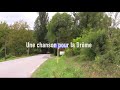 | A Song for the Drôme
4. 12. 2017 16:51:06
A Song for the Drôme'A Song for the Drôme' is a project carried out by the association Cœur en Drôme based in Saint Jean en Royans.... |
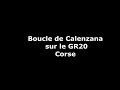 | Calenzana Walk – start or end of GR20, Corsica
28. 12. 2017 15:48:51
At the foot of the mountain, close to the confines of Balagne, Calenzana is the starting or ending point of the GR 20. This walk invites us to discover its first leagues.Distance: ~ 8 kmAltitude: Max 720m... |
 | Ostriconi to Acciolu Walk, Corsica
28. 12. 2017 19:18:19
Beaches and coves of sand or pebbles. A trail between the coast and the maquis, crossing streams and old shepherds' huts. Distance: ~ 15 kmAltitude: Max 100 mCumulative elevation: ~ +- 450 m... |
 | Scandola Nature Reserve, Corsica
28. 12. 2017 22:50:30
The territory of the nature reserve is in the department of Corse-du-Sud, in the commune of Osani, west of Corsica. It is accessible only by sea.Find us on the site« RANDONNEE MICRODROME »... |
 | Speloncato Loop: ancient Roman baths and Giustiniani village
30. 12. 2017 15:11:46
From the rocky spur to the fertile plain lands, we will cross multiple remnants of a past. Our steps will lead our imagination from Antiquity to the contemporary era on peaceful and pleasant paths.... |
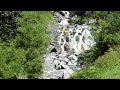
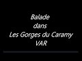 | VAR | Gorges du Caramy
31. 03. 2018 22:51:18
GORGES DU CARAMYThe Sainte Baume massif is a catchment basin for several rivers. The Caramy takes its source there at Mazaugues and quickly plunges into narrow gorges before reaching the agricultural plain of Saint Maximin. Gorges, caves, old mills, Roman bridge, and the permanent tumult of the wate... |
 | The Dancing Rocks (26-Drôme)
3. 04. 2018 13:46:43
The Dancing Rocks - sacred placesIt is in a wood near Saint-Barthélémy-de-Vals that the dancing rocks stand.Natural geological curiosities in which some believe to see a druidic place of worship. Sandstone blocks with strange engraved symbols. Magical place full of mystery!... |
 | Geocaching Course on Coteau de Mours Saint Eusèbe 26 Drome
6. 04. 2018 21:08:15
Geocaching Course on Coteau de Mours Saint Eusèbe 26 DromeNice geocaching hike with 10 caches.Distance: ~ 8 kmAltitude: Max 300 mCumulative elevation change: ~ +- 300 mLevel: Easy.... |
 | Loop Cluny via Chemin des vachers 73 Savoie
11. 06. 2018 16:22:09
Loop Cluny via Chemin des vachersNice hikeDistance: ~ 7 kmAltitude: Max 1631 mCumulative elevation change: ~ +-390 mLevel: EasyFind us on the site« RANDONNEE MICRODROME »... |
 | Loop Cluny via La Chal 73 Savoie
11. 06. 2018 17:47:01
Loop Cluny via La ChalNice hikeDistance: ~ 7 kmAltitude: Max 1608 mCumulative elevation change: ~ +-395 mLevel: EasyFind us on the site« RANDONNEE MICRODROME »... |