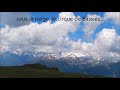
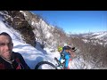
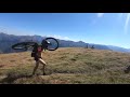
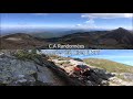
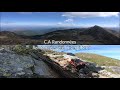
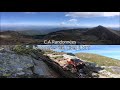
 | Pic de Bassibié (2114 m)
5. 07. 2018 16:13:16
Starting from Gourbit, joined the Col de Lastris, Pic de Boucarle, Pic de Bassibié and descended by bike via Grougn (étang d'Artax)...... |
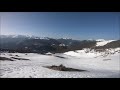 | Col des Passagers (1478m)
1. 03. 2019 11:13:39
Climb to Col des Passagers (1478m) from Col de Portet d'Aspet (1069). Snow encountered around 1350m... |
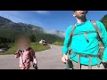
 | First outing (initiation) (in mountains). Col des Passagers (1478 m)
8. 05. 2019 18:36:33
... |
 | CA Hikes | Pic du Han (2074m)
23. 06. 2019 08:55:46
Pic du Han loop from Senconac...1160m elevation gain.... |
 | CA Hikes | Pic de Paloumère 1608m | Pic de l'Aube by MTB
1. 08. 2019 13:15:12
Second time I want to reach the summit, the third will be the one. Sky is low but I'm motivated anyway. Much nicer via Col de Portet d'Aspet, this side is very flat (gentle slope) and very easy for the little ones (day trip anyway). Very nice panorama from the top...in clear weather...... |
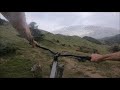
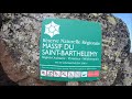 | CA Hikes | Pic de Saint Barthélemy (2348m)
10. 09. 2019 09:58:38
Starting from the parking of Étang de Moulzoune, I climb to St Barthélemy with bike on back... small trail through forest, then along the ridge, slope, forest, some rocks at the end... everything's there... Turn up the sound!!! Don't hesitate to comment and subscribe, it always pleases...... |
 | Lac d'Oo lake (1507m) from Granges d'Astau
1. 08. 2020 09:48:52
The Lac d'Oo is a lake accessible to most people. Start from Granges d'Astau (direction Bagnères de Luchon (2h15 drive). Ascent via a wide almost drivable path. Above are notably the lakes d'Espingo, du Portillon, du Saussat, du Portillon and du Port d'Oô. I invite you to discover the lake, its path... |
 | CA Hikes | to Étang d'Escalès (1594m)
13. 10. 2020 11:22:15
I start from Étang d'Escalès (Ariège) and descend by bike.... |
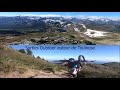
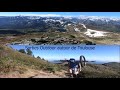
 | Highest point of the Tabe massif | Pic de Soularac by MTB
13. 10. 2020 15:31:08
Highest point of the Tabe massif (or Saint Barthélemy),I take my bike up to Pic de Soularac and descend on it...... |
 | CA Hikes | Sarrat de la Pelade Ariège MTB
13. 10. 2020 18:43:20
We take our bikes up to the top of Sarrat de la Pelade and descend!!!... |
 | Pic de Tarbésou (2368m) by MTB
13. 10. 2020 22:26:27
We take our bikes up to the top of Tarbésou and descend...on it!!!... |
 | CA Hikes | Cabane de Pratmau (1560m, Ariège) by MTB
14. 10. 2020 13:50:23
The Cabane de Pratmau (above Montségur, 09). Ideal for a mountain picnic, accessible to all via a wide non-technical trail. Here's what it looks like.... |
 | CA Hikes | on the north slopes of Mont Ceint (09)
14. 10. 2020 16:17:08
We climb as high as possible with our bikes and descend fooling around!!!... |
 | CA Hikes | Pic de Paloumère (1608m) by MTB
14. 10. 2020 18:18:08
Descent from Pic de l'Aube (or Paloumère) by MTB...... |
 | CA Hikes | Étang d'Appy (1734m) MTB
14. 10. 2020 21:07:40
Étang d'Appy from Appy village (09, Ariège) Monts d'Olmes sector.1h30 south of Toulouse for 110km).744m elevation gain. (990m-1734m)difficulty: medium (steep but doable).... |
 | CA Hikes | Étang d'Arbu (1726m) loop from Suc
16. 10. 2020 09:18:01
With Raphi Rider, we start from Suc and Sentenac (Ariège, 09) and climb the road to the hike start leading to étang d'Arbu then Pic des 3 Seigneurs. For return, we take the footpath all along. Ultra slippery outing as weather very humid. We even get a thunderstorm!!!... |
 | CA Hikes | Étang d'Arbu (1726m)
27. 10. 2020 00:13:17
Hike to étang d'Arbu (1726m). In Vicdessos, head to Port de Lers then park the car 3 turns before the Port. Start sign.I locate several peaks on the video. List below.... |
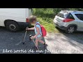
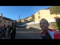
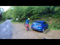
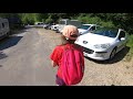
 | Castanet Tolosan | near Toulouse 1
1. 12. 2020 10:26:11
Hello,For info, the start (sign) is at the 'Place Fourés' roundabout, at the intersection of streets Jean Marie Arnaud / Jean Gironis / de la Carrelasse and François Miquel.... |
 | Pic de Girantès (2088m, Ariège) highest point of Lherz massif - Mont Ceint
15. 12. 2020 13:52:01
Highest point of Lherz massif,I start from Coumebières parking (between Aulus les Bain and Vicdessos on the road to port de Lhers and col d'Agnes) and climb to Mont Ceint / Pic de Girantès (2088m) via port de Saleix and descend by MTB.... |
 | CA Hikes | Red Isard trail | Barèges Bike Park
2. 01. 2021 10:30:28
First time I set my wheels in a bike park and it will be the red Isards trail at Barèges.... |
 | CA Hikes | Complete Green Marmotte trail | Barèges Bike Park
15. 01. 2021 17:29:52
After the red trail here https://youtu.be/8mU4M-YdRVY , I take you to the green Marmotte trail.... |
 | CA Hikes | Complete Blue Renard trail | Barèges Bike Park
1. 02. 2021 09:11:25
3rd and last trail descended that day, find the red one here: https://www.youtube.com/watch?v=8mU4M-YdRVY&t=1s and the green https://www.youtube.com/watch?v=Xd2zVIVotRA&t=116s, now I take you down the blue. Good descent!!!... |
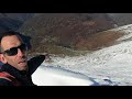
 | CA Hikes | Pic de la Coume d'Or (2826m)
15. 02. 2021 18:47:56
Starting from a parking above Col du Puymaurens (09, Ariège) at 1960m, we reach Pic de la Coume d'Or (2826m) via Portela de la Cometa d'en Garcia (2534m). All with our bikes!!!... |
 | CA Hikes | Pic de Bacanère at 2193m
1. 03. 2021 08:00:05
We climb to Pic de Bacanère with our MTBs.Start: Gouaux de Luchon.Between 1300 and 1700 m of pushing / carrying / rolling...... |
 | CA Hikes | A day at Ariège Enduro.
17. 03. 2021 16:00:25
November 2020, I have nothing particular planned, and for 5, with Martin, we spend the day on the tracks of Ariège Enduro... A real treat!!!... |
 | CA Hiking | 50 km along Canal du Midi between Castelnaudary and Toulouse
14. 04. 2021 09:37:43
I've wanted to do this route for a long time to check the bike feasibility of this greenway... well, it's not that rollable, at least the Audoise part!!!... |
 | CA Hiking | Mont Fourcat from Croquié
29. 04. 2021 19:22:30
Mont Fourcat is a summit in Ariège (09) on the GR de pays of Tabe massif. Several marked starts possible. I take the easiest and shortest, from Brougues parking (above Croquié). 800m elevation fairly easy. Some forest and lots of ridge. Standard for snowshoes, MTB descendable.... |
 | CA Hiking | La Montagne de La Frau (1925m)
8. 05. 2021 08:06:04
February 2021. I start from Montségur and climb Montagne de La Frau (1925m).... |
 | Auzeville-Tolosane | near Toulouse 2
16. 05. 2021 13:00:04
10km of singletracks on MTB near Toulouse, at Auzeville-Tolosane...start at the bottom of côte Bourgoy,track here https://www.utagawavtt.com/randonnee-vtt-gps/Dans-les-bois-d-Auzeville-Tolosane-32592... |
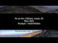 | CA Hiking | Pic du Far (1925m), Auzat (09)
21. 05. 2021 18:25:23
Training ground for vertical km, starting from Auzat (09) to climb Pic du Far and descend via Étangs de Bassiès and GR10...... |
 | CA Hiking | Auzat | Étang de Sigriou Lake (1996m)
27. 05. 2021 09:44:10
ERROR IN VIDEO: at 2.29, only Pique d'Endron is seen, we are far from Picot!!!Hello everyone. I forgot spare batteries for the camera. Which explains the end-of-film photos and the last 2 shots of lesser quality...... |
 | Étang Long - Étang Rond - Nérech Waterfall
7. 06. 2021 08:06:04
We set out to climb to Étang Rond with Raphi Rider (https://www.youtube.com/user/THEPOWER31) but Étang Long winked at us!!!... |
 | La Pique d'Endron (2472m)
25. 07. 2021 19:40:07
... |
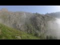
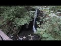
 | Nérech Waterfall
31. 07. 2021 16:19:49
Nérech Waterfall starting from Pla de la Lau parking. On the way to Mont Valier... |
 | Mazamet footbridge
5. 08. 2021 10:45:13
Less than 100m elevation to access it, 140m long and 70m drop underfoot. No vertigo??? Come challenge it!!!Music by Infraction: https://www.youtube.com/watch?v=QaL9W3_njck... |
 | Artigue waterfalls
14. 08. 2021 09:12:37
Looking for coolness on hot days???Want to enjoy a spot with clear water in a natural, shaded place at the foot of the mountains???No problem climbing 180m over nearly 3km???... |
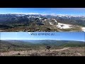
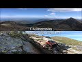
 | Pic de la Coume d'Or (2826m) from Col du Puymorens
30. 08. 2021 19:00:10
Located straddling the Pyrénées Orientales and Ariège at 2826m altitude,Overlooking Étang du Lanoux and facing Pic Carlit (highest point of P.O.),A wide 4x4 track that ends with an easy trail,... |
 | Pique d'Estats (3143m) & Montcalm (3077m) (highest point of the Montcalm massif)
17. 09. 2021 20:08:08
Highest point of the Montcalm massif & Ariège,Doable in a day or 2 days with bivouac at refuge du Pinet,Nearly 1900m elevation gain without any technical difficulty,The l'Artigue waterfalls on the way for some coolness at the end of the day...... |
 | Etang de Légunabens (1655m)
22. 10. 2021 16:34:01
I start from the Bassiès power plant and follow the path to étang Long de Bassiès. From there, I leave the path to go due north to étang de Légunabens. Off-path not too easy at the end...... |
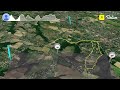
 | Pic des 3 Seigneurs via les Goutets (940-2199). Highest point of the 3 Seigneurs massif
20. 11. 2021 14:49:40
Highest point of the 3 Seigneurs massif (Ariège), I take you to Pic des 3 Seigneurs via the north ridge. The area is not very frequented, nearly 1260m elevation gain including 700m unmarked and pathless.... |
 | Albi via Cap'Découverte by bike | Carmaux
7. 12. 2021 11:20:58
I start from Carmaux SNCF station to go via chemin de Gaillagues to Albi (where I parked the car). A track 95% away from cars.I take the opportunity to see the Titans park and Cap'Découverte...... |
 | Foix (450) via GRP Tour de la Barguillère | Col du Touron (1450)
4. 01. 2022 15:36:51
I start from Foix, climb to the end of D421 and descend via GRP Tour de la Barguillère...Full track here: https://www.utagawavtt.com/randonnee-vtt-gps/Foix-Col-de-Touron-Foix-par-le-GR-du-Tour-de-la-Barguillere-35688... |
 | Pijol de Sarrouge (1875m) from Goulier | Crête des Pijols
13. 02. 2022 22:26:45
The goal was to climb to Pique d'Endron but I stopped halfway.A 'tough' day. I wanted to climb to Pique d'Endron via the NW ridge (crête des Pijols). Very few topos on this passage. I made my little track with IGN maps and go!!!... |
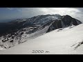
 | Mont Fourcat (2001) - Mercus Garrabet (480) by MTB. 1500m descent on singletrack over 12km. Lapierre AM 529i
18. 03. 2022 18:05:54
To the music of Altitude Universe - The top of the Mountainhttps://www.youtube.com/watch?v=rKlrhv9lRjcFull track here: https://www.utagawavtt.com/randonnee-vtt-gps/Mont-Fourcat-Croquie-Mercus-depuis-Tarascon-SNCF-36292... |
 | April 2022 | Pic de St Barthélémy (2348m)
18. 04. 2022 20:49:49
I climb to Pic de St Barthélémy from Monts d'Olmes.... |
 | 20km south of Toulouse. Lapierre 529i
3. 05. 2022 09:30:58
I take you mountain biking on the trails of short hikes in forests south of Toulouse.Track here: https://www.utagawavtt.com/randonnee-vtt-gps/Circuit-a-l-ouest-de-Castanet-Tolosan-36730... |
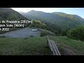 | May 2022 | Tuc de Poujastou (2015m)
17. 05. 2022 14:22:37
Tuc de Poujastou (2015m) from Sode (960m).... |
 | Pic Près de Puntussan from l'Artigue (2699m, highest point of the Bassiès massif)
30. 06. 2022 09:13:15
I start from the l'Artigue parking (1170m) and climb to Pic Près de Puntussan. Passage through the couloir and Bentéfarine pond then directly to the summit.... |
 | Between the Hilette and Alet ponds
18. 10. 2022 20:57:39
Even though there is no path leading up to Montabone pond, by climbing up you can find a magnificent little cirque and its lake (around 2150m)... |
 | The unmissable Ars waterfall
27. 10. 2022 17:51:55
With the complicity of Raphi Rider https://www.youtube.com/c/RaphiRIDER... |