|
| lijaneja21. 09. 2026 10:25:19 |
An otherwise unplanned tour, since I was already up in January, but this year, on my life's jubilee, I have an interesting plan, so yesterday I was again on Jalovec.
I start almost four kilometres of road in the dark; I turned off the light already before the hut in Tamar. Peaceful silence, even the birds are still resting. A little before the turn-off in Mali kot I overtake three ladies who went straight on; I go right, along a pleasant, steep path. I pass the bivouac exactly at the moment when it was freeing itself from shadow; I saved its visit for the return. I do not stop even at Kotovo sedlo, but at the entrance to the wall, where I put away the poles; a group of lads is putting on self-belay sets. Super climbing; after the middle of Mrzla gora the knee had enough time to adapt. After less than three and three-quarter hours I find myself on the summit among a crowd of young men. We all enjoy the sun in turn in perfect calm and excellent visibility. On the smooth rock I spread out the soaked rags; after a good hour I leave the top. Descent by the same route; without a rucksack I still climb Mali Jalovec (the reason I did this tour today), which is not technically demanding, only a bit 'airy'. Špica v Planji is also within reach; it would be a sin not to step onto this exceptional viewpoint.
I make another longer pause at the bivouac, where the blankets are neatly folded and I air it out; in between, in socks, I step into the puddle where water had somehow collected . On leaving I latch it securely and step onto the path that runs some 50 metres away. In front of the Dom there was a swarm of tourists; only the lounger was free and I occupy it for half an hour; before that I refresh myself to the waist at the nearby trough with running water. I time myself to the car and, although the road descends gradually, it takes me 33 minutes, and I was not going slowly . On leaving I latch it securely and step onto the path that runs some 50 metres away. In front of the Dom there was a swarm of tourists; only the lounger was free and I occupy it for half an hour; before that I refresh myself to the waist at the nearby trough with running water. I time myself to the car and, although the road descends gradually, it takes me 33 minutes, and I was not going slowly . .
At Dani I finish the sandwich and wash it down with a large draught beer.
 1 1 2 2 3 3 4 4 5 5 6 6 7 7 8 8 9 9 10 10 11 11 12 12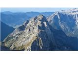 13 13 14 14 15 15 16 16 17 17 18 18 19 19 20 20 21 21 22 22 23 23 24 24 25 25 26 26 27 27 28 28 29 29 30 30 31 31 32 32 33 33 34 34 35 35 36 36 37 37 38 38 39 39 40 40 41 41 42 42 43 43 44 44 45 45 46 46 47 47 48 48 49 49 50 50 51 51
| (+13) |  | |
|
|
|
|
| bos21. 09. 2026 11:23:30 |
Nice Tone, the Slovenian forecast held better than the Norwegian one.
|
|
|
|
| lijaneja21. 09. 2026 18:19:54 |
You can't rely on any. I only know that the weather will be nice on Wednesday.
|
|
|
|
| mito300021. 09. 2026 20:40:39 |
Nice, Tone, I also need to hop up there soon. On Wednesday it really looks good.
|
|
|
|
| vitan22. 09. 2026 11:56:01 |
Tone, we almost met, as my original plan was to go to Jalovec together with a new friend, but then we decided to go via Via dela Vita to V Koncu špico, Vevnico and all the way to Strugov and back to the valley via Kugy's ferrata. But this time I had a camera with me and it's possible we saw each other, if nothing else at least through the lens
 1 1
| (+3) | | |
|
|
|
|
| lijaneja22. 09. 2026 17:19:37 |
They've probably already gone down, Vito, this picture is from 9.54h, and I don't see anyone anywhere.
Just go, Matjaž, there definitely won't be such a rush as there was on Sunday tomorrow, only the temperature will be a bit lower.
 1 1
| (+3) | | |
|
|
|
|
| sanjamejac22. 09. 2026 20:27:42 |
Hello, on Saturday I plan Jalovec from Zadnja Trenta, up over the saddle, back past the Shelter. Over the saddle I see that the self-belay kit is not among the recommended equipment, but how is the path past the Shelter? How much via ferrata is there actually? Not much on the pictures. Many thanks for the information!
|
|
|
|
| mirank22. 09. 2026 21:08:07 |
You know best what you can handle, but if you're not exactly among the addicts who have to watch out as soon as they see ropes, then leave this at home.
| (+1) | | |
|
|
|
|
| ejti22. 09. 2026 21:26:17 |
The svk will be more of a hindrance than a help to you. The rope is quite short. Across the Goličica wall there are only pitons.
| (+1) | | |
|
|
|
|
| darinka423. 09. 2026 03:26:26 |
There is also some via ferrata over the Goličica wall. I was there twice this year. It is quite an airy route. If you are used to it, there are no problems.
| (+1) | | |
|
|
|
|
| sanjamejac23. 09. 2026 07:35:24 |
You are great, thank you all very much!
|
|
|
|
| mito300024. 09. 2026 06:39:45 |
He, he Tone, I've had it in my plans for some time, but you beat me to it. I haven't been to Mali Jalovec and Špica in Planja yet. The only thing is I didn't air out the bivouac.
|
|
|
|
| ločanka24. 09. 2026 07:32:31 |
But I think that lijaneja on sl.16 and mito3000 on picture 5 on the right have more Mali Ozebnik than Vrh Zelenic, because this one is closer to the edge of the picture
|
|
|
|
| lijaneja24. 09. 2026 07:46:46 |
You are absolutely right, @ločanka! When a person does too much by heart, a mistake happens. Thank you very much for the warning, I'm already correcting it.
And I also led Matjaž onto thin ice
| (+1) | | |
|
|
|
|
| sanjamejac28. 09. 2026 08:04:11 |
Once again thanks to everyone, SVK would really be completely unnecessary weight for me personally, but I believe it comes in handy for someone. Anyway a wonderful weekend, up over Jalovško škrbina to the top, down to the Shelter under Špička where I slept and the next day another descent to the car. Time-wise from the starting point Zadnja Trenta to the top I needed a little less than 4h, then to the Shelter another good hour and a half, so it would easily go to the car as well, but I love evenings and mornings in the mountains in such weather. In the evening observing the rising of the full moon, in the morning sunrise. Yesterday I started from the hut only shortly before 12 o'clock, because it was simply so beautiful that I just didn't feel like going down to the valley. The path itself without any peculiarities, but definitely not for those with vertigo.
 1 1 2 2
| (+7) | | |
|
|
|
|
| Po Hodnik5. 10. 2026 16:06:53 |
We used the nice weather this weekend for Jalovec.
Although I had already conquered it from Tamar, I also wanted to hike the path over Jalovška škrbina. This time the execution was harder for me.
Start at 6.00 on Vršič - there was still plenty of parking available. Descent in the dark served as a pleasant warm-up, although we knew that at the very end we would have to push up here. After the fork we tackled the slope that lasts all the way to the entrance to the climbing part.
Crossing Goličica represented a big challenge. I have already hiked and conquered quite a few two-thousanders; the climbing section on Goličica was definitely one of the hardest for me. SVK doesn't help at all, but we are extremely exposed. Still, I enjoyed the climbing part, but an extremely focused step was needed - I wouldn't recommend the descent here.
The continuation is easier; it becomes serious again in the last part. The summit ridge (and the peak itself) on such a beautiful day allowed wonderful views. But again on certain parts it is exposed and requires caution.
On the entire path to the top we didn't meet anyone; at the top there were 5 of us.
The descent followed via Zavetišče pod Špičko, which is easier but still requires focus. Here too the path was empty. The descent from ZPŠ to Vršič was pleasant except for the last ascent to Vršič which kills you
Although on hribi.net it says 6 hours of walking on the route, on the board at the starting point 5 hours are planned. We needed 10 hours there and back, of which 2 hours were for breaks.
18km, 1700 vm, super day.
 1 1 2 2 3 3 4 4 5 5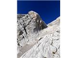 6 6 7 7 8 8 9 9 10 10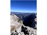 11 11 12 12 13 13 14 14 15 15 16 16 17 17
| (+6) | | |
|
|
|
|
| mikkeni5. 10. 2026 18:47:49 |
Current conditions for Jalovec - excellent until Wednesday - also the path itself over Jalovška Škrbina as it was 5 years ago. Return via Špiček. More in the collage of pictures and a few words at...
https://ma-uc.blogspot.com/2026/10/jalovec.html
| (+1) | | |
|
|
|
You must log in to post a comment:
If you do not yet have a username, you must first
register.