|
| Lukito8. 01. 2021 15:05:37 |
Last week I had some slightly heavier ones and it was nice. 5cm fresh on top, groomed below, flying head almost to the ground on turns and grinning ear to ear 
| (+2) |  | |
|
|
|
|
| Lukito19. 01. 2021 18:06:14 |
Friday, 15.1.2021
Quickly a bit earlier from the office, did one lap. Already quite hard and windblown as before. But still nice
| (+2) | | |
|
|
|
|
| ejti29. 05. 2021 22:04:24 |
Maybe mistyped.. Not Križišče, but Kržišče, locally Pokovše.
Otherwise nice.
|
|
|
|
| skala12330. 05. 2021 21:08:04 |
hey Thanks for the warning, I'd fix it but I can't.
|
|
|
|
| Stone24. 08. 2024 11:19:04 |
Velkavrh great tour, views divine. Those "baskets" are for disc golf. You throw frisbee into baskets, by certain rules. On Areh on Pohorje this thing is quite popular, also new mini golf at Ruška koča. Maybe on Krvavec they'll use this novelty with enthusiasm too. Just being in nature, whatever you do, is the greatest luxury.  Thanks for the report. Thanks for the report.
| (+1) | | |
|
|
|
|
| velkavrh25. 08. 2024 07:44:56 |
Stone thanks! Happy for every like and positive response. I was four days in the Dolomites, but home is the best! Tomorrow going with retirees a bit to Austria. Greetings.
| (+3) | | |
|
|
|
|
| Katrca30. 11. 2024 06:05:39 |
Since the skiing season on Krvavec has already started, but I would go to Veliki Zvoh on foot, I'm interested if the path from Planina Jezerca described on Hribi.net crosses any ski slope? Thanks for answers.
| (+1) | | |
|
|
|
|
| lencad30. 11. 2024 16:41:48 |
On the described path you only need to cross 10 m of the Vrh Krvavca slope-spring slope (if you go over Vrh Krvavca you avoid that too), on the last slope to Zvoh there's enough space on the service road right by the fence (snowy only three quarters of the slope).
I was there today.
 1 1
| (+3) | | |
|
|
|
|
| arta6. 11. 2025 13:49:53 |
Yesterday visibility was exceptional. It was so beautiful up there.
| (+4) | | |
|
|
|
|
| Premik9. 10. 2026 08:21:34 |
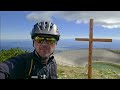
Veliki Zvoh from a slightly different perspective - recently I recorded the entire path to the summit. Although I went up by bike, the first-person footage can be an excellent preview of the terrain for all hikers. Especially nicely visible are those last 500 meters on steep paving stones just below the top, where the path really stands up and requires quite some fitness.
Maybe the recording comes in handy for someone for an easier idea of the path itself and the wonderful views that await you above.
Video:
 1 1
|
|
|
You must log in to post a comment:
If you do not yet have a username, you must first
register.