Lepenatka and Veliki Rogatec (Rogač)
|
| joža x28. 09. 2014 10:29:41 |
Yesterday with buddy after 1 year again in hills. Tour:Sv.Lenart-Kal-Rogatec-Lepenatka-Sv.Lenart, really great tour for enjoyment, climbing path needs some mountain experience, otherwise path ok. Recommend to solo hikers.
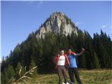 1 1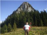 2 2
|
|
|
|
| garmont13. 01. 2015 19:00:04 |
Today over Lepenatka and Kal to Rogatec. Descent to Špeh and back to car.
Road to Sv.Lenart church icy last km and impassable without chains.
Not much snow on path, only on ridge shade slip risk on few cm snow. Used crampons for descent to Špeh - recommended.
Regards
| (+5) |  | |
|
|
|
|
| garmont22. 10. 2015 18:16:59 |
Today over Rogatec to Lepenatka and past Planšarska koča to Lenart.
Weather after morning snow shower rather miserable, path wet and slippery...
Regards
| (+4) | | |
|
|
|
|
| zokipoki25. 01. 2020 09:47:38 |
Yesterday afternoon in super company to Lepenatka and Rogatec.
Descent towards Zg. Špeh icy in places.
Safe!
| (+5) | | |
|
|
|
|
| Rejvarka3. 06. 2021 11:49:24 |
Hello mountain hikers  on Sunday we plan with the group to go first to Lepenatka, then via the climbing route to Rogatec. We would descend the other side to the Zgornji Špeh pasture, so please advise on the condition of both routes to and from Rogatec. on Sunday we plan with the group to go first to Lepenatka, then via the climbing route to Rogatec. We would descend the other side to the Zgornji Špeh pasture, so please advise on the condition of both routes to and from Rogatec.
Thanks 
|
|
|
|
| garmont3. 06. 2021 12:27:42 |
No special features on the mentioned paths. Just need to be a bit careful on the descent from Rogatec towards Špeh, because of fallen trees there are a few small detours.
Best regards
| (+3) | | |
|
|
|
|
| Kafetarca8. 02. 2023 06:03:46 |
What are the conditions like? Has anyone been there recently?
|
|
|
|
| geppo8. 02. 2023 08:52:14 |
From Sv. Lenart to Lepenatka past Zg. Špeh I know it's tracked (colleague was there yesterday). But about Rogatec, I don't know?
best regards
| (+1) | | |
|
|
|
|
| zokipoki19. 11. 2023 22:09:19 |
A short ambient video of an afternoon hike.
The road to sv. Lenart is good, but it was quite damaged in the flood. Only when you see the consequences of the August flood like this in micro-locations, you can see how bad and intense it was.
The path is without features.
Good luck!
https://youtu.be/UQLFYFeB1bs?si=JvolxmapVGcVuvfj
| (+9) | | |
|
|
|
|
| mirank20. 11. 2023 10:11:50 |
Really nicely shot video; one of the rare ones where the author isn't showing off selfies or scarily presenting completely normal more demanding spots on the path.
| (+7) | | |
|
|
|
|
| zokipoki20. 11. 2023 16:25:21 |
Thanks @mirank! It's more amateurish, but to the best of my abilities at that moment. First time I tried filming that way with me in the frame during the hike, and I have to say it's not that easy!
best regards
| (+3) | | |
|
|
|
|
| lijaneja20. 11. 2023 18:27:41 |
Super. For the icing on the cake right at the end, a slow 360-degree shot of the horizon with peaks is missing.
| (+2) | | |
|
|
|
|
| j.23. 11. 2023 17:12:45 |
Yesterday (Wednesday, 22 November) from the parking lot near Sv. Lenart on a walk around there. I started on a wet, slippery, and steep path straight up towards Lepenatka. The path continuation, which leads along the forest on lush meadows, soon freed me from the muddy ordeal, luckily. On the top it was annoyingly windy, but the views of the snow-sugared peaks were invigorating despite partial cloudiness.
On Kal saddle everything was churned up. Who knows by whom, maybe by surveyors. Puddles partly frozen. I carefully avoided the climbing paths to Rogatec and continued towards Gornji Špeh. The cart track was annoyingly muddy, once you have to cross a small tree fall. Completely by chance I spotted a left turnoff to Rogatec and headed up. It snowed overnight at around 1500 meters, but the snow had already melted into annoying wetness. Some 100 meters below the summit there were still occasional snow patches visible here and there. I was fed up to my neck with the numerous slippery roots on the narrow trail on the steep slope 15 minutes before the summit and turned back.
From Gornji Špeh to Sv. Lenart I descended the serpentine road and thus avoided the risk of muddy paths. All brooks that flow over or under the road have greatly enlarged beds, at one spot the brook flows over the road and is impassable. The largest landslide I've seen measures approximately 50 by 50 meters. As for the road along Kanolščica, I had the feeling that despite the machine flood control works, it barely holds the bank in places.
Beautiful places, I'll come again. However, the day for yesterday's excursion after the night rain was not the best chosen despite good weather prospects. Next time it will surely be better .
 1 1 2 2 3 3 4 4 5 5 6 6 7 7 8 8 9 9 10 10 11 11 12 12
| (+8) | | |
|
|
|
You must log in to post a comment:
If you do not yet have a username, you must first
register.