Nabois / Monte Nabois Grande
|
| tilka7. 07. 2011 15:25:09 |
Does anyone know if the path to Great Nabojs from Pallarini hut is dry?
|
|
|
|
| kofetarca8. 07. 2011 00:24:09 |
Tilka, it's dry, look back at one description 
|
|
|
|
| tilka8. 07. 2011 13:49:26 |
oops  , overlooked - thanks! , overlooked - thanks!
|
|
|
|
| dolinka24. 08. 2011 20:44:51 |
Alessio, I would kindly ask if you can tell something about VIA NORD aka SENTIERO MARTINOLLI to Mali Nabojs and then the path further to Veliki Nabojs. I found something on CAI but I understand Italian very poorly.
Thanks.
|
|
|
|
| 2061alessio25. 08. 2011 16:50:53 |
Hi, to Mali Nabois now there is a marked CAI path with a number because CAI Monfalcone made it in memory of the former president Martinolli so there shouldn't be a problem walking there, many old WWI memories on this summit, for VIA NORD the difficulties are 2nd degree but for the route description you'll have to wait a bit because I need to translate something exactly from the "holy book" ALPI GIULIE - Gino Buscaini. Lp.
|
|
|
|
| IgorZlodej25. 08. 2011 17:57:47 |
Suddenly I realize I haven't been to Zajzera for a long time, so quickly on the trail. I park at parking lot #2, then over the new bridge, immediately along the right bank on some gravel embankment and later on the road to the junction of road-path 616 to the lower cargo cableway station. I don't go far on the road, soon I turn right onto the Great War thematic path. When it ends, I go through scree fields that are getting larger. With nice views of the beautiful mountains above Zajzera, the path passes quickly and soon I am at the completely buried bridge in the headwall of Zajzera, and on the path to Špranja. Slowly I warm up in shorts, the valley is quite cold in the morning. I stop for a moment at the Darjo Majcen bivouac, which is in poor condition - shame. I continue on the Sentiero alpinistico Carlo Chersi path. The path is not difficult. Under the Viševa west wall there are two scenic promontories, which are without doubt the most romantic places above Zajzera with a majestic view of the Špice; it would be a sin not to stop. Then I continue to the Nabojs saddle, descend a bit and climb to Veliki Nabojs. Under Montaž at the start of Via Amalie there was a helicopter, obviously an accident. At the summit I sit a bit, then back down to Žabniška krnica and to Pellarini hut. To Nabojs I met no one, then I think 5. Beautiful, solitary, too beautiful to describe. Followed by descent to Zajzera, then to Sabina at Trbiž for beers.
 1 1 2 2 3 3 4 4 5 5 6 6 7 7 8 8 9 9 10 10 11 11 12 12 13 13 14 14 15 15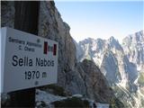 16 16 17 17 18 18 19 19 20 20 21 21 22 22
|
|
|
|
| dolinka25. 08. 2011 18:03:49 |
Thanks Alessio, I'm just interested if the path is marked somehow or if you have to search for it? We'll manage the 2nd degree. We know each other anyway. lp.
|
|
|
|
| dolinka25. 08. 2011 18:10:10 |
Where does the Great War path go, Igor? Tomorrow I planned to go the whole Carlo Chersi path, from Grego hut to biv. Stuparich, biv. Majcen to Nabojs saddle and V. Nabojs then to Pellarini. I think it will be solitary, hot but probably not so much there. lp
|
|
|
|
| IgorZlodej25. 08. 2011 18:31:14 |
The Frat.Grego hut and Stuparič bivouac have no relation to the Carlo Chersi path, it would also be decidedly too much for one day unless you're a mountain runner. The Great War path must be sought to the right along the road to the lower cargo cableway station, it is nicely signposted with tablets, but then you can forget Veliki Nabojs. It seems to me that the paths above Zajzero are not very well known to you.
|
|
|
|
| dolinka25. 08. 2011 18:39:03 |
No, I know the paths on the other side better, but I've also walked some here. Then Mašer is wrong too and my Tabacco 019 map where the path is marked and written so. Thanks anyway. lp
|
|
|
|
| 2061alessio26. 08. 2011 15:40:46 |
Here I am; from parking - Saisera stream - to saddle on the south side of small Nabois (1535 m) h1.30. Here still visible "memories" of the First World War army, to here somewhat marked (even fully marked) no orientation problem, from here only track and it goes like this: to grassy saddle with bushes uphill on track south then under a tower across rocky gully to shoulder (1736 m) h0.20, ahead across small grassy saddle between 1736 m and 1840 m descend 30 m right into gully direction big Nabois, cross channel approx. 10 m steep up grassy rib chamois track side big Nabois steps scree in gully to start of north wall entry h0.40, wall solid with many holds, ledges, steps but small gullies full of scree; on ascent best hold right but a few meters under chamois ledge climb left side to ledge h0.30; follow ledge left to one big crack, then up across steep grassy rocks right side of crack and next exit right to wide ledge, follow ledge to steep gully in which descend, ledge always wide and easier for 100 m - chamois path - then directly up cross a few meters slab to small step (2 m), bypass on right and soon to summit h1.00 - h4.00 from parking Saisera stream. This is VIA NORD relation from "holy book". Tell if succeeded (how do we know each other???) notice for all: since sometimes I don't read/look at all things on forum if you have direct question easier to reach me at: sentieri@caitarvisio.it or private messages. Bye.
|
|
|
|
| Okmodko26. 08. 2011 16:58:03 |
Saisera = Zajezera. From here follows my next question. Why are there no Slovenian bilingual signs in the Trbiž area? In villages and on hills. Is nationalism at its peak?
|
|
|
|
| miri26. 08. 2011 17:25:58 |
Will have to ask minister Žekš.
| (+1) |  | |
|
|
|
|
| Okmodko26. 08. 2011 17:40:32 |
Yeah, he is really responsible for that :P
|
|
|
|
| dolinka27. 08. 2011 09:18:19 |
Thanks Alessio, we'll go there this autumn now, and now you know how we know each other and that it's not just Markot and me interested in that path. It invites so nicely on the road - new sign, it has to interest a person. I went yesterday along the eastern ridge to Nabojs (quite bushy and rocky, need some sense to find) and then on to biv. Mazzeni, great.
lp
|
|
|
|
| dolinka27. 08. 2011 09:18:34 |
Thanks Alessio, we'll go this autumn now, and now you know how we know each other and that it's not just Markot and me interested in that path. It invites so nicely on the road - new sign, it has to interest a person. I went yesterday along the eastern ridge to Nabojs (quite bushy and thorny, and you need some sense to find it) and then on to biv.Mazzeni, great.
lp
|
|
|
|
| 2061alessio27. 08. 2011 13:35:41 |
Marko told me how things went (hope those who turned back because of bad weather forecast) as we were in touch today by mobile; it's time I go check this new path to little Nabojs as friend-historical guide-has invited me several times (has at least some other historical paths to mark around little Nabojs), LP. CIAO.
|
|
|
|
| hudson27. 08. 2011 15:10:21 |
Regarding the course of Chersi path "dolinka" is quite right - start from the Grego hut, past bivouacs Stuparič and Mazzeni to Pellarini hut at the end.
For better prepared completely doable in one day (8-10 hours moderate walking without stops).
|
|
|
|
| dolinka27. 08. 2011 19:05:04 |
Alessio, thanks again. Hope we meet somewhere, lately I've been only in your neck of the woods and must admit they've completely captivated me. Tomorrow going to White Waters. Best regards.
|
|
|
|
| gorenjka115. 09. 2011 22:51:40 |
Today from Zajzera over Špranja to bivak Mazzeni, on to Škrbina V.Nabojska, Veliki Nabojs, descent via Pellarini hut back to Zajzera. Weather in the morning quite miserable, fog everywhere, afternoon acceptable 
Bivak Mazzeni no longer in poor condition - completely newly painted, renovated. Still smells of paint. We were first to sign in the book
|
|
|
You must log in to post a comment:
If you do not yet have a username, you must first
register.