Lenzanger - Hocharn (via Hoher Sonnblick)
Starting point: Lenzanger (1550 m)
| Latitude/Longitude: | 47,08142°N 12,98469°E |
| |
Route name: via Hoher Sonnblick
Walking time: 7 h 45 min
Difficulty: very difficult marked way
Elevation gain: 1704 m
Elevation difference along the route: 2130 m
Map:
Recommended equipment (summer): helmet, self belay set, ice axe, crampons
Recommended equipment (winter): helmet, self belay set, ice axe, crampons
Views: 2.417
 | 2 people like this post |
Access to starting point:
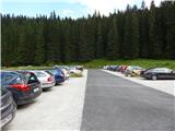
Through the Karawanks Tunnel, we drive into Austria, and then we continue driving on the Tauern motorway. Further, we drive through the Katschberg Tunnel and later also the Tauerntunnel. We follow the motorway towards Salzburg only to the exit for Bischofshofen, from where we continue driving on a four-lane road towards the already mentioned town. From Bischofshofen we follow the signs for Zell am See through the valley along the Salzach River. At the end of Taxenbach we turn towards Rauris. Further, we drive through the Raurisertal valley through Rauris and Wörth. We then follow the ascending road all the way to the large parking lot Lenzanger. In the last part, the road is subject to toll (9€ - August 2013).
Route description:
From the parking lot, we continue following the signs »Naturfreundehaus« on the road, which is further closed to traffic. The road, which immediately after the barrier becomes macadam, first leads us through the forest and brings us to a junction. To the right, slightly downhill, the road leads to the alpine pasture Grießwiesalm, while we continue slightly left on the road towards the hut Naturfreundehaus.
The road then soon brings us out of the forest and leads us along the Scheidbach stream with beautiful views towards the summit Hoher Sonnblick. Here we soon come to a junction where to the right, over a bridge, footpath 123 branches off towards the notch Goldzechscharte and the summit Hocharn.
We continue further on the road and soon we are again at a junction. To the left, the road leads to the hut Ammerhof, while we continue right and soon reach the hut Naturfreundehaus on the flat road.
At the hut, we continue following the signs »Hoher Sonnblick, Schutzhaus Neubau«. The path takes us into the forest, through which we ascend southwards for some time. Further on, the path leads past the Barbarafall waterfall, and from the path increasingly beautiful views open up on the nearby summits and the Raurisertal valley.
Out of the forest, we then reach grassy slopes where livestock grazes in the summer months. Here, the signposts direct us right, and a traverse towards the west follows. When we reach the vicinity of the stream, the path turns left uphill again and then ascends for quite some time on mostly grassy slopes.
A little before the hut, we reach a junction where the path to the hut Niedersachsenhaus branches off to the left. At the junction, we continue right, and only a short ascent remains to the hut Neubau, which we can already see ahead.
From the hut, we continue westwards following the signs »Hoher Sonnblick«. To the right, the circular path Tauerngold-Rundwanderweg then branches off, along which we can see sights related to the gold mines in this area. The path soon crosses the stream and brings us to a marked junction. To the left, the Tauerngold-Rundwanderweg continues towards the glacier, while we continue slightly right towards the hut Rojacherhütte and the summit Hoher Sonnblick.
From the junction, the path then ascends for some time on the slopes on the eastern side of the summit Hoher Sonnblick. Higher up, the path turns slightly left towards the south, and soon a view opens onto the Goldbergkees glacier. Here, the path to the notch Niedere Scharte branches off to the left, while we continue slightly right, followed by a few ascents on the rocky slope to the hut Rojacher Hütte.
At the hut, we continue northwestwards following the signs »Hoher Sonnblick«. The path leads us along a rocky slope and onto an initially still wide ridge. From the left, a somewhat less visible path over the glacier joins us, and the ridge then becomes narrower and quite steep; at some points it is also somewhat exposed, so caution is required. During the ascent along the ridge, a steel cable and a few staples and pitons occasionally assist us. In the final part towards the summit Hoher Sonnblick, the path along the ridge becomes somewhat more demanding, but we have the option in this section to bypass the steep ridge via the glacier. In case of ice or hard snow, we will need an ice axe and crampons. The path along the ridge steeply ascends briefly in this section with the aid of a few staples and pitons. The ridge then soon becomes less steep, followed by an easy ascent along a very panoramic path to the summit.
From the summit, we descend to the glacier and continue northwestwards following the signs »Alter Pocher, Heiligenblut«. Further on, we descend slightly along the glacier in a northwesterly direction; for walking on the glacier, we will need an ice axe and crampons. It is also recommended to walk roped, especially when the path is not trodden.
When we pass the notch Pilatusscharte, we leave the path to the hut Alter Pocher and head slightly right, beginning a traversing ascent below the slopes of the summit Goldzechkopf. The glacier then becomes somewhat steeper, followed by an ascent to the rocky slope on the south side of the summit Goldzechkopf.
Here the glacier ends, and a very steep ascent follows with the aid of a steel cable and a few staples. For the less experienced, belaying is highly recommended. When we reach the ridge, we continue left, followed by a few more ascents along the steel cable. Later, the ridge becomes less demanding, and only a short ascent remains along the panoramic ridge to the summit Goldzechkopf.
From the summit, we continue northwestwards and begin descending along the ridge. At some points, a steel cable assists us. Further on, the path mostly follows the left (western) side of the ridge and begins ascending again from the notch Südliche Goldzechscharte. The path then also leads past the notch Nördliche Goldzechscharte and brings us along the ridge to a junction.
At the junction, where a shorter path from the Raurisertal valley joins from the right, we continue straight along the ridge.
From the junction, we continue mostly ascending along the ridge beside the Hocharnkees glacier. On a shorter section where the ridge becomes somewhat steeper, the path moves to the right (eastern) side of the ridge. This is followed by another ascent to the ridge, from which increasingly beautiful views open up. When we reach the forepeak (3203m), the ridge turns slightly right. We continue along the ridge and soon reach the summit on a slightly steeper slope.
We descend along a somewhat easier and shorter path towards the Raurisertal valley (path 123), which runs below the eastern slopes of the summit Hocharn.

Photos:
 1
1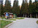 2
2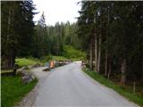 3
3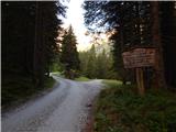 4
4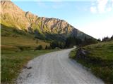 5
5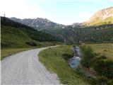 6
6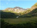 7
7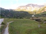 8
8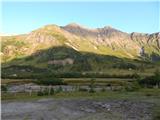 9
9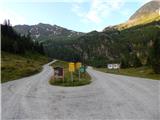 10
10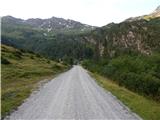 11
11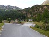 12
12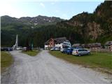 13
13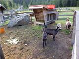 14
14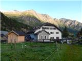 15
15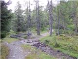 16
16 17
17 18
18 19
19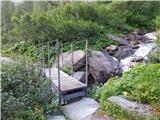 20
20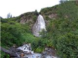 21
21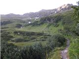 22
22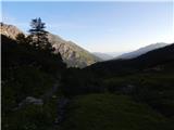 23
23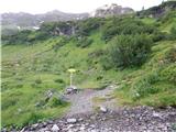 24
24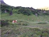 25
25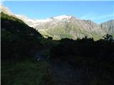 26
26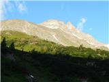 27
27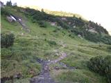 28
28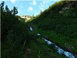 29
29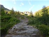 30
30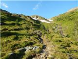 31
31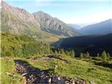 32
32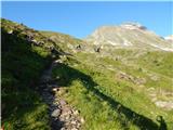 33
33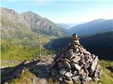 34
34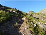 35
35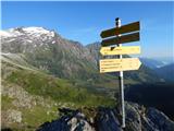 36
36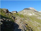 37
37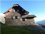 38
38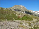 39
39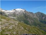 40
40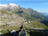 41
41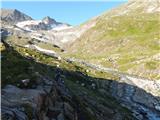 42
42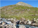 43
43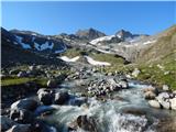 44
44 45
45 46
46 47
47 48
48 49
49 50
50 51
51 52
52 53
53 54
54 55
55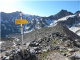 56
56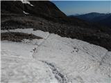 57
57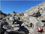 58
58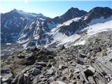 59
59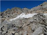 60
60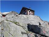 61
61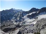 62
62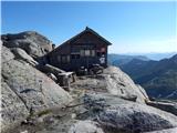 63
63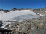 64
64 65
65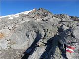 66
66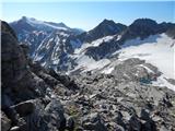 67
67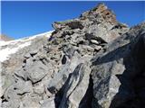 68
68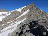 69
69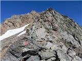 70
70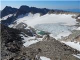 71
71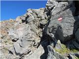 72
72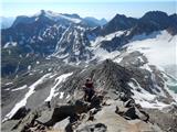 73
73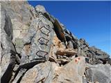 74
74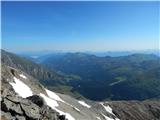 75
75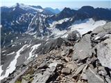 76
76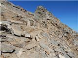 77
77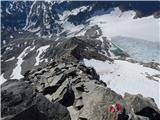 78
78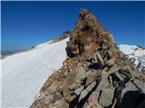 79
79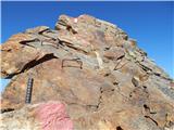 80
80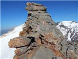 81
81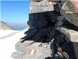 82
82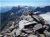 83
83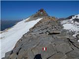 84
84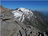 85
85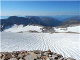 86
86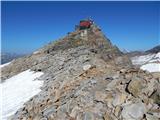 87
87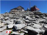 88
88 89
89 90
90 91
91 92
92 93
93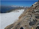 94
94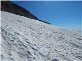 95
95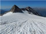 96
96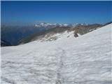 97
97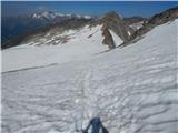 98
98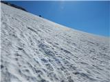 99
99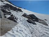 100
100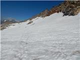 101
101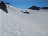 102
102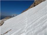 103
103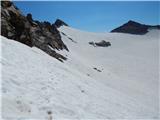 104
104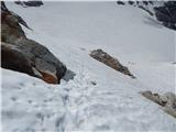 105
105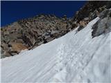 106
106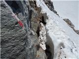 107
107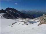 108
108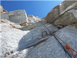 109
109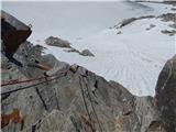 110
110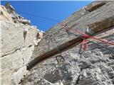 111
111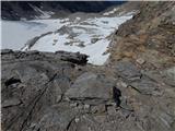 112
112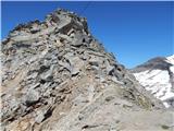 113
113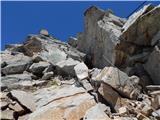 114
114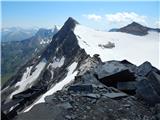 115
115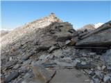 116
116 117
117 118
118 119
119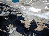 120
120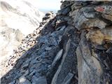 121
121 122
122 123
123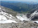 124
124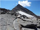 125
125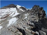 126
126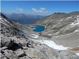 127
127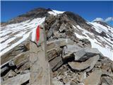 128
128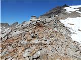 129
129 130
130 131
131 132
132 133
133 134
134 135
135 136
136 137
137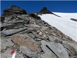 138
138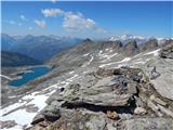 139
139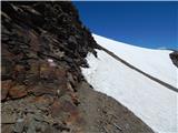 140
140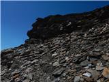 141
141 142
142 143
143 144
144 145
145 146
146 147
147 148
148 149
149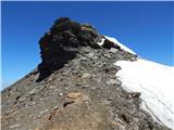 150
150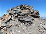 151
151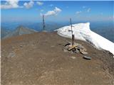 152
152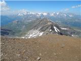 153
153 154
154 155
155
Discussion about the trip Lenzanger - Hocharn (via Hoher Sonnblick)
To post a comment you must log in:
If you do not yet have a username, you must first
register.