Starting point: Bučan (1010 m)
| Latitude/Longitude: | 46,44630°N 14,25640°E |
| |
Walking time: 3 h 5 min
Difficulty: very difficult unmarked way
Elevation gain: 526 m
Elevation difference along the route: 800 m
Map: Karavanke - osrednji del 1:50.000
Recommended equipment (summer): helmet, self belay set
Recommended equipment (winter): helmet, self belay set, ice axe, crampons
Views: 7.737
 | 1 person like this post |
Access to starting point:
From the highway Ljubljana - Jesenice we take the exit Ljubelj (Tržič), and then we continue driving in the direction of Celovec / Klagenfurt. After the Ljubelj tunnel the road starts descending, and on the Austrian side we follow it to the first left turn, where the old Ljubelj road branches off to the right. We park at a suitable place at the crossroads, or we can also park higher on the Austrian side of the former border crossing Ljubelj.
Route description:
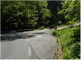
From the starting point, we head onto the old Ljubelj road, which is closed to public traffic by a traffic sign. The road first moderately ascends over two serpentines, then continues along the stream to the ruins of the former church of St. Lenart, by which stands a somewhat larger sign. Here the road turns left and gradually moves away from the valley. From the road, nice views then begin to open onto Palec and other surrounding peaks. The road further leads past a smaller crossroads, where we continue sharply right on the "main" road, then in a moderate ascent cross steep slopes (danger of falling rocks, or in winter snow avalanches and slips). Higher up, the road makes a few more serpentines, then brings us to a marked junction, where a marked footpath to Košutica / Loibler Baba branches off to the left. We continue on the wider road and after 10 minutes of further walking arrive at the old border crossing, behind which stands the Koča na Ljubelju mountain hut.
From the hut, we continue right in the direction of Zelenica and Povna peč (Polna peč). The path goes past the hut and immediately behind it begins to ascend. The steepness soon eases and the path brings us to a mostly vegetated ridge from which we occasionally get some views. After a few more minutes, we already see the peak of Polna peč ahead, which the path bypasses on its northern side along steep slopes. The path, which almost encircles the peak, brings us just a few steps below the summit to a junction, where we continue right in the direction of Ljubeljščica (left Polna peč 1 minute, peak with a view on the central Karavanke).
The path running along the border ridge then begins to descend and after 50 meters of descent brings us into the dwarf pines. Further on, the path moves slightly away from the ridge to the right and crosses a slightly exposed crumbly gully. This is followed by a gentle ascent to one of the many peaks in the Ljubeljščica ridge. Here on a wooden sign we notice a faded inscription that the safe path ends (less experienced hikers can end the trip here and return the same way to the starting point).
Immediately behind the sign, the ridge narrows and changes from vegetated to crumbly and somewhat exposed (danger of slipping). After a few steps of descent along the crumbly ridge, the path returns to the safe embrace of the dwarf pines, but the difficulties are not over yet. The path, which ascends and descends again, crosses a few more similar gullies, where greater caution is needed. The unmarked path then brings us to an inscription on a rock. The inscription marked Zelenica directs us to the Slovenian side, where we then bypass steep rocky towers on the left side. The path then returns to the ridge and brings us to probably the most difficult part of the path. With the help of steel cables, we descend steeply down the narrow, steep and precipitous ridge (for the less experienced, a self-belay set is recommended). After a short descent, the ridge widens and the path begins to ascend again. After a few more minutes of moderate ascent, we reach the next sign, where the mark for Zelenica directs us left downward. This is followed by traversing the scree, after which a steep side ridge blocks the path. With the help of fixed safety gear we climb one level higher, then still within the embrace of the safety gear descend to the other side of the mentioned ridge. Gradually a somewhat less visible trail then turns slightly right and ascends again on quite an overgrown slope to the border ridge. Here the path turns slightly left and ascends on the overgrown slope to the saddle Čez Pod (saddle between Zgornji Plot and the ridge Na Možeh).
Here we continue slightly right (left Zgornji Plot 1704 m, 1 minute) to the border sign, then descend along a small path to the upper edge of the Triangel ski slope. Here we step onto a cart track (transport-rescue road), which turns slightly right and descends moderately to the next ski slope, where we step onto the marked path. We continue straight ahead or slightly left (sharply right Stol and Vrtača) across the ski slope. The path then crosses a short strip of forest and after a further short descent brings us to the Dom na Zelenici.
From the border ridge we can also descend to the hut along the ski slope, but this path is quite overgrown and steeper.

The trip can be extended to the following destinations: Dom pri izviru Završnice,
Roblekov dom na Begunjščici,
Klagenfurter Hutte/Celovška koča,
Spodnji Plot,
Vrh Ljubeljščice (Triangel),
Na Možeh,
Srednji vrh (above Završnica),
Žleb (Suho ruševje),
Srednja peč,
Bielschitza/Svačica,
Pautz/Zelenjak,
Selenitza/Palec,
Begunjščica,
Prešernova koča na Stolu,
Vertatscha/Vrtača,
Hochstuhl/Stol
Photos:
 1
1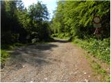 2
2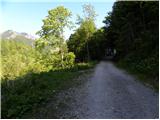 3
3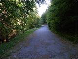 4
4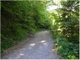 5
5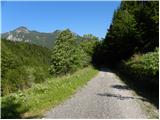 6
6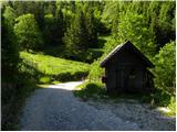 7
7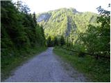 8
8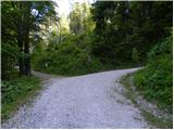 9
9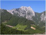 10
10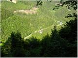 11
11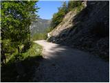 12
12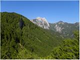 13
13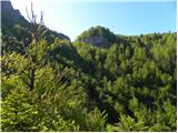 14
14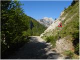 15
15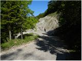 16
16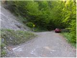 17
17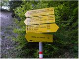 18
18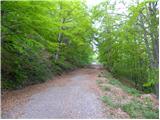 19
19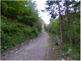 20
20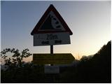 21
21 22
22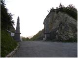 23
23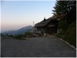 24
24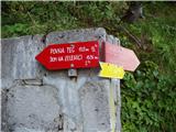 25
25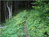 26
26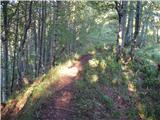 27
27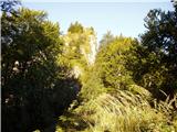 28
28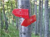 29
29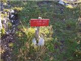 30
30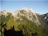 31
31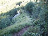 32
32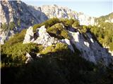 33
33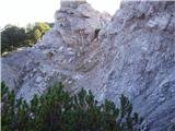 34
34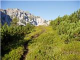 35
35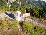 36
36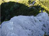 37
37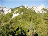 38
38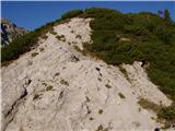 39
39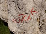 40
40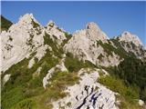 41
41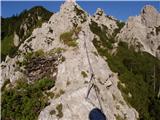 42
42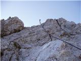 43
43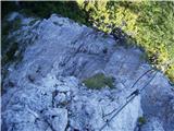 44
44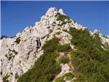 45
45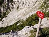 46
46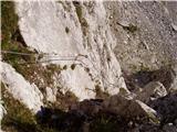 47
47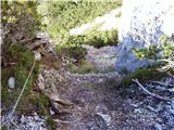 48
48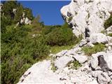 49
49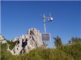 50
50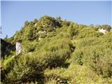 51
51 52
52 53
53 54
54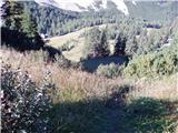 55
55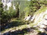 56
56 57
57 58
58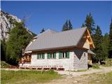 59
59
Discussion about the trip Bučan - Dom na Zelenici
To post a comment you must log in:
If you do not yet have a username, you must first
register.