Kesselfall - Mooserboden (Klettersteig MoBo 107)
Starting point: Kesselfall (1034 m)
| Latitude/Longitude: | 47,21724°N 12,72585°E |
| |
Route name: Klettersteig MoBo 107
Walking time: 4 h 10 min
Difficulty: very difficult marked way
Via ferrata: B/C
Elevation gain: 1002 m
Elevation difference along the route: 1120 m
Map:
Recommended equipment (summer): helmet, self belay set
Recommended equipment (winter): helmet, self belay set, ice axe, crampons
Views: 757
 | 1 person like this post |
Access to starting point:
Through the Karawanks Tunnel, we drive into Austria, and then we continue driving on the Tauern motorway. Further on, we drive through the Katschberg Tunnel and later also the Tauerntunnel; we follow the motorway towards Salzburg (also Solnograd) only as far as the exit for Bischofshofen, from where we continue on a four-lane road towards the already mentioned town. From Bischofshofen, we follow the signs for the town of Zell am See and then for Kaprun. In Kaprun, we continue through the Kaprunertal valley and follow the signs »Speichererseen«. We follow the slightly ascending road all the way to the end. We park in the free parking garage, which is located at the end of the road next to the Kesselfall Alpenhaus mountain hut. The road continuing from the garage is closed to public traffic.
Route description:
In the garage, we follow the signs for the exit and ascend the stairs upwards. The exit is at the top of the garage. From the garage, we reach the road where we continue right, where the signs for the ticket office also direct us, where tickets can be purchased towards Lake Mooserboden.
We continue past the barrier on the road that is closed to public traffic. After a very short ascent on the road, a signpost directs us left onto a footpath through the forest. The path then leads through the forest and soon crosses a stream. We walk for some time on a relatively flat path through the forest, then join a cart track along which we reach the bottom station of the inclined elevator. The cart track is the old access to the inclined elevator; the new road leads through a tunnel. The mentioned inclined elevator is otherwise the largest of its kind in Europe and leads to the upper part of the road towards Lake Mooserboden. The elevator was originally built for the construction of the dams on Lakes Wasserfallboden and Mooserboden.
In front of the bottom station of the elevator, our path turns right and then ascends through the forest for quite some time. During the ascent, it crosses the elevator route several times through a short tunnel. Higher up, we cross a grazing fence and the path brings us to a mountain pasture where cows graze in the summer months. For some time, we then ascend more panoramic grassy slopes, then the path turns left and leaves the pasture. The path then follows a cart track that brings us to an asphalt road. To the left, the road leads to the lower part of the dam on Lake Wasserfallboden; we continue right uphill, where the signposts also direct us. We soon reach a junction where the road from the upper station of the inclined elevator joins from the right.
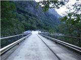
At the junction, we continue left on the road, which quickly brings us to a tunnel. Walking through the tunnel is forbidden, so our path turns left and crosses somewhat steeper slopes beside the tunnel. On the other side of the tunnel, we rejoin the road and reach the dam on Lake Wasserfallboden. At the dam, we continue slightly right on the road and soon avoid the tunnel again by going left onto the footpath. The path further crosses fairly steep slopes above the lake, from which we have a very nice view of the numerous three-thousanders above the lake. The path then turns right and briefly joins the tunnel. In the tunnel, the path runs along a narrow sidewalk separated from the road by a fence. We soon leave the tunnel, and the path brings us back to steep slopes above the lake. This time the slope is even a bit steeper, and considerable caution is needed when walking. Here, the path first descends slightly, aided by safety gear. For a short time, we join an old abandoned road, then after a short exposed crossing, we rejoin the main asphalt road. At the next tunnel, we leave the road again, but this time the slopes we cross are less steep. The path here runs across grassy slopes with a nice view of the lake and surrounding peaks. When we rejoin the road, it soon brings us to a junction. Signposts direct us right uphill, and after a short ascent, we reach the Fürthermoaralm pasture, where there is also a hut and a chapel.
We continue along the cart track past the chapel and soon reach another junction. Right uphill leads the Hochkammerweg path towards the Kitzsteinhorn–Kaprun ski area; we continue straight ahead following the signs for Mooserboden. From the junction, our path first descends slightly and leads past some information boards presenting plants and animals on the pasture. The path then crosses several streams, and the cart track turns into a trail. Here, the path turns left and begins to ascend somewhat more steeply, bringing us back to the asphalt road. We follow the road to the next tunnel, where the markers direct us right onto the footpath. The last ascent to the dam on Lake Mooserboden follows. There is also a restaurant by the dam.
It is also possible to reach Lake Mooserboden by a combination of bus transport and inclined elevator.
At the dam, we head left onto the asphalt road and descend to the first left bend. At the bend, we turn right onto a narrow footpath leading to the start of the secured climbing path named MOBO 107. There is also a small information board at the bend. A descent follows along the narrow path running across grassy terrain below the dam. We descend to the entry into the climbing section of the path, where there are also some information boards.
Before entering the climbing section of the path, we must equip ourselves with a helmet and self-belay set. At the very beginning, we first descend on a short zipline (flying fox) to the dam. The carabiners on the pulley are clipped into the climbing harness; the self-belay set is clipped into the rope located somewhat lower, intended for protection. Since the descent is very gentle, we can also pull ourselves towards the dam using this rope. When we reach the dam, we first clip the self-belay set onto the steel cables, then remove the pulley.
Further on, we climb the dam, aided by various artificial holds and steps. The path alternates between steep ascents and short traverses. Approximately halfway up the ascent, there is a bench by the path from which we have a very nice view of Lake Wasserfallboden and the surrounding peaks. The climbing path continues slightly left and in the final section brings us to a junction.
To the left runs a somewhat easier path, to the right uphill a harder one. If we continue right, we first ascend steeply along the steel cable, aided also by steps in the form of stones bolted to the dam. A leftward traverse follows, where we mostly walk along the steel cable. Here we are already almost at the top of the dam, and consequently the slope is almost vertical. The path then brings us to the »swing«, where with the aid of a hanging rope we cross the almost vertical slope. The carabiners on the rope are clipped into the climbing harness, the self-belay set onto the steel cable, and we cross the steep slope to the other side. From the left, the easier variant rejoins us, followed by a short traverse to the suspension bridge. After crossing the bridge, the path brings us to grassy terrain below the summit of Höhenburg, which also has secured climbing paths of various difficulties. Here the secured path ends; we turn right and join the road running along the dam. On the dam, we continue right and then descend via the ascent path.
The described climbing path is rated difficulty level B/C. The climbing section on the dam has 80 meters of elevation gain. The ascent takes approximately 30 minutes.

Photos:
 1
1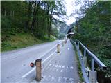 2
2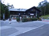 3
3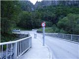 4
4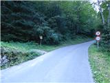 5
5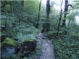 6
6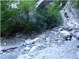 7
7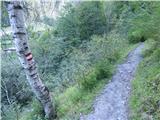 8
8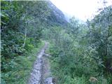 9
9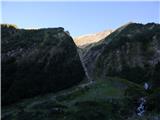 10
10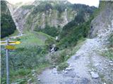 11
11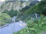 12
12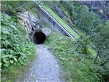 13
13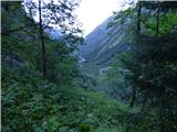 14
14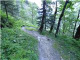 15
15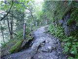 16
16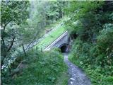 17
17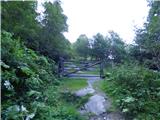 18
18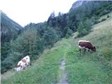 19
19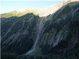 20
20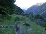 21
21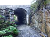 22
22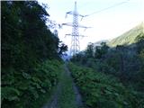 23
23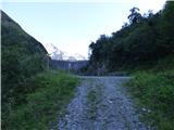 24
24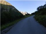 25
25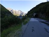 26
26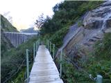 27
27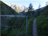 28
28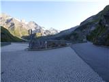 29
29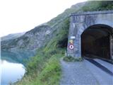 30
30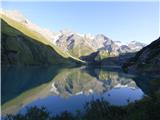 31
31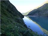 32
32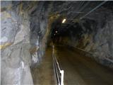 33
33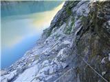 34
34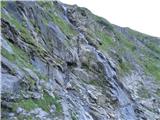 35
35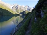 36
36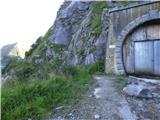 37
37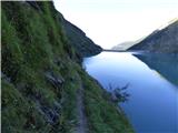 38
38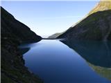 39
39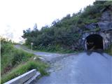 40
40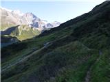 41
41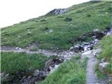 42
42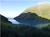 43
43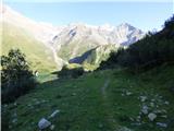 44
44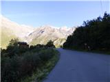 45
45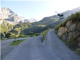 46
46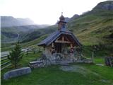 47
47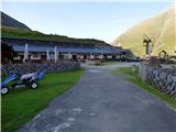 48
48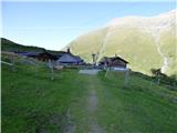 49
49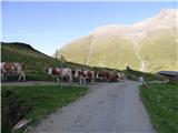 50
50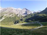 51
51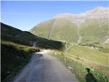 52
52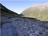 53
53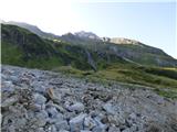 54
54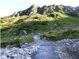 55
55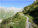 56
56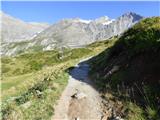 57
57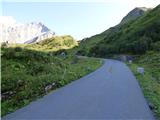 58
58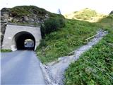 59
59 60
60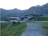 61
61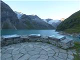 62
62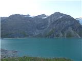 63
63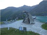 64
64 65
65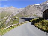 66
66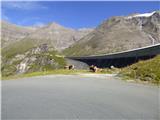 67
67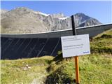 68
68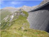 69
69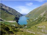 70
70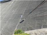 71
71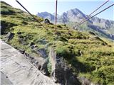 72
72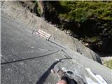 73
73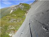 74
74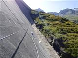 75
75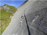 76
76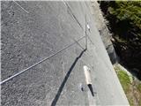 77
77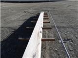 78
78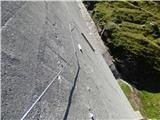 79
79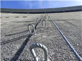 80
80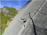 81
81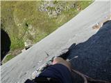 82
82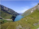 83
83 84
84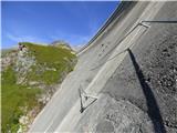 85
85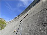 86
86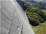 87
87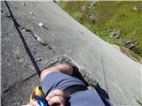 88
88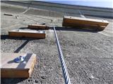 89
89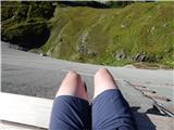 90
90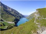 91
91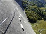 92
92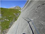 93
93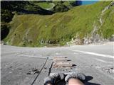 94
94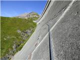 95
95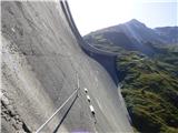 96
96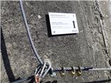 97
97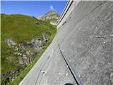 98
98 99
99 100
100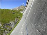 101
101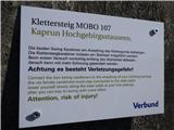 102
102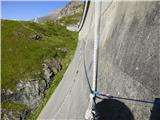 103
103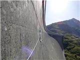 104
104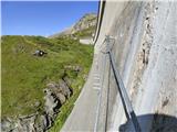 105
105 106
106 107
107 108
108 109
109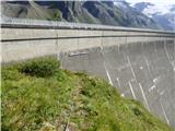 110
110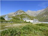 111
111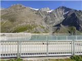 112
112
Discussion about the trip Kesselfall - Mooserboden (Klettersteig MoBo 107)
To post a comment you must log in:
If you do not yet have a username, you must first
register.