Ljubelj - Dom na Zelenici (via Ljubeljščica)
Starting point: Ljubelj (1058 m)
| Latitude/Longitude: | 46,43240°N 14,26020°E |
| |
Route name: via Ljubeljščica
Walking time: 2 h 50 min
Difficulty: very difficult unmarked way
Elevation gain: 478 m
Elevation difference along the route: 750 m
Map: Karavanke - osrednji del 1:50.000
Recommended equipment (summer): helmet, self belay set
Recommended equipment (winter): helmet, self belay set, ice axe, crampons
Views: 26.984
 | 1 person like this post |
Access to starting point:
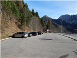
From the Ljubljana - Jesenice highway, we take the Ljubelj exit and follow the road ahead to the border crossing. Just a few meters before the border crossing, we will notice a parking lot on the right side, where we park.
Route description:
At the end of the parking lot, we notice signposts for the mountain hut Koča na Ljubelju, which after a few stairs lead us to the old Ljubelj road. We follow this road, which ascends moderately and in winter is converted into a sledding track, all the way to the Koča na Ljubelju. We reach it with occasional nice views on Košutica, Veliki vrh and Begunjščica after less than an hour of walking.
At the end of the parking lot, we notice signposts for Koča na Ljubelju, which after a few stairs lead us to the old Ljubelj road. We follow this road, which ascends moderately and in winter is converted into a sledding track, all the way to the Koča na Ljubelju. We reach it with occasional nice views on Košutica, Veliki vrh and Begunjščica after 45 minutes of walking.
From the hut, we continue left in the direction of Zelenica and Povna peč (Polna peč). The path ahead goes past the hut and immediately behind it starts to ascend. The steepness soon eases and the path leads us to a mostly vegetated ridge, from which we occasionally get some views. After a few more minutes, we already see ahead the summit of Polna peč, which the path bypasses on its northern side along steep slopes. The path, which almost encircles the summit, brings us a few steps below the summit to a path junction. Here we continue left in the direction of Povna peč (Polna peč) on the path that brings us in a few steps to the panoramic summit (right Zelenica).
From Povna peč we return a few 10 steps back to the last junction, then continue along the ridge in the direction of Zelenica or the Ljubeljščica ridge. The path, which continues towards the west, first leads us along a partly forested ridge, then temporarily descends steeply along the edge of a steep grassy slope. When the path levels out, the ridge narrows and on the right side we cross an exposed gully, behind which we quickly return to the ridge. There follows some easy ascent, then we arrive at the place where there is (was) the sign "end of safe path", but the safe path already ended at the crossing of the first gully.
There follows a moderate descent along a crumbly exposed ridge, then the path again starts to ascend and further mostly ascends moderately. The path ahead also leads us through a few passages dangerous for slipping, and the sign Zelenica a little further temporarily takes us to the Slovenian side of the ridge. When we return to the ridge, the path brings us to the technically most difficult part of the path, where with the help of fixed safety gear we descend steeply (although this part is technically the most difficult, some prior unsecured passages are more dangerous). Further, we walk in moderate ascent along a very panoramic ridge, then the signs for Zelenica - secured path direct us left, transversely downwards, where we cross a shorter scree slope. When the scree ends, with the help of fixed safety gear we ascend steeply to a side ridge, and from it also with the help of fixed safety gear we descend to the other side, but the descent is not particularly demanding. There follows an ascent where we return to the border ridge, after which there is some more ascent to the saddle Čez Pod, where we go left towards Vrh Ljubeljščice and reach it after a minute of further walking.
From the summit, we descend towards the south to the saddle that separates Vrh Ljubeljščice and Spodnji Plot, then we go sharply right (straight Spodnji Plot 2 to 3 minutes) and start descending towards Zelenica. Lower, the path turns slightly left and gradually flattens. There follows some easy walking to the mountain hut, which in good weather we have already been seeing ahead for some time.
Ljubelj - Koča na Ljubelju 0:45, Koča na Ljubelju - Povna peč 0:30, Povna peč - Vrh Ljubeljščice 1:15, Vrh Ljubeljščice - Dom na Zelenici 0:20.
We descend on the usual marked path back to Ljubelj.

The trip can be extended to the following destinations: Dom pri izviru Završnice,
Roblekov dom na Begunjščici ( 30 min),
Klagenfurter Hutte/Celovška koča (1 h 20 min),
Spodnji Plot,
Na Možeh,
Srednji vrh (above Završnica),
Žleb (Suho ruševje),
Srednja peč,
Bielschitza/Svačica,
Pautz/Zelenjak ( 5 min),
Selenitza/Palec ( 10 min),
Begunjščica,
Prešernova koča na Stolu,
Vertatscha/Vrtača,
Hochstuhl/Stol
Photos:
 1
1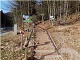 2
2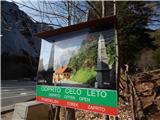 3
3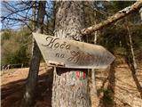 4
4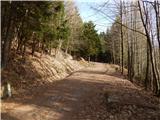 5
5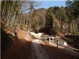 6
6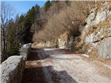 7
7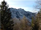 8
8 9
9 10
10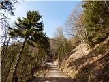 11
11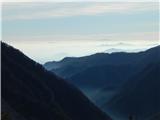 12
12 13
13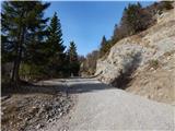 14
14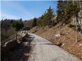 15
15 16
16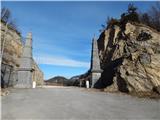 17
17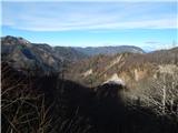 18
18 19
19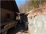 20
20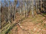 21
21 22
22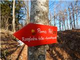 23
23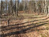 24
24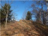 25
25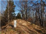 26
26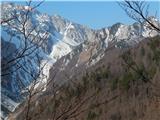 27
27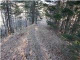 28
28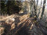 29
29 30
30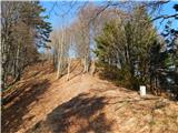 31
31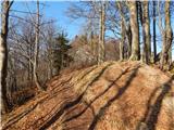 32
32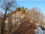 33
33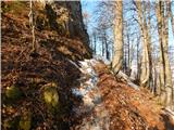 34
34 35
35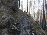 36
36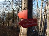 37
37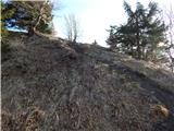 38
38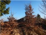 39
39 40
40 41
41 42
42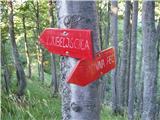 43
43 44
44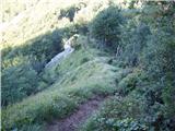 45
45 46
46 47
47 48
48 49
49 50
50 51
51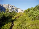 52
52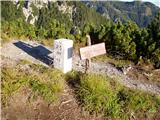 53
53 54
54 55
55 56
56 57
57 58
58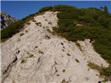 59
59 60
60 61
61 62
62 63
63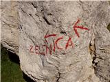 64
64 65
65 66
66 67
67 68
6869
 70
70 71
71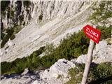 72
72 73
73 74
74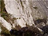 75
75 76
76 77
77 78
78 79
79 80
80 81
81 82
82 83
83 84
84 85
85 86
86 87
87 88
88 89
89 90
90 91
91 92
92 93
93 94
94 95
95 96
96 97
97 98
98 99
99
Discussion about the trip Ljubelj - Dom na Zelenici (via Ljubeljščica)
|
| Tadej20. 08. 2008 |
Yesterday I climbed to Zelenica via the path described above. I recommend this trip to everyone who likes quiet and scenic paths and is up to more demanding sections as well. The path is indeed very exposed and steep at one short spot. The fixed protections are in good condition.
|
|
|
|
| svila7. 06. 2010 |
Yesterday I hiked the described path from the Ljubelj hut to Zelenica, but even today I feel anxious thinking about some difficult spots. The path is definitely beautiful, views wonderful, at this time there is so much alpine flowers that you stare. The inscription on the sign marking the end of the safe path is erased and you reach the rocks without warning. The path is very dangerous if you are not sufficiently skilled. Simply there is nothing to hold on to and nowhere to step, especially downhill it's very hard and slow, requires great concentration and caution. If you have even a little vertigo, I advise against the path. For the stated distance we took just under 3 hours. We met 2 hikers in the opposite direction.
|
|
|
|
| samoa7. 06. 2010 |
I also hiked this trail on Saturday. The trail seems sufficiently secured to me, the view is fantastic, not to mention all the flowers growing along the path. Well, there are also chamois.
|
|
|
|
| svila8. 06. 2010 |
Congratulations to all who can manage this beautiful trail without problems, but at the same time I warn less experienced ones (we also go to the mountains), because some spots are really very difficult and dangerous. Not to mention that due to the poor marking of the trail you can get lost. The sign about the end of the safe trail doesn't work because it's illegible.
|
|
|
|
| Lothar10. 06. 2010 |
Today I decided for this exact trail.
It was very pleasant. I didn't meet any people, only some animals. 
As for dangers: Personally, it didn't seem very dangerous to me. There are quite a few such narrow paths (with a drop on both sides) where you have nowhere to hold on. And the wind likes to blow quite strongly right in such places.  Therefore I wouldn't recommend this trail to those with poor balance and/or poor fitness. But you know how capable you are. If it doesn't work, just turn back. No shame. Therefore I wouldn't recommend this trail to those with poor balance and/or poor fitness. But you know how capable you are. If it doesn't work, just turn back. No shame.
Trekking poles are recommended for the first part of the trail (up to the end of the safe path). For the last, more demanding part, you can strap the poles to your backpack (if you have one).
The entire trail from Ljubeljska koča all the way to Zelenica is, as said, unmarked, but it's *very* hard to get lost. Just follow the border stone walls and you won't stray. If it happens that you turn onto the wrong path, you can always go back, as all these *wrong* paths quickly turn into grass or a precipice. If that happens to you, you know you've strayed. 
|
|
|
|
| velkavrh23. 11. 2015 |
Bojan, great! Nice pictures as always. I've been here already in dry conditions, in such conditions when the track is not yet made, I wouldn't dare at all. Down I turned at the cables at the end of the path.
|
|
|
To post a comment you must log in:
If you do not yet have a username, you must first
register.