Planina Blato - Dom na Komni (via Črno jezero)
Starting point: Planina Blato (1147 m)
| Latitude/Longitude: | 46,31130°N 13,85010°E |
| |
Route name: via Črno jezero
Walking time: 4 h 15 min
Difficulty: easy marked way
Elevation gain: 373 m
Elevation difference along the route: 800 m
Map: TNP 1:50.000
Recommended equipment (summer):
Recommended equipment (winter): ice axe, crampons
Views: 8.490
 | 2 people like this post |
Access to starting point:
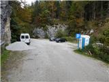
From the Gorenjska motorway (Lesce exit), Železniki or Soriška planina, we drive to Bohinjska Bistrica, then continue driving towards Bohinj Lake. In Ribčev Laz, just before the lake, we turn right towards Stara Fužina, where we first drive over a bridge with a beautiful view of Bohinj Lake and past the church of St. John the Baptist. When we arrive in Stara Fužina, at the intersection by the chapel, we turn sharply left onto the ascending road towards planina Blato, planina Vogar and Voje valley. The road then takes us to the place where toll and parking fees are collected, and we follow it further to the next intersection, where we continue left (right to Voje). We then follow the road to the next intersection (we drive for quite some time), where we turn sharply right towards planina Blato (straight to planina Vogar). We follow this road to the marked parking lot above planina Blato.
Route description:
From the marked parking lot, we return a short way back along the road, then head onto the ascending cart track towards Planina pri Jezeru, Planina v Lazu and Planina Dedno polje. The path on the cart track initially rises quite steeply and after about ten minutes brings us to a marked junction, where we continue on the left, upper cart track (straight to Planina v Lazu and steep path to Planina pri Jezeru).
After less than five minutes of further ascent, in a right bend, the path from Planina Vogar joins from the left, and we continue right towards Planina pri Jezeru. We then ascend on a somewhat less steep cart track, which levels out briefly, then rises more steeply and leads us through an artificial "narrowing". After the "narrowing", the cart track levels out again, and behind two benches, the aforementioned steep path joins from the right. After the junction, the path turns left and brings us to a pasture fence, behind which we enter a small valley where cold air usually lingers. The path gradually becomes steeper again, then, when it levels, turns right. A little further, a path leading over or past Planina Vodični vrh joins from the left.
From the mentioned junction onwards, the forest begins to thin, and when we finally emerge from the forest, we are already at Planina pri Jezeru, where only a few dozen steps of easy walking separate us from the nearby mountain hut.
From the hut, we continue left downhill (slightly right to Planina v Lazu and Vodnikov dom na Velem polju) and descend to the shepherds' huts, where the next marked junction is.
From the junction, we continue left uphill on a less pronounced path towards Planina Viševnik (straight on the cart track to Planina Dedno polje and Planina Viševnik past Krištofojca), which climbs above the pasture and then enters the forest. Through the forest, we ascend steeply for a while, then the path gradually levels out. Alternating ascents and level sections follow, and when we emerge from the forest, the path past Krištofojca joins from the right. From this junction, a short ascent to the saddle follows, and Bregarjevo zavetišče at Planina Viševnik is just a few steps further.
From Planina Viševnik, we continue straight downhill towards Črno jezero (left Planina Vogar, slightly left Pršivec, slightly right Planina Ovčarija), on a path that brings us in moderate descent into the forest. Through the forest, we descend more steeply down the valley Dol za Studorjem. In the lower part of the valley, the fairly damp path levels completely, then gradually moves onto the slopes between Komarča and Studorski Orlič (1782 m), across which we descend transversely, with occasional views opening towards the mountains above Bohinj. The path then returns to dense forest, and we arrive at the point where the path over Komarča joins from the left, and we continue right towards Komna, or we can first descend to Črno jezero.
From the lake, we return to the marked path, which bypasses the lake on the right (northern) side and forks.
We continue left towards Komna (straight to Koča pri Triglavskih jezerih), on a path that soon begins to ascend steeply, and during the ascent, the path that bypasses the lake on the left joins from the left. A steep ascent follows on the slopes of peak Orlič (1457 m), and when the path levels, we reach the ridge or rather the edge of cliffs, from which a beautiful view opens towards Bohinj and the mountains above it. Wonderful views open several more times, then before Jagrova skala (1516 m), the path returns to dense forest. The path rises and descends a few more times, continuing like this until we join the path from Koča pri Savici. A few junctions follow, and from all we continue towards Dom na Komni, which we reach without major difficulties, and from which a beautiful view opens to Bohinj Lake, the chain of Bohinj-Tolmin mountains, sometimes called Lower Bohinj mountains, and the peaks above the Valley of Triglav Lakes.
Planina Blato - Planina pri Jezeru 1:00, Planina pri Jezeru - Planina Viševnik 0:30, Planina Viševnik - Črno jezero 1:10, Črno jezero - Dom na Komni 1:35.
Description and photos refer to the condition in 2016 (October).

The trip can be extended to the following destinations: Dom pri Krnskih jezerih,
The lake Krnsko jezero,
Planina Govnjač,
Koča pod Bogatinom,
Planina Lopučnica,
Planina za Migovcem,
Koča pri Triglavskih jezerih,
Kser,
Vrh Škrli,
Mali Šmohor,
Vrh Planje,
Bogatin,
Kal,
Lanževica,
Mahavšček,
Velika Baba,
Zeleni vrh,
Vrh nad Škrbino,
Podrta gora,
Tolminski Kuk,
Batognica,
Vrh nad Peski,
Čelo,
Krn
Photos:
 1
1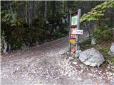 2
2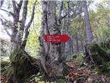 3
3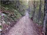 4
4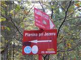 5
5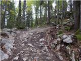 6
6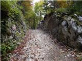 7
7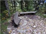 8
8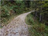 9
9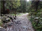 10
10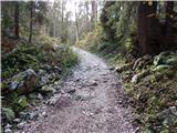 11
11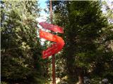 12
12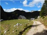 13
13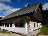 14
14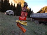 15
15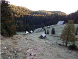 16
16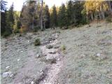 17
17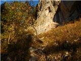 18
18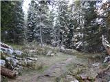 19
19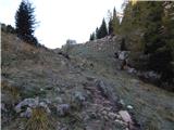 20
20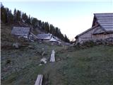 21
21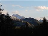 22
22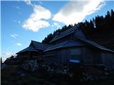 23
23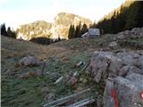 24
24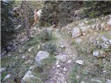 25
25 26
26 27
27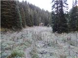 28
28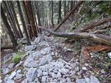 29
29 30
30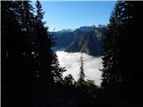 31
31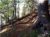 32
32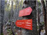 33
33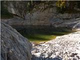 34
34 35
35 36
36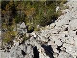 37
37 38
38 39
39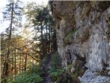 40
40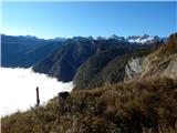 41
41 42
42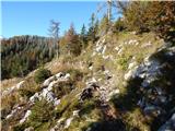 43
43 44
44 45
45 46
46 47
47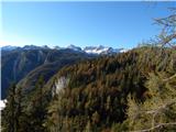 48
48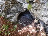 49
49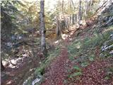 50
50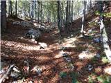 51
51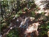 52
52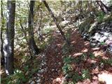 53
53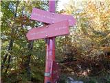 54
54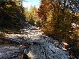 55
55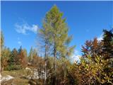 56
56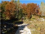 57
57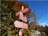 58
58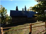 59
59 60
60 61
61 62
62 63
63 64
64
Discussion about the trip Planina Blato - Dom na Komni (via Črno jezero)
To post a comment you must log in:
If you do not yet have a username, you must first
register.