Ukanc - Dom na Komni (via planina Zadnji Vogel)
Starting point: Ukanc (570 m)
| Latitude/Longitude: | 46,27580°N 13,83580°E |
| |
Route name: via planina Zadnji Vogel
Walking time: 6 h 45 min
Difficulty: easy marked way
Elevation gain: 950 m
Elevation difference along the route: 1450 m
Map: TNP 1:50.000
Recommended equipment (summer):
Recommended equipment (winter): ice axe, crampons
Views: 2.100
 | 2 people like this post |
Access to starting point:
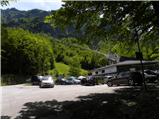
A) From the Ljubljana-Jesenice highway, take the Lesce exit and follow the road towards Bled, Bohinjska Bistrica, Ribčev Laz and Vogel ski resort. The path starts at a large well-maintained parking lot at the lower station of the cable car to Vogel.
B) From Primorska, first drive to Bohinjska Bistrica, then follow the signs for Lake Bohinj and Vogel. The path starts at the parking lot at the lower station of the gondola to Vogel.
Route description:
Below the lower station of the cable car on Vogel we notice a forest road (in winter a ski slope), which starts to ascend moderately towards the west. The path ahead ascends gently to moderately for some time more, then brings us out of the forest onto a panoramic slope, from where a beautiful view opens up on Komarča, Pršivec and Lake Bohinj.
After that, the road starts to turn increasingly to the left and becomes steeper and steeper. Higher up we continue along a relatively steep ski slope, along which a poorer and gravelly transport-rescue road leads us all the time. After some time the road or ski slope temporarily flattens, then steeply ascends again and brings us to a marked junction, where we continue left in the direction of the Ski hotel on Vogel (straight ahead lower station of the double chairlift Zadnji Vogel).
A little further on we arrive at the next junction, where we continue right towards Planina Zadnji Vogel (slightly left Ski hotel on Vogel and Planinska koča Merjasec). We walk along the ski slope for less than 10 minutes and the path brings us to the dairy on Planina Zadnji Vogel.
We continue past the dairy and follow the signs for Komna (left branches the path to Vogel). The path then leads us through dwarf pines into the forest and starts to descend slightly. After some time a quite overgrown path branches off to the right towards the valley (path through Žagarjev graben, old markings along the path), while we moderately ascend to a marked junction.
We continue straight in the direction of Komna (left pass Globoko), where after a few minutes of further ascent we reach the plateau-like terrain south of Konjski vrh (1558 m), from where along a pleasant path we descend towards a smaller valley, where on the left we notice an interesting marsh, which during heavier rain turns into a small lake. We continue for a few minutes along the valley, at the indistinct spur the path turns slightly to the left and ascends the slope of Rušnati vrh or Meja. Before the slope becomes steeper the path turns sharply to the right, then ascends transversely all the way to Konjsko sedlo, which we reach with nice views on Bohinjski Migovec (1896 m) and neighbouring Konjski vrh (1739 m).
From Konjsko sedlo, which is located below the summit of the almost 2000 metres high Meja, we start to descend transversely in the direction of Komna (sharply left Vogel and pass Globoko), and the path leads us across the scree slopes of Bohinjski Migovec. Lower we arrive in flatter terrain, still mostly descending, during the descent accompanied by wonderful views on the Julian Alps. Lower the path leads us past a viewpoint, which is less than a minute away from the path and from which a nice view opens up on Lake Bohinj. A few minutes of descent follow and we arrive at a junction, from which we continue sharply right towards Komna (straight Škrbina).
From the junction we descend a little further and arrive at the central part of the indistinct Planina za Migovcem.
We continue in the direction of Komna, and further along the right side we bypass the nearby and mostly dwarf pine-covered Mohor. Initially we walk without major changes in elevation, then we start to descend transversely, from the path a nice view opens up on Lake Bohinj. When we start to ascend again, an unmarked path through Ražnova Suha joins almost unnoticeably from the right. We continue along the marked path, along which we quickly ascend to the pass between Mohor on the left and Mali vrh on the right, where we cross a pasture fence. A moderate descent towards the frost hollow Krošnja follows, which the path bypasses on the right side. A few minutes of easy walking follow and we arrive at a marked junction, from which we continue right upwards (straight Planina Govnjač and Dom na Komni via the mentioned planina).
From the junction a few minutes of ascent follow, then even more descent. Lower the path flattens and from the left a path joins, which leads across Planina Govnjač.
We continue in the direction of Dom na Komni, which we reach after a few minutes of further walking.
Ukanc - Planina Zadnji Vogel 2:30, Planina Zadnji Vogel - Konjsko sedlo 1:50, Konjsko sedlo - Planina za Migovcem 0:40, Planina za Migovcem - Dom na Komni 1:45.

Along the route: Planina Zadnji Vogel (1413m), Konjsko sedlo (1782m), Planina za Migovcem (1600m)
The trip can be extended to the following destinations: The lake Črno jezero,
Dom pri Krnskih jezerih,
The lake Krnsko jezero,
Planina Govnjač,
Koča pod Bogatinom,
Planina Lopučnica,
Koča pri Triglavskih jezerih,
Kser,
Vrh Škrli,
Mali Šmohor,
Vrh Planje,
Bogatin,
Kal,
Lanževica,
Mahavšček,
Velika Baba,
Zeleni vrh,
Vrh nad Škrbino,
Podrta gora,
Tolminski Kuk,
Batognica,
Vrh nad Peski,
Čelo,
Krn
Photos:
 1
1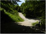 2
2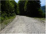 3
3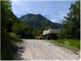 4
4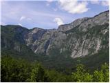 5
5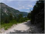 6
6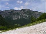 7
7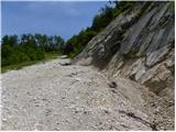 8
8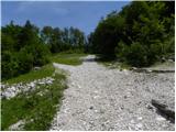 9
9 10
10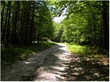 11
11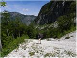 12
12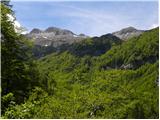 13
13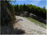 14
14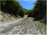 15
15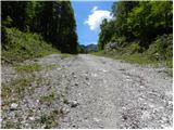 16
16 17
17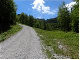 18
18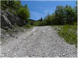 19
19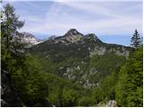 20
20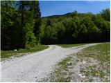 21
21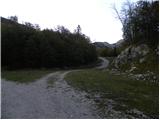 22
22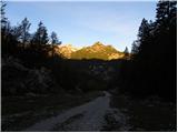 23
23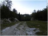 24
24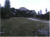 25
25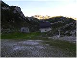 26
26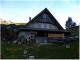 27
27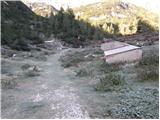 28
28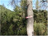 29
29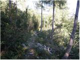 30
30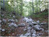 31
31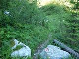 32
32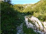 33
33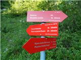 34
34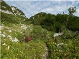 35
35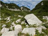 36
36 37
37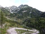 38
38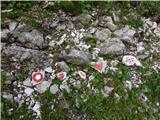 39
39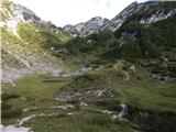 40
40 41
41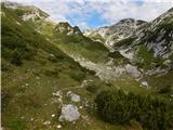 42
42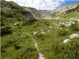 43
43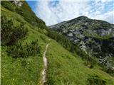 44
44 45
45 46
46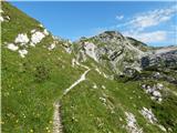 47
47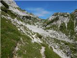 48
48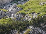 49
49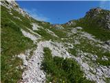 50
50 51
51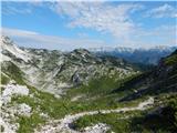 52
52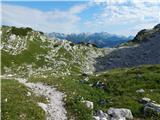 53
53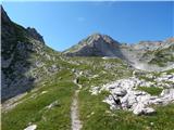 54
54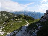 55
55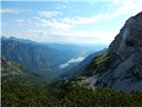 56
56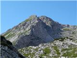 57
57 58
58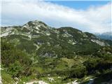 59
59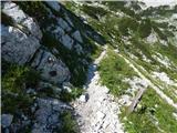 60
60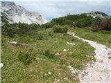 61
61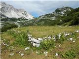 62
62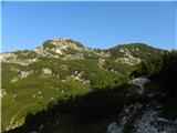 63
63 64
64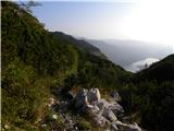 65
65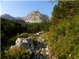 66
66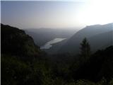 67
67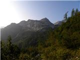 68
68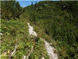 69
69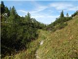 70
70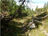 71
71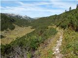 72
72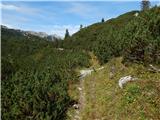 73
73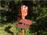 74
74 75
75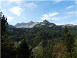 76
76 77
77 78
78 79
79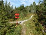 80
80 81
81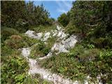 82
82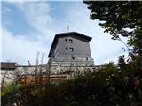 83
83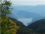 84
84
Discussion about the trip Ukanc - Dom na Komni (via planina Zadnji Vogel)
To post a comment you must log in:
If you do not yet have a username, you must first
register.