Similar trips - Dolenji Novaki (Pod Kovkom) - Škofje (steep path)
 | Kokarje (ŠRC Laze) - Vrhe (via Tajna)
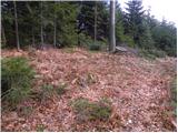
Vrhe is a forested peak located east of the Church of the Holy Mother of God on Čreta. There are no views from the summit due to the forest....
1 h 45 min |
| Potok (Mostni graben) - Vrhe (via Dom na Farbanci)
Vrhe is a forested peak located east of the Church of the Holy Mother of God on Čreta. There are no views from the summit due to the forest....
1 h 40 min |
 | Jablance - Oslica (Bohor) (via Koča na Bohorju)
Oslica is one of Bohor's peaks, located in the eastern part of the range. Unlike some higher Bohor peaks such as Veliki Javornik, Koprivnik, Debe...
1 h 55 min |
| Šentvid pri Planini - Oslica (Bohor) (northern path)
Oslica is one of Bohor's peaks, located in the eastern part of the range. Unlike some higher Bohor peaks such as Veliki Javornik, Koprivnik, Debe...
2 h 5 min |
 | Bottom station of cableway on Krvavec - Kopa (Partizanski vrh)
Kopa, also known as Partizanski vrh, is a 1,024-meter-high mountain located west of the Davovec saddle, which itself lies west to southwest of Kr...
1 h 15 min |
| Spodnja Kokra - Kopa (Partizanski vrh)
Kopa, also known as Partizanski vrh, is a 1,024-meter-high mountain located west of the Davovec saddle, which itself lies west to southwest of Kr...
1 h 30 min |
 | Planina pri Sevnici - Plešivec (Bohor)
Plešivec, known on some maps as Špic hrib, is a 915-meter peak on Bohor located southeast of Koča na Bohorju....
2 h |
| Šentvid pri Planini - Plešivec (Bohor)
Plešivec, known on some maps as Špic hrib, is a 915-meter peak on Bohor located southeast of Koča na Bohorju....
1 h 35 min |