Similar trips - Ledinsko Razpotje - Medvedje Brdo (west path)
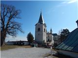 | Vače - Zasavska Sveta gora (on a slope)
Zasavska Sveta Gora is a popular excursion destination located between Litija and Izlake. From the summit, where the parish church of the Nativit...
2 h 30 min |
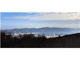 | Velike Lašče - Kamen vrh (via Gornje Retje and Grmada)
Kamen Vrh is a panoramic hill located on the northern edge of Mala Gora. From the summit, surrounded by low bushes, there are fine views of parts...
2 h 35 min |
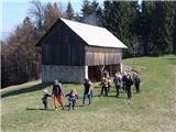 | Mislinja - Črepič (circular path)
Črepič is an 798-meter-high peak west of Mislinja. The summit is forested and offers no view, but there is an expansive panorama from a nearby me...
3 h 30 min |
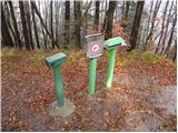 | Zavrh pri Trojanah - Golčaj
Golčaj is a 690 m high hill rising south of Blagovica. At the summit, which has a logbook box and stamp, stands a NOB monument; a few tens of met...
2 h 30 min |
 | Planina pri Sevnici - Brest (Bohor) (northern path)
Brest is a peak on Bohor, though it resembles more of a saddle. It is an important trail junction on Bohor, lying between more easterly Oslica an...
2 h 20 min |
 | Radeljski prelaz - Sveti Pankracij (Radelca) (Austrian path)
The Church of St. Pankracij on Radelca is located at an altitude of 900 meters, directly on the border ridge between Slovenia and Austria. The or...
3 h |
| Sveta Katarina (Zgornja Kapla) - Sveti Pankracij (Radelca) (Slovenian way)
The Church of St. Pankracij on Radelca is located at an altitude of 900 meters, directly on the border ridge between Slovenia and Austria. The or...
3 h 15 min |
| Sveta Katarina (Zgornja Kapla) - Sveti Pankracij (Radelca) (Austrian way)
The Church of St. Pankracij on Radelca is located at an altitude of 900 meters, directly on the border ridge between Slovenia and Austria. The or...
2 h 45 min |
 | Sveti Jurij (Remšnik) - Sršenov vrh
Sršenov vrh is a 963-meter-high peak located in the Kozjak hills, more precisely between Ožbalt and Zgornja Kapla. The summit itself offers no sp...
3 h 30 min |
 | Sveta Katarina (Zgornja Kapla) - Sveti Jurij (Remšnik)
The Church of St. Jurij is located on a panoramic hill in the Remšnik settlement, which lies on the slopes of Kozjak. Opposite the church, next t...
2 h 50 min |
 | border crossing Remšnik - Tolsti vrh (on Kozjak) (Slovenian way)
Tolsti vrh is a 756-meter-high peak on Kozjak, located on the Austria-Slovenia border north of Zgornja Kapla settlement. The summit lies in fores...
2 h 30 min |
 | Male Drage - Okrugljak (via Razdrto)
Okrugljak is a forested hill located in the eastern part of Gorski Kotar, near the border with Slovenia. The summit was formerly an HPO point (no...
2 h 30 min |