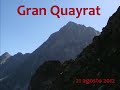
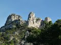
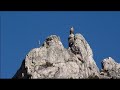
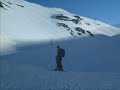
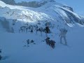
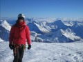
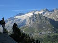
 | Pic Spijeoles + the three Pic Belloc
3. 09. 2012 08:38:18
Track on Wikiloc: http://es.wikiloc.com/wikiloc/view.do?id=3265924Since only the Belloc and Gran Quayrat three-thousanders remained in the area, we organized a morning activity to climb the Bellocs and an afternoon one for the Quayrat. From Refugio de Portillón, taking advantage of the little-freque... |
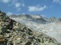
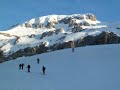
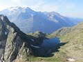
 | Gran Quayrat
3. 09. 2012 08:40:45
Track on Wikiloc: http://es.wikiloc.com/wikiloc/view.do?id=3265992From Refugio Portillón we took the marked itinerary that, losing about 200 m. of elevation, allows us to connect with the normal ascent from Espingo. Ascent to Gran Quayrat (3060 m.) and descent to Les Granges d'Astau.... |
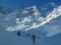
 | Pico Abadías, La Maladeta and Pico Collado de la Rimaya
4. 09. 2012 08:28:49
Track on Wikiloc: http://es.wikiloc.com/wikiloc/view.do?id=3266021From La Besurta we climbed to Portillón Superior and after crossing it headed towards Pico Abadías (3.279 m.). Along the ridge and the Cregüeña side we climbed to Pico La Maladeta (3308 m.). We descended about 80 m. towards Ibón de Cr... |
 | Aguja d'Ussel, Torre Costerillou and Balaitous
4. 09. 2012 08:32:28
Track on Wikiloc: http://es.wikiloc.com/wikiloc/view.do?id=3266026From Refugio Respomuso we tackled the ascent to the so-called most difficult three-thousander. We went up the normal route to Balaitous to divert towards Aguja d'Ussel, which we ascended via a series of traverses and chimneys. From Ag... |
 | Los Veteranos and Los Gemelos
4. 09. 2012 08:35:30
Track on Wikiloc: http://es.wikiloc.com/wikiloc/view.do?id=3299312Ascent from Estós via Collado de Chistau and Collada Negra to Pico Veteranos (3.134 m.) and to Los Gemelos (3.176 m.), the last of the three-thousanders (212) missing to complete the list.... |
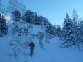 | Tuc Baciver (2.644 m.)
14. 12. 2012 12:11:29
First ski outing of the season and we chose Vall d'Aran as the area with the best snow cover, although all the fallen snow was mostly on the ground. We followed a track of someone who preceded us and who was heading to Tuc del Rosari. When we had Estany in sight, we turned left to head to Tuc de Bac... |
 | Moncayo 2.316 m. Provincial roof of Zaragoza and Soria
14. 12. 2012 12:17:24
Track on Wikiloc: http://es.wikiloc.com/wikiloc/view.do?id=3717494... |
 | Tuc del Port de Viella (2.605 m.)
3. 01. 2013 11:46:50
Track on Wikiloc: http://es.wikiloc.com/wikiloc/view.do?id=3803004... |
 | Pic Coma del Forn (2.683 m.)
3. 01. 2013 11:55:37
Track on wikiloc: http://es.wikiloc.com/wikiloc/view.do?id=3802943... |
 | Castell d'Airosa from La Vall - Els Ports
3. 01. 2013 13:37:17
Track on wikiloc: http://es.wikiloc.com/wikiloc/view.do?id=3770471... |
 | Mont Caro from Lloret. Tarragona Provincial Highpoint - Els Ports
3. 01. 2013 13:48:12
Track on Wikiloc: http://es.wikiloc.com/wikiloc/view.do?id=3767222... |
 | Calles, Peña Cortada, Chelva and Water Route
4. 01. 2013 11:50:43
Track on Wikiloc: http://es.wikiloc.com/wikiloc/view.do?id=3766840... |
 | Pic d'Acue 2.258 m from Forges d'Abel
8. 01. 2013 14:09:17
Track on Wikiloc: http://es.wikiloc.com/wikiloc/view.do?id=3821000... |
 | Col Moines-Casterau-Cabañas Hosse-Col Astún - Astún Circular
8. 01. 2013 14:28:47
Track on Wikiloc: http://es.wikiloc.com/wikiloc/view.do?id=3821004... |
 | Agulles de Sta. Àgueda
6. 02. 2013 09:56:49
Ridge of the Agujas de Santa Águeda in the Desierto de las PalmasAnother related video: http://youtu.be/hR83YvjtJMg... |
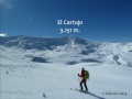 | Sierra Nevada | El Cartujo (3.151 m)
6. 02. 2013 10:48:34
Track on Wikiloc: http://es.wikiloc.com/wikiloc/view.do?id=3941376... |
 | Arroyeras Peak (2.573 m)
27. 02. 2013 07:57:47
Track on Wikiloc: http://es.wikiloc.com/wikiloc/view.do?id=4008466... |
 | Pico Olibon and Pico Bernera, from Lizara
5. 03. 2013 18:23:17
Track on Wikiloc: http://es.wikiloc.com/wikiloc/view.do?id=4070660... |
 | Bisaurín Peak 2.670 m
5. 03. 2013 18:28:38
Track on Wikiloc: http://es.wikiloc.com/wikiloc/view.do?id=4070671... |
 | Vall Laguar (Fleix-Benimaurell along the Girona River and the Barranc de l'Infern)
14. 03. 2013 12:29:00
Track on Wikiloc: http://es.wikiloc.com/wikiloc/view.do?id=4103430... |
 | Traverse AigüesTortes 2013
25. 03. 2013 12:47:20
Track on Wikiloc: http://es.wikiloc.com/wikiloc/view.do?id=4143909... |
 | La Vall-Canal d'Enganyó-La Joca-Faixes Tancades - Els Ports
5. 04. 2013 12:07:20
Track on Wikiloc: http://es.wikiloc.com/wikiloc/view.do?id=4219526... |
 | Cabo Tiñoso from La Azohía
10. 04. 2013 12:13:48
Track on Wikiloc: http://es.wikiloc.com/wikiloc/view.do?id=4260067... |
 | Pic Fouillouse 2,780 m. (or Tuca d'es Caballos) via Remuñe
16. 04. 2013 09:26:59
Track on Wikiloc: http://es.wikiloc.com/wikiloc/view.do?id=4306508... |
 | Montan-Torralba del Pinar-Fuentes de Ayódar-Salto de la Novia (Cirat)
6. 05. 2013 08:03:25
Track on Wikiloc: http://es.wikiloc.com/wikiloc/view.do?id=4431087... |
 | From Font Partagás (Benifato) to Font Molí (Finestrat). Roof of Alicante province - From Aitana to the sea
6. 05. 2013 12:07:46
Track on Wikiloc: http://es.wikiloc.com/wikiloc/view.do?id=4401105From Font de Partagás (Benifato) to Font del Molí (Finestrat) passing through the three most emblematic summits of La Marina: Aitana, Ponoig and Puig Campana.... |
 | Boixar-Mas d'en Roda-Tossal d'en Canader-Mas Blanc - Els Ports
13. 05. 2013 13:50:47
Track on Wikiloc: http://es.wikiloc.com/wikiloc/view.do?id=4475780... |
 | Loop around Tossal de MitjaVila (Coratxà) - Els Ports
13. 05. 2013 13:56:16
Track on Wikiloc: http://es.wikiloc.com/wikiloc/view.do?id=4475785... |
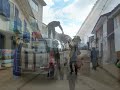
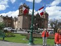 | Cusco City
1. 08. 2013 13:11:54
First day of our stay in Peru, at the same time a rest from the trip and the start of acclimatization, since Cusco is at 3,400 m. We spent it visiting the city of Cusco.... |
 | Surroundings of Cusco
1. 08. 2013 13:22:23
From Cusco we took a taxi to Tambomachay (3,700 m.) to then descend to Cusco (about 8 km.) visiting Pukapukara, Q'enqo and Saqsaywuaman... |
 | Salkantaypampa | Day 1 Mollepata | Salkantay Trekking
1. 08. 2013 13:26:04
Track on Wikiloc: http://es.wikiloc.com/wikiloc/view.do?id=4890714The Salkantay trek is one of the ways of access on foot to MachuPicchu. Unlike the traditional Inca Trail, where hiring an agency is mandatory and it has a daily access quota due to its overcrowding, the Salkantay trek allows you to d... |
 | Lluscamayo | Day 2 Salkantaypampa | Salkantay Trekking
1. 08. 2013 13:32:31
Track on Wikiloc: http://es.wikiloc.com/wikiloc/view.do?id=4890714The Salkantay trek is one of the ways of access on foot to MachuPicchu. Unlike the traditional Inca Trail, where hiring an agency is mandatory and it has a daily access quota due to its overcrowding, the Salkantay trek allows you to d... |
 | Hidroeléctrica (Aguas Calientes) | Day 3 Lluscamayo | Salkantay Trekking
1. 08. 2013 13:40:00
Track on Wikiloc: http://es.wikiloc.com/wikiloc/view.do?id=4890714The Salkantay trek is one of the ways of access on foot to MachuPicchu. Unlike the traditional Inca Trail, where hiring an agency is mandatory and it has a daily access quota due to its overcrowding, the Salkantay trek allows you to d... |
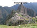 | MachuPicchu
5. 08. 2013 13:43:43
After finishing the Salkantay trek, we dedicated the next day to visiting the MachuPicchu citadel, also climbing HuaynaPicchu. In the afternoon we return to Cusco.... |
 | Huaraz
5. 08. 2013 14:41:14
After our stay in Cusco, we moved to Huaraz to carry out activities in the Cordillera Blanca. Images of Huaraz from the various days we were there.... |
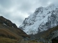
 | Nevado Pisco 5.752 m
5. 08. 2013 14:47:29
Track on Wikiloc: http://es.wikiloc.com/wikiloc/view.do?id=4890798Ascent to Nevado Pisco (5.752 m) in two stages.From Huaraz take public transport to Yungay (5 soles and 1h.30m.) and from Yungay private transport to Cebollapampa (20 soles and 1h. 30 m.).... |
 | From Huaraz to Base Camp (4.200 m.) | Huascarán Sur (6.768 m.)
7. 08. 2013 09:57:31
Track on Wikiloc: http://es.wikiloc.com/wikiloc/view.do?id=4890891... |
 | From Base Camp (4.200 m.) to C. I (5.300 m.) | Huascarán Sur (6.768 m.)
7. 08. 2013 10:06:35
Track on Wikiloc: http://es.wikiloc.com/wikiloc/view.do?id=4890895... |
 | From C. I (5.320 m.) to C.II (5.850 m.) | Huascarán Sur (6.768 m.)
7. 08. 2013 10:12:06
Track on Wikiloc: http://es.wikiloc.com/wikiloc/view.do?id=4890902... |
 | From C.II (5.850 m.) to the summit | Huascarán Sur (6.768 m.)
7. 08. 2013 10:16:34
Track on Wikiloc: http://es.wikiloc.com/wikiloc/view.do?id=4890909... |
 | Punta Celestin Passet and Besiberri South via Estanys de Gémena
20. 08. 2013 14:14:38
Track on Wikiloc: http://es.wikiloc.com/wikiloc/view.do?id=4981857... |
 | Pic Roi (2.750 m.) from Pont Ribera via Estanys Pessó
22. 08. 2013 11:20:56
Track on Wikiloc: http://es.wikiloc.com/wikiloc/view.do?id=4981927... |
 | Refugio Maupas | Hospice de France | Traverse (3 days) Hospital de Benasque
23. 08. 2013 10:20:21
Track on Wikiloc: http://es.wikiloc.com/wikiloc/view.do?id=5085865... |
 | Hospital de Benasque Artiga de Lin via Port Picada and return via Coll Toro
23. 08. 2013 11:21:06
Track on Wikiloc: http://es.wikiloc.com/wikiloc/view.do?id=5085876... |
 | Tuca del Mon (2.629 m.) via Clot de Chil
23. 08. 2013 12:28:26
Track on Wikiloc: http://es.wikiloc.com/wikiloc/view.do?id=5085956... |
 | Cresta Sacroux, Bonneco, Estauas from Port de la Glère
26. 08. 2013 09:20:08
Track on Wikiloc: http://es.wikiloc.com/wikiloc/view.do?id=5087195... |
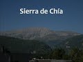 | Sierra de Chía
26. 08. 2013 09:33:11
Track on Wikiloc: http://es.wikiloc.com/wikiloc/view.do?id=5085993... |
 | Cresta Espadas to Posets (3.370 m.)
4. 09. 2013 12:01:49
Track on Wikiloc: http://es.wikiloc.com/wikiloc/view.do?id=5180944... |
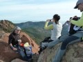
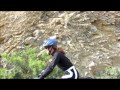
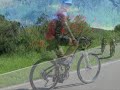
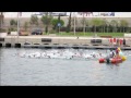 | CIM at the Valencia Triathlon
17. 09. 2013 08:48:27
Participation of members of Club Integral de Muntanya in the Valencia Triathlon... |
 | Pico Aspe (2.645 m.) via Arista de los Murciélagos
19. 09. 2013 09:12:07
Track on Wikiloc: http://es.wikiloc.com/wikiloc/view.do?id=5275744Another video of the same ascent (with GoPro): http://youtu.be/b4M6KBA1DGM... |