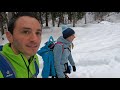
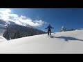
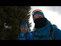
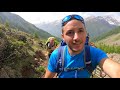
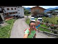
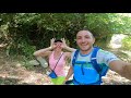
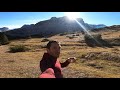
 | Calalzo di Cadore (BL) | Cascata delle Pile | Snowshoeing in Val d'Oten
9. 02. 2021 12:08:49
From Praciadèlan (above Calalzo), take the road marked with signpost no. 255, which is also passable by off-road vehicles, ascending the long scree slope of Val dOten. After about 500 meters, cross the Diassa stream (frozen in winter), which alternates periods of dryness with impetuous flow. The pla... |
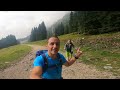
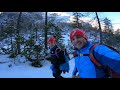
 | Apennines | Snowshoeing | Corno alle Scale with Snowshoes
10. 02. 2021 20:37:18
... |
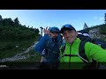
 | 4 hikers stuck in icy snow
10. 02. 2021 23:57:32
... |
 | Glutei Team Sledding
22. 02. 2021 22:48:52
... |
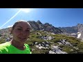
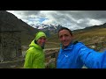
 | Brentonico | Monte Altissimo di Nago 2,079m
24. 02. 2021 01:31:57
The hike proposed here allows for a loop, with ascent and descent along different slopes, truly very rewarding from a landscape point of view. The route even in winter presents no particular difficulties, and can be done either in one day (6h total walking) or in two days, as we did, thanks to the p... |
 | Snowshoe Trail | Trentino | Passo Rolle | Malga Rolle to Laghi di Colbricon
26. 02. 2021 06:39:04
Departure from Malga Rolle (1,900 m) descend towards the start of the Paradiso chairlift from which follow the well-visible signs for Laghi di Colbricon, trail no. 348, venturing into the upper part of the Paneveggio forest, with centuries-old red firs, larches and cimbrian pines. Arriving at Laghi ... |
 | Carega 2,259m and Rifugio Fraccaroli in WINTER
1. 03. 2021 19:14:41
... |
 | Verona | Monti Lessini | Monte Sparavieri 1,797m
2. 03. 2021 21:06:09
With snowshoes on Monte Sparavieri...!<br>Very easy snowshoe hike accessible to all...!<br>Start from San Giorgio 1494 m on CAI trail no. 250, which with regular never excessive slope will take us past Bocca Gaibana (1576 m) and Pozza Morta, from the saddle at 1715 m we go right up to th... |
 | Carega Group | Cima Carega 2,259m and Rifugio Fraccaroli
3. 03. 2021 21:15:37
Starting point: Giazza - road leading to Rifugio Boschetto, the car can be left along the road.<br>Continue walking on the dirt road (now closed due to snow), passing Rifugio Boschetto and Rifugio Revolto. Then take the trail leading up to Rifugio Passo Pertica, after a few switchbacks we see ... |
 | Asiago Plateau | Val Formica | Cima Mandriolo with Snowshoes
6. 03. 2021 08:16:59
To reach Cima Manderiolo (Mandriolo), continue on trail no. 205 from Porta Manazzo towards Vezzena along the ridge that marks the end of the Asiago plateau with Valsugana, reaching Cima Manderiolo in about an hour.... |
 | Rocca Pendice | Double Rope Descent
25. 04. 2021 17:44:44
... |
 | Prealps Trevigiane | Cison di Valmarino | Col dei Moi | Bivacco dei Loff
4. 05. 2021 23:29:35
Subscribe to the Channel to stay always updated with our trekkings. This time we take you to discover the wild Trevigian Alps, precisely we are in the municipality of Cison di Valmarino, one of the most beautiful villages in Italy. We leave the car in the Peroz parking lot, a few kilometers from the... |
 | Little Dolomites | Vaio dei Colori and Cima Carega
24. 05. 2021 19:34:32
The Vaio dei Colori is a magnificent gorge that cuts through the northern side of the Carega Group. Although not of particularly high difficulty or extreme length, it is a coveted and appreciated destination by many mountaineers who love winter ascents.... |
 | Tuscan-Emilian Apennines | Regional Park | Sassi di Roccamalatina
24. 05. 2021 22:21:21
Sassi di Roccamalatina Park<br>Stone pinnacles of the Apennines<br>The Sassi di Roccamalatina Park protects 2,300 hectares of land on the hills of the Middle Modenese Apennines consisting of ancient chestnut groves, forests and crops, in whose center imposing sandstone pinnacles of the S... |
 | Bella Gioia Route | Parete Rigata | Tessari
1. 06. 2021 22:45:24
It is the first route encountered climbing the trail from Tessari. According to Brighente's report, the pitches are:1) 30m, 5a2) 20m IV+3) 30m, IV+/5a4) 35m, IV+/5a5) 30m, IV+/5a... |
 | Tessari | Parete Rigata | Chiodi Rossi Route
4. 06. 2021 23:00:05
Region: VenetoStart: Tessari (135m)Attack altitude: 210 mArrival altitude: 290 mElevation gain: 80 mDifficulty: AD+ / V+ (V+ obligatory)Exposure: East... |
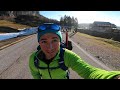
 | Italy | Pedavena | Trail running | Dolomiti Beer Trail
7. 06. 2021 23:42:27
A distance of 24 kilometers that enhances the pleasure of running fast among the broadleaves of the forest. A positive elevation gain of 1400 meters that requires commitment and is by no means a 'minor test'. Common start with Dolomiti Beer Trail 45K at 8:30 a.m. directly from the Brewery that since... |
 | Vigo di Cadore | Mede Trail | Monte Tudaio
9. 06. 2021 21:35:54
State road Alemagna heading towards Auronzo. On the right, a narrow deviation to Piniè. Cross the group of houses and park at Chalet Pino Solitario (878 m a.s.l.). Today we talk about an equipped trail, not a via ferrata; in fact, harness and carabiners may be superfluous. The helmet, as always, is ... |
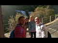
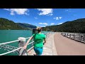 | Sottocastello | Pieve di Cadore | Lake Cadore
14. 06. 2021 19:27:32
The Cadore Lake or simply Centro Cadore Lake is an artificial body of water located in the historic-geographic region of Cadore, along the upper course of the Piave River.The 2.3 km² basin originated in the 1950s with the construction of the Pieve di Cadore dam in the Sottocastello area. Narrow and ... |
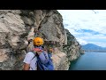 | Lake Garda | Smugglers' Trail
15. 06. 2021 22:55:50
The Massimiliano Torti Alpine Trail is also called Smugglers' Trail; it is a narrow ledge overhanging Lake Garda that develops horizontally. It features some equipped sections with metal cable, but predominantly there are numerous spits useful for clipping our quickdraws. ... |
 | San Vito di Cadore | A Step from Heaven 'The Guardians' | Lago di Mosigo
16. 06. 2021 23:25:17
The San Vito di Cadore lake is one of the locations of the successful series A Step from Heaven which, after ten years, left Lago di Braies and South Tyrol to find its space at no less enchanting lake, Lago di Mosigo, where the new police station will rise. In the 6th season, enchanting landscapes, ... |
 | Venosta Alps | Val Senales | Similaun Glacier 3,606m
29. 06. 2021 08:33:28
From the parking lot of the Vernago lake dam (1699 m a.s.l.), take dirt road no. 2 which winds northwest to the ancient Tisa farmhouse (refreshment point, 1814 m a.s.l.). From the farmhouse, the road continues uphill along the Val di Tisa northward. ... |
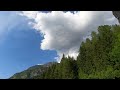 | Clouds Monte Tudaio
29. 06. 2021 19:55:19
... |
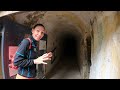 | 1942 | Vallo Alpino del Littorio 1938 | Monte Tudaio
30. 06. 2021 23:33:50
Thanks to the patient work of many volunteers, which lasted several months, the armored positions and observation posts can be visited safely thanks to a lighting system that automatically activates from 10 a.m. to 6 p.m., while all the most dangerous points, such as the water collection pits, have ... |
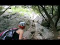
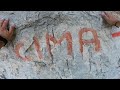
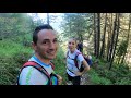 | Val d'Oten | Pile Waterfall | Rifugio Chiggiato
1. 07. 2021 21:32:55
... |
 | Dolomites | Cridola | Cima Montanel 2,461m
4. 07. 2021 18:02:11
Region: Veneto (Belluno)Alps and Group: Dolomites - Dolomite Alps - Cridola Group Province: Belluno Starting point: Rif. Cercenà (1051 m) Ascent side: n Ascent elevation gain: 1411 m - Total: 2822 m ... |
 | Dolomiti di Zoldo | Messner Museum | Monte Rite 2,183m
6. 07. 2021 00:39:03
Monte Rite (2,183 m a.s.l.) is a mountain of the Dolomites (Dolomiti di Zoldo), densely wooded, rising between Venas and Vodo di Cadore, on the right bank of the Bóite, above the Chiusa gorge, while with its southern slope it overlooks Cibiana, a town famous worldwide for its murals. The summit ridg... |
 | A N T E L A O | Rifugio Galassi 2,018m
19. 07. 2021 22:24:28
The Rifugio Galassi is an alpine refuge located at the small pass of Monte Antelao, in the Dolomiti Bellunesi, at 2,018 m a.s.l. and serves as a support point for the high routes no. 4 and 5, the alpine route and the ascent to Monte Antelao.... |
 | Domegge di Cadore | Val di Toro | Rifugio Padova 1,300m
20. 07. 2021 23:05:05
It was built in 1910 by the CAI Padova section. It stands in a clearing at the foot of the Monfalconi and Spalti di Toro chain (1300 m). It is framed by a splendid wood where maples, ashes and birches mix with beeches and firs in an environment where it is still possible to savor forgotten sensation... |
 | Cortina d'Ampezzo | Punta Anna | Olivieri Via Ferrata
26. 07. 2021 23:49:09
... |
 | Cortina d'Ampezzo | Equipped Trail G. Barbara | Fanes Waterfalls
27. 07. 2021 19:53:41
A special and easy ring loop, well-equipped in the short necessary sections, which can also be done in half a day. It is convenient access from Cortina to the beautiful Fanes Valley, in a setting that marries the enchanting green of the woods with the vertiginous south wall of Taè and the beautiful ... |
 | Canale d'Agordo | Orrido delle Comelle | Rifugio Rosetta from Val Garès
28. 07. 2021 23:34:45
In our list of natural attractions in Agordino, the two wonderful Comelle Waterfalls, the impressive Orrido delle Comelle gorge and the spectacular Pian delle Comelle cannot be missing, three truly very evocative places reachable quite easily from the valley floor of Valle di Gares, in the Agordino ... |
 | Equipped Trail 'Antelao Glacier' | Glacier Via Ferrata
29. 07. 2021 22:53:08
Crossing of the Antelao GlaciersWe pass through the Antelao group visiting its two glaciers and continue along its southern slopes along the solitary trails leading to the Rifugio Antelao.... |
 | Trentino | Canalone dei Bassanesi | Cima d'Asta 2,847m
1. 08. 2021 10:56:02
Cima d'Asta is the main summit of the homonymous massif located in eastern Trentino, between the Altopiano del Tesino, Valsugana and Valle del Vanoi. The mountain group is made up of granitic rocks, which distinguishes it from the nearby Lagorai reliefs, mainly composed of porphyries. However, due t... |
 | Trentino | Lake of Cima d'Asta | Slackline Italia
13. 08. 2021 16:42:32
... |
 | Cadore | Marmarole Circuit | Marmarole Round 2021
23. 08. 2021 06:45:56
... |
 | Trekking and Via Ferratas | Sorapiss Circuit in 2 Days
24. 08. 2021 00:21:57
The Sorapis (or Sorapiss, Sorapíss, Sorapís) ring trek is an alpine route around one of the most imposing massifs of the Dolomites.The Sorapís Group originally Soràpiš in Ladin consists of a central massif including Punta Sorapiss (3205 m), Croda Marcora (3154 m) and the Tre Sorelle (3005 m). Famo... |
 | Pieve di Cadore | Nebbiù | Pissandro Waterfall
24. 08. 2021 21:30:53
The trail is in Nebbiù, a hamlet of Pieve between Tai and Valle di Cadore.It starts from the square of the church of San Bartolomeo, which is part of the Titian itineraries. Inside the church there are interesting paintings by Carlo Capobianco and Marco Vecellio.... |
 | Nevegal (BL) | Giant Bench
9. 09. 2021 20:59:49
A selfie bench more than a resting one. Certainly for photos. It will become a must-stop on Nevegal, the red bench installed by Pro loco Pieve Castionese in synergy with the Municipality of Belluno. Reason? It is 2.20 meters high and 3.5 meters wide. A cyclopean bench that makes everyone who sits on... |
 | Normal Route | Antelao 3264m
11. 09. 2021 18:40:45
It is the highest peak of Cadore, hence the nickname King of Cadore or King of the Dolomites, third highest Dolomite peak after Punta Penia and Punta Rocca in Marmolada. Ascent route not difficult but requires suitable conditions, absence of ice, experience and great attention in some points with sh... |
 | Normal Route | Cevedale 3769m
11. 09. 2021 19:18:05
Mount Cevedale or simply Cevedale (3769 m) is one of the main summits of the Ortles-Cevedale Group. Its ascent via the normal route is a pleasant glacier alpine itinerary (somewhat crevassed in recent years).... |
 | Genga (AN) | Frasassi Caves
29. 09. 2021 20:29:21
The Frasassi Caves are karst underground caves located in the territory of the municipality of Genga, in the province of Ancona. The cave complex falls within the Regional Natural Park of Gola della Rossa and Frasassi.... |
 | San Vittore alle Chiuse | Valadier Temple | Foro degli Occhialoni
29. 09. 2021 22:30:55
Short but evocative itinerary arriving at the spectacular Foro degli Occhialoni!From San Vittore alle Chiuse, follow the Sentino river among pleasant scents of the aromatic plant garden and 'strange' smells of the sulfur spring to the beautiful Roman bridge. Then climb the trail that, crossing first... |
 | The Crossing | Monte Conero
2. 10. 2021 11:40:39
Difficulty: T/ELength: 12 kmElevation gain: +550 m, -650 mTotal duration: 5 hoursRequirements: Suitable for everyone. Just some walking training neededIt is the classic hike of the Conero Natural Park: a path crossing the strawberry tree mountain from north to south.... |
 | Trekking | Loop from San Giacomo | Monte Altissimo
13. 10. 2021 00:07:05
... |
 | Trentino-Alto Adige | Lake Braies Circuit
16. 10. 2021 19:47:27
The emerald green lake, the imposing Croda del Becco massif in the background: we are on the northern shore of Lake Braies. This body of water has become even more famous in recent years thanks to the Italian TV series Un passo dal cielo starring Terence Hill. However, the lake has always been a ver... |
 | Alta Badia Easy 3000 | Piz Conturines
20. 10. 2021 22:43:27
Introduction:Main summit of the Cunturines massif, dominating the San Cassiano valley (Alta Badia). Interesting and exciting ascent, in combination with Lavarella. Long and quite strenuous itinerary. Pay attention near the summit, exposed section.... |
 | Umbria | Marmore Falls ⛰ Terni
9. 11. 2021 21:44:53
The Marmore Falls is a waterfall located about 7 km from Terni, in Umbria, almost at the end of Valnerina, the long valley carved by the Nera River. It is a controlled-flow waterfall, the highest artificial waterfall in the world and one of the highest in Europe, with a total drop of 165 m divided i... |
 | Umbria | Lake Piediluco ⛰ Terni
10. 11. 2021 22:20:31
Lake Piediluco is located in central Italy: on its shores stands the village of Piediluco, a fraction of Terni. Located on the southeastern foothills of Umbria, with a branch extending into Lazio, Lake Piediluco, although with an area of 1.85 km², can be considered the largest natural lake basin in ... |
 | Trail 102 | Tre Cime di Lavaredo Lake Landro
12. 11. 2021 21:10:30
... |