|
| nevtro1. 08. 2020 22:12:40 |
I meant which of these two paths marked on [the] Pešpoti map as 1 and 2 is easier esp. red parts. [The] difficulty of [the] easier part of path 1 or 2 and continuation to Grintovec i.e. part 3. To "Dolce" fork I'd go on red-marked path or from Ovnov Čer fork [which] you reach from Kokrsko Sedlo.
 1 1
|
|
|
|
| coffee1. 08. 2020 22:22:48 |
From Dolcev on [the] orange path [is] incomparably harder than [the] red, both climbing and orientation-wise, plus very crumbly slope. Red path from Dolcev [onwards is an] easy [path] without special objective dangers.
| (+3) |  | |
|
|
|
|
| biba2. 08. 2020 10:29:32 |
The part marked with 3 is technically more demanding, includes some cables and climbing, also downhill.
|
|
|
|
| lijaneja28. 10. 2022 11:08:40 |
Yesterday's day was for the gods in the mountains and I felt the same. I took advantage of the nice weather, just like Boštjan more than fourteen months ago, only I didn't see any bus. I took advantage of the nice weather, just like Boštjan more than fourteen months ago, only I didn't see any bus.
At quarter to seven I start with a headlamp from in front of the cable car, but soon put it away. Pleasant temperature gave me a boost, at the saddle I find myself with four girls who had other goals. I leave wet clothes, after just over an hour and a half I'm already enjoying the bench in front of the bivouac, which hikers from Suhadolnik just left. I air it a bit, sign in and continue the ascent to the first goal. Above the scree I enjoy scrambling, at the top the lidless box annoys me.
It's time to modernize the connection made thirty years ago between the huts, as the marks have faded, many pitons are pulled out. Since I had plenty of time (return option), I 'overlooked' the sign about temporary path closure to Grintovec and found out where the snag is. The closure is due to a small landslide next to the path, just before it turns into shade on the north side. Extreme caution is needed and don't touch the walls (rusty), because more will fall there. The delicate part is only just under two meters long. No snow on the north side at all, but incredibly cold there, and luckily only good ten minutes to the top. I descend last, meet only two paragliders who are worried about no wind.
I thought the scree under Kok. Kočna was the most demanding part of the tour, but the path through the forest to the car due to abundance of leaves was even more difficult.
 1 1 2 2 3 3 4 4 5 5 6 6 7 7 8 8 9 9 10 10 11 11 12 12 13 13 14 14 15 15 16 16 17 17 18 18 19 19 20 20 21 21 22 22 23 23 24 24 25 25 26 26 27 27 28 28 29 29 30 30 31 31 32 32 33 33 34 34 35 35 36 36 37 37 38 38 39 39 40 40 41 41 42 42 43 43 44 44 45 45 46 46 47 47 48 48 49 49 50 50 51 51 52 52 53 53
| (+4) | | |
|
|
|
|
| lijaneja27. 08. 2025 09:21:05 |
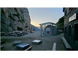
Yesterday's tour I could describe again as - divine. I set myself a 'totally easy' plan. Parking at the cable car, where there's already one car, I leave at 5:10am and with headlamp in short gear uphill. At the bench I catch up with the trio from the mentioned car, headlamp goes into backpack. Due to slow pace I'm in the hut for tea as the only guest at 6:40, chat a bit with the keeper. A really super day is promising, at the same pace I continue to the bivouac in Kočna, in pleasant sun and complete calm I have no hurry. Perfect silence, peace, now I know where I'll go for pleasure in old age. Steep scree above bivouac I mostly ignore, keep to the right where grassy-rocky terrain all the way to wonderful natural bivouac. Short unavoidable scree part and I'm already in the wall. Enjoy light scrambling, less grit on rocks than previous years, but marks completely faded, so I climbed mostly by instinct. In fog this could cause some trouble for many, but - just go up. Just below summit instead right, I turn a bit left and along ridge to today's first summit Na Križu, 2484m high. Wonderful views, sky flawless. Except base layers, dry all wet clothes. Return along right side under ridge, bit annoying short descent and I'm already in the cables of Kokrska Kočna. I think one more piton pulled since last time, but this flaw poses no problems. Here too I enjoy solitude long, only on Jezerska Kočna two hikers join me. To my joy light mists started appearing, views disturbed only upon arrival at Grintovec. Path to it is CLOSED, also quite difficult, as besides mentioned issue a bit lower a huge landslide with rocks and boulders completely covered part of the path. At Grintovec summit three foreigners struggling with selfies, I planned return via Dolge stene, but fog was such in that direction that I descended classically. I planned return via Dolge stene, but fog was such in that direction that I descended classically.
Recently the markers worked hard and at the exit from forest (ascent) made a new path, as part of old one was washed away by storm.
 1 1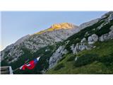 2 2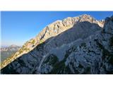 3 3 4 4 5 5 6 6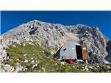 7 7 8 8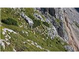 9 9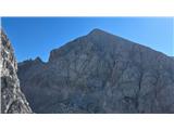 10 10 11 11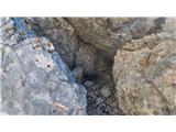 12 12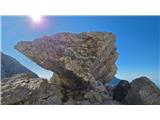 13 13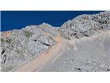 14 14 15 15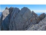 16 16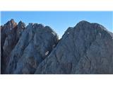 17 17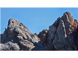 18 18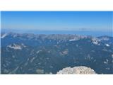 19 19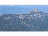 20 20 21 21 22 22 23 23 24 24 25 25 26 26 27 27 28 28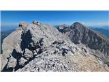 29 29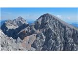 30 30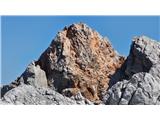 31 31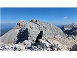 32 32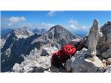 33 33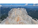 34 34 35 35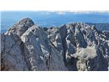 36 36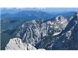 37 37 38 38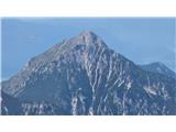 39 39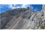 40 40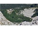 41 41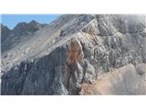 42 42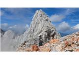 43 43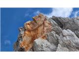 44 44 45 45 46 46 47 47 48 48 49 49 50 50
| (+7) | | |
|
|
|
|
| Marx28. 08. 2025 10:13:36 |
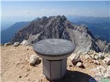
Where on the picture (picture borrowed from user Bos) is the summit of Koles?
 1 1
|
|
|
|
| lijaneja28. 08. 2025 12:40:14 |
On picture 34. Far right, right next to the main summit of Jezerska Kočna. And on pictures 16 and 18 it's on the far left side.
|
|
|
|
| lijaneja28. 08. 2025 15:54:36 |
I think we've already debated this issue heavily on page 7, the final answer should come from the relevant institution, or let the locals decide, as Drago noted in the '19 debate.
|
|
|
|
| jbs28. 07. 2026 19:32:07 |
Today with my older daughter on Kočna and Grintovec. Up the Kremžar route, a nice climb, secured just as much as necessary. Personally, in the famous chimney I don't miss any protections, but it certainly wouldn't hurt if there was a piton for greater reliability. On the summit a surprise: three sheep, two adults with a lamb; it seemed extremely unusual to me . The only possible explanation I see is that they climbed up the red gully from Dolc. They seemed quite helpless, as if they could neither go forward nor back, so on the way back at the Czech hut I warned about it. They said other hikers had already warned them too, that this was definitely not normal, and that they would notify the authorities. From Jezerska Kočna then to Kokrska Kočna, and down the rubble to Bivak v Kočni. Several years ago I had an unpleasant memory of this section, but it is not that bad—just quite broken and rubble-filled, though not very exposed. I would describe it as “marked pathless terrain”, because the path is almost unrecognizable; you can see that very few people go there. Gradually even the “marked” part will disappear, because the markings are really very faded. There are no protections on this descent section, only the necessary cables on the ridge part (in OK condition; a few individual pitons have been pulled out in two places). In short, this section definitely has the feel of pathless terrain. On Dolci there were quite a few sheep with lambs; probably those on the summit of Kočna belonged to the same flock. From Dolc then over Ovnov čer to Grintovčeva Streha and to the summit. The Roof has a completely different feeling when you reach it from Kočna . The only possible explanation I see is that they climbed up the red gully from Dolc. They seemed quite helpless, as if they could neither go forward nor back, so on the way back at the Czech hut I warned about it. They said other hikers had already warned them too, that this was definitely not normal, and that they would notify the authorities. From Jezerska Kočna then to Kokrska Kočna, and down the rubble to Bivak v Kočni. Several years ago I had an unpleasant memory of this section, but it is not that bad—just quite broken and rubble-filled, though not very exposed. I would describe it as “marked pathless terrain”, because the path is almost unrecognizable; you can see that very few people go there. Gradually even the “marked” part will disappear, because the markings are really very faded. There are no protections on this descent section, only the necessary cables on the ridge part (in OK condition; a few individual pitons have been pulled out in two places). In short, this section definitely has the feel of pathless terrain. On Dolci there were quite a few sheep with lambs; probably those on the summit of Kočna belonged to the same flock. From Dolc then over Ovnov čer to Grintovčeva Streha and to the summit. The Roof has a completely different feeling when you reach it from Kočna . Here we meet the first hikers. Then descent to Mlinarsko saddle and from the saddle to the Czech hut (regarding the recent debate on prices, Radler is also 6.5 EUR here, despite there being no helicopter transport). The descent from Mlinarsko saddle is quite winding, exposed and minimally secured. Cables only at key points; practically no pitons. The protection on these routes compared with the Julian Alps is really ascetic—only where absolutely necessary. It certainly has its charm; I hope it stays that way, though the foreigners you meet really struggle (a group descending from Mlinarsko saddle). . Here we meet the first hikers. Then descent to Mlinarsko saddle and from the saddle to the Czech hut (regarding the recent debate on prices, Radler is also 6.5 EUR here, despite there being no helicopter transport). The descent from Mlinarsko saddle is quite winding, exposed and minimally secured. Cables only at key points; practically no pitons. The protection on these routes compared with the Julian Alps is really ascetic—only where absolutely necessary. It certainly has its charm; I hope it stays that way, though the foreigners you meet really struggle (a group descending from Mlinarsko saddle).
The sheep on Kočna won't leave my mind; I hope they rescue them—one really feels sorry for them.
 1 1 2 2 3 3 4 4 5 5 6 6 7 7 8 8 9 9 10 10 11 11 12 12 13 13 14 14 15 15 16 16 17 17 18 18 19 19 20 20 21 21 22 22 23 23 24 24
| (+11) | | |
|
|
|
|
| lijaneja28. 07. 2026 20:57:05 |
Bravo, Jurij! You two made a long detour. With such things (spelling on official notices sl. 21) I get purulent pimples.
| (+2) | | |
|
|
|
|
| dprapr28. 07. 2026 22:45:37 |
“Personally in the famous chimney I don't miss protections, but certainly it wouldn't hurt if there was some piton for greater reliability.”
I believe you don't need them.
You probably didn't have them under Mali Triglav either. Why are they installing them there now?
| (+1) | | |
|
|
|
|
| Tomco28. 07. 2026 23:39:04 |
dprapr,
you're a bit strict with the comments. Safety is sometimes relative. Judging by the pictures, you recently climbed Končno without helmets, which in my opinion is more dangerous than one piton missing in the pitch.
No offense.
@jbs: wonderful tour and all credit to the daughter.
| (+3) | | |
|
|
|
|
| jbs29. 07. 2026 00:31:29 |
Tone, thanks, it wasn't meant as a detour But it's true that if the direct connection to Grintovec was officially open, I would probably go on it.
@dprapr... well, that's why this is just my personal opinion, how I saw it after many years since I was last here on this section again... again, if I look at it completely personally, on some other parts I missed some additional pitons or cables. But the charm of these paths in KSA is that they still insist on "less is more", how long this will be possible from a safety point of view, we'll see... Triglav is still an extreme example due to the multitude of all sorts of hikers who go on it, and it is probably really inevitable that sooner or later they will equip it with cables from the base to the top without interruption.
@Tomco, thanks, the daughter is despite her youth already a very seasoned mountain girl
| (+2) | | |
|
|
|
|
| bos29. 07. 2026 09:15:31 |
Nice demanding tour you two have chosen, bravo to both!
| (+1) | | |
|
|
|
|
| bbugari129. 07. 2026 10:29:38 |
Congratulations to Jurij on a nice circular tour!
Do you think it isn't easier to do the opposite direction: up to Mlinarsko sedlo and up through the scree to Kokrska Kočna, then down via Kremžarjeva?
What condition is the bivouac under Kočna in?
Is the marked path from Dolci to Ovnov čer visible? At the junction on Ovnov čer I didn't notice any markings, of course except the signpost?
| (+1) | | |
|
|
|
|
| jbs30. 07. 2026 00:27:23 |
Bojan, thanks. The variant is certainly easier in the opposite direction, but the main goal was Kočna, so we ticked it off first. Also climbing down on broken terrain is useful to train... We didn't go all the way to the bivouac though, so I can't really say in what condition it is, from afar everything seemed bp. The path over Ovnov čer is clearly visible though, but it's narrow and you have to watch the grass hanging from the path (so you don't step into the void). I wasn't paying attention to the markings (I think there really aren't many, maybe one on the rock), but the signposts are clearly visible both from the path to Grintovec and on Dolci. On Dolci the signposts for Kočna and Dolska škrbina are fallen (but still visible) though.
| (+1) | | |
|
|
|
|
| dprapr30. 07. 2026 06:21:04 |
Why would it be easier in the opposite direction? Then you'd have one of the longest scree fields in KSA to ascend!
| (+1) | | |
|
|
|
You must log in to post a comment:
If you do not yet have a username, you must first
register.