|
| stankoju3. 04. 2011 20:39:38 |
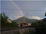
Today on Boč full of visitors like probably on all easily accessible hills, as the weather today was really wonderful for this time. The pasque flowers along the path around Velikonočnica have mostly wilted.
|
|
|
|
| drago407. 04. 2011 23:11:59 |
Today I missed the still blooming pasque flowers, however I was surprised to find out that pasque flowers under Boč, if the theft continues like this year, there won't be any in 2 years. In the smaller enclosure not even one, in the larger I counted only 6 or 7.
I recommend the path from Zg.Gabrnik over Galka and past Balunjača to the top, return past the Velikonočnica hut.
 1 1
|
|
|
|
| bruny1. 06. 2011 11:59:19 |
On Tuesday late afternoon from Studenice hiking for training to Boč in the area between Stavske peak, climbing area and Formilo meadow. Conditions for hiking excellent due to dry paths and somewhat lower temperatures and lack of mugginess in Boč forests... Today on Wednesday steamy mists are already chasing over Boč but characteristic "caps" for Boč they still can't make...
GPS Boč above Studenice, 31.05.2011
Regards
|
|
|
|
| bruny15. 06. 2011 22:13:19 |
...The longest day of the year is approaching its annual maximum these days and it was the right reason for late afternoon training ascent - this time for a change in nordic walking technique from Studenice a bit higher into the landscape park Boč & Plešivec...During the way I decided to step to the top of the barren Plešivec, which is rich in coniferous forest and excellent variant for late afternoon cooling...To the top in the last part along the Styrian-Zagorje brotherhood path and return from Plešivec along the well-compacted forest road & conditions for walking today as expected excellent...
GPS Plešivec 822 m.a.s.l. between Boč and Donačka gora from starting point Studenice
 1 1
|
|
|
|
| panda7. 08. 2011 11:49:28 |
Yesterday to Boč from the lower parking lot, where at eight there was already "crowd". Start along the educational trail up the gully, at the junction over Balunjača along the ledges past the radio tower to the viewpoint tower. Down the other side to the hut for refreshment and bite for the stomach. Both satisfied with excellent food and service. We'll come back. Down to the car the classic way. Mark maintainers need praise, who renewed the markings and signs, which unfortunately show times that contradict each other. No problem. Benches on the path over Balunjača (below the cross and at the cross) newly painted - praiseworthy. No views due to mists and clouds in the distance. Afternoon a bit on bike and evening to Ptuj night. LP
|
|
|
|
| bruny21. 08. 2011 21:18:06 |
At the beginning of the last quarter of today's day hiking from muggy Poljčane or Studenice into natural climate - Boč to the climbing area...I decided to check the pronounced winter frost hollows at the climbing area in summer time and they didn't disappoint me...- they excellently also perform the function of summer "coolers". Pleasant two hours of walking and today exceptionally return on the identical track as the ascent was.
GPS Boč above Studenice/climbing area/, 21.08.2011
Regards
 1 1 2 2
|
|
|
|
| Lj31. 08. 2011 20:11:07 |
This one is really long! Congratulations! Congratulations!
Regards, Ljubica
|
|
|
|
| repika15. 10. 2011 17:53:54 |
Today family trip to Boč to maintain fitness. Morning cold, windy but suitable for walking. Boč quite crowded, as quite a few young hikers were ascending on one and the other path. Path suitable for everyone, especially the one over Balunjača interesting for children's curiosity. Views nice although in slight mist.
|
|
|
|
| bruny22. 10. 2011 19:59:02 |
Besides the interesting points on Boč that attract attention and visitors, which are certainly the tower on Boč, Balunjača, spring adonis habitat, climbing area, Formila meadows, St. Nicholas chapel,... there is also something ,,unusual,, and today I climbed from Studenice towards the tower along the forest road to one of those   points, which remained as a bitter memory of the occupation of Boč summit by the then JLA in the eighties of the last century. Under one of the bends lies a concrete ,,pear,, full of concrete and in the past years it has already merged quite a bit with the surroundings. Today hardly anyone notices it anymore and especially during vegetation it is almost invisible. It is exactly 2.20 kilometers above the hunters' hut LD Poljčane on Golnik and at sea level 720 meters, 10-15 meters below the forest road in the bend that turns right...Whenever I walk or cycle past here I throw a glance at it for a few moments as some kind of nonsense from past times and also as the point where the final steep points, which remained as a bitter memory of the occupation of Boč summit by the then JLA in the eighties of the last century. Under one of the bends lies a concrete ,,pear,, full of concrete and in the past years it has already merged quite a bit with the surroundings. Today hardly anyone notices it anymore and especially during vegetation it is almost invisible. It is exactly 2.20 kilometers above the hunters' hut LD Poljčane on Golnik and at sea level 720 meters, 10-15 meters below the forest road in the bend that turns right...Whenever I walk or cycle past here I throw a glance at it for a few moments as some kind of nonsense from past times and also as the point where the final steep  ,,štajga,, especially for MTB technique begins towards Boč summit... ,,štajga,, especially for MTB technique begins towards Boč summit...
Regards bruny
 1 1
|
|
|
|
| joža x31. 10. 2011 18:04:27 |
Today the autumn colors drew us with the kids to Boč. Zg. Poljčane - Baba - Boč summit and back the same way. We really enjoyed this splendor of colors, and it would be a shame to miss this autumn color finale these days.
| (+1) |  | |
|
|
|
|
| bruny6. 11. 2011 18:28:59 |
This afternoon from Studenice along the shortest and optimal variant to Plešivec summit 822 m.a.s.l... Today practically no wind and on dry paths in rustling leaves. On the way back also two sections that I rarely walk or cycle, namely hunters' hut Rogaška Slatina - climbing area on Boč (forest connecting path) and descent from Formila partially along the hiking path behind Makole to the forest road... Quite lively on Boč today, nice autumn day lured people outdoors...
GPS Boč & Plešivec, 06.11.2011
|
|
|
|
| joža x22. 11. 2011 19:26:25 |
Yes, on Boč time is also eroding the stones, which is really not a pride for the locals (Maistrov kamen).
 1 1
|
|
|
|
| -23. 11. 2011 16:41:30 |
Today 23.11.2011. 200th time this year on Boč. Sun shone above 900 m.
|
|
|
|
| bruny25. 11. 2011 16:31:52 |
On Thursday afternoon from Pritensko to Boč between the climbing area and Formila. Fog and rime created almost a real winter scenery in the past days... Today, on Friday, the fog retreated a bit and Boč was again visible after .... ten days from Poljčane above 700 meters...
|
|
|
|
| bruny5. 12. 2011 15:49:47 |
On Sunday afternoon a somewhat longer path from Studenice to Boč and this time continuing along educational trail No. II also to Boč summit to the viewpoint and RTV tower on Boč. Descent along the forest road back to Studenice...
GPS:Boč 978 m.a.s.l., 4.12.2011
In some parts quite a strong southwest wind and the ,,concrete-filled pear,, under the right bend about which I wrote a few entries higher a few days ago was removed after more than...thirty years!? Today on Boč it is still raining for now.
|
|
|
|
| bruny11. 12. 2011 18:54:40 |
Boč & Plešivec from Studenice in combination over Dedni vrh above Makole and all the way to the Ravnocerje plateau above Sv. Florijan... Conditions for walking excellent, paths dry and a few small raindrops at Domačija Gavez - no wind...
GPS:Boč & Plešivec, 11.12.2011
Today met quite a few hikers, walkers, runners, quad bikers, cross motorcycles, hunters, foresters in the Boč area, while the part around Plešivec was as usual solitary... On Boč and - especially Plešivec they are felling a lot in the forests and it probably has to be that way...
Regards bruny
|
|
|
|
| ales2818. 12. 2011 11:14:48 |
Morning cold walk to Boč without summiting it was kinda "fresh" yeah
| (+2) | | |
|
|
|
You must log in to post a comment:
If you do not yet have a username, you must first
register.