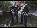
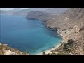
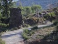
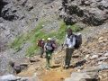
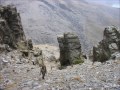
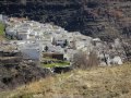
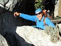
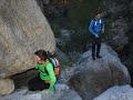
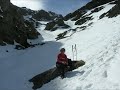
 | Descent of Almachares canyon (Canillas de Aceituno) Malaga
10. 06. 2013 17:39:46
Canyon located very close to the Malaga town of Canillas de Aceituno. Ideal for initiation, with fourteen rappels in the canyons of the Almachares river. (30-meter rope required)... |
 | Capileira | La Caldera | Poqueira | Río Veleta | Capileira Route
12. 06. 2013 13:46:12
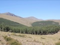
It's the typical mountain route, where you enter hidden areas of Sierra Nevada.We increasingly enjoy walking in unknown and little-trafficked zones.Curiously, we're heading towards the most crowded places in this Sierra.... |
 | Route Alto del Chorrillo 7 Lakes and Alcazaba Summit
17. 07. 2013 21:23:35
We arrived the night before in Capileira, located over 1740 m above sea level, convenient for acclimatization before ascending. At 8:35 we took the shuttle up to Alto del Chorrillo (2700m). Full with 22 people plus the driver, we left the Information Center. In summer, you need to book in advance, i... |
 | Route from Las Cuadras de Turón to Lavaderos de la Reina
18. 07. 2013 14:08:17
... |
 | Postero Alto to Picón de Jerez, Puntal de Juntillas and Return via Barranco Alhorín
17. 05. 2014 15:45:13
Ascent 1175 m - Descent 1260 m.Distance: 15 km - Duration: 7 hours - Difficulty: DifficultIt had been some time since we came to this area. The sierra is very large, to do in one day only. When you've walked it so long, it seems small and sometimes you don't know where to head.... |
 | Ascent to Cerro del Caballo Ventura Refuge and Acequia to the Dam
28. 05. 2014 00:37:26
In our route today we plan to climb Cerro del Caballo (3005m). Early wake-up, especially those from Almería. Once in Lanjarón, take the track up the sierra. First five bad km cemented. 13 left, not easy for low-clearance cars.... |
 | Hoya del Portillo Alto del Chorrillo Poqueira Refuge and Return via Acequia Trail
28. 05. 2014 01:40:22
In today's route we plan to climb Cerro del Caballo (3005m). Early rise needed, especially from Almería. Once in Lanjarón, we take the track up to the sierra. They've cemented the first five bad kilometers. Thirteen remain, not easy for low cars.... |
 | Ascent from Postero Alto to Picón de Jerez and Puntal de Juntillas
28. 05. 2014 16:55:19
POSTERO ALTO PICÓN DE JEREZ AND PUNTAL DE JUNTILLASAscent elevation 1175m - Descent 1260m.Distance: 15km - Duration: 7 hours - Difficulty: DifficultIt had been a while since we were in this area. The sierra is too big for one day. When you've been hiking it so long, sometimes you don't know which wa... |
 | Ascent to Mera Peak | Himalaya Expedition
30. 05. 2014 01:42:47
... |
 | Integral of Cabo Gata Natural Park. From Aguamarga to Cabo Gata Lighthouse
5. 06. 2014 20:44:48
... |
 | Traverse of Cabo Gata Natural Park
6. 06. 2014 11:45:40
... |
 | Ascent to Alcazaba and Globo from Trevelez
13. 06. 2014 19:55:41
ROUTE: SEMI-LINEARDURATION: 9.00 HOURSDIFFICULTY: MEDIUM-HIGH: 1845m.KILOMETERS: 26 km.There are many beautiful routes in Sierra Nevada and this is one of them. To do it, good physical preparation and being accustomed to this type of terrain with great elevation change and significant scree is recom... |
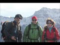
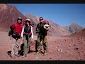 | Ascent to Aconcagua
14. 06. 2014 01:25:27
Salvador Hurtado, Mari Trini Torralvo, Sergio Cano and Javier García are the Almerians who traveled to Argentina to summit Cerro Aconcagua. In this expedition, three members (Salvador, Mari Trini and Sergio) arrived first at the Park. A week later Javier arrived, the fourth member of the only Spanis... |
 | Seven Lagoons and Trevelez | Calderetas | Trevelez Puntal de Vacares
19. 06. 2014 13:59:13
TREVELEZ -- EL HORCAJO -- RIO JUNTILLAS -- LOMA DE VACARES -- LAS CALDERETAS -- YUNQUE -- 7 LAGOONS -- TREVELEZROUTE: CIRCULARDURATION: 11.30 HOURSDIFFICULTY: MEDIUM - HIGHELEVATION: TOTAL ASCENT: 2,075 M. TOTAL DESCENT: 2,185 M.... |
 | La Estrella Trail to River Junction and Return via Aceral Refuge and La Cucaracha
25. 06. 2014 20:37:10
We got up early planning to climb Juego de Bolos via Vereda de La Estrella.The parking at barranco San Juan (1200m) is almost full. Vereda de La Estrella is a very popular spot in Sierra Nevada. Just like in the Veleta, Mulhacén, Los Lavaderos de La Reina and Siete Lagunas areas, you always meet lot... |
 | Poqueira Hydroelectric Plant to Cerro Pulpito
2. 07. 2014 05:15:39
We cross the village of Capileira and continue along the track leading to the sierra for a few kilometers, until we branch off onto the left-hand lane where there's a sign indicating Central Hidroeléctrica. Curiously, there was only one car parked; there are always many cars, even early. We start ou... |
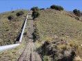 | Poqueira Power Plant to Laguna de las Cabras
2. 07. 2014 05:32:21
We pass through the village of Capileira and continue along the track to the sierra for a few kilometers, until we turn off onto the lane on the left with a sign indicating Central Hidroeléctrica. Curiously, there was only one car parked; there are always many cars, even early. We start our hiking d... |
 | Poqueira Power Plant to Fraile and Tajos de la Virgen
9. 07. 2014 14:33:09
Route: Poqueira Power Plant, Discharge Chamber and via trail El Toríl - arroyo del Peñón, Loma Peñón Abarca, El Fraile, Tajos de la Virgen, Carihuela Hut, Loma Púa, Power Plant.... |
 | Veleta | los Machos | Posiciones del Veleta short version
16. 07. 2014 22:07:51
POSICIONES DEL VELETA -- COLLADO DE VETA GRANDE -- LOS MACHOS and VIA FIDEL FERRO TO VELETA AND RETURN TO THE POSICIONESDIFFICULTY: VERY HIGHACCUMULATED ELEVATION: Ascent 742 m. Descent 525 m.DURATION: 6 HOURS (only 3,15 hours in movement)... |
 | Ascent to Mulhacén, introduction to high mountain
24. 07. 2014 09:53:58
This past weekend, the IV Day of initiation to high mountain without snow took place, organized by the Asociación belladurmiente.The participation has been of both sexes and ages between 15 and 50 years. 35 people, led by the mountaineers Salvador Hurtado, Mari Trini Torralvo and José Miguel Ramiro,... |
 | Hoya de la Mora to Arista del Cartujo via Lagunillo Misterioso
29. 07. 2014 14:46:01
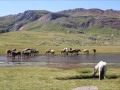
Wonderful mountain day without wind or clouds, as we had not seen for a long time.We started walking from the parking of Hoya de la Mora and it was like never before. There was nowhere to park, including three or four buses. Many bikes that had arrived on the buses and people everywhere, to enjoy in... |
 | Ascent to the Alcazaba via Tajos del Goterón and return to Hoya del Portillo
6. 08. 2014 09:37:05
Route:Departure from Hoya del Portillo to Refugio de Poqueira. The next day ascent to Alto del Chorrillo, Siete Lagunas, Piedra Yunque, Las Calderetas, Raspa de Los Azucareros, Puntal del Goterón, Puntal de Las Calderetas, Puntal de Vacares and return to Las Calderetas. After bivouacking at the Lagu... |
 | Hoya de la Mora las Calderetas and return via the vasar del Mulhacén
14. 08. 2014 00:28:47
Hoya de la Mora, Vereda del Trigo, Vereda Inferior, Corrales del Veleta, Veta Grande, Sendero de las Lagunas Intermitente, Gabata y Larga, Collado Juego de Bolos, Laguna de la Mosca, Vasar de la Alcazaba, climb from the Espolón to summit, bivouac in the suite de las Calderetas. The next day. ... |
 | Alpine route to enjoy the landscapes of Sierra Nevada
21. 08. 2014 19:54:09
Posiciones del Veleta to Siete LagunasWe use the shuttle, to get closer to Las Posiciones del Veleta. At 10:45h. We set off, along the old road that reaches Capileira. The temperature is good and upon arriving at La Carihuela, we climb the puntal that bears the same name.... |
 | Route of the Posiciones del Veleta Siete Lagunas
24. 08. 2014 02:12:30
Posiciones del Veleta to Siete LagunasWe use the shuttle, to get closer to Las Posiciones del Veleta. At 10:45h. We set off, along the old road that reaches Capileira. The temperature is good and upon arriving at La Carihuela, we climb the puntal that bears the same name.... |
 | Ascent to the summit Tajo de los Machos from la Cebadilla (Capileira)
27. 08. 2014 02:38:10
Hot and sunny August morning. After breakfast in Capileira, after the early rise, we head by car to the La Cebadilla power station (1425m altitude). Once here, we put on our boots and begin the route passing next to the ermita. The passage was cut, a livestock truck and a large herd of goats prevent... |
 | Introduction to the mountain | Ascent to Chullo
27. 08. 2014 03:42:26
This route is ideal to start in the mountain in summer time, the rest of the year it has to be done well equipped with clothes for the cold and for snow when it has.To us who like the mountain, from time to time we usually take friends and family to hills like this to initiate them, where the maximu... |
 | Ascent to the peaks Vértice and Geodésico de Anayet
12. 09. 2014 20:00:54
Formigal Ibones de Anayet, Pico de Anayet and Vértice /Punta o GarmoGoing up the A-136 road, past Formigal towards France, just after Km 23, we reach the corral de Las Mulas where there is a large parking next to the entrance to the Anayet parking of the ski resort. You cannot reach the parking by ... |
 | Balneario Panticosa to Refugio Bachimaña and Pico Serrato
12. 09. 2014 20:38:58
Ascent from the stone house of Balneario de Panticosa to the Refugio de los ibones de Bachimaña and continue to cerro SerratoWe arrive at Los Baños de Panticosa and through the ibón de Baños we head directly to the refugio Casa de Piedra (1640m.). It has large parking areas covered by trees.... |
 | Refugio de Bachimaña to Pico Tebarrai, Picos de los Infiernos return to the Balneario
13. 09. 2014 05:07:46
We got up early and after a good breakfast, we started walking towards Los Picos del Infierno. The route is easy for us, the GR-11 (Senda Transpirenaica) takes us to the collado de Los Infiernos. We skirt El Ibón Bajo and Alto de Bachimaña. From what we have hiked from the Balneario, this GR path is... |
 | Ascent to Pico del Caballo from Cortijo del Espino
7. 10. 2014 22:33:19
From the Cortijo del Espino and next to the Río Lanjarón, we begin this Route towards the summit of Pico del Caballo at 3011m.We ascend from Órgiva towards Pampaneira and a little after passing the Soportújar junction, we arrive at the ermita del Padre Eterno. Right in front, the track starts that c... |
 | Recreational area of Puente Palo to Cerrillo Redondo
9. 11. 2014 19:35:19
ROUTE: CIRCULAR - DIFFICULTY: MEDIUM-HIGH ELEVATION: 1630 m. - KILOMETERS: 17 Km.Spectacular autumn morning, sunny and with very good temperature. To the south, evolution clouds could be seen over the sea.... |
 | Descent through Barranco de Los Cazadores | Barranco de las Higueras to Pico del Cielo and Navachica
9. 11. 2014 20:32:39
We take the track that starts very close to the Hotel Al-Andalus and that takes us towards the Área Recreativa El Pinarillo; after passing this, we continue along the track, direction the fuente del Esparto. There is a point where this track crosses the barranco de Las Higueras, here we leave the ca... |
 | Juviles Path the Cross of Berchules
18. 11. 2014 02:34:26
The belladurmiente Association Organizes a volunteer group to restore the old path that from Juviles arrives at the Cross of Berchules.... |
 | Circular Hiking Route in Olivares (Granada)
25. 11. 2014 18:55:21
ROUTE: CIRCULARDIFFICULTY: LOW - MEDIUMDURATION: 3 HOURS IN MOTIONELEVATION GAIN: 475 M.KILOMETERS: 10 km Beautiful with a mix of nature, history and culture.Olivares and Moclin are two villages close to the Granadan capital. To access them from Granada, we must take the N 432, direction to Córdoba... |
 | carihuela | veleta | posiciones | tajos del campanario | Hoya de la mora
25. 11. 2014 19:33:30
HOYA DE LA MORA BARRANCO SAN JUAN TAJOS DEL CAMPANARIO POSICIONES DEL VELETA EL VELETA REFUGIO LA CARIGUELA HOYA DE LA MORAROUTE: CIRCULARDIFFICULTY: MEDIUM WITH SNOWELEVATION GAIN: 900 m.... |
 | Circular Hiking Route in Olivares (Granada)
26. 11. 2014 12:49:46
ROUTE: CIRCULARDIFFICULTY: LOW - MEDIUMDURATION: 3 HOURS IN MOTIONELEVATION GAIN: 475 M.KILOMETERS: 10 KM.Olivares and Moclin are two villages close to the Granadan capital. To access them from Granada, we must take the N 432, direction to Córdoba. After passing the locality of Pinos Puente we take... |
 | La Rosandrá Recreational Area to Morrón del Mediodia and Puerto de la Ragua
21. 01. 2015 10:46:42
Cold January morning, at 9:30 a.m. the thermometer marked 4 º in the recreational area la Rosandrá in Aldeire (Granada). Our idea was to go up and down the same place to the Morrón del Medio Día. We begin our route well wrapped up and immediately arrive at the iron hanging bridge. We cross it and co... |
 | Abrucena (Sierra Nevada) | Ascent to cerro del buitre, from las Rozas
21. 01. 2015 13:04:26
Splendid December morning, almost on Christmas eve. After crossing the village of Abrucena, with typical Christmas decorations. We continue in the direction of the Las Rozas Recreational Area. We leave the recreational area on both sides and in five hundred meters we arrive at the cuerda crossing an... |
 | Route from Trevelez to the Poqueira Refuge and the next day Mulhacen and return via Siete Lagunas
21. 01. 2015 13:11:03
Today Saturday our objective is to arrive only at the Poqueira Refuge, so without much early rising, we arrive at Trevelez well into the morning. We follow the indications of the SL-A 81; this signposted path takes us to the Alto del Chorrillo. We cross the barranco and among orchards we were ascend... |
 | Ascent to San Cristóbal and Ridge to the Torreón (Sierra del Pinar)
9. 02. 2015 13:47:36
Climbing the rocks, avoiding as much as possible stepping on the snow. They are large stones with many holes full of snow, in some I have fallen like traps): It can give you a scare! When you sneak in, up to above the chest. Finally we arrive at the summit of the Torreón at 1,654 m altitude. Formida... |
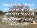 | Quejigales Recreational Area Torrecilla via SL-A 140 (Sierra de las Nieves)
9. 02. 2015 16:22:51
From Ronda we take the A-397 direction San Pedro de Alcántara and drive about 13 km, until we see on our left the sign for Sierra de Las Nieves, we leave the road and take the track that passes through the Conejeras Recreational Area and the campsite. After 14 km of total track, we arrive at the Que... |
 | Mirador de la Espartera to Pico Trevenque – Cerro Tamboril and Pico la Carne
10. 02. 2015 22:05:29
We arrive from la Zubia (Granada), to leave the vehicles in the parking lots of the Mirador de La Espartera or Collado Sevilla. As soon as we start, we gain height and in a short time, the fog disappeared. The view became that of a beautiful painting with the Alayos, the loma de Peñamadura and furth... |
 | Fuerte Ravine or Hell (Between Alhama de Almería and Huécija)
16. 02. 2015 20:49:50
Today it's the turn of the Barranco Fuerte, it is aggressive and different depending on the time of the year. We leave the car in the Barrio de la Luna, next to the road (A-348) Benahadux - Alhama de Almería. In the place also known as Los Molinicos, about five kilometers from Alhama. We are at 555 ... |
 | Traverse of Barranco Fuerte to the End and Return by Trail
25. 02. 2015 16:21:40
... |
 | Ascent to La Sagra via Embudo and Descent via Pedrera
5. 03. 2015 01:24:33
ROUTE: CIRCULAR; DURATION: 4.00 HOURS; DIFFICULTY: MEDIUM-HIGH; ELEVATION GAIN: 1310m; DISTANCE: 9.00 km. Every year when we go to La Sagra, it's usually in January, this year the bad weather didn't allow us until this weekend, March 1st.... |
 | Adra to Turón Route
16. 03. 2015 20:21:06
The information sign PR A-340 at the start of the route is located in the same rambla next to the N-340 bridge. Here it coincides with the GR-92 or E-10 trail along the Mediterranean. We start the route ascending through the urban park built in the rambla, leaving the sea behind us. The signs lead u... |
 | Postero Alto Refuge, Barranco Alhorí, Puntal de Juntillas and Picón de Jerez
17. 03. 2015 10:28:47
DISTANCE: 15.50 Km; ELEVATION GAIN: 1250 m; DIFFICULTY: HIGH; ROUTE: CIRCULAR; DURATION: 6 HOURS Wonderful morning for winter, sunny and windless, weather forecast for the day was good. We start the route from Postero Alto refuge parking, practically full of cars. We start walking after greeting fri... |
 | Cañada El Sereno Trail and Barranco Las Víboras | Huétor Natural Park
24. 03. 2015 02:05:56
ROUTE: CIRCULAR; DIFFICULTY: EASY; DISTANCE: 14 KM; DURATION: 4 HOURS; ELEVATION GAIN: 300 M. This weekend bad weather again, high mountains out. Rain forecast and lower mountains more bearable, so we went for a walk in Sierra de Huétor in Granada province.... |
 | Ascent to Pico Alcazaba from Trevelez via Alto del Chorrillo and return via Culo Perro
6. 04. 2015 18:42:46
We start our route from the parking in the upper neighborhood, it was 9 in the morning and the sun was beating strong. Following the signs of the Alto del Chorrillo trail SLA-81, GR-7 and GR-240 (Sulayr), we leave the village descending on a path next to orchards that makes us cross the ravine where... |