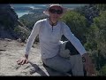
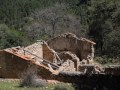
 | Trevelez to Alto de Chorrillo, Puerto Molina and Trevelez
14. 04. 2015 21:38:14
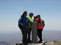
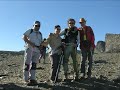
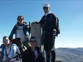
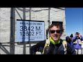
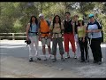
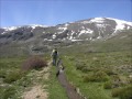
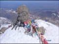
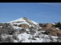
WE WERE GOING TO MULHACÉN. We left Trevélez with perfect visibility. We decided to climb the path that from the village leads to Alto del Chorrillo and from there ascend the Loma. We had a forecast that it would clear up by mid-morning.... |
 | Berja Darrical | Ascent to Mulhacen from Almería. I stage from sea to sky
23. 04. 2015 19:20:09
It is a linear route and we previously left a vehicle in Darrical. We leave from the town hall square in the direction of Carrera de Granada, a historic road of the locality formerly a Moorish neighborhood and we walk about 500 meters on the A-347 Granada road to the BP service station. At this roun... |
 | Route from Adra to Turón via the Old Path
29. 04. 2015 14:30:00
We start the route ascending through the urban park built in the rambla, leaving the sea behind us. The signs lead us directly to the bed. Following the trail cairns, we leave the rambla on a track and make a 180-degree turn. The track runs parallel to the rambla and takes us to another fork, we ski... |
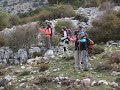
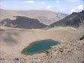
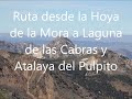 | Hoya de la Mora, Laguna de las Cabras and Atalaya del Pulpito
15. 05. 2015 03:15:46
We traveled from Almería and arrived at Hoya de la Mora mid-morning; the parking lots were full, it was impossible to park on the asphalt, finally we had to park on the ditch. It was clear that the weather forecast was good and there was a mountain atmosphere. Our goal today is not to reach any summ... |
 | Darrical Jorairatar | Ascent to Mulhacen from Almería. II stage from sea to sky
22. 05. 2015 12:52:41
We start our journey from the village square of Darrical, at 394 m altitude. We descend passing by the church gate and the shelter. We find signs of the GR-142, our route coincides in some sections with this trail. We arrive directly at the Darrical river and walk along a dirt track parallel to the ... |
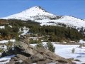
 | Ascent to Cerro del Caballo from Lanjarón, Sierra Nevada
4. 06. 2015 08:30:55
We went up from Lanjarón (659m), right on the track that climbs from the El Frenazo Restaurant (we left by car at 9:45h). It took us one hour to cover the 16 km of track. A year ago the start of the track was in very bad condition. Now they have concreted and signposted it. Now it's very good, only ... |
 | Postero Alto to Picón de Jeres, scramble from Alhorí and return via Sendero del Avión
10. 06. 2015 14:49:04
Nice route planned for today! With two attractive alternatives, we can get up early or sleep at Postero Alto Refuge.In our case we had to get up early and after a good breakfast in Calahorra, 24 km of track remain to the refuge parking. The track is very good compared to other years. There are a cou... |
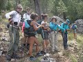
 | Cortijo las Angosturas to Barranco las Praderas del Puerto
18. 06. 2015 09:08:21
ROUTE: LOOP; DIFFICULTY: EASY; DISTANCE: 20 KM; ELEVATION GAIN: 550 M; DURATION: 6 H.Sunday near the end of spring. As usual in recent days, mornings are sunny and clear but as the day progresses, clouds form in the heights with showers. We cross the village of Berchules and head towards Jubiles. Up... |
 | Tajos de Breca las Calderetas, Puntal de Vacares, Collado las Buitreras, Río Juntillas and return
26. 06. 2015 19:05:49
Music: Harvie S - First Light of Spring... |
 | Trevélez to Peñabón, Los Papos, Barranco las Albardas, Rivers junction and return to Trevélez
1. 07. 2015 11:58:41
... |
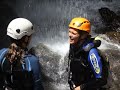
 | Hoya de la Mora, La Carihuela, Laguna Larga, Los Machos and Veleta
22. 07. 2015 21:49:38
SCRAMBLES THROUGH SIERRA NEVADAVELETA POSITIONS LA CARIHUELA - RÍO SECO CRESTS - LAGUNA LARGA COLLADO DE VETA GRANDA LOS MACHOS CAMPANARIO ZACATÍN SALÓN FIDEL FIERRO - VELETA VELETA POSITIONS... |
 | La Cebadilla scramble via Terreras Azules
23. 07. 2015 02:17:59
SCRAMBLES THROUGH SIERRA NEVADALA CEBADILLA POWER STATION (CAPILEIRA) LOAD CHAMBER FUENTE LA RAJA TERRERAS AZULES RÍO VELETA RÍO POQUEIRA CEBADILLAThis week we came to Capileira to do our route. We left the car at the La Cebadilla power station (approx. 1,600 m). We ascend along the PR-A 23 tr... |
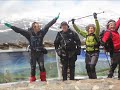
 | Capileira | Mulhacen | Veleta | Hoya de la Mora | Sierra Nevada traverse
5. 08. 2015 01:50:07
HOYA DE LA MORA - VELETA - MULHACEN - POQUEIRA REFUGE - CAPILEIRAOn Saturday morning we took the first shuttle from the university hostel. It took us up to the Veleta positions above 3,100 m. Here we really started the traverse. The first group photo before starting to walk and then we headed on the... |
 | Descent of Barranco Bermejo in Capileira
5. 08. 2015 13:04:44
... |
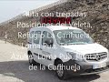 | Route Posiciones del Veleta, Loma Pua, Trepadero Terreras Azules, Río Veleta and return
11. 08. 2015 00:57:26
... |
 | Route to the source of the Río Castril and descent through Barranco del Túnel
23. 09. 2015 19:59:13
... |
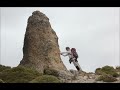
 | Ascent to Mont Blanc
25. 09. 2015 20:26:52
... |
 | Sierra de Cazorla Route
25. 09. 2015 20:59:33
... |
 | Rural House La Salega del Maguillo to Balneario de Tus
29. 09. 2015 10:40:58
... |
 | Source of the Río Castril, Barranco La Osa, Collado del Puerto and Arroyo del Puerto
7. 10. 2015 09:45:17
We set out from the source of the Río Castril, Barranco La Osa and along the path to the yew. We follow the PR path to Cortijo de la Puerca. Before reaching the cortijo, we take a track that leads us to Collado del Puerto.... |
 | Source of the Río Castril, Cortijo Las Asperillas, Collado Las Tablas and Barranco Canalejas
7. 10. 2015 09:48:35
From the source of the Río Castril along the path to Cortijo de las Asperillas, we continue to the collado and along the ridge to Collado de las Papas. We jump the fence and traverse to Collado de las Tablas.... |
 | My Photo Album 2015
7. 10. 2015 20:23:43
... |
 | Arroyo de San Juan to San Francisco Shelters
14. 10. 2015 13:27:08
Our intention was to go to the high mountains, specifically to Caballo, but the weather made us change plans. We met early in Cenes and after some churros, we distributed ourselves in the cars. It was drizzling, as we ascended the Sierra road, the fog was thicker. Upon arriving at Prado Llano, we de... |
 | Adeire Route to Chorreras Negras Refuge
20. 10. 2015 18:54:42
We arrive at Adeire with the idea of climbing to the San Juan summit. Upon reaching the last houses of the village in the direction of A.R. La Rosandrá, some town hall volunteers stop us preventing passage. During these weeks of October they celebrate the chestnut festival and many people come to pi... |
 | Lanjarón Tello | Acequias Route
31. 10. 2015 09:41:12
ROUTE: CIRCULAR; DURATION: 7 HOURS; DIFFICULTY: EASY MEDIUM; ELEVATION GAIN: 1,430 m.; DISTANCE: 19.5 km.We are at 650 m altitude, we walk through the village until we reach a small playground. We begin to ascend through the narrow streets, to soon enter the orchards of Lanjarón. We pass through tu... |
 | King's Pathway
4. 11. 2015 01:00:34
The King's Little Pathway is a walkway built on the walls of the Gaitanes gorge, next to the village of El Chorro, which serves as the boundary between the municipalities of Ardales, Álora and Antequera, in the province of Málaga, autonomous community of Andalusia, Spain. It is a pedestrian walkway ... |
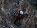
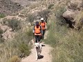
 | Carcauz Via Ferrata, Sierra de Gador. Almeria
5. 11. 2015 10:34:37
We took exit no. 420 from the A7 motorway, passed by the gas station and headed towards the mountain northbound on asphalt. At the end of the warehouses there is a junction with greenhouses, we turn right and the first one right away between greenhouses. We cross between several cortijos following t... |
 | Route from Hoya de la Mora to Carihuela
11. 11. 2015 01:15:29
ROUTE: CIRCULAR; DIFFICULTY: MEDIUM; ELEVATION GAIN: 800 m.; DISTANCE: 14.5 KM.; DURATION: 5 HOURSWonderful morning of the San Martín indian summer, the sky is cloudless and there is no wind at all in Hoya de la Mora at 2,550 m. altitude.... |
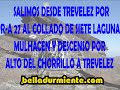 | Trevelez Collado de Siete Lagunas, Mulhacen, Alto del Chorrillo and Trevelez
18. 11. 2015 20:27:46
The weather forecasts for the weekend were very good and we took the opportunity to do this beautiful route through two of the most emblematic sites of Sierra Nevada Siete Lagunas and Mulhacen. Although we will ascend this summit via a very little-used place.... |
 | Carcauz Via Ferrata and Hiking Route
10. 12. 2015 21:32:30
This weekend we return to Barranco de Carcauz again, this time the group is larger.We all meet at the Repsol gas station at exit 420 of A7 highway, group in cars to take as few as possible and head to the mountain northwards. At end of warehouses a junction with greenhouses, turn right (east) withou... |
 | Sierra Nevada Traverse, Lanjarón Horse Lagoon, Elorrieta and Lanjarón
15. 12. 2015 23:55:54
First day: We leave one car in Lanjarón village and with another ascend the track next to El Frenazo restaurant. A track with now cemented sections. Following Tello and Sulayr trail signs, we reach the chain blocking the track to wheeled vehicles above 1,875m altitude. Prepare gear for three days an... |
 | Barranco el Salar or Espantaperros (no water)
16. 12. 2015 13:35:21
... |
 | Bérchules Trevélez | 4th Stage of the Sea to Sky Trail
26. 04. 2016 02:35:38
From Plaza Obispo Peinado in Bérchules we start our route, descending along Calle Carretera de Granada. We reach GR-4130 road, where we find a fork, we turn left descending towards Alcútar, in less than a kilometer walking in the shade of trees, with views over Cádiar and Sierra de la Contraviesa. W... |
 | Artuñedo, Peña Amusgo | Route through Sierra de Segura
7. 05. 2016 18:07:43
... |
 | Venta de Ticiano, Peñon de los Almendros, Riverte Farmsteads
7. 05. 2016 18:35:21
Venta de Ticiano (Zumeta River), Peñon de los Almendros, Riverte Farmsteads... |
 | Sierra de Baza. Padilla Trail
10. 05. 2016 11:29:51
Circular route through unique spots of Sierra de Baza. We leave the vehicles in Barranco de Barea, ascending through barranco de los Vallejos to Pico Durillo and return via Barranco del Aguardentero, Arroyo de Bodurria, Cortijo de la Fraguilla, Cortijada de los Mellizos, Casas de Santa Olalla. More ... |
 | Recreational Area from Puente Palo to Cerrillo Redondo and Tajo de los Machos
7. 06. 2016 21:25:19
... |
 | Corral de Turon, Picón de Jeres
7. 06. 2016 22:03:20
... |
 | Hoya de la Mora, Susana Monument, Veleta, Lagunillos de la Virgen
8. 06. 2016 13:05:09
... |
 | Corral de Turon, Lavaderos de la Reina to Picón de Jeres
8. 06. 2016 13:35:42
... |
 | Cazin Ravine, Padules and Almocita, Sierra de Gador
14. 06. 2016 19:12:41
... |
 | Cazin Ravine to Cerro Pulpito, Sierra de Gador
14. 06. 2016 20:15:01
... |
 | Salvador Hurtado's curriculum in mountains outside Spain
14. 06. 2016 21:23:08
... |
 | Ascent to Buitre, Almerian Sierra Nevada
15. 06. 2016 09:32:30
... |
 | Peña Partida, Calderetas, Alcazaba, Laguna Larga, Posiciones
11. 08. 2016 21:19:37
... |
 | Trevelez, Calderetas, Vasares, Dry River Lagoon, Chorrillo Alto and Trevelez
20. 08. 2016 02:57:12
... |
 | Los Cerecillos to Almirez and return via SL-A 151
4. 01. 2017 02:04:06
... |
 | Ascent to Los Cerecillos Refuge, Morron and Almirez
4. 02. 2017 02:08:06
ROUTE: CIRCULAR; DISTANCE: 17.30 KM; DIFFICULTY: MEDIUM-HIGH; DURATION: 7 HOURS; TOTAL ELEVATION GAIN: 1600 m.We arrive at Paraje Los Cerecillos and leave car before track junction at 1700 m, very near Sulayr trail crossing. Refuge Los Cerecillos very close, under 500 m. Unfortunately not advisable ... |
 | Capileira, Poqueira Refuge, Alcazaba and back to refuge
4. 02. 2017 19:58:30
We gear up and start walking to the refuge, the acequia was snow-covered and in some sections completely. The afternoon was great and a sea of clouds rose up Poqueira barranco but without overtaking us, giving impression of flying airplane above clouds.... |
 | Poqueira Refuge, Mulhacen, Refuge and Capileira
4. 02. 2017 20:26:43
... |