|
| Domch5. 10. 2014 21:58:36 |
My opinion too is that for up it's better past the Hut in Krnica and over Lipnica to the top, Kačji Graben for descent.
|
|
|
|
| JusAvgustin6. 10. 2014 05:53:32 |
Every time I descend Kačji Graben I swear to myself that this descent won't see me again.... Until now I have always broken the promise.
| (+7) |  | |
|
|
|
|
| Žiga226. 10. 2014 07:46:44 |
I totally get you..  Don't know if any descent dragged so long for me as on this path, though I've walked quite a bit.
|
|
|
|
| ms_primoz6. 10. 2014 07:57:32 |
well the path itself isn't that long downhill...far from it...just mentally tough. To go up this path though - no way
| (+1) | | |
|
|
|
|
| techouse12. 10. 2014 17:07:35 |
Yesterday went up Kačji graben and down past the hut in Krnica. No snow 
| (+1) | | |
|
|
|
|
| damjan_trbovlje19. 10. 2014 20:01:06 |
Was yesterday on Špik past the hut in Krnica over Lipnica to top and back same path. Weather excellent views exceptional people plenty
| (+2) | | |
|
|
|
|
| Bandzo20. 10. 2014 10:55:38 |
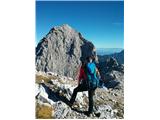
Yesterday we headed to the wonderful, beautiful Špik. It had been calling us for a long time, now we finally found time to visit it. First time in the Martuljek area, but definitely not the last! Wonderful tour, perfection of views, varied path. I'd just highlight Juše's comment: I won't break my promise =D I'm not going down Kačji graben anymore, period
 1
| (+2) | | |
|
|
|
|
| Potohodnik20. 02. 2015 21:06:52 |
Super tour, gotta say I'm a bit >>folž<<. How steep is the slope? 35, maybe 40 degrees?
|
|
|
|
| Pero_2420. 02. 2015 21:43:30 |
This is really a beautiful report, stunning photos 
|
|
|
|
| Irina20. 02. 2015 23:12:58 |
Wonderful tour. Thanks for sharing your ascent experiences with those of us who hike to the mountain in dry conditions.
| (+2) | | |
|
|
|
|
| risto21. 02. 2015 06:57:02 |
Very good description of conditions and useful info, not on the edge of secretive
like "tomorrow it will be completely
different" and similar. This way one can also
relive your ascent. Nice. Thanks!
| (+2) | | |
|
|
|
|
| funnyboy21. 02. 2015 09:46:05 |
Thanks everyone for the encouraging words
@Potohodnik: the steepness of the summit slope is in my opinion around 40 degrees.
|
|
|
|
| 1mitjas9. 03. 2015 15:25:13 |
This weekend was quite demanding. It started on Friday with ice climbing in Mlačca – we still have ice in Mojstrana, continued with skiing from Špik on Saturday and Vajnež on Sunday.
To Špik we skied up via Lipnica. This variant turned out more ski-friendly, as most of the ascent can be done on skis. Conditions for skiing ascent from this side are good, for hikers rather bad – in the upper part there would be a lot of trailbreaking. We skied from the top through Kačji graben. The descent was super to the tree line, below it skiing from Špik always turns into a fight with trees. That day quite a few came through Kačji graben to below Frdamanih police, there they probably all turned back. Among them at least one hiker, so the ski track is nicely chopped up.
Yesterday to Vajnež through Medji dol. Although the view from the highway doesn't inspire much hope for good skiing, it was excellent again. Snow starts soon after Trilobit hut, on open slopes it was super. The overall impression was again spoiled by the forest in the lower part and the dwarf pine belt below Kamitnik. Hikers have already reached Vajnež, so people are coming.
But conditions are fully wintery now, without crampons and ice axe nowhere.
Some photos at: http://gorski.vodnik.alpinizem.net/blog/
| (+6) | | |
|
|
|
|
| sigo15. 03. 2015 10:17:03 |
Amazing photos if you can please tell me where you started or the starting point because I'm thinking of going to Špik, these photos attract me even more thanks for the answer in advance and many more beautiful and varied adventures.
|
|
|
|
| andrej7815. 03. 2015 10:29:12 |
You park the car at the bridge over Pišnica and head towards the hut in Krnica...that is along the left side of Pišnica..after about 15-20 min fast walking you have the turn-off for Špik over the gully...the path is strenuous and can sink a lot, so I suggest an early hour...
|
|
|
|
| Maemi22. 04. 2015 20:18:21 |
Ascent to Špik at sunrise via path through Kačji graben.
Path dry almost to start of scree, then snow patches, only at end of scree vast snowy area, in middle also remnant of old slab. Snow is windblown, at night and morning hours still nicely frozen, so nice to climb to top, remnants of tracks from predecessors. In summit part already some scratching on rocks, for skiing quite uncomfortable.
Nice to sit on top in peace in morning spring sun, winter season slowly departing...
| (+5) | | |
|
|
|
|
| hanč7. 06. 2015 08:29:04 |
Has anyone been to Špik these days? What are the conditions? Lp
| (+2) | | |
|
|
|
You must log in to post a comment:
If you do not yet have a username, you must first
register.