 | Forestry cottage Rovtarica - Krekova koča na Ratitovcu
Krekova koča is located on the slopes of Ratitovec below Gladki Vrh. From the hut there is a beautiful view across the Škofjeloško and Cerkljansk...
3 h 30 min |
 | Bitenjska planina - Krekova koča na Ratitovcu
Krekova koča is located on the slopes of Ratitovec below Gladki Vrh. From the hut there is a beautiful view across the Škofjeloško and Cerkljansk...
2 h 20 min |
 | Rotek - Krekova koča na Ratitovcu
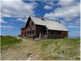
Krekova koča is located on the slopes of Ratitovec below Gladki Vrh. From the hut there is a beautiful view across the Škofjeloško and Cerkljansk...
2 h 45 min |
 | Kranjski Rak - Gradišče (Velika planina) (footpath)
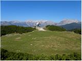
Gradišče (also known as Njivice) is, at 1666 metres, the highest peak of Velika planina. From the summit, where there is a viewpoint plaque, a be...
2 h 10 min |
 | Koča pri izviru Soče - Slemenova špica
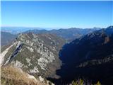
Few people are unfamiliar with the iconic view of Jalovec from Sleme, often featured on calendars with a small lake in the foreground and the maj...
3 h 25 min |
 | Bitenjska planina - Kosmati vrh (Ratitovec)
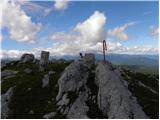
Kosmati vrh is situated at the far northeastern edge of Ratitovec. From the unvegetated peak there is a very nice view towards the neighbouring G...
2 h 40 min |
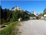 | Parking Alpspitzbahn - Kreuzeckhaus
The Kreuzeckhaus mountain hut, also known as Adolf Zoeppritz Haus, is located on the Kreuzeck summit at 1652 meters. Next to the hut is the upper...
3 h |
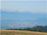 | Klösterle - Gerlitzen
Osojščica / Gerlitzen is a 1,909-meter-high mountain located north of Ossiacher See lake. At the summit, accessible by cable car, stands the Gipf...
2 h 50 min |
| Klösterle - Gerlitzen (via Stifterboden)
Osojščica / Gerlitzen is a 1,909-meter-high mountain located north of Ossiacher See lake. At the summit, accessible by cable car, stands the Gipf...
3 h |
 | Mönichkirchen - Hochwechsel (via Steinerne Stiege)
Hochwechsel is the highest peak of the Wechsel range at 1743 meters. It lies on the border between the Austrian federal states of Styria and Lowe...
3 h 30 min |
| Mönichkirchen - Hochwechsel (via Studentenkreuz)
Hochwechsel is the highest peak of the Wechsel range at 1743 meters. It lies on the border between the Austrian federal states of Styria and Lowe...
3 h 45 min |
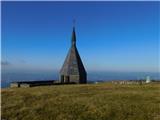 | Mariensee (Biotop) - Hochwechsel (leichterer Anstieg)
Hochwechsel is the highest peak of the Wechsel range at 1743 meters. It lies on the border between the Austrian federal states of Styria and Lowe...
2 h 10 min |
| Mariensee (Biotop) - Hochwechsel (mimo slapu Marienseer Wasserfall)
Hochwechsel is the highest peak of the Wechsel range at 1743 meters. It lies on the border between the Austrian federal states of Styria and Lowe...
2 h 25 min |
 | Kapellen - Schneealpenhaus
The Schneealpenhaus mountain hut is located just a few meters below the 1788-meter-high Schauerkogel peak, on which a cross stands and from which...
3 h 30 min |