 | Setnica (Turistična kmetija Gonte) - Tošč
Tošč, which became the highest peak of the Polhov Gradec Hills decades ago when the Yugoslav army lowered Pasja ravan by 9 metres, is located nor...
45 min |
 | Breznica - Lubnik
Lubnik is a 1025 m high mountain that rises steeply west of Škofja Loka. From the summit, where a mountain hut stands, there is a beautiful view ...
40 min |
 | Brdo - Koprivnik
Koprivnik is a 1393-meter-high mountain located between Blegoš and Mladi vrh. From the summit, which has a registration box and a stamp, the view...
45 min |
 | Krvavi kamen - Trdinov vrh
Trdinov vrh (1178 m) is the highest point in the Gorjanci range, across which the state border between Slovenia and Croatia runs. Although the su...
40 min |
 | Dom na Paškem Kozjaku - Špik (Paški Kozjak)
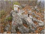
Špik is the easternmost peak of the relatively long ridge of Paški Kozjak. From the summit, which has a summit register, the view is only towards...
30 min |
 | Ledine - Sivka
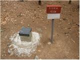
Sivka is a forested peak located west of Žiri and north of Idrija. At the summit there is a stamp for the Slovenian Mountain Trail and a logbook ...
45 min |
 | Hunting cottage Prehod - Jelenk
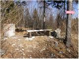
Jelenk is a mountain between the valley of the Idrijca River, above which it rises steeply, and the valley of the Kanomljica River. From the summ...
30 min |
 | Retjiški gozd - Koča na Kamnem griču
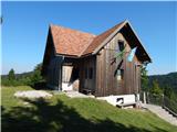
The Koča na Kamnem griču mountain hut is located on Kamni grič, a panoramic hill rising southwest of Sodražica. From the grassy summit surrounded...
25 min |
 | Lom - Koča na Kamnem griču
The Koča na Kamnem griču mountain hut is located on Kamni grič, a panoramic hill rising southwest of Sodražica. From the grassy summit surrounded...
45 min |
 | Hunting cottage Urška - Racna gora
Racna gora is a little-visited peak rising east of Loška dolina. From the summit, which has a logbook box and stamp, there is no view due to the ...
45 min |
 | Planinski dom Vrhe - Sveta planina (Partizanski vrh)
Sveta planina, also Partizanski vrh, is a 1,011-meter-high mountain located between Čemšeniška planina and Mrzlica. From the summit, where there ...
35 min |
 | Kamen - Mokrc
Mokrc (Mokrec on maps) is a 1,059-meter-high mountain located east of Iški Vintgar. The summit is forested and offers no views.For some views, it...
40 min |
 | Petrovo Brdo - Kup
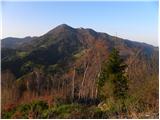
Kup is a 1,046-meter-high peak located between Petrovo Brdo and Podbrdo. From the summit, which features a cross and several transmitters, there ...
45 min |
 | Lokve - Škol
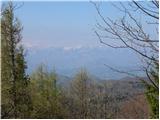
Škol is a 1182 m high peak that rises steeply above Čepovanski dol, more precisely above the village of Lokve on the edge of the Trnovski gozd pl...
40 min |
 | Solarji - Na gradu
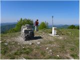
Na gradu is a 1115 m high peak located in the middle of the Kolovrat range, precisely on the border between Slovenia and Italy. From the grassy s...
30 min |
 | Dražgoše (Jelenšče) - Dražgoška gora
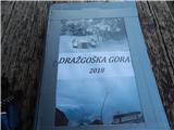
Dražgoška gora is located on the southern slopes of Jelovica and covers a fairly extensive area northwest of Dražgoše. The name Dražgoška gora is...
30 min |
 | Sedlo nad Lohačo - Špilnik (lower path)
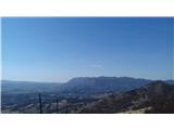
Špilnik is a less visited but very panoramic peak on the southern side of Hrušica, more precisely above the village of Strmec. It holds a central...
30 min |
 | Sveti Trije kralji - Veliki vrh (on Pohorje)
Veliki vrh is a 1344-meter-high peak located above the RTC Jakec - Trije kralji ski slope. The highest point of the peak is in the forest, but ju...
30 min |
 | Teichalm (Parking Heulantsch) - Heulantsch
Heulantsch is a 1,473 m high grassy hill above Teichalm, which together with "Sommeralm" forms the largest area of mountain meadows in the Alps.F...
45 min |
 | Pohorje cable car - Ledinekov kogel
Ledinekov kogel is a 1,182-meter-high peak located north of Mariborska koča. Just below the summit there is a fenced area with a radar tower....
40 min |
 | Frbežari - Rudnik (on ski slope)
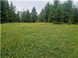
Rudnik is a peak in the northern part of Gorski Kotar, specifically above the place Tršće, near the Slovenian border. The peak is an HPO point an...
45 min |