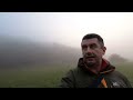
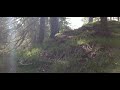
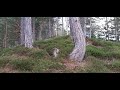
 | Island in the fog
25. 11. 2020 21:50:08
#prozorina #fogFOR MORE SUCH VIDEOS IF YOU CAN FOLLOW THE CHANNEL!'Subscribe' is an option to fully support our work for free. It costs you nothing and is great support and help for us in further work.... |
 | How Zrće beach looks in November
29. 11. 2020 12:12:46
#zrce #pag #zrćeFOR MORE SUCH VIDEOS IF YOU CAN FOLLOW THE CHANNEL!'Subscribe' is an option to fully support our work for free. It costs you nothing and is great support and help for us in further work.... |
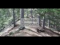
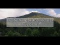
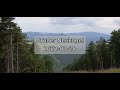
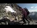
 | Ascent to Velebitska Plješevica
20. 12. 2020 10:17:34
FOR MORE SUCH VIDEOS IF YOU CAN, FOLLOW THE CHANNEL!'Subscribe' is an option that completely free supports our work. It costs you nothing but is great support and help for us in further work.... |
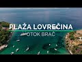 | Brač Island
10. 01. 2021 11:19:30
FOR MORE SUCH VIDEOS IF YOU CAN, FOLLOW THE CHANNEL!'Subscribe' is an option that completely free supports our work. It costs you nothing but is great support and help for us in further work.... |
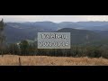
 | The most beautiful beaches of Pag island
20. 06. 2021 11:06:57
If you know a good beach not in the video, leave a message in the comments so it can be included in a new video! FOR MORE SUCH VIDEOS IF YOU CAN, FOLLOW THE CHANNEL!'Subscribe' is an option that completely free supports our work. It costs you nothing but is great support and help for us in further w... |
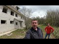
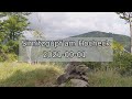
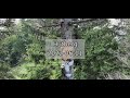
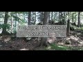
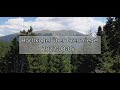
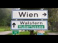
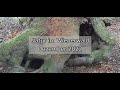
 | view of Želj ava | Čelopek Base
16. 06. 2021 11:21:18
#čelopek #željavaAbandoned military base on Čelopek hill from which there is a view of Želj ava.... |
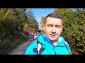 | Mali Hržić | Gašparac | Hiking
18. 10. 2021 07:04:34
... |
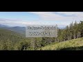
 | Velebitska Plješevica 2022
18. 05. 2022 08:45:48
... |
 | 2022 | Gacka Run
18. 06. 2022 14:39:39
#gackarun #gackarun202291 participants took part in the 5 kilometer course.The best result was achieved by Milan Špehar from AK Plitvice, second Dragan Narančić, third Goran Narančić. Among women, the best was Helena Gleđa from AK Dubrovnik, second Veronika Erlić from AK Kvarner Rijeka, third Sanja ... |
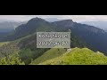
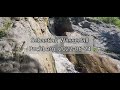
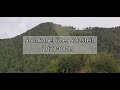
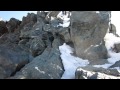
 | Gola Plješevica
1. 07. 2022 07:06:10
Follow the channel at: https://www.youtube.com/c/ZoranOreskovic?sub_confirmation=1Many compare Gola Plješevica and consider it a counterpart to Hitler's Eagle's Nest (Kehlsteinhaus) in Berchtesgaden. The similarities are indeed many Berchtesgaden is located on the Germany-Austria border, Plješevica... |
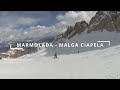 | Marmolada glacier ski slope from Punta Rocca (3265 m.) to Capanna Bill (Fedaia) integral descent
28. 03. 2023 19:13:22
A late spring (you will realize it's spring around the end of the slope ) integral descent from the top of the Marmolada glacier at Punta Rocca (3265 m.) all the way down to Passo Fedaia until Capanna Bill. You will not find in this video the last 2 km from Capanna Bill to Malga Ciapela as it is sim... |
 | Hirschenkogel in the Wachau, 2021-08-30
31. 08. 2021 20:09:09
The hike was actually supposed to go from Spitz on the Danube to Jauerling, but the bad weather forced me to seek shelter and wait several times. Also, I started an hour late due to a dead car battery. So I did not make it to Jauerling.... |
 | Sirnitzgupf at Hocheck, 2021-09-01
1. 09. 2021 22:42:59
Sirnitzgupf is a subsidiary peak of Hocheck, 956 m high.If you do not stop at the large parking lot in Furth (toll road from the south to Hocheck) but drive through, the road does get narrower but goes much further. I only drove to 'Kreuzbauer' and parked the car to the right in front of the Bildsto... |
 | Geißruck and Gaisstein, 2021-09-07
8. 09. 2021 17:34:35
This video consists of clips that I recorded during two hikes in the Gaisstein area.During the first hike, I did not find the entrance to Gaisstein on Himmelreith-Alm because I did not think it possible that this ascent is unmarked. During the second hike, I approached via forest paths and Geißruck ... |
 | Schönbodenhöhe near Thal, 2021-10-29
30. 10. 2021 14:49:16
Tip: if the YouTube video is blurry, do a web browser 'Reload', maybe it will then be in original quality! However, my Android camera is not always the sharpest, I haven't figured out yet why it sometimes shows everything blurry.... |
 | Sunstoa 2022-04-29
30. 04. 2022 21:20:05
Sonnstein is located southwest of Araburg near Kaumberg in Wienerwald. Actually, it is the end of the ridge that stretches from Hocheck to the west.Like most mountains or hills of the Wienerwald, 'Sunstoa' is marked by human forestry. I tried to follow the mountain ridge and film the distant views a... |
 | Jochart via Dachsbeck, 2022-05-27
28. 05. 2022 00:36:41
In the southeast of Ebenberg (see my last hiking video), a few kilometers south of Kleinzell, extends the Dachsbeck ridge towards Jochart (1266 m). I hiked along it pathless (paths are found everywhere!), until I was at the top of Jochart, the last section on a forest road in the southeast of the su... |
 | Kuntnerweg, Obersberg, 2022-05-14
14. 05. 2022 22:37:47
From Vienna West motorway exited at Böheimkirchen towards Fahrafeld and Rohrbach, then to Kleinzell and at Kalte Kuchl towards Schwarzau, before Schwarzau parked at Gasthof Rossböck.Then I hiked along Kuntnerweg towards Trauch, but at Zehnerkogel branched off onto the mountain ridge that leads pathl... |
 | Spielkogel on Schneealpe, 2022-06-03
3. 06. 2022 23:00:21
The western part of Schneealpe offers a wonderful landscape. Gentle hills, open woodland, green alpine meadows, breathtaking distant views, at an altitude of about 1500 m. Spielkogel is 1599 m high.... |
 | Nebelstein 2022-06-06
6. 06. 2022 20:41:19
I explored the Nebelstein (1009 m) in the Gutenstein Alps from Klostertal, which branches left from the road towards Rohrersattel about 1.5 km after Gutenstein (district Pernitz). At Gasthof Denk / Jörglhans a forest road runs south-southwest between two ridges roughly towards Nebelstein. On the lef... |
 | Hutberg 2022-06-11
11. 06. 2022 23:46:40
Does this mountain is called Hutberg because a hat hangs at the summit, or does a hat hang at the summit because this mountain is called Hutberg?The eastern part of the Hutberg ridge is accessible from Klostertal, which branches left towards south shortly after Gutenstein. It is the logical extensio... |
 | Great and Little Königskogel, 2022-06-17
17. 06. 2022 23:03:20
South motorway - Semmering - Mürzzuschlag - Neuberg, then in Mürzsteg right towards Frein. About 1.5 km after Roßlochklamm, at the end of Scheiterboden, a restricted forest road branches left from the main road, there I went uphill. By the way, 8 km west at Gußwerk there is another Königskogel, I do... |
 | Föhrenstein? 2022-06-19 | Hochkogel
19. 06. 2022 21:31:37
Vienna West motorway to St. Pölten South, there towards Wilhelmsburg, then Lilienfeld, in Freiland branch towards Hohenberg. Opposite Freiland station I parked behind the bus stop. The Hochkogel (873 m), leading to Föhrenstein (92 m), which in turn leads to Türnitzer Höger, is south of Freiland, for... |
 | Sebastian Waterfall near Puchberg, 2022-06-24
25. 06. 2022 00:22:54
If you drive through Puchberg am Schneeberg towards Losenheim, you pass through Sonnleiten, there turn right to the waterfall car park (further up at Sebastian-Wirt parking is only for guests). In 5 minutes you are at the inn, past it to the left and another 5 minutes and you stand in front of the w... |
 | Größenberg near Puchberg, 2022-06-24
25. 06. 2022 18:00:17
Größenberg is 1188 m high and northeast of Schneeberg. From Puchberg am Schneeberg, drive towards Losenheim to Sonnleiten, there a narrow road branches right towards Sebastian Waterfall. Shortly after, there is an elongated car park on the right for waterfall visitors.... |
 | Fronbachkogel at Kuhschneeberg, 2022-07-01
2. 07. 2022 01:26:47
The Fronbachkogel (1446 m) is a forested elevation at Kuhschneeberg, west-northwest of Schneeberg.Approach: South motorway to Gloggnitz, then to Reichenau, to Hirschwang and through Höllental to Singerin car park. (The inn of the same name has now been demolished, no one sings there anymore.)... |
 | Search for the Gahns Shaft, 2022-07-08
9. 07. 2022 14:07:55
The Gahns is a plateau mountain located southeast of the Schneeberg, connected to the Schneeberg via the Krumbachsattel at 1333 m. The average height there is 1200 m, thus below the tree line.... |
 | Mitterberg in Preintal, 2022-07-15
16. 07. 2022 18:02:37
If you drive from Vienna south motorway towards Semmering/Bruck and then exit at Gloggnitz, then to Reichenau and Hirschwang, you can take the Höllental federal road to Schwarzau im Gebirge. When Schwarzau comes into view, immediately after the first meadows there is a left turn into the Preintal, m... |
 | Föhrenstein 2022-07-22
23. 07. 2022 11:17:20
From Vienna west motorway at St. Pölten South exit towards Wilhelmsburg - Traisen - Lilienfeld - Freiland, there left towards Hohenberg / Furthof.I first tried to reach the Kreuztal from the Mauthof (before Innerfahrafeld) and from there to the Föhrenstein, but the Kreuztaler Hof blocks all accesses... |
 | Hohes Eck, Großer Neukogel, 2022-07-29
29. 07. 2022 23:21:10
From Vienna south motorway exit at Wöllersdorf, then to Pernitz and Gutenstein. In Gutenstein, before the church turn left immediately left again, then immediately right. At the next junction to Mariahilfberg, however, turn left or straight ahead. Follows a single-lane road into the valley of the Lä... |
 | Hochkogel over Grenzriegel, Kuhschneeberg 2022-08-05
6. 08. 2022 11:01:25
The Hochkogel is a 1486 m high summit at the west end of the Kuhschneeberg. From Vienna, take the south motorway towards Semmering to Gloggnitz, then via Payerbach and Reichenau into the Höllental to the Voismaut, where the Klostertalstraße joins the Höllentalstraße and the Voisbach flows into the S... |
 | Luckerte Wand and Kaltenberg, Semmering 2022-08-12
13. 08. 2022 19:14:23
The Kaltenberg is a 1302 m high mountain ridge in the southeast of the Rax, extending exactly from east to west south of the village of Prein. The mountain becomes steeper and rockier and also impassable the further west you go. There is no hiking trail here.... |
 | Roßstallfelsen 2022-09-06
7. 09. 2022 02:34:02
The Roßstallfelsen is not marked on every map. It is located in the Gutensteiner Alpen west of the northern part of the Klostertal or north of the Urgersbachtal. A forest road from the Urgersbachtal leads directly there from the south and ends there. At 892 m height, it is not the highest, but perha... |
 | Linsberg from the West, 2022-09-02
3. 09. 2022 12:27:15
The Linsberg is 1238 m high and is located in the Türnitzer Alpen west-southwest of Hohenberg. It is usually hiked from Hohenberg. However, I approached it from the west from the Türnitz direction. The ascent leads over an approximately 4 km long unnamed mountain chain, starting at the forestry Höge... |
 | Dreispitz at Hubertussee, 2022-08-26
27. 08. 2022 11:05:29
The Hubertussee is a reservoir in a very remote area, the Dreispitz is a 1307 m high mountain south of it. Drive from Vienna on the south motorway over the Semmering, in Mürzzuschlag towards Neuberg and Mürzsteg, there right towards Frein and Lahnsattel into the Halltal. After the village of Halltal... |
 | Sonnkogel over Salzstein, 2022-08-19
20. 08. 2022 12:29:07
The Sonnkogel is a 1190 m high elevation on the mountain ridge that extends about 6 km as the crow flies south of Türnitz from the Enzian in the west (1233 m) to the Traisenbergsattel in the east (942 m). There is no hiking trail there, not even a footpath did I see at the summit. The mountain seems... |
 | Jochart via Waschhofer Ridge, 2022-09-09
10. 09. 2022 14:13:06
The Jochart is a 1266 m high mountain northwest of Rohr im Gebirge. Hiking trails lead up from the Traisenbeck curve or from Rohr. I ascended pathless from the northwest from the Innerhalbachtal over the ridge, which old maps call 'Waschhofer Berg'. Starting point was the point south of the 'Kumpfmü... |
 | Trafelberg from the East 2022-09-14
14. 09. 2022 22:16:09
The Trafelberg is quite a colossus of a mountain in terms of mass, although only 1142 m high. It is located east of the Unterberg. The ridge running in an east-west direction is steep on the north side, gentler on the south side.... |
 | Roßstall North Ridge 2022-09-22
22. 09. 2022 23:21:04
The wildly romantic pine forests of Roßstall in the northern Klostertal near Gutenstein attracted me again. On the about 800 m high north ridge there is no marked hiking trail and no named peaks, it is a long forested ridge with constant ups and downs and some branches, leading to Streimling as the ... |
 | Hegerberg and Kienstein, 2022-10-01
1. 10. 2022 22:45:25
Coming from Kleinzell, about 2 km before Kalte Kuchl after a left curve there is a layby with space for about 8 cars. From there, a few steps back north, a bridge on the left leads over Hal(l)bach to a forest road (Hinterberggraben), which points exactly west towards the mountain ridge from Kienstei... |
 | Kalbenschweighöhe and Schönbodenhöhe, 2022-10-23
24. 10. 2022 00:26:34
There was nice weather with temperatures up to 21 degrees forecast, time for an outing. The 959 m high Kalbenschweighöhe is one of the elevations on the ridge running from the 946 m high Matzingtaler Höhe to the 1022 m high Schönbodenhöhe.... |
 | Höllkogel in Halbachtal, 2022-10-28
28. 10. 2022 23:44:59
The 875 m high Höllkogel in the Kleinzell area is one of the mountain ridges that enter the Jochart from the north. Drive from Vienna West Motorway exit Altlengbach south via Hainfeld and Kleinzell to the Traisenbach curve. After this, a forest road with no-entry sign branches left.... |
 | Nature in the Vienna Woods, December 2022
2. 01. 2023 23:58:31
I took the recordings in west Vienna starting from 11.12.2022. The foggy scenes in the second part are already from 02.01.2023, by then after a warm weather phase the little snow from December was long gone.... |
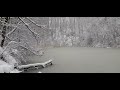 | Real snow in Vienna, 2023-01-22
22. 01. 2023 17:24:13
In the night from Jan 20 to 21 it started snowing, and today Sunday the 22nd it's snowing again. The world is transformed, the city's background noise is muffled, the air is purer due to the snowflakes, everything is white. Drivers and dog owners try to restore the gray everyday life as quickly as p... |
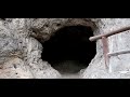
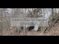 | Hohlur Cave near Berndorf, 2023-03-10
11. 03. 2023 23:15:58
The Hohlur Cave is located about 3 km west-southwest of Steinhof near Berndorf in Lower Austria. From Vienna South Motorway, exit at Leobersdorf to Berndorf, then in the Veitsau district half-right to Steinhof. At the end of Steinhof, I took the unmarked forest path behind the houses between the hik... |
 | Above the Grillenberg Valley, 2023-03-17
19. 03. 2023 17:54:43
Exit from Vienna South Motorway at Leobersdorf, in Berndorf center turn left to Veitsau towards Grillenberg. There is a stretch of country road between Berndorf and Grillenberg, and the right turn into the village is quite sudden. At the end of the village (keep straight until you can't go further) ... |
 | Almerhorn. Baby scales mountains 15
23. 10. 2011 08:22:19
Autumn hike with 10-month-old Ronja to a near-3000m peak in the Rieserferner Group in East Tyrol.Music: J. Brahms, Hungarian Dances. London Festival Orchestra under Alfred Scholz, Pilz 1990.... |
 | Hirscheck. Ski touring monograph Dead Mountains North, Part 10/11
29. 03. 2016 22:50:30
Ski tour between Stoderkamm and Warscheneck area in the eastern Dead Mountains. More info and photos on the tour at http://nature-classic.at/tourenbuch-s...(c) 2016 Ulli & Erich Haderer... |
 | Kiddie climbs mountains 5 | Lerchknoten
17. 01. 2018 21:43:40
Ronja is now 7 years old and tests her new touring skis on a popular route in the Villgratner Mountains, East Tyrol. More info and photos about the tour at www.nature-classic.at.... |
 | Exiting 'Stüdlgrat' and summiting the 'Grossglockner' (3798m), Austria - Peak View
26. 12. 2011 22:22:31
Summiting the 'Grossglockner' (3897m) over the legendary 'Stüdlgrat'. Maybe the most wonderful route onto Austria's highest peak. It took some 3h10' from 'Stüdl hut' (2802 m). The difficulty of this route does not exceed climbing grade 3+/4-. However, you should not suffer from fear of heigths. The ... |