 | Zidani Most - Kum (through Škratova dolina (old path))
Kum, at 1,220 metres, is the highest peak in the Posavje Hills. As it rises above the Zasavje region, some call it the Zasavje Triglav. At the su...
3 h |
 | Zagorje ob Savi - Kum (via Završje and Čebulova dolina)
Kum, at 1,220 metres, is the highest peak in the Posavje Hills. As it rises above the Zasavje region, some call it the Zasavje Triglav. At the su...
3 h |
 | Hrastnik (Podkraj) - Kum (via Matca)
Kum, at 1,220 metres, is the highest peak in the Posavje Hills. As it rises above the Zasavje region, some call it the Zasavje Triglav. At the su...
2 h 55 min |
| Zidani Most - Kum (through Škratova dolina (new path))
Kum, at 1,220 metres, is the highest peak in the Posavje Hills. As it rises above the Zasavje region, some call it the Zasavje Triglav. At the su...
3 h 5 min |
| Radeče - Kum
Kum, at 1,220 metres, is the highest peak in the Posavje Hills. As it rises above the Zasavje region, some call it the Zasavje Triglav. At the su...
3 h 45 min |
 | Hrašče - Vojkova koča na Nanosu (via Brižnik)
Vojkova koča is located on the southern edge of the high karst Nanos plateau, near Pleša. This is the prominent peak with television transmitters...
3 h 10 min |
| Hrašče - Vojkova koča na Nanosu (past troughs)
Vojkova koča is located on the southern edge of the high karst Nanos plateau, near Pleša. This is the prominent peak with television transmitters...
3 h 10 min |
| Podnanos - Vojkova koča na Nanosu (Pod zatrepom)
Vojkova koča is located on the southern edge of the high karst Nanos plateau, near Pleša. This is the prominent peak with television transmitters...
3 h 50 min |
 | Lokavec - Kucelj (on Čaven)
Kucelj is located on the southern slopes of the Trnovski Forest, northwest of the Vipava Valley. From the bare summit, where a cross stands, ther...
3 h 15 min |
 | Gojače - Kucelj (on Čaven)
Kucelj is located on the southern slopes of the Trnovski Forest, northwest of the Vipava Valley. From the bare summit, where a cross stands, ther...
2 h 55 min |
 | Lokavec - Veliki Modrasovec
Veliki Modrasovec is located on the southern part of the Trnovski Forest near Predmeja. On the summit stands an old military building, which we m...
2 h 55 min |
 | Zidani Most - Veliko Kozje (mimo Gašperjeve koče)
Veliko Kozje is a mountain that rises steeply above the left bank of the Savinja River, descending more gently towards the Sava River. The highes...
2 h 40 min |
 | Gračnica Valley (Blatnik) - Veliko Kozje
Veliko Kozje is a mountain that rises steeply above the left bank of the Savinja River, descending more gently towards the Sava River. The highes...
3 h 5 min |
| Breg - Veliko Kozje
Veliko Kozje is a mountain that rises steeply above the left bank of the Savinja River, descending more gently towards the Sava River. The highes...
3 h 15 min |
 | Laško - Gozdnik
Gozdnik is a hill that rises steeply above the village of Zabukovica. There is no view from the summit due to the forest, but a bivouac has been ...
3 h 45 min |
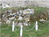
 | Zidani Most - Sveta Marija (Ključevica)
The Church of St. Mary is located on a hill called Ključevica, which rises 1,067 meters above sea level. From the partly vegetated summit, there ...
2 h 30 min |
| Radeče - Sveta Marija (Ključevica)
The Church of St. Mary is located on a hill called Ključevica, which rises 1,067 meters above sea level. From the partly vegetated summit, there ...
3 h 10 min |
 | Railway station (Most na Soči) - Veliki vrh (above Lom)
Veliki vrh is located on the northeastern part of the Banjška planota plateau, which rises above Čepovani dol, the Soča river valley, and the Idr...
3 h 15 min |