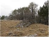
 | Gradec - Osojnica
Osojnica is a forested hill located west of Pivka. The summit features a logbook box, stamp, and bench, but offers no views....
45 min |
 | Pogorelec - Sedlata gorica (Pogorelec)
Sedlata gorica is a peak above the village of Podturn pri Dolenjskih Toplicah. It used to be forested, but today a clearing on the summit is used...
45 min |
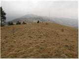
 | Završnica (Pri žagi) - Smokuški vrh
Smokuški vrh is a panoramic mountain located on the ridge between the Završnica Valley and the Gorenjska plain. From the summit, where there is a...
1 h |
 | Kamenščina - Milanka
Milanka is a 948 m high peak located west of Volovje rebri. Since the summit is partly forested, views from it extend only south and west, to the...
1 h 15 min |
 | Kamenščina - Volovja reber
Volovja reber, known for the proposed wind farm construction, is located west of the vast Snežnik forests. From its grassy summit, which hosts nu...
1 h |
 | Rovte - Medvedje Brdo (via Trtovška grapa)
Medvedje Brdo is a small settlement located north of Hotedršica. The highest point of the village is a pleasant viewpoint on Šinkovcov grič (814 ...
1 h 10 min |
 | Podblica - Sveti Primož in Felicijan (Jamnik)
The Church of St. Primož and Felicijan at Jamnik is located on a scenic grassy ridge rising between Kropa and Podblica. From the church or its ne...
50 min |
 | Gozd - Vovar (Pot razgleda)
A viewless hill in front of the Kamnik mountains. In recent times, due to storms, it is crisscrossed with cart tracks for log extraction.Below th...
45 min |
| Gozd - Vovar (eastern path)
A viewless hill in front of the Kamnik mountains. In recent times, due to storms, it is crisscrossed with cart tracks for log extraction.Below th...
45 min |
| Gozd - Vovar (northern path)
A viewless hill in front of the Kamnik mountains. In recent times, due to storms, it is crisscrossed with cart tracks for log extraction.Below th...
45 min |
 | Povlje - Gradišče (Pustinjak)
Gradišče or Pustinjak (also Gradišče nad Bašljem) is an 871-meter-high peak located above the Belica stream, which lies below the 2,132-meter-hig...
1 h 5 min |
 | Kočna - Vrše (by ski slope)
The 850-meter-high hill Vrše, over which the Triglav National Park border runs, rises southwest above the village of Blejska Dobrava, or east of ...
45 min |
 | Kočna - Vrše (čez senožeti)
The 850-meter-high hill Vrše, over which the Triglav National Park border runs, rises southwest above the village of Blejska Dobrava, or east of ...
50 min |
 | Rekarjev rovt - Police
Some of the numerous peaks of the Mežakla plateau, which belongs to the Julian Alps, are interesting as viewpoints. One of them is certainly the ...
45 min |
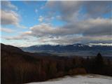
 | Podblica - Sleme (Površnica)
Sleme is a panoramic peak located between Rudno, Dražgoše, and Lajše. From the summit, where transmitters are located, there is a nice view of th...
1 h 10 min |
 | Dražgoše (Jelenšče) - Bela peč (Podbliška gora)
Bela peč is situated on the edge of Jelovica above the village Podblica. From the top of the cliff a beautiful view opens up towards the mentione...
1 h |
 | Dražgoše (Jelenšče) - Bela peč (Podbliška gora) (via Rigli)
Bela peč is situated on the edge of Jelovica above the village Podblica. From the top of the cliff a beautiful view opens up towards the mentione...
1 h |
 | Koča na Pikovem - Jesenik (Jesenikov vrh)
Jesenik, also known as Jesenikov vrh, is a 1,199-meter-high forested peak situated between Mežica and Podpeca....
1 h 5 min |
 | Koča na Pikovem - Veliki vrh (above Mežiška dolina) (via Pikov vrh)
Veliki vrh is a 1,165-meter-high peak located between Mežica and Črna na Koroškem. On the summit, beside the television transmitters, there is a ...
1 h 10 min |