|
| redbull9. 07. 2013 16:15:30 |
urbancek you're right-- that snow patch is really the nastiest,, so mandatory bypass it right over rocks--can also on snow, but mandatory crampons-cause otherwise you fly off
best regards
| (+1) |  | |
|
|
|
|
| jedriličar9. 07. 2013 22:03:13 |
There is also another crossing variant ....
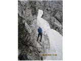 1 1
|
|
|
|
| Wine18. 07. 2013 21:47:00 |
is the access from the shelter to the notch above the tower dry?
|
|
|
|
| rok.si22. 07. 2013 14:04:25 |
Hi,
interested if anyone went to Jalovec from Tamar via Kotovo sedlo these days - is the path passable without winter gear ?
thanks !
|
|
|
|
| jaz22. 07. 2013 15:25:19 |
Today without problems. Regards!
|
|
|
|
| martinza27. 07. 2013 16:23:28 |
Is the path from the last Trenta past the shelter under the peak dry or are crampons needed? Thanks!
|
|
|
|
| janna27. 07. 2013 19:51:36 |
Checked yesterday afternoon. Need to cross one snowfield which is quite steep. Crampons not needed, good steps made, but need to be very careful.
| (+1) | | |
|
|
|
|
| pohodni30. 07. 2013 18:07:14 |
For visiting one of the most beautiful mountains in Slovenia, it's proper to choose a nice day. Today was definitely such a day.
In the freshly washed morning, my older son and I set off from Planica towards Dom v Tamarju. Up to here we were already well warmed up, as the path drags on nicely. We continued uphill through the valley and at the junction turned steeply up towards Kotovo sedlo. At the saddle, a rather cold wind with occasional strong gusts surprised us a bit. Obviously, we've been spoiled by the high temperatures of the last days. Above Kotovo sedlo, the path becomes quite demanding, but there is plenty of iron on the critical spots. In the gully a bit below the summit, we encountered a snowfield that can be nicely bypassed on the upper side with caution. But it's clear this is not a path for beginners. At the summit, peace and nice views awaited us, the wind also eased a bit, only here and there clouds raced and covered some peak.
We descended the same path, only lower we shortened the path across the scree.
Interestingly, we enjoyed solitude all day, as we didn't meet any hikers on the path. It was a bit livelier only up to Dom v Tamarju.
 1 1 2 2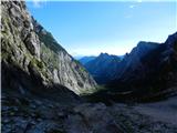 3 3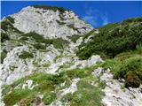 4 4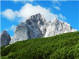 5 5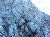 6 6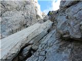 7 7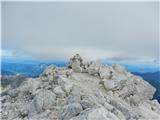 8 8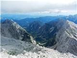 9 9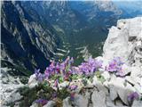 10 10 11 11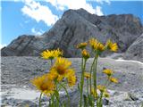 12 12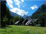 13 13
| (+11) | | |
|
|
|
|
| Becar30. 07. 2013 19:47:45 |
Does anyone have a good photo of what the snowfield looks like on the southern path from the hut?
|
|
|
|
| Gorska planika1. 08. 2013 10:42:11 |
On Tuesday, my wonderful mountain friend and I started in Tamar and headed to Mala Mojstrovka (over Grlo, over Sleme and via Hanzova path to the top). From there we descended the southern side to Vršič. We continued the path via Kopiščarjeva path to Prisojnikovo okno and descended again to Vršič via Grebenska path. From there we went to Jalovec and returned to Tamar valley over Kotovo sedlo. On the way to Jalovec we had a small snowfield, but it was normally passable.
The day was fantastic and unforgettable!! 
| (+1) | | |
|
|
|
|
| LidijaJesih1. 08. 2013 14:15:08 |
Well, now we've probably all really read it. Some three times. 
| (+5) | | |
|
|
|
|
| Daaam1. 08. 2013 14:27:28 |
Aha... I'm just wondering why you didn't go further over Strug to Sredja Ponca and finish the tour ideally in Tamar.
| (+4) | | |
|
|
|
|
| Ulčnik1. 08. 2013 17:08:47 |
Gorska planika, how much time did you two need for this tour of yours?
|
|
|
|
| smukc1. 08. 2013 17:47:02 |
According to the route description on hribi.net at least 10 hours and they also went to Jalovec, which means additional 10-12 hours
| (+2) | | |
|
|
|
|
| Gorska planika2. 08. 2013 11:05:32 |
We needed 15 hours, but we got a bit lost in between and searched for the right path... Without that, it would take 12/13 hours.
|
|
|
|
| miri2. 08. 2013 11:15:20 |
Next year then to GM4O for the record.
 1 1
| (+1) | | |
|
|
|
|
| jesihar2. 08. 2013 15:45:04 |
Can anyone tell me approximately what the distance is between the parking lot in Planica (in km) and the mountain hut in Tamar?
|
|
|
You must log in to post a comment:
If you do not yet have a username, you must first
register.