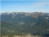
 | Dolenji Novaki - Porezen
Porezen is a 1,630 m high mountain situated between Davča and Baška Grapa. From the summit, where a large Partisan monument stands, a beautiful v...
4 h |
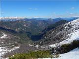 | Spodnja Kokra - Bašeljski vrh
Bašeljski vrh is a 1744-meter-high mountain located between Mali Grintovec and Storžič. From the summit, where there is a bench and a registratio...
4 h 40 min |
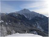 | Tržič - Bela peč (via Potarje and Spodnja Konjščica)
The mountain, known mainly among climbers, is located north of Storžič on the slopes of Konjščica. From the summit there is a beautiful view of t...
3 h 55 min |
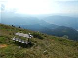 | Rosenbach - Rosenkogel/Hruški vrh (via Koprivnjak)
Hruški vrh is a 1776-metre-high mountain located between Dovška Baba and the lesser-known Klek. From the summit, where there is a small chapel de...
4 h |
 | Ljubno ob Savinji - Veliki Travnik (Turnovka)
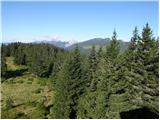
Veliki Travnik, also known as Turnovka by the locals, is located on the western edge of the Smrekovec mountain range. From the summit, which has ...
4 h |
 | Vitanje - Rogla
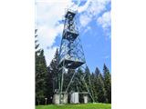
Rogla is a peak in the middle of the eponymous ski resort. The peak is forested with a small clearing on which stands a lookout tower. The tower ...
4 h |
 | Mislinja - Rogla (via Tolsti Vrh)
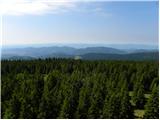
Rogla is a peak in the middle of the eponymous ski resort. The peak is forested with a small clearing on which stands a lookout tower. The tower ...
4 h 15 min |
 | Lovrenc na Pohorju - Rogla
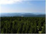
Rogla is a peak in the middle of the eponymous ski resort. The peak is forested with a small clearing on which stands a lookout tower. The tower ...
4 h 30 min |
 | Oplotnica - Rogla
Rogla is a peak in the middle of the eponymous ski resort. The peak is forested with a small clearing on which stands a lookout tower. The tower ...
4 h 20 min |
 | Lovrenc na Pohorju (cemetery) - Jezerski vrh
Jezerski vrh is located on Ribniško Pohorje near the Ribniška koča mountain hut. Due to the unvegetated peak, there is a nice view of Pohorje and...
4 h 20 min |
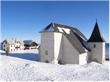 | Mežica - Uršlja gora (Plešivec) (via Sveti Lenart and Koča na Naravskih ledinah)
Uršlja gora, or Plešivec, is a panoramic mountain between Slovenj Gradec and Črna na Koroškem. At or just below the summit stands the Church of S...
5 h 30 min |
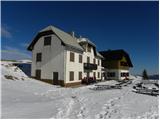 | Mežica - Uršlja gora (Plešivec) (via Sveti Lenart and over Kozji hrbet)
Uršlja gora, or Plešivec, is a panoramic mountain between Slovenj Gradec and Črna na Koroškem. At or just below the summit stands the Church of S...
5 h 15 min |
| Leše - Uršlja gora (Plešivec) (via Koča na Naravskih ledinah)
Uršlja gora, or Plešivec, is a panoramic mountain between Slovenj Gradec and Črna na Koroškem. At or just below the summit stands the Church of S...
4 h 25 min |
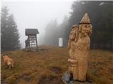 | Bistriški jarek (border crossing Muta) - Huhnerkogel/Košenjak (via Bivak Piramida)
Košenjak is located north of Dravograd and the Drava River on the border with neighbouring Austria. Access to Košenjak is possible on foot or by ...
4 h 50 min |
| Bistriški jarek (border crossing Muta) - Huhnerkogel/Košenjak (via Sveti Urban)
Košenjak is located north of Dravograd and the Drava River on the border with neighbouring Austria. Access to Košenjak is possible on foot or by ...
4 h 35 min |
| Bistriški jarek (Glasbeni dom) - Huhnerkogel/Košenjak (via Bivak Piramida)
Košenjak is located north of Dravograd and the Drava River on the border with neighbouring Austria. Access to Košenjak is possible on foot or by ...
4 h 45 min |
| Bistriški jarek (Glasbeni dom) - Huhnerkogel/Košenjak (via Sveti Urban)
Košenjak is located north of Dravograd and the Drava River on the border with neighbouring Austria. Access to Košenjak is possible on foot or by ...
4 h 30 min |
| Muta (Zgornja Muta) - Huhnerkogel/Košenjak (past Bivouac Piramida)
Košenjak is located north of Dravograd and the Drava River on the border with neighbouring Austria. Access to Košenjak is possible on foot or by ...
5 h 45 min |
| Muta (Zgornja Muta) - Huhnerkogel/Košenjak (past Sveti Urban)
Košenjak is located north of Dravograd and the Drava River on the border with neighbouring Austria. Access to Košenjak is possible on foot or by ...
5 h 30 min |
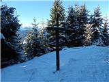 | Bistrica v Rožu / Feistritz im Rosental - Singerberg / Žingarica
Žingarica / Singerberg is a peak on the Austrian side of the Karawanks above the village of Slovenji Plajberk / Windisch Bleiberg. From the summi...
3 h 55 min |
 | Pivola (Reka) - Žigartov vrh (via Petkovo sedlo)
Žigartov vrh, at 1,346 meters, is the highest peak in the eastern part of Pohorje. An "observation" tower once stood on the summit, erected solel...
3 h 55 min |
 | Razdrto - Suhi vrh (Nanos) (gentle path)
Suhi vrh is the highest peak of the mighty karst plateau Nanos at 1313 meters. Although Pleša with its transmitters and Vojko's hut is more popul...
4 h |
 | Mislinja - Ostruščica (via Tolsti Vrh)
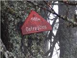
Ostruščica is a 1,498-meter-high peak located west of the ski slopes on Rogla....
4 h 15 min |
 | Podrožca / Rosenbach - Kamnica (Komnica) / Ferlacher Spitze
Kamnica is a panoramic mountain on the Austrian side of the Karawanks, more precisely north of Kepa. From the summit, which has a cross, summit r...
3 h 55 min |
 | Lovrenc na Pohorju - Pesek
Pesek is a 1,423-meter-high peak on Pohorje, located above Koča na Pesku....
4 h 8 min |
 | Kosmadei - Vigla (Kerkis) (Samos) (no. 11 / 10)
Vigla is at 1,443 m the highest peak of Mount Kerkis on the Greek island of Samos.There are several interesting spots on and near the mountain of...
4 h 15 min |
 | Kosmadei - Vigla (Kerkis) (Samos) (no. 9 / 10)
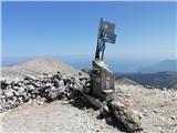
Vigla is at 1,443 m the highest peak of Mount Kerkis on the Greek island of Samos.There are several interesting spots on and near the mountain of...
5 h |