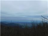
 | Gojače - Školj Svetega Pavla above Vrtovin (past trough)
Školj sv. Pavla is located on a panoramic hill above the village of Vrtovin, which lies west of Ajdovščina. From the church, near which the logbo...
1 h |
| Malovše - Školj Svetega Pavla above Vrtovin
Školj sv. Pavla is located on a panoramic hill above the village of Vrtovin, which lies west of Ajdovščina. From the church, near which the logbo...
1 h 5 min |
 | Tremerje - Veliki Slomnik
Veliki Slomnik is a peak located between Košnica pri Celju and Liboje. The summit has a logbook box, but due to the surrounding forest, there are...
1 h |
 | Tremerje - Veliki Slomnik (Tremerje - Veliki Slomnik - Liboje)
Veliki Slomnik is a peak located between Košnica pri Celju and Liboje. The summit has a logbook box, but due to the surrounding forest, there are...
1 h 35 min |
 | Zagrad - Grmada above Celje (gentle path)
What Šmarna gora is to people from Ljubljana, Grmada is to those from Celje. Celje's local mountain lies south of the town above Zagrad village. ...
1 h 30 min |
 | Zvodno - Grmada above Celje (via Suhi potok)
What Šmarna gora is to people from Ljubljana, Grmada is to those from Celje. Celje's local mountain lies south of the town above Zagrad village. ...
1 h 15 min |
 | Štore - Srebotnik
Srebotnik is a slightly vegetated peak located south of Celje and Štore in the Posavsko hribovje. The summit, which has a logbook box and a small...
1 h 30 min |
 | Lopata - Planinski dom Šentjungert
The mountain hut is located just a few meters below the summit of Gora, where the Church of St. Kunigunda stands; it was built in the 14th centur...
1 h 30 min |
 | Pišece (Pri mlinu) - Veliki Špiček
Veliki Špiček is the highest peak of Brežice municipality. From the top a nice view spreads towards the south and east. Most of Brežice municipal...
1 h 25 min |
 | Pliskovica - Volnik
Volnik (Monte Lanaro in Italian) is a 546 m high hill located near the village of Pliskovica on the Karst. At the summit there is a small tower, ...
1 h 30 min |
 | Reka - Rodne
Rodne is a 698-meter-high peak situated west of Orehovška Grapa. From the grassy summit, a nice view opens up towards the Cerkljansko-Idrijsko hi...
1 h 20 min |
 | Seljanec - Ham (via Seljanečki potok)
Ham is an isolated peak beside the Ivanščica range, above the Bednja river valley. It is separated from Ivanščica by the Železnice stream valley,...
1 h 30 min |
 | Zagorica pri Dobrniču - Lisec (Liška gora)
Lisec is a 565-meter-high peak located north to northeast of Žužemberk and southwest of Dobrnič. On the summit stands a metal cross with an attac...
1 h |
 | Tremerje - Vipota
Vipota is a 532-meter-high peak south of Celje above the left bank of the Savinja River. Approaches to the summit are possible from several direc...
1 h |
 | Zagrad - Vipota
Vipota is a 532-meter-high peak south of Celje above the left bank of the Savinja River. Approaches to the summit are possible from several direc...
1 h |
 | Zagrad - Vipota (via crossing Ivankovič)
Vipota is a 532-meter-high peak south of Celje above the left bank of the Savinja River. Approaches to the summit are possible from several direc...
1 h 15 min |
 | Štore - Turn (Sveti Janez Krstnik) (via Kompole)
Turn is a peak above Štore - Šentjanž nad Štorami. Slightly below the summit, at the site of the former Prežin Castle, the Church of St. John the...
1 h 15 min |
 | Zvodno - Bavč (via Suhi potok)
Bavč is a wooded peak located south of Celje and Zvodno in the Posavsko hribovje between Grmada and Srebotnik. On the way to the summit, views re...
1 h 10 min |
 | Hunting cottage Muljava - Mali Petrovac (Petrova gora) (via Mali Velebit)
Mali Petrovac is a rather low hill located somewhere on the border between Banija and Kordun, as well as Pannonian Croatia and Gorski Kotar. The ...
1 h 15 min |
 | Naraplje - Church of St. Bolfenk (Jelovice)
The Church of St. Bolfenk is situated on a 537-meter-high hill above the settlement of Jelovice. From the top, a nice view opens up towards Haloz...
1 h |
| Stogovci (Vabča vas) - Church of St. Bolfenk (Jelovice)
The Church of St. Bolfenk is situated on a 537-meter-high hill above the settlement of Jelovice. From the top, a nice view opens up towards Haloz...
1 h |
 | Stogovci (Vabča vas) - Kerješetov vrh
Kerješetov vrh is a 590-meter-high hill located above the settlement of Jelovice. The summit is overgrown with forest, so there is no good view f...
1 h 30 min |
 | Rimske Toplice - Stražnik (via Borovo)
Stražnik is a 648-meter peak south of Rimske Toplice. The summit features a bench and summit register box, with a cross erected in 2021 about 50 ...
1 h 20 min |
 | Podčetrtek (Terme Olimia) - Zavetišče Šmarnica on Mala Rudnica (past castle Podčetrtek)
The Šmarnica shrine is located on Mala Rudnica within the Rudnica range, a smaller hill chain above Podčetrtek. From the shrine there opens a bea...
1 h 15 min |
| Podčetrtek (sveti Lovrenc) - Zavetišče Šmarnica on Mala Rudnica (past castle Podčetrtek)
The Šmarnica shrine is located on Mala Rudnica within the Rudnica range, a smaller hill chain above Podčetrtek. From the shrine there opens a bea...
1 h 5 min |
| Podčetrtek (sveti Lovrenc) - Zavetišče Šmarnica on Mala Rudnica
The Šmarnica shrine is located on Mala Rudnica within the Rudnica range, a smaller hill chain above Podčetrtek. From the shrine there opens a bea...
1 h |
 | Slake (Church of the Virgin Mary on Pesek) - Zavetišče Šmarnica on Mala Rudnica
The Šmarnica shrine is located on Mala Rudnica within the Rudnica range, a smaller hill chain above Podčetrtek. From the shrine there opens a bea...
1 h 35 min |
 | Podčetrtek (Terme Olimia) - Silavec (The Tower of Health and Joy on Rudnica) (past castle Podčetrtek)
Silavec is a 622-meter-high peak on Rudnica above Podčetrtek, on which stands a lookout tower slightly over 35 meters tall, offering a beautiful ...
1 h 35 min |
| Podčetrtek (sveti Lovrenc) - Silavec (The Tower of Health and Joy on Rudnica) (past castle Podčetrtek)
Silavec is a 622-meter-high peak on Rudnica above Podčetrtek, on which stands a lookout tower slightly over 35 meters tall, offering a beautiful ...
1 h 25 min |
| Podčetrtek (sveti Lovrenc) - Silavec (The Tower of Health and Joy on Rudnica) (easier path)
Silavec is a 622-meter-high peak on Rudnica above Podčetrtek, on which stands a lookout tower slightly over 35 meters tall, offering a beautiful ...
1 h 15 min |
| Podčetrtek (sveti Lovrenc) - Silavec (The Tower of Health and Joy on Rudnica) (harder path)
Silavec is a 622-meter-high peak on Rudnica above Podčetrtek, on which stands a lookout tower slightly over 35 meters tall, offering a beautiful ...
1 h 15 min |
| Spodnje Tinsko - Silavec (The Tower of Health and Joy on Rudnica)
Silavec is a 622-meter-high peak on Rudnica above Podčetrtek, on which stands a lookout tower slightly over 35 meters tall, offering a beautiful ...
1 h 20 min |
| Slake (Church of the Virgin Mary on Pesek) - Silavec (The Tower of Health and Joy on Rudnica) (harder path)
Silavec is a 622-meter-high peak on Rudnica above Podčetrtek, on which stands a lookout tower slightly over 35 meters tall, offering a beautiful ...
1 h 25 min |
| Slake (Church of the Virgin Mary on Pesek) - Silavec (The Tower of Health and Joy on Rudnica) (easier path)
Silavec is a 622-meter-high peak on Rudnica above Podčetrtek, on which stands a lookout tower slightly over 35 meters tall, offering a beautiful ...
1 h 25 min |
 | Stojdraga (Glažuta) - Tuščak (Žumberačka gora)
Tuščak is a forested hill above the Bregana River valley on Žumberačka gora. The summit features a logbox....
1 h 10 min |
 | Stojdraga (Glažuta) - Gradina Tuščak (via Tuščak)
Gradina Tuščak is an HPO point about 10 minutes off the Tuščak summit. The castle is believed to have been built at the end of the 12th or beginn...
1 h 20 min |
 | Podsreda - Rigelj
Rigelj is a 626-meter-high indistinct peak in the Orlice range, on which a few antennas stand....
1 h 15 min |
 | Pišece (Pri mlinu) - Velika Vagla
Velika Vagla is a 667-meter-high peak located in the Orlice mountain range, specifically along the marked trail from Pišece to Veliki Špiček....
1 h 5 min |
 | Pišece (Pri mlinu) - Veliki vrh (nad Pišecami)
Veliki vrh is a forested peak located between Veliki Špiček and Velika Vagla. A marked trail from Pišec to Veliki Špiček passes over the summit, ...
1 h 15 min |