 | Mangartsko sedlo - Mangart (Italian way)
Mangart (also spelled Mangrt; both forms are grammatically correct) is a mountain that attracts a large number of visitors in summer. Access to t...
2 h |
 | Planina Podvežak - Ojstrica (via Mala Ojstrica)
Ojstrica, named for its sharp shape, rises steeply above Korošica, the Logarska Dolina valley, and Robanov Kot. From the summit, which has a regi...
3 h 30 min |
 | Dom na Gospincu - Vrh Korena (via Zvoh)
Vrh Korena is located between Zvoh and Kalški greben near the Krvavec ski resort. The summit offers a beautiful view of the highest peaks in the ...
2 h 40 min |
| Kriška planina - Vrh Korena (via Zvoh)
Vrh Korena is located between Zvoh and Kalški greben near the Krvavec ski resort. The summit offers a beautiful view of the highest peaks in the ...
2 h 40 min |
| Planina Jezerca - Vrh Korena (via Dom na Krvavcu)
Vrh Korena is located between Zvoh and Kalški greben near the Krvavec ski resort. The summit offers a beautiful view of the highest peaks in the ...
2 h 55 min |
 | Pod Krnico - Koschutnikturm (Košutnikov turn) (western way)
Košutnikov Turn is the highest peak in Košuta, the longest Slovenian ridge. The summit offers a beautiful view of the entire ridge. Austria and t...
2 h 15 min |
| Pod Krnico - Koschutnikturm (Košutnikov turn) (eastern way)
Košutnikov Turn is the highest peak in Košuta, the longest Slovenian ridge. The summit offers a beautiful view of the entire ridge. Austria and t...
2 h 30 min |
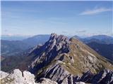 | Planina Pungrat - Veliko Kladivo
Veliko Kladivo is a 2094 m high peak in the longest Slovenian ridge, Košuta. From the summit, which has a register box and stamp, there is a very...
2 h 15 min |
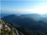 | Ogris - Ovčji vrh (Kozjak) / Geissberg (Kosiak) (direct way)
Ovčji Vrh or Kozjak, known in German as Geissberg or Kosiak, is a 2024 m high peak located north of the main Karawanks ridge. Rising above Celovš...
3 h |
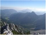 | Ogris - Bielschitza/Svačica
Svačica is a less prominent peak in the main ridge of the Karawanks. It lies between Vrtača and Stol, slightly offset to the north. The summit, m...
3 h 15 min |
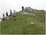 | Podolševa (Rogar) - Govca (Olševa) (direct way)
Govca is the highest peak of the Olševa range, rising above Koprivna, Solčava, and Remšenik (Remšenik/Remschenig is a valley on the Austrian side...
2 h 10 min |
 | Podolševa (Sveti Duh, Strevc) - Govca (Olševa) (via Obel kamen)
Govca is the highest peak of the Olševa range, rising above Koprivna, Solčava, and Remšenik (Remšenik/Remschenig is a valley on the Austrian side...
2 h 30 min |
| Podolševa (Sveti Duh, Strevc) - Govca (Olševa)
Govca is the highest peak of the Olševa range, rising above Koprivna, Solčava, and Remšenik (Remšenik/Remschenig is a valley on the Austrian side...
2 h 15 min |
| Podolševa (Rogar) - Govca (Olševa) (via Obel kamen)
Govca is the highest peak of the Olševa range, rising above Koprivna, Solčava, and Remšenik (Remšenik/Remschenig is a valley on the Austrian side...
2 h 25 min |
 | Jochalm - Reißkofel (235-1)
Reißkofel is a 2371 m high mountain in the Gailtal Alps. The summit, marked by a cross, also features a summit register. The view is particularly...
3 h |
 | Jochalm - Reißkofel (path 235)
Reißkofel is a 2371 m high mountain in the Gailtal Alps. The summit, marked by a cross, also features a summit register. The view is particularly...
3 h 25 min |
 | Passo Falzarego - Lagazuoi Piccolo (via gallery)
Lagazuoi Piccolo is a 2,778 m high mountain located north of the Passo Falzarego pass (2,105 m). From the summit, where a cross stands, there is ...
2 h 15 min |
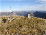 | Plockenpass - Monte Floriz
Monte Floriz is a 2,184 m high grassy peak located south of the Marinelli hut. From the summit there is a very nice view of the Coglians group; i...
3 h |
 | Planina Zapleč - Krnčica
Krnčica is a peak in the undulating ridge stretching from Bovec to Krn. It is actually Krn's northwestern ridge. It is comfortably accessible alo...
2 h 40 min |
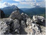 | Fiames - Punta Fiames
Punta Fiames is a 2,240-meter-high peak located north of Cortina d'Ampezzo. The mountain is popular mainly among fans of via ferrata routes, as a...
3 h 30 min |
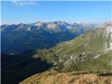 | Obertauern - Gamsleitenspitze (via Zehnerkar Sattel)
Gamsleitenspitze is a 2359-meter-high mountain in the Radstädter Tauern mountain group. From the summit, located above the Obertauern ski center,...
2 h 30 min |
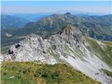 | Obertauern - Zehnerkarspitze
Zehnerkarspitze is a 2382-meter-high peak in the Radstädter Tauern group. The summit lies west of Obertauern pass above the ski center. From the ...
2 h 10 min |
 | Podolševa (Sveti Duh, Strevc) - Obel kamen (Olševa) (west path)
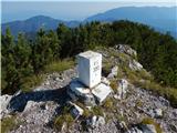
Obel kamen is a 1,911-meter-high peak located in the ridge of Olševa. On the summit is a border stone marked RS XXII 1; a cross and summit logboo...
2 h |
| Podolševa (Rogar) - Obel kamen (Olševa) (west path)
Obel kamen is a 1,911-meter-high peak located in the ridge of Olševa. On the summit is a border stone marked RS XXII 1; a cross and summit logboo...
1 h 55 min |
 | Podolševa (Sveti Duh, Strevc) - Obel kamen (Olševa) (east path)
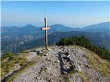
Obel kamen is a 1,911-meter-high peak located in the ridge of Olševa. On the summit is a border stone marked RS XXII 1; a cross and summit logboo...
2 h 15 min |
| Podolševa (Rogar) - Obel kamen (Olševa) (east path)
Obel kamen is a 1,911-meter-high peak located in the ridge of Olševa. On the summit is a border stone marked RS XXII 1; a cross and summit logboo...
2 h 10 min |
| Spodnje Sleme - Obel kamen (Olševa)
Obel kamen is a 1,911-meter-high peak located in the ridge of Olševa. On the summit is a border stone marked RS XXII 1; a cross and summit logboo...
3 h 30 min |
 | Saddle Sedlo - Bobotov kuk
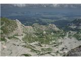
Bobotov kuk is the highest peak of Durmitor. There are several routes to it. The southern approaches are the shortest, the eastern ones the longe...
3 h |
 | Dolina Dobri do - Bobotov kuk
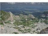
Bobotov kuk is the highest peak of Durmitor. There are several routes to it. The southern approaches are the shortest, the eastern ones the longe...
2 h 45 min |
 | Sella di Razzo - Clapsavon (via 210 & 212)
Clapsavon is a 2,462-meter-high mountain in the Carnic Alps in Italy. It lies about an hour's walk west of the 2,474-meter-high Bivera. Both peak...
3 h |
 | Planina Zapleč - Srednji vrh (at Krn)
Srednji vrh is a 2134-meter-high peak located in the ridge between Krn and Krnčica. A marked path leads to the summit, which offers very nice vie...
3 h 10 min |