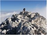
 | Zadnja Trenta (Flori) - Jalovec (via Jalovška škrbina)
At 2,645 m, Jalovec is the sixth highest mountain in Slovenia. The summit drops steeply towards three alpine valleys (Loška Koritnica, Tamar, and...
5 h 40 min |
| Zadnja Trenta (Flori) - Jalovec (via Zavetišče pod Špičkom)
At 2,645 m, Jalovec is the sixth highest mountain in Slovenia. The summit drops steeply towards three alpine valleys (Loška Koritnica, Tamar, and...
5 h 45 min |
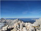 | Zadnjica - Razor
The summit of Razor lies above the alpine valley of Mlinarica. Though not spacious, it offers a superb view. All the peaks above the Kriški podi ...
6 h |
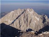 | V Koncu - Grintovec (via Kokrsko and Mlinarsko sedlo)
Grintovec is the highest peak of the Kamnik-Savinja Alps. It is located above the Kamniška Bistrica Valley, Suhi Dol, and the Ravenska Kočna Vall...
5 h 30 min |
| Suhadolnik - Grintovec (via Kokrsko and Mlinarsko sedlo)
Grintovec is the highest peak of the Kamnik-Savinja Alps. It is located above the Kamniška Bistrica Valley, Suhi Dol, and the Ravenska Kočna Vall...
5 h 45 min |
 | Suhadolnik - Jezerska Kočna (via Grdi graben and Dolci)
Jezerska Kočna is located west of Grintovec. From the summit, there is a very nice view towards Grintovec. The Karawanks and the Gorenjska plain ...
5 h 15 min |
| Suhadolnik - Jezerska Kočna (via Kokrsko sedlo and Dolci)
Jezerska Kočna is located west of Grintovec. From the summit, there is a very nice view towards Grintovec. The Karawanks and the Gorenjska plain ...
6 h 15 min |
| V Koncu - Jezerska Kočna (via Dolci)
Jezerska Kočna is located west of Grintovec. From the summit, there is a very nice view towards Grintovec. The Karawanks and the Gorenjska plain ...
6 h |
 | V Koncu - Jezerska Kočna (via Kokrska Kočna)
Jezerska Kočna is located west of Grintovec. From the summit, there is a very nice view towards Grintovec. The Karawanks and the Gorenjska plain ...
6 h |
| Suhadolnik - Jezerska Kočna (via Grdi graben and Kokrska Kočna)
Jezerska Kočna is located west of Grintovec. From the summit, there is a very nice view towards Grintovec. The Karawanks and the Gorenjska plain ...
5 h 15 min |
| Suhadolnik - Jezerska Kočna (via Kokrsko sedlo and Kokrska Kočna)
Jezerska Kočna is located west of Grintovec. From the summit, there is a very nice view towards Grintovec. The Karawanks and the Gorenjska plain ...
6 h 15 min |
 | Suhadolnik - Kokrska Kočna (via Grdi graben)
Kokrska Kočna is a panoramic and spacious mountain between Jezersko and Suhadolnik. From the summit, which has a logbook box, there is a very nic...
4 h 45 min |
| Suhadolnik - Kokrska Kočna (via Kokrsko sedlo)
Kokrska Kočna is a panoramic and spacious mountain between Jezersko and Suhadolnik. From the summit, which has a logbook box, there is a very nic...
5 h 45 min |
| V Koncu - Kokrska Kočna
Kokrska Kočna is a panoramic and spacious mountain between Jezersko and Suhadolnik. From the summit, which has a logbook box, there is a very nic...
5 h 30 min |
 | V Koncu - Dolgi hrbet (via Kokrsko sedlo)
Dolgi Hrbet lies between Grintovec and Skuta. From its precipitous summit there is a fine view across the heart of the Kamnik-Savinja Alps. Dolgi...
5 h |
 | Pišnica - Špik (via Koča v Krnici)
Špik is a 2,472 m high mountain situated in the heart of the Martuljek group. From the summit, clearly visible from the road through Gozd Martulj...
5 h 30 min |
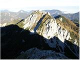 | Sele-Zvrhnji Kot (Male) / Zell-Oberwinkel (Male) - Veliki vrh (Košuta)
Veliki Vrh, at 2,088 m, is the westernmost two-thousander in Slovenia's longest ridge, the Košuta. From the summit, which has a registration box ...
4 h 35 min |
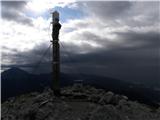 | Zalog - Storžič (via Psica)
Storžič is a 2132 m high mountain located in the western part of the Kamnik-Savinja Alps. From the summit, where there is a cross, a beautiful vi...
4 h 35 min |
| Križe - Storžič (via Psica)
Storžič is a 2132 m high mountain located in the western part of the Kamnik-Savinja Alps. From the summit, where there is a cross, a beautiful vi...
6 h 5 min |
| Gozd - Storžič (via Psica)
Storžič is a 2132 m high mountain located in the western part of the Kamnik-Savinja Alps. From the summit, where there is a cross, a beautiful vi...
4 h 50 min |
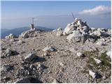 | Na Razpotju - Ojstrica (Kopinšek way)
Ojstrica, named for its sharp shape, rises steeply above Korošica, the Logarska Dolina valley, and Robanov Kot. From the summit, which has a regi...
4 h 10 min |
| Dom Planincev v Logarski dolini - Ojstrica (Kopinškova pot)
Ojstrica, named for its sharp shape, rises steeply above Korošica, the Logarska Dolina valley, and Robanov Kot. From the summit, which has a regi...
4 h 5 min |
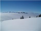 | Rogovilec - Velika Raduha (via Grohat on the climbing path)
Velika Raduha, at 2062 m, is the highest peak of the Raduha range, which rises steeply east of Robanov Kot. From the summit, with its registratio...
4 h 30 min |
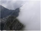 | Drežnica - Krn (Silvo Koren route)
Krn, at 2244 m, is the highest peak of the Krn mountain group, which rises steeply above the central part of the Soča River. From the summit, fea...
5 h |
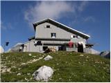 | Pišnica - Pogačnikov dom na Kriških podih
The hut is located on the scenic ridge Griva on Kriški Podi above Trenta. The hut, open during the summer season, also has a large winter room. T...
6 h 10 min |
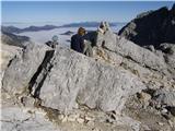 | Pišnica - Križ
Križ is a 2,140 m high mountain located northeast of the Kriški Podi plateau. The summit, which has a registration box with a stamp, offers a bea...
5 h 25 min |
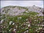 | V Koncu - Kalški greben
Kalški greben is a 2224 m high peak and the highest point of the ridge bearing the same name. From the summit, where there is a summit register a...
4 h |
| Suhadolnik - Kalški greben
Kalški greben is a 2224 m high peak and the highest point of the ridge bearing the same name. From the summit, where there is a summit register a...
4 h 15 min |
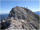 | Ridovc / Ridovcsäge - Koschutnikturm (Košutnikov turn) (along Mrzlem potok and via ÖTK Steig Neu)
Košutnikov Turn is the highest peak in Košuta, the longest Slovenian ridge. The summit offers a beautiful view of the entire ridge. Austria and t...
4 h 10 min |
 | Jermanca - Turska gora (via Kamniško sedlo)
The mountain is located above Logarska dolina and the Kamniška Bistrica valley. From the summit, there is a beautiful view of the neighboring pea...
4 h 45 min |
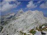 | Suhadolnik - Turska gora
The mountain is located above Logarska dolina and the Kamniška Bistrica valley. From the summit, there is a beautiful view of the neighboring pea...
6 h 15 min |
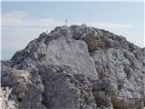 | Matkov kot - Mrzla gora (via eastern ridge)
This difficult-to-access mountain is located on the border with Austria in the Kamnik-Savinja Alps. From the summit there is a beautiful view tow...
4 h |
 | Bagni di Lusnizza - Cima Alta (Due Pizzi) (via Forcella Cuel Tarond)
Dve špici (Due Pizzi) comprise two peaks in the Naborjet mountains group, namely Cima Alta (2046 m) and Cima Vildiver (2008 m). Both peaks have a...
5 h 45 min |
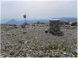 | Podkraj / Unterort - Petzen (Kordeschkopf) (Peca (Kordeževa glava)) (Walter Mory Klettersteig)
Kordeževa glava, better known as Peca, is the highest peak of the Peca range. It is located on the border with Austria above the Mežiška dolina v...
5 h 20 min |
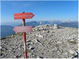 | Podpeca (Mitnek) - Petzen (Kordeschkopf) (Peca (Kordeževa glava)) (climbing way)
Kordeževa glava, better known as Peca, is the highest peak of the Peca range. It is located on the border with Austria above the Mežiška dolina v...
4 h 15 min |
| Mežica - Petzen (Kordeschkopf) (Peca (Kordeževa glava)) (climbing way)
Kordeževa glava, better known as Peca, is the highest peak of the Peca range. It is located on the border with Austria above the Mežiška dolina v...
5 h |
| Podpeca (Helenski potok) - Petzen (Kordeschkopf) (Peca (Kordeževa glava)) (over Mirjance and on climbing way)
Kordeževa glava, better known as Peca, is the highest peak of the Peca range. It is located on the border with Austria above the Mežiška dolina v...
4 h 40 min |
| Topla (Burjak) - Petzen (Kordeschkopf) (Peca (Kordeževa glava)) (over Mala Peca and on climbing way)
Kordeževa glava, better known as Peca, is the highest peak of the Peca range. It is located on the border with Austria above the Mežiška dolina v...
4 h |
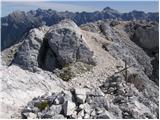 | Zadnja Trenta (Flori) - Bavški Grintavec (via Kanski preval)
Bavški Grintavec is a mighty mountain that rises steeply above the valleys of Bavšica, Zadnja Trenta, and Soča. All approaches to the summit are ...
4 h 45 min |
| Zadnja Trenta (Flori) - Bavški Grintavec (direct way)
Bavški Grintavec is a mighty mountain that rises steeply above the valleys of Bavšica, Zadnja Trenta, and Soča. All approaches to the summit are ...
4 h 30 min |
 | Koča pri Savici - Vrh nad Škrbino (via Dom na Komni and Škrbina)
Vrh nad Škrbino is the easternmost two-thousander in the ridge of the Lower Bohinj Mountains. From the summit, there are excellent views of the n...
5 h 50 min |
 | Podkraj / Unterort - Končnikov vrh (Peca) (Walter Mory Klettersteig)
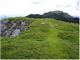
Končnikov vrh (German: Knieps) is a 2109 m high peak situated in the central part of Peca. From the grassy summit, there is a beautiful view of t...
4 h 5 min |
 | Korito / Coritis - Vrh Krnice
Vrh Krnice is a 2,441-meter-high peak located northwest of Visoki Kanin. From the summit, where there is usually an empty logbook box, there is a...
5 h 50 min |
 | Robanov kot - Mala Ojstrica (čez Jaruzale)
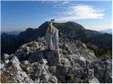
Mala Ojstrica is an indistinct peak located between Ojstrica, Molička Planina mountain pasture, and Korošica. From the summit, which features a l...
4 h 45 min |
 | Zajzera - Monte Nabois grande (variante per la crestaest)
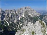
Veliki Nabojs, or Monte Nabois grande in Italian, is a 2313 m high mountain located north of the higher and better-known Viš. From the summit, wh...
4 h 30 min |
| Zajzera - Monte Nabois grande
Veliki Nabojs, or Monte Nabois grande in Italian, is a 2313 m high mountain located north of the higher and better-known Viš. From the summit, wh...
4 h 30 min |
 | Parking Alpspitzbahn - Alpspitze (Alpspitz Ferrata)
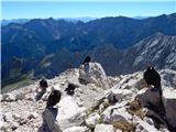
Alpspitze is a 2628-meter-high peak in the Wetterstein mountain group. From the summit, where a cross from 1946 stands, there is a very nice view...
6 h 15 min |
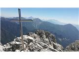 | Val Aupa - Creta Grauzaria (via normale)
Creta Grauzaria (Friulian: La Crete) is a 2,065-meter-high mountain in the Carnic Alps in Italy. The first ascent occurred on June 18, 1893, due ...
4 h 20 min |
 | Bagni di Lusnizza - Monte Gosadon
Monte Gosadon is a somewhat less-visited peak in the Naborjet Mountains group. The surroundings of the peak also feature quite a few remains from...
3 h 50 min |
| Bagni di Lusnizza - Monte Gosadon (via Forcella Cuel Tarond)
Monte Gosadon is a somewhat less-visited peak in the Naborjet Mountains group. The surroundings of the peak also feature quite a few remains from...
5 h 35 min |
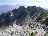 | La AleGra - Monte Musi (western peak)
Vrh Muzcev (western peak) is located in the central part of the Muzcev Ridge, separating Rezija Valley and Terska Valley. Its 1,864-meter summit,...
3 h 30 min |
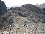 | Pišnica - Lipnica (via Koča v Krnici)
Lipnica is a high-mountain peak standing in the immediate vicinity of Špik and representing its southern neighbour. It lies on the ridge that des...
4 h 55 min |