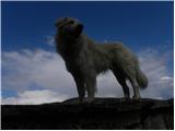
 | Dom na Govejku - Osolnik
Osolnik is an 858-metre-high mountain located south of Škofja Loka and west of Medvode. From the summit, where the Church of St Mohor and Fortuna...
1 h |
 | Črni Vrh - Pasja ravan
Pasja ravan is the second-highest peak in the Polhograjsko hribovje. A few decades ago, at 1029 meters, it was the highest, but in the second hal...
1 h |
 | Selo - Sveti Ožbolt (above Zminec)
Sveti Ožbolt is situated on a panoramic rise in the north of the Polhograjski Dolomiti. There is a beautiful view toward the Škofjeloško hribovje...
1 h 15 min |
 | Sv. Andrej - Sveti Ožbolt (above Zminec)
Sveti Ožbolt is situated on a panoramic rise in the north of the Polhograjski Dolomiti. There is a beautiful view toward the Škofjeloško hribovje...
1 h |
 | Čepulje - Archangel Gabriel (Planica)
Planica is an 824-meter-high peak located north of Škofja Loka, more precisely between Križna gora and Planica. From the summit, where the church...
50 min |
 | Zaplana (St. Urh and St. Martin) - Ulovka
Ulovka is a peak between Zaplana and Zavetišče na Planini nad Vrhniko. From the summit, to which ski lifts run, there is a nice view to the north...
50 min |
 | Kamen - Sveti Lenart (Krvava Peč)
The Church of St. Lenart is located on a small hill above the village of Krvava Peč and the Iška River valley. From the summit or a nearby vantag...
1 h 30 min |
 | GEOSS - Slivna (Pivkelj)
Slivna, also known as Pivkelj (or Pivkelj turn), lies south of Limbarska gora. Pivkelj is the highest point of the Moravška planinska pot and at ...
1 h |
 | Pivka - Osojnica
Osojnica is a forested hill located west of Pivka. The summit features a logbook box, stamp, and bench, but offers no views....
1 h |
 | Otlica - Sinji vrh
Sinji vrh is a panoramic mountain between Col, Ajdovščina, and Predmeja. It offers views across much of western Slovenia (the sea on clear days)....
1 h 20 min |
 | Vrbiški dol - Koča na Kozleku
The Koča na Kozleku mountain hut is situated southwest of Ilirska Bistrica, just a few meters below the summit of Kozlek. From the summit, there ...
1 h |
 | Mali Log - Koča na Kamnem griču
The Koča na Kamnem griču mountain hut is located on Kamni grič, a panoramic hill rising southwest of Sodražica. From the grassy summit surrounded...
50 min |
 | Leskovec - Obolno
Obolno is a 776-meter-high peak located southwest of the eponymous village. From the grassy summit, by which a radio club hut stands, there is a ...
1 h |
 | Veliko Trebeljevo - Obolno
Obolno is a 776-meter-high peak located southwest of the eponymous village. From the grassy summit, by which a radio club hut stands, there is a ...
1 h 20 min |
 | Mala Goričica - Obolno
Obolno is a 776-meter-high peak located southwest of the eponymous village. From the grassy summit, by which a radio club hut stands, there is a ...
1 h 10 min |
| Mala Goričica - Obolno (by road)
Obolno is a 776-meter-high peak located southwest of the eponymous village. From the grassy summit, by which a radio club hut stands, there is a ...
1 h 15 min |
 | Velike Lašče - Kamen vrh
Kamen Vrh is a panoramic hill located on the northern edge of Mala Gora. From the summit, surrounded by low bushes, there are fine views of parts...
1 h 15 min |
 | Križevska vas - Murovica (circular path)
Murovica is a popular excursion point, accessible from the Posavje side, Domžale, or the Moravška Valley. On the summit there is a bench and a lo...
50 min |
 | Rovte - Medvedje Brdo (via Kamnikov Grič)
Medvedje Brdo is a small settlement located north of Hotedršica. The highest point of the village is a pleasant viewpoint on Šinkovcov grič (814 ...
1 h 15 min |
 | Mislinja - Časov vrh
Časov vrh (Časkov vrh on some maps) is a less prominent hill located between Fričev vrh and Črepič. Since the summit is forested, there is no vie...
1 h 15 min |
 | Mislinja - Sveti Rupert (Završe)
The Church of St. Rupert (Završe) is located on a panoramic rise south of Fričev vrh. In good weather, from the church or its nearby surroundings...
1 h 25 min |
 | Mislinja - Sveti Vid (Završe)
The Church of St. Vitus, next to which there is also a small cemetery, is located in the middle of the dispersed settlement Završe. From the chur...
1 h 10 min |
 | Mesnice - Rotovc
Rotovc is a 964-meter-high peak situated northeast of Rakitna. From the summit, where a wooden bench stands, a beautiful view opens up toward the...
55 min |
 | Podlanišče - Štor
Štor is a 1005 m high peak located directly above the Koča na Ermanovcu hut. The summit itself is forested, but from a meadow just a few dozen me...
1 h 20 min |
 | Podlanišče - Škofje
Škofje is a 973-meter-high peak located above the villages of Čeplez, Planina pri Cerknem, and Podpleče. The summit itself, marked by a small con...
1 h 10 min |
 | Planinski dom pod Ježo - Deveti konfin (survey point 930)
Deveti konfin at survey point 930 is located along the marked path leading from Planinski dom pod Ježo towards Očna. From the meadow a few meters...
55 min |
 | Pivka - Šilentabor
Šilentabor is a 751-meter-high peak just above the village of the same name. From the summit, near which there is a bench and a logbook box, ther...
1 h 30 min |
 | Vrbiški dol - Ahac
Ahac (or Sv. Ahac) is a 799-meter-high peak located east of Ilirska Bistrica. The summit hosts a summit logbox, a cross, and ruins of the former ...
1 h |
 | Drnulk - Vrh Skopice
Vrh Skopice, also known as Skopica, is a panoramic peak located between the Čepovan Valley, the Idrijca River valley, and the Trebuščica River va...
1 h 20 min |
 | Ortnek - Sveti Gregor on Slemena
Sveti Gregor is a settlement on the panoramic Slemena. At its center stands the parish church of St. Gregory the Great, nearby a large sports fie...
1 h 10 min |
 | Pikovnik - Sveti Vid (Vidovska planota)
Sveti Vid is a small village in the middle of the Vidovska planota plateau, situated between Menišija and the upper course of the Iška River vall...
1 h 30 min |
 | Sveti Jurij (Remšnik) - Sveti Pankracij (Radelca)
The Church of St. Pankracij on Radelca is located at an altitude of 900 meters, directly on the border ridge between Slovenia and Austria. The or...
1 h 15 min |
 | Sveta Katarina (Zgornja Kapla) - Sršenov vrh
Sršenov vrh is a 963-meter-high peak located in the Kozjak hills, more precisely between Ožbalt and Zgornja Kapla. The summit itself offers no sp...
1 h |